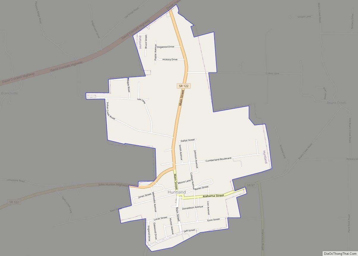
Huntland is a town in Franklin County, Tennessee, United States. The population was 872 at the 2010 census and 886 at the 2020 census. It is part of the Tullahoma, Tennessee Micropolitan Statistical Area.
The town was established in the early 1900s, and is named after an early settler, Clinton Armstrong Hunt. It was incorporated in 1907. The town is home to a Pre K-12 school, Huntland School.
| Name: | Huntland town |
|---|---|
| LSAD Code: | 43 |
| LSAD Description: | town (suffix) |
| State: | Tennessee |
| County: | Franklin County |
| Incorporated: | 1907 |
| Elevation: | 942 ft (287 m) |
| Total Area: | 1.52 sq mi (3.95 km²) |
| Land Area: | 1.52 sq mi (3.95 km²) |
| Water Area: | 0.00 sq mi (0.00 km²) |
| Total Population: | 886 |
| Population Density: | 581.36/sq mi (224.43/km²) |
| ZIP code: | 37345 |
| Area code: | 931 |
| FIPS code: | 4736600 |
| GNISfeature ID: | 1288762 |
| Website: | huntland.org |
Online Interactive Map
Click on ![]() to view map in "full screen" mode.
to view map in "full screen" mode.
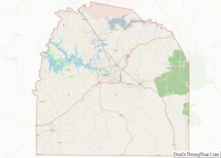
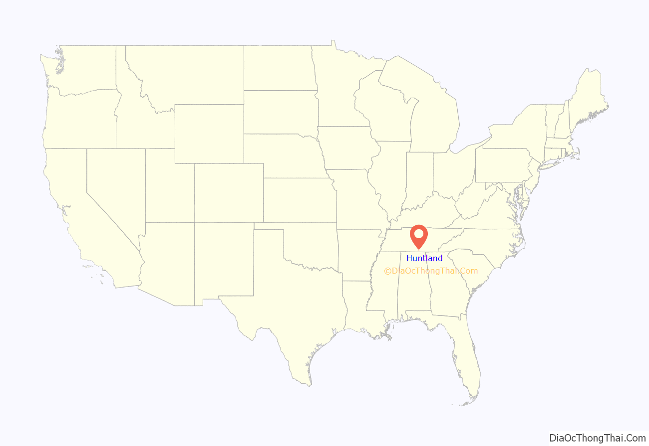
Huntland location map. Where is Huntland town?
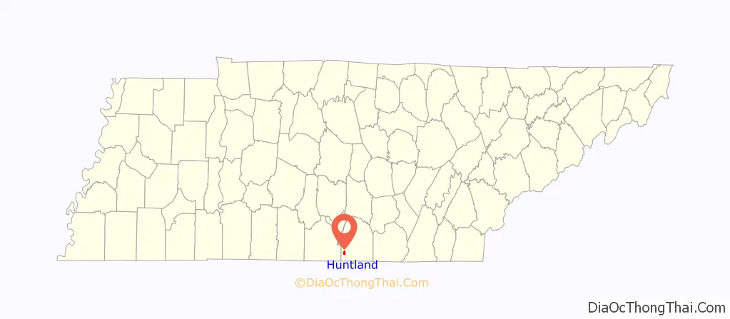
Huntland Road Map
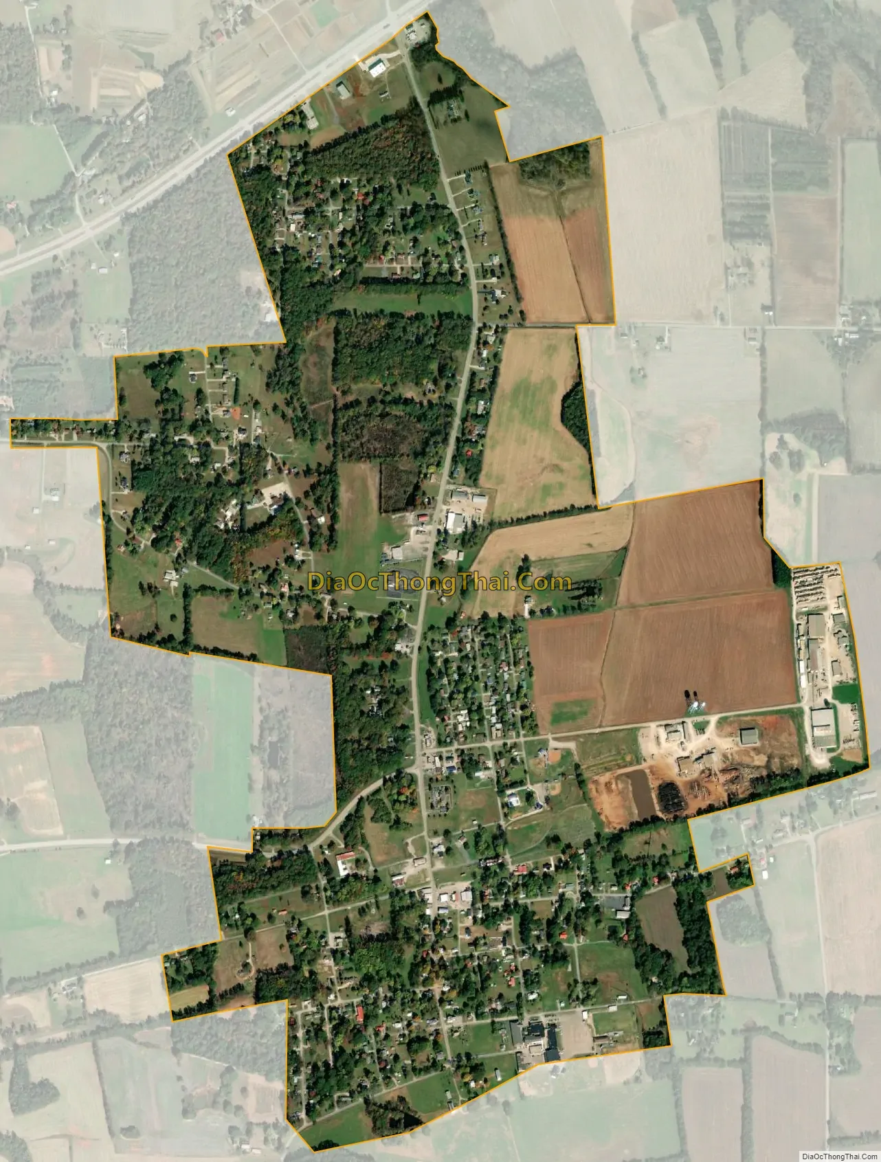
Huntland city Satellite Map
Geography
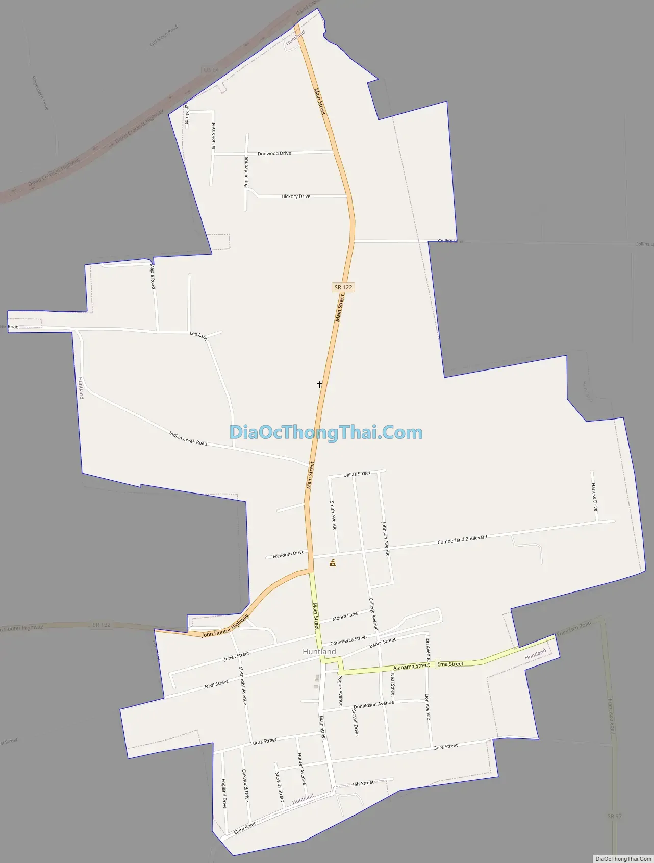
Huntland is located at 35°3′13″N 86°16′7″W / 35.05361°N 86.26861°W / 35.05361; -86.26861 (35.053508, -86.268678). The town is situated primarily around the intersection of State Route 122 and State Route 97, though its boundaries stretch northward to the intersection of State Route 122 and U.S. Route 64. State Route 122 continues southwestward to Elora, Tennessee, while State Route 97 continues southward into Alabama.
The town of Huntland is a beautiful rural community in Middle Tennessee located in the Appalachian foothills of the southwest part of Franklin County. Huntland lies 12 miles south of Winchester, the county seat; 22 miles east of Fayetteville, the Lincoln County seat; 35 miles north of Huntsville, Alabama; and 100 miles south of Nashville, Tennessee’s state capitol. Huntland is governed by five aldermen and meet every third Monday of each month. There is also a planning and zoning commission and an industrial board.
Huntland has one of the county’s high schools, established in the very early 1900’s. Huntland School educates students K-12, and presently has about 600 students enrolled. Huntland is proud of its elementary, middle school, and high school.
Water for the town is obtained from three wells, and an up to date filtration plant. In the center of the community lies a nice city park, community center and fire hall.
According to the United States Census Bureau, the town has a total area of 1.5 square miles (3.9 km), all of it land.
See also
Map of Tennessee State and its subdivision:- Anderson
- Bedford
- Benton
- Bledsoe
- Blount
- Bradley
- Campbell
- Cannon
- Carroll
- Carter
- Cheatham
- Chester
- Claiborne
- Clay
- Cocke
- Coffee
- Crockett
- Cumberland
- Davidson
- Decatur
- DeKalb
- Dickson
- Dyer
- Fayette
- Fentress
- Franklin
- Gibson
- Giles
- Grainger
- Greene
- Grundy
- Hamblen
- Hamilton
- Hancock
- Hardeman
- Hardin
- Hawkins
- Haywood
- Henderson
- Henry
- Hickman
- Houston
- Humphreys
- Jackson
- Jefferson
- Johnson
- Knox
- Lake
- Lauderdale
- Lawrence
- Lewis
- Lincoln
- Loudon
- Macon
- Madison
- Marion
- Marshall
- Maury
- McMinn
- McNairy
- Meigs
- Monroe
- Montgomery
- Moore
- Morgan
- Obion
- Overton
- Perry
- Pickett
- Polk
- Putnam
- Rhea
- Roane
- Robertson
- Rutherford
- Scott
- Sequatchie
- Sevier
- Shelby
- Smith
- Stewart
- Sullivan
- Sumner
- Tipton
- Trousdale
- Unicoi
- Union
- Van Buren
- Warren
- Washington
- Wayne
- Weakley
- White
- Williamson
- Wilson
- Alabama
- Alaska
- Arizona
- Arkansas
- California
- Colorado
- Connecticut
- Delaware
- District of Columbia
- Florida
- Georgia
- Hawaii
- Idaho
- Illinois
- Indiana
- Iowa
- Kansas
- Kentucky
- Louisiana
- Maine
- Maryland
- Massachusetts
- Michigan
- Minnesota
- Mississippi
- Missouri
- Montana
- Nebraska
- Nevada
- New Hampshire
- New Jersey
- New Mexico
- New York
- North Carolina
- North Dakota
- Ohio
- Oklahoma
- Oregon
- Pennsylvania
- Rhode Island
- South Carolina
- South Dakota
- Tennessee
- Texas
- Utah
- Vermont
- Virginia
- Washington
- West Virginia
- Wisconsin
- Wyoming