Gurnee (/ˈɡɜːrˌniː/ GUR-nee) is a village in Lake County, Illinois, United States. Its population was 30,706 as of the 2020 census. It borders the city of Waukegan, and is a popular tourist attraction within the Chicago metropolitan area.
Best known for being the location of Six Flags Great America, Six Flags Hurricane Harbor Chicago and Gurnee Mills, the village sees an average of over 23 million visitors annually.
| Name: | Gurnee village |
|---|---|
| LSAD Code: | 47 |
| LSAD Description: | village (suffix) |
| State: | Illinois |
| County: | Lake County |
| Founded: | 1928 |
| Total Area: | 13.59 sq mi (35.18 km²) |
| Land Area: | 13.51 sq mi (34.99 km²) |
| Water Area: | 0.08 sq mi (0.20 km²) |
| Total Population: | 30,706 |
| Population Density: | 2,273.00/sq mi (877.62/km²) |
| ZIP code: | 60031 |
| FIPS code: | 1732018 |
| Website: | www.gurnee.il.us |
Online Interactive Map
Click on ![]() to view map in "full screen" mode.
to view map in "full screen" mode.
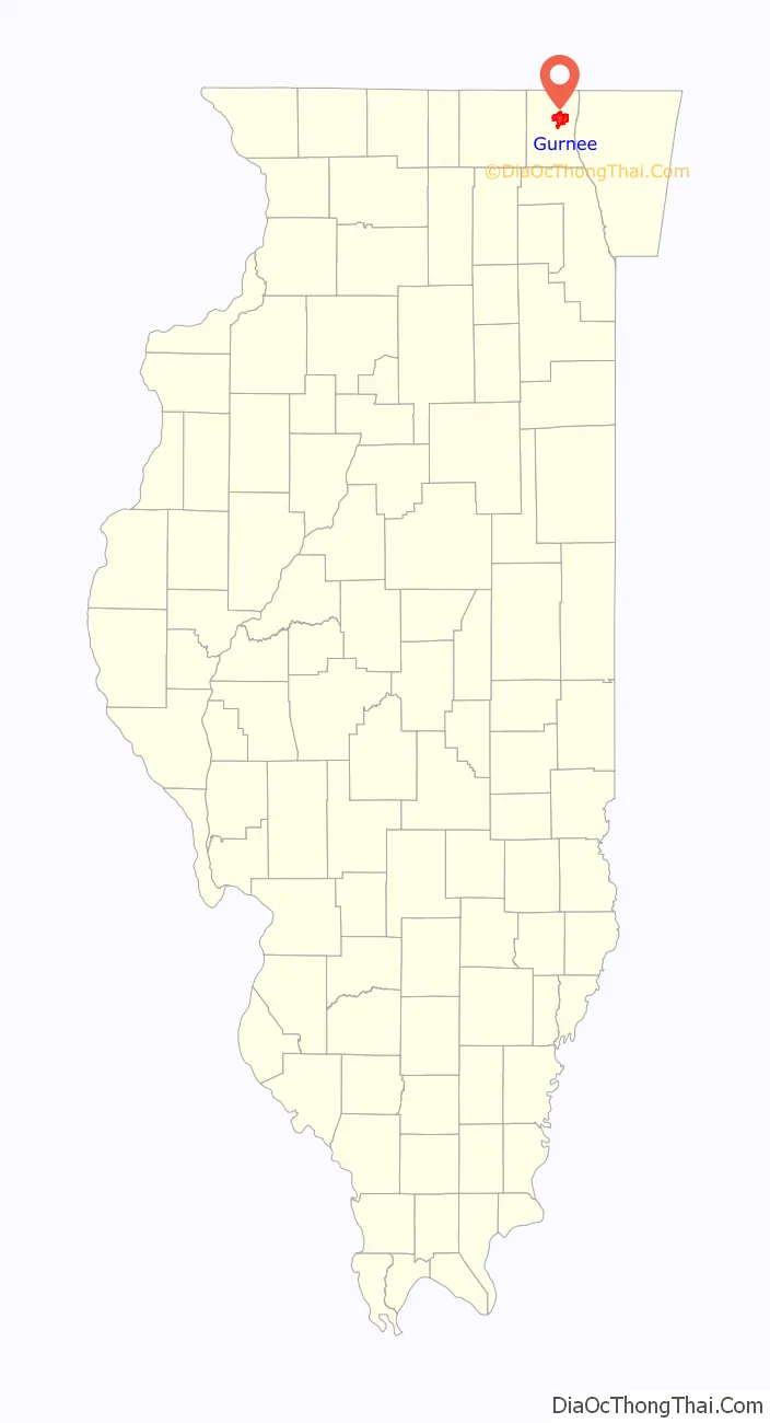
Gurnee location map. Where is Gurnee village?

History
Early settlers in the Gurnee area came by foot horseback and by “Prairie Schooners” drawn by oxen or via the Erie Canal and the Great Lakes. They came from the town of Warren, New York, which was named in honor of Major General Joseph Warren, killed at the Battle of Bunker Hill. Warren Township, formed in 1850, was also named after him. The first settlement of Warren Township commenced in 1835 in the vicinity of the Aux Plaines River (now the Des Plaines River).
In 1835–36, a land company from New York State erected a Community House (site of the old Gurnee Grade School) to accommodate families while they were locating and getting government land grants to their farms. Near the Community House, there was a ford used by the Potowatomi Indians for crossing the river. A floating log bridge was built in 1842. Later, both a wood and iron bridge were built.
With the erection of a permanent bridge, roads were established, and this area became the hub of the township. It was at this junction that the Milwaukee Road crossed the river from west to east, and then continued north to eventually connect Chicago to Milwaukee. This road was “laid out” in 1836 by three early settlers: Thomas McClure, Mark Noble, and Richard Steele. The east–west road, now known as Grand Avenue, was a main route from McHenry County to the port of Waukegan. Stage coaches ran on this route as late as 1870.
The hamlet was originally called “Wentworth”, after Congressman “Long John” Wentworth, who also served as the Republican Mayor of Chicago between 1857 and 1863. Thereafter, Walter S. Gurnee, the 14th Mayor of Chicago and one of the directors of the railroad, agreed to develop a station in Wentworth, which was called “Gurnee Station” in honor of Mr. Gurnee. Over time, Gurnee Station became known simply as “Gurnee” and was incorporated as such.
Just east of the bridge, at the junction of Milwaukee Road and Grand Avenue, was the Mutaw Tavern, earlier known as “Marm Rudd’s Tavern” and more recently as the Mother Rudd House. This was a stage coach stop between Chicago and Milwaukee and was a stopover for farmers from the west traveling to Little Fort (now known as Waukegan) to barter their crops for supplies and to ship out from the ports. It also served as a stop during the underground railroad. This building was acquired by the Village of Gurnee in 1984, has been restored, and now houses the Warren Township Historical Society.
In May 2004, Gurnee received major rainfall, causing the worst flooding in 100 years. The flood forced several schools to close and caused building damage to dozens of homes and businesses.
Gurnee Road Map
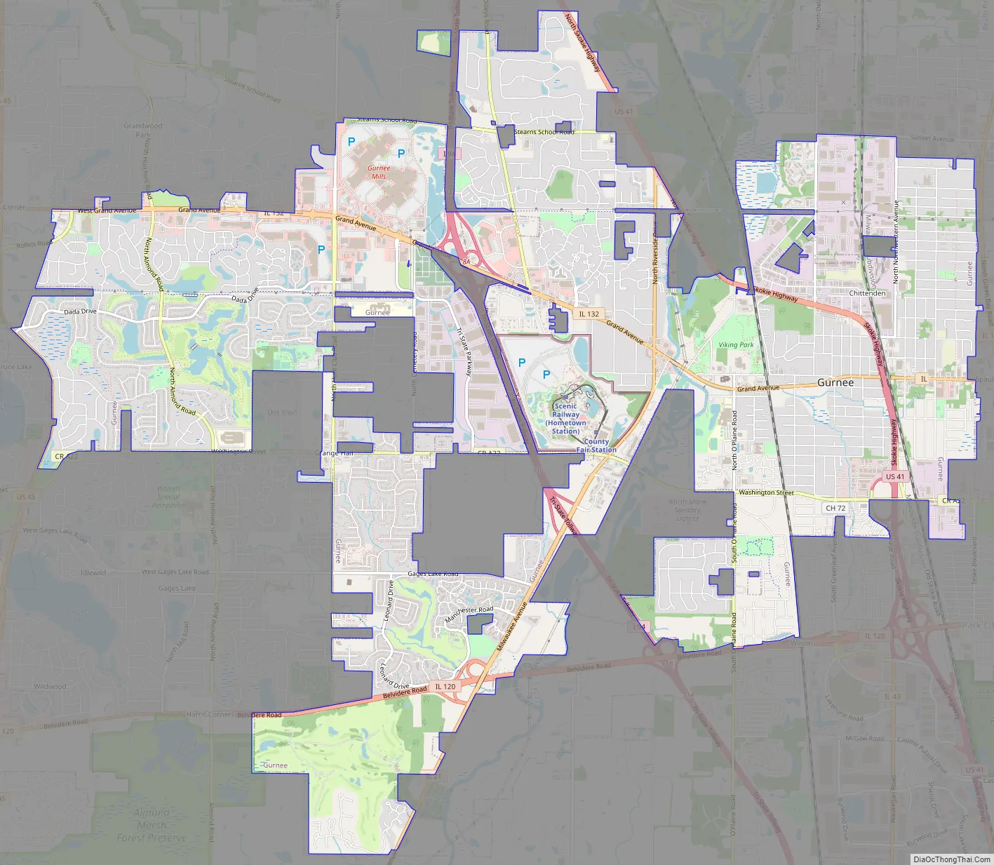
Gurnee city Satellite Map

Geography
Gurnee is located at 42°22′N 87°56′W / 42.367°N 87.933°W / 42.367; -87.933 (42.3737, −87.9344).
According to the 2010 census, Gurnee has a total area of 13.576 square miles (35.16 km), of which 13.5 square miles (34.96 km) (or 99.44%) is land and 0.076 square miles (0.20 km) (or 0.56%) is water. It is located on the banks of the Des Plaines River and is split by Interstate 94, which divides the village into east (old) and west (new) sides.
See also
Map of Illinois State and its subdivision:- Adams
- Alexander
- Bond
- Boone
- Brown
- Bureau
- Calhoun
- Carroll
- Cass
- Champaign
- Christian
- Clark
- Clay
- Clinton
- Coles
- Cook
- Crawford
- Cumberland
- De Kalb
- De Witt
- Douglas
- Dupage
- Edgar
- Edwards
- Effingham
- Fayette
- Ford
- Franklin
- Fulton
- Gallatin
- Greene
- Grundy
- Hamilton
- Hancock
- Hardin
- Henderson
- Henry
- Iroquois
- Jackson
- Jasper
- Jefferson
- Jersey
- Jo Daviess
- Johnson
- Kane
- Kankakee
- Kendall
- Knox
- La Salle
- Lake
- Lake Michigan
- Lawrence
- Lee
- Livingston
- Logan
- Macon
- Macoupin
- Madison
- Marion
- Marshall
- Mason
- Massac
- McDonough
- McHenry
- McLean
- Menard
- Mercer
- Monroe
- Montgomery
- Morgan
- Moultrie
- Ogle
- Peoria
- Perry
- Piatt
- Pike
- Pope
- Pulaski
- Putnam
- Randolph
- Richland
- Rock Island
- Saint Clair
- Saline
- Sangamon
- Schuyler
- Scott
- Shelby
- Stark
- Stephenson
- Tazewell
- Union
- Vermilion
- Wabash
- Warren
- Washington
- Wayne
- White
- Whiteside
- Will
- Williamson
- Winnebago
- Woodford
- Alabama
- Alaska
- Arizona
- Arkansas
- California
- Colorado
- Connecticut
- Delaware
- District of Columbia
- Florida
- Georgia
- Hawaii
- Idaho
- Illinois
- Indiana
- Iowa
- Kansas
- Kentucky
- Louisiana
- Maine
- Maryland
- Massachusetts
- Michigan
- Minnesota
- Mississippi
- Missouri
- Montana
- Nebraska
- Nevada
- New Hampshire
- New Jersey
- New Mexico
- New York
- North Carolina
- North Dakota
- Ohio
- Oklahoma
- Oregon
- Pennsylvania
- Rhode Island
- South Carolina
- South Dakota
- Tennessee
- Texas
- Utah
- Vermont
- Virginia
- Washington
- West Virginia
- Wisconsin
- Wyoming


Beautiful