Knollwood is an unincorporated community and census-designated place (CDP) in Lake County, Illinois, United States. Per the 2020 census, the population was 2,221. It is located within Shields Township and Libertyville Township. Knollwood shares a ZIP Code with the neighboring village of Lake Bluff, and children attend Lake Bluff schools. The residents of Knollwood were served by the Knollwood Fire Department until October 2018, after the trustees of the Rockland Fire Protection District ended their relationship with the department. Residents now receive fire protection from the Libertyville and Lake Forest fire departments. Police protection is provided by the Lake County Sheriff’s Department.
| Name: | Knollwood CDP |
|---|---|
| LSAD Code: | 57 |
| LSAD Description: | CDP (suffix) |
| State: | Illinois |
| County: | Lake County |
| Elevation: | 700 ft (200 m) |
| Total Area: | 0.60 sq mi (1.57 km²) |
| Land Area: | 0.60 sq mi (1.57 km²) |
| Water Area: | 0.00 sq mi (0.00 km²) |
| Total Population: | 2,121 |
| Population Density: | 3,505.79/sq mi (1,354.08/km²) |
| ZIP code: | 60044 (Lake Bluff) |
| FIPS code: | 1740364 |
Online Interactive Map
Click on ![]() to view map in "full screen" mode.
to view map in "full screen" mode.
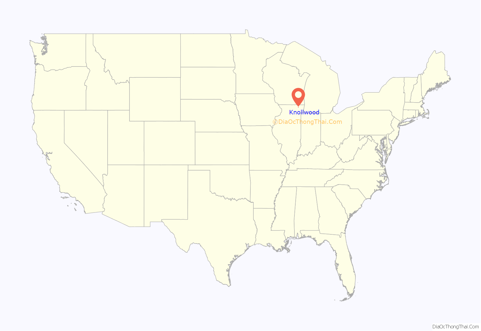
Knollwood location map. Where is Knollwood CDP?

History
The name “Knollwood” first became associated with the area in the early 20th century. The Chicago North Shore and Milwaukee Railroad stop, located at the intersection of Rockland Road and Telegraph Road (now Waukegan Road), was named “Creamer Corners”. To the southwest of the station was a 248-acre (100 ha) property, consisting of two farms, owned by Mrs. Granger Farwell and Mr. A.C. Accord. This property was known as “Knollwood Farm”. In 1923, Knollwood Farm was purchased by a group of wealthy Chicago businessmen (including Samuel Insull, Robert P. Lamont, Nathan William MacChesney and Thomas E. Wilson), who wished to turn the land into a country club. The following year, the Knollwood Country Club was founded, and the purchase was finalized in 1925. The community that sprang up around the club came to be known as Knollwood.
Knollwood’s volunteer fire department was founded as the Rockland Fire Department and recognized by the state government in January 1947. Two years later, the department purchased their first fire engine, and a fire department building was constructed in 1951. In 1952, the Rockland Fire Department joined the Illinois Association of Fire Protection Districts and changed its name to the Knollwood Fire Department. The original firehouse was replaced with a modern facility in the same location in 2002, with the new building opening the following year.
Under state statute, trustees of the Fire Protection District Board were appointed by the Lake County Board. The trustees included Robert Grum, Dan Rogers and Carl Snoblin. Mr. Grum, a former full-time member of the Lake Forest Fire Department who retired as deputy chief, and Dan Rogers led the efforts to dissolve the district. Despite a referendum that required trustees to be elected, rather than appointed, and a majority of residents opposing his re-appointment, Rogers was re-appointed to his position, and along with Trustee Grum cast the voted needed to approve an Inter-Governmental Agreement that ended Knollwood FD operations on August 31, 2018.
Several unsuccessful referendums for annexation into the neighboring village of Lake Bluff were held in 1978, 1982, and 1996.
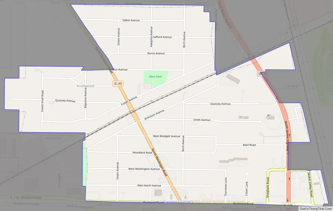
Knollwood Road Map
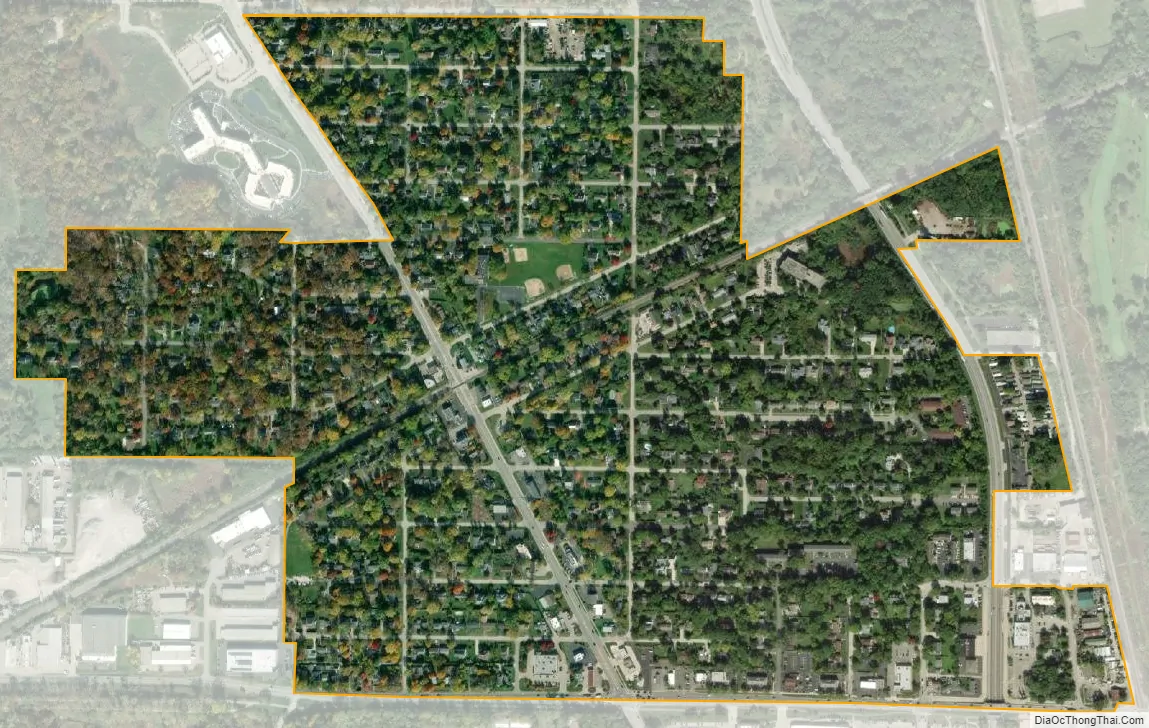
Knollwood city Satellite Map
Geography
Knollwood is located in eastern Lake County at 42°16′18″N 87°53′44″W / 42.271667°N 87.895556°W / 42.271667; -87.895556. Knollwood is bordered by the village of Lake Bluff to the north, east, and southeast, by the city of Lake Forest to the south, and by the village of Green Oaks to the west. Downtown Chicago is 34 miles (55 km) to the south.
According to the U.S. Census Bureau, the Knollwood CDP has an area of 0.6 square miles (1.6 km), all of it land.
See also
Map of Illinois State and its subdivision:- Adams
- Alexander
- Bond
- Boone
- Brown
- Bureau
- Calhoun
- Carroll
- Cass
- Champaign
- Christian
- Clark
- Clay
- Clinton
- Coles
- Cook
- Crawford
- Cumberland
- De Kalb
- De Witt
- Douglas
- Dupage
- Edgar
- Edwards
- Effingham
- Fayette
- Ford
- Franklin
- Fulton
- Gallatin
- Greene
- Grundy
- Hamilton
- Hancock
- Hardin
- Henderson
- Henry
- Iroquois
- Jackson
- Jasper
- Jefferson
- Jersey
- Jo Daviess
- Johnson
- Kane
- Kankakee
- Kendall
- Knox
- La Salle
- Lake
- Lake Michigan
- Lawrence
- Lee
- Livingston
- Logan
- Macon
- Macoupin
- Madison
- Marion
- Marshall
- Mason
- Massac
- McDonough
- McHenry
- McLean
- Menard
- Mercer
- Monroe
- Montgomery
- Morgan
- Moultrie
- Ogle
- Peoria
- Perry
- Piatt
- Pike
- Pope
- Pulaski
- Putnam
- Randolph
- Richland
- Rock Island
- Saint Clair
- Saline
- Sangamon
- Schuyler
- Scott
- Shelby
- Stark
- Stephenson
- Tazewell
- Union
- Vermilion
- Wabash
- Warren
- Washington
- Wayne
- White
- Whiteside
- Will
- Williamson
- Winnebago
- Woodford
- Alabama
- Alaska
- Arizona
- Arkansas
- California
- Colorado
- Connecticut
- Delaware
- District of Columbia
- Florida
- Georgia
- Hawaii
- Idaho
- Illinois
- Indiana
- Iowa
- Kansas
- Kentucky
- Louisiana
- Maine
- Maryland
- Massachusetts
- Michigan
- Minnesota
- Mississippi
- Missouri
- Montana
- Nebraska
- Nevada
- New Hampshire
- New Jersey
- New Mexico
- New York
- North Carolina
- North Dakota
- Ohio
- Oklahoma
- Oregon
- Pennsylvania
- Rhode Island
- South Carolina
- South Dakota
- Tennessee
- Texas
- Utah
- Vermont
- Virginia
- Washington
- West Virginia
- Wisconsin
- Wyoming


