Maroa is a city in Macon County, Illinois, United States. Its population was 1,577 at the 2020 census, down from 1,801 in 2010. It is included in the Decatur, Illinois Metropolitan Statistical Area.
| Name: | Maroa city |
|---|---|
| LSAD Code: | 25 |
| LSAD Description: | city (suffix) |
| State: | Illinois |
| County: | Macon County |
| Elevation: | 718 ft (219 m) |
| Total Area: | 1.76 sq mi (4.57 km²) |
| Land Area: | 1.76 sq mi (4.57 km²) |
| Water Area: | 0.00 sq mi (0.00 km²) |
| Total Population: | 1,577 |
| Population Density: | 893.99/sq mi (345.11/km²) |
| ZIP code: | 61756 |
| Area code: | 217 |
| FIPS code: | 1747072 |
| Website: | maroaillinois.gov |
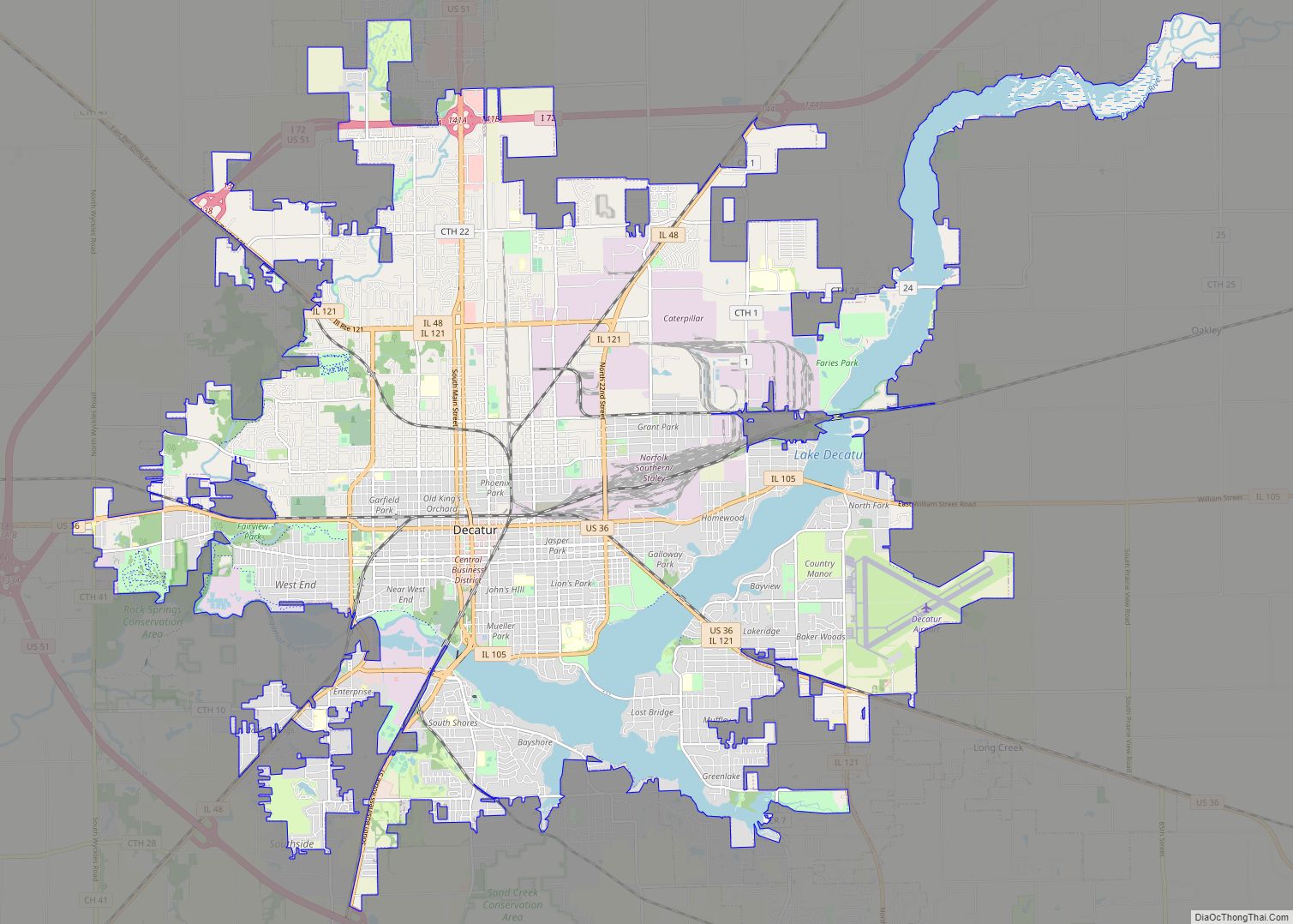
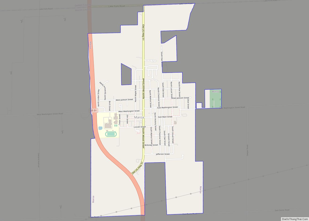
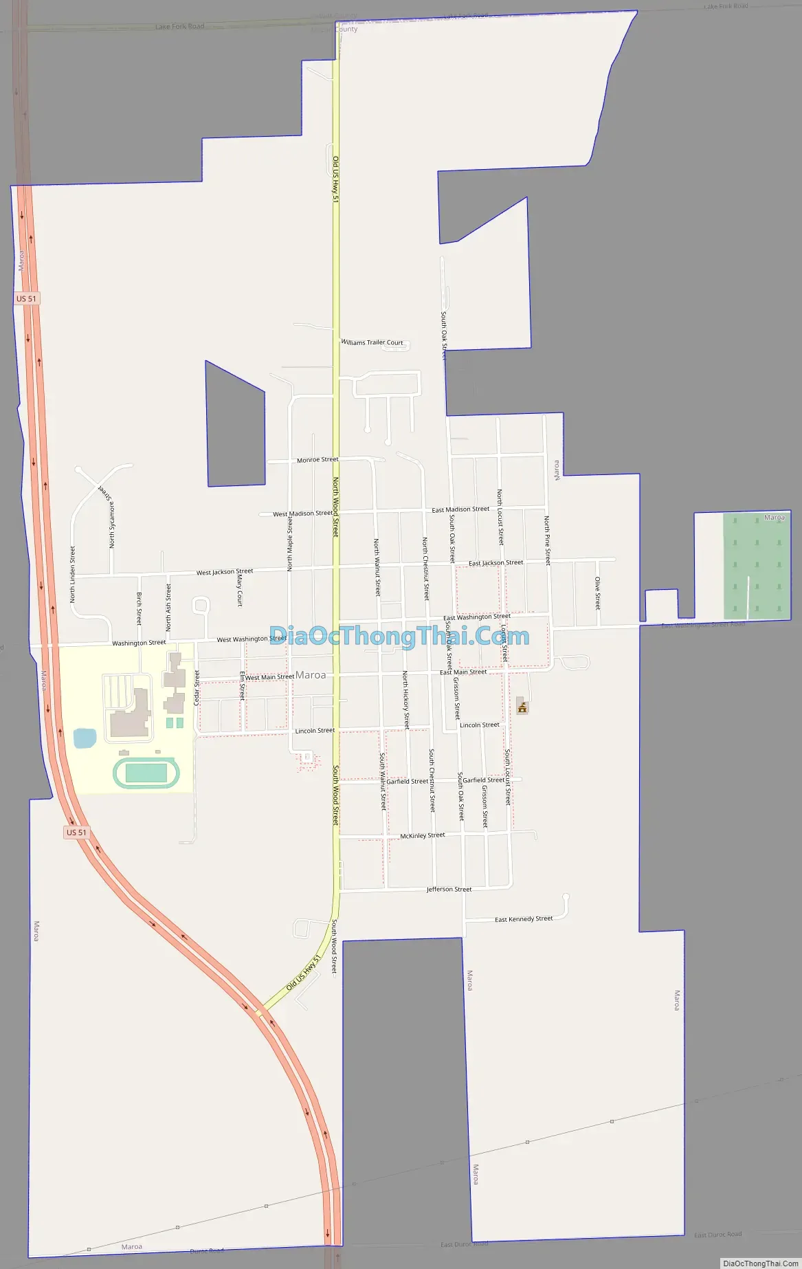
Online Interactive Map
Click on ![]() to view map in "full screen" mode.
to view map in "full screen" mode.
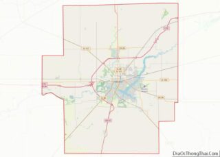
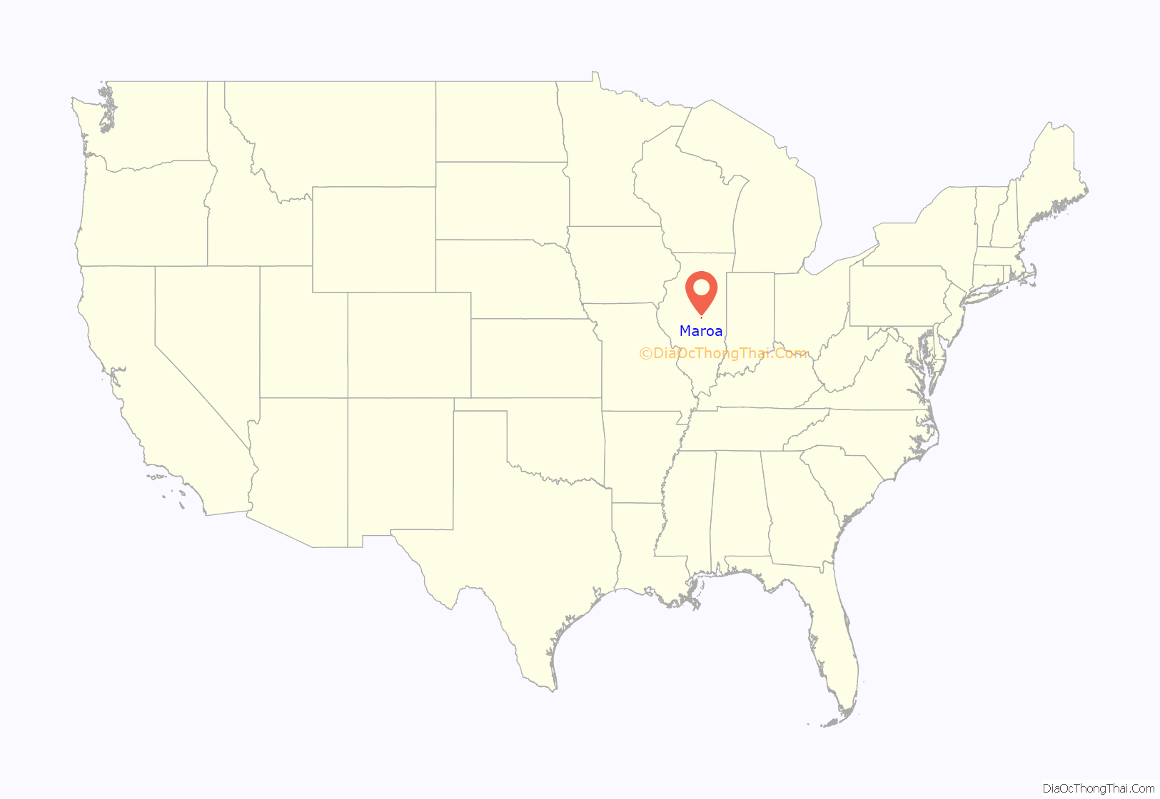
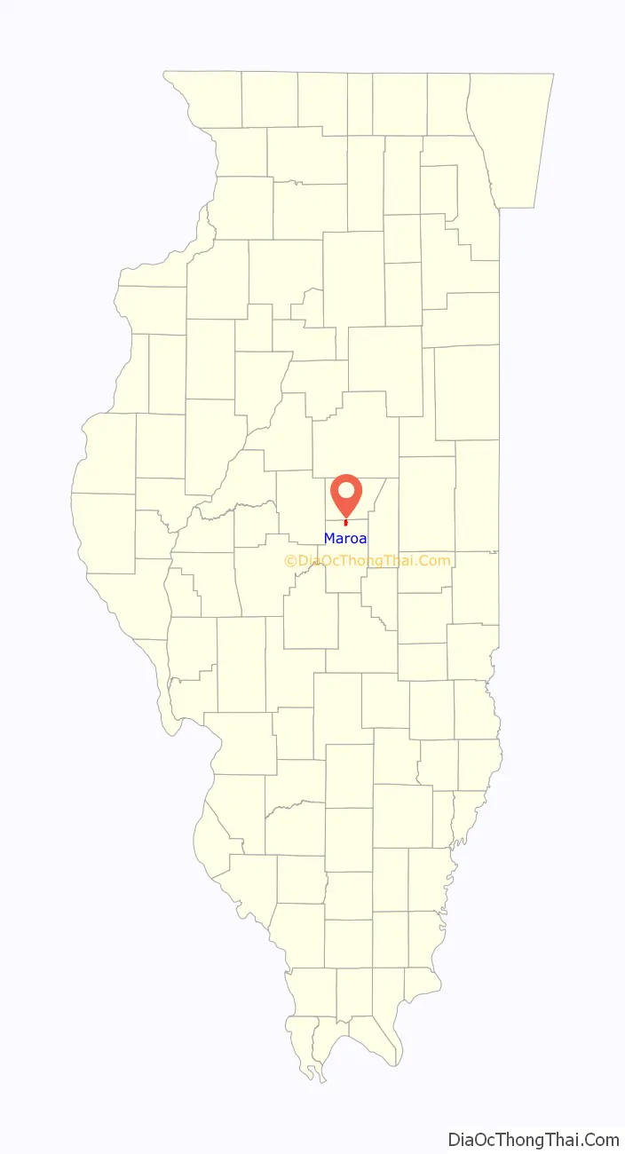
Maroa location map. Where is Maroa city?
History
The city was named after the Maroa people.
The first settler of the township was James Pettyjohn, who came from Kentucky and settled in 1839. The next group of settlers came from Ohio, Indiana, and Tennessee. The first schoolhouse was built in 1852. Maroa at one time was the second largest township, besides county seat Decatur, as it sat at the junction of both the Illinois Central Railroad and the Midland Railroad Company.
Maroa was officially incorporated as a town on March 7, 1867.
Maroa Road Map
Maroa city Satellite Map

Geography
Maroa is located in northern Macon County at 40°2′13″N 88°57′18″W / 40.03694°N 88.95500°W / 40.03694; -88.95500 (40.036951, -88.954967). Its northern boundary is the DeWitt County line. U.S. Route 51 passes through the west side of the city, leading south 13 miles (21 km) to Decatur and north 8 miles (13 km) to Clinton.
According to the U.S. Census Bureau, Maroa has a total area of 1.76 square miles (4.56 km), all land. The headwaters of the North Fork, a west-flowing tributary of the Lake Fork and part of the Sangamon River watershed, pass through the northern part of the city.
On January 3, 2023, An EF1 tornado with estimated peak winds of 110 miles per hour hit the northwest outskirts of Maroa. The tornado damaged silos and caused minor shingle damage to 2 homes.
See also
Map of Illinois State and its subdivision:- Adams
- Alexander
- Bond
- Boone
- Brown
- Bureau
- Calhoun
- Carroll
- Cass
- Champaign
- Christian
- Clark
- Clay
- Clinton
- Coles
- Cook
- Crawford
- Cumberland
- De Kalb
- De Witt
- Douglas
- Dupage
- Edgar
- Edwards
- Effingham
- Fayette
- Ford
- Franklin
- Fulton
- Gallatin
- Greene
- Grundy
- Hamilton
- Hancock
- Hardin
- Henderson
- Henry
- Iroquois
- Jackson
- Jasper
- Jefferson
- Jersey
- Jo Daviess
- Johnson
- Kane
- Kankakee
- Kendall
- Knox
- La Salle
- Lake
- Lake Michigan
- Lawrence
- Lee
- Livingston
- Logan
- Macon
- Macoupin
- Madison
- Marion
- Marshall
- Mason
- Massac
- McDonough
- McHenry
- McLean
- Menard
- Mercer
- Monroe
- Montgomery
- Morgan
- Moultrie
- Ogle
- Peoria
- Perry
- Piatt
- Pike
- Pope
- Pulaski
- Putnam
- Randolph
- Richland
- Rock Island
- Saint Clair
- Saline
- Sangamon
- Schuyler
- Scott
- Shelby
- Stark
- Stephenson
- Tazewell
- Union
- Vermilion
- Wabash
- Warren
- Washington
- Wayne
- White
- Whiteside
- Will
- Williamson
- Winnebago
- Woodford
- Alabama
- Alaska
- Arizona
- Arkansas
- California
- Colorado
- Connecticut
- Delaware
- District of Columbia
- Florida
- Georgia
- Hawaii
- Idaho
- Illinois
- Indiana
- Iowa
- Kansas
- Kentucky
- Louisiana
- Maine
- Maryland
- Massachusetts
- Michigan
- Minnesota
- Mississippi
- Missouri
- Montana
- Nebraska
- Nevada
- New Hampshire
- New Jersey
- New Mexico
- New York
- North Carolina
- North Dakota
- Ohio
- Oklahoma
- Oregon
- Pennsylvania
- Rhode Island
- South Carolina
- South Dakota
- Tennessee
- Texas
- Utah
- Vermont
- Virginia
- Washington
- West Virginia
- Wisconsin
- Wyoming