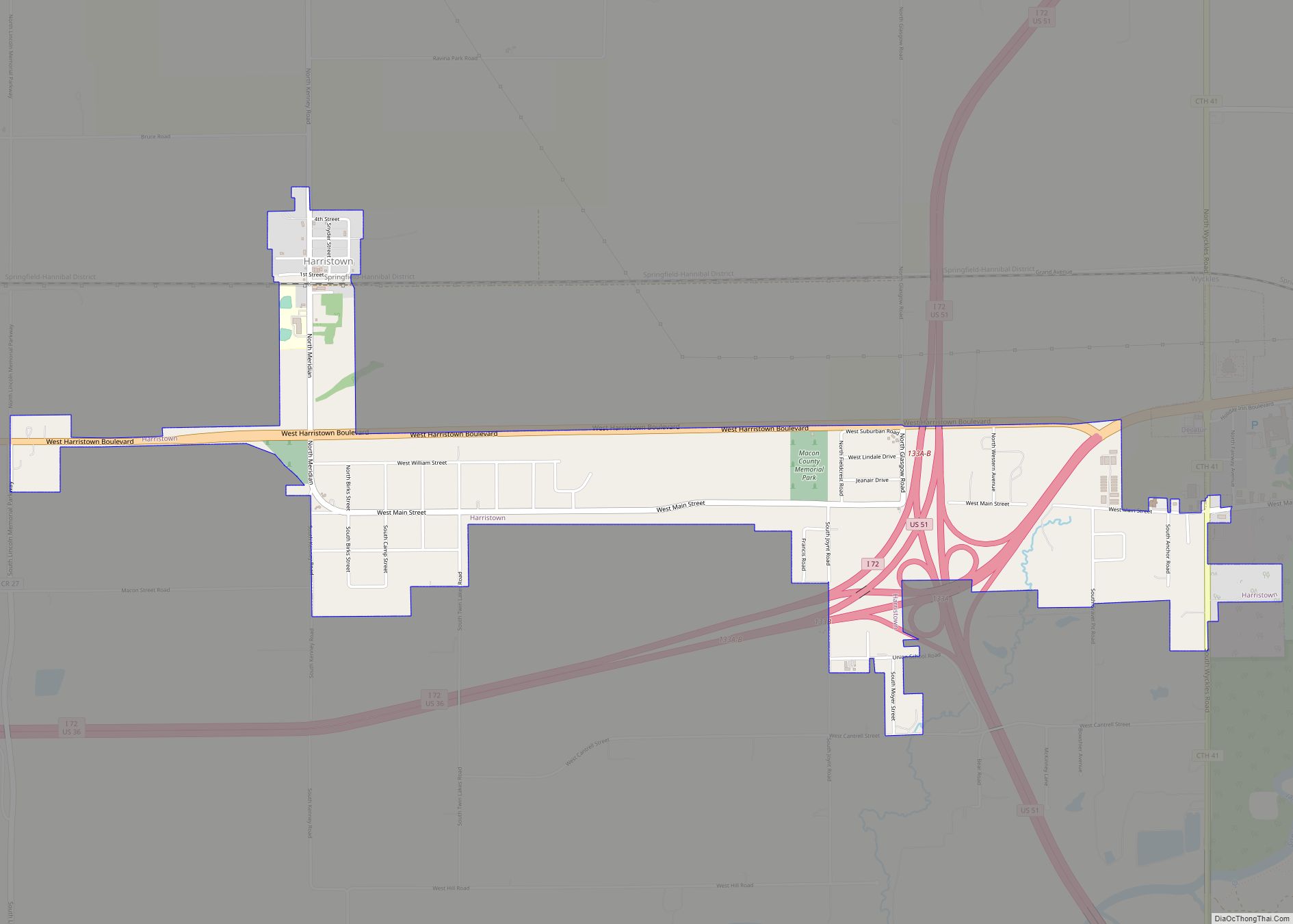
Harristown is a village in Macon County, Illinois, United States. The population was 1,310 at the 2020 census. It is included in the Decatur, Illinois Metropolitan Statistical Area.
| Name: | Harristown village |
|---|---|
| LSAD Code: | 47 |
| LSAD Description: | village (suffix) |
| State: | Illinois |
| County: | Macon County |
| Elevation: | 672 ft (205 m) |
| Total Area: | 1.80 sq mi (4.65 km²) |
| Land Area: | 1.80 sq mi (4.65 km²) |
| Water Area: | 0.00 sq mi (0.00 km²) |
| Total Population: | 1,310 |
| Population Density: | 728.99/sq mi (281.50/km²) |
| ZIP code: | 62537 (Harristown) 62522 (Decatur) |
| Area code: | 217 |
| FIPS code: | 1733227 |
| Website: | villageofharristown.com |
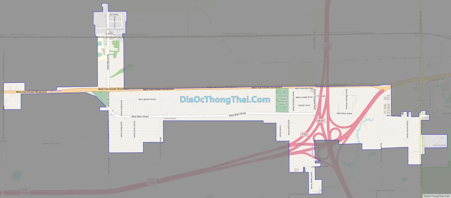
Online Interactive Map
Click on ![]() to view map in "full screen" mode.
to view map in "full screen" mode.
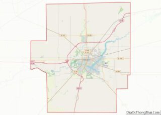
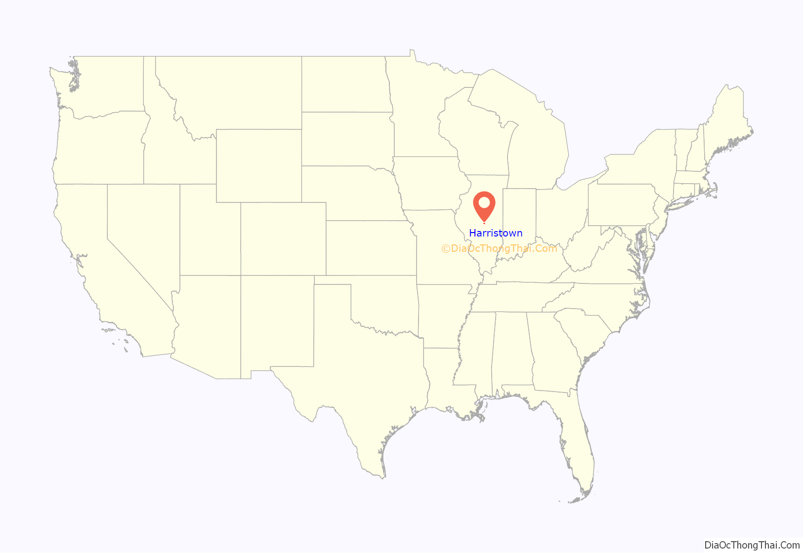
Harristown location map. Where is Harristown village?

History
The village was named in honor of Major Thomas L. Harris, who was elected and served as Major of the Fourth Illinois Regiment in the Mexican–American War, and who was afterward a member of Congress from 1849 to 1858.
The first settlers arrived in 1828 and began building log cabins and improving land around the area. 1841 saw the building of the township’s first schoolhouse, a log building, and served as both the school and as a place of worship until 1853 when the first church was built. Harristown was along the main line of the Wabash Railroad, which contributed to increased population and business.
Harristown was the first Illinois home of Abraham Lincoln. His family settled alongside the Sangamon River 4 miles (6 km) south of the present village in 1830 for a little over a year before relocating due to the harsh winter and extreme sickness. Lincoln and his family constructed a log cabin and fenced in 10 acres (4.0 ha) of land, planting corn in the fenced land. During that winter, Lincoln, together with his stepmother’s son, John D. Johnston, and John Hanks were hired by Denton Offutt to build a flatboat and navigate it from Beardstown, Illinois, down the Illinois and Mississippi rivers to New Orleans. It was during this time that Lincoln saw slavery first-hand for the first time.
Lincoln departed the Harristown area in the spring of 1831. Lincoln Trail Homestead State Park was created in 1904 and marks the spot where his cabin stood.
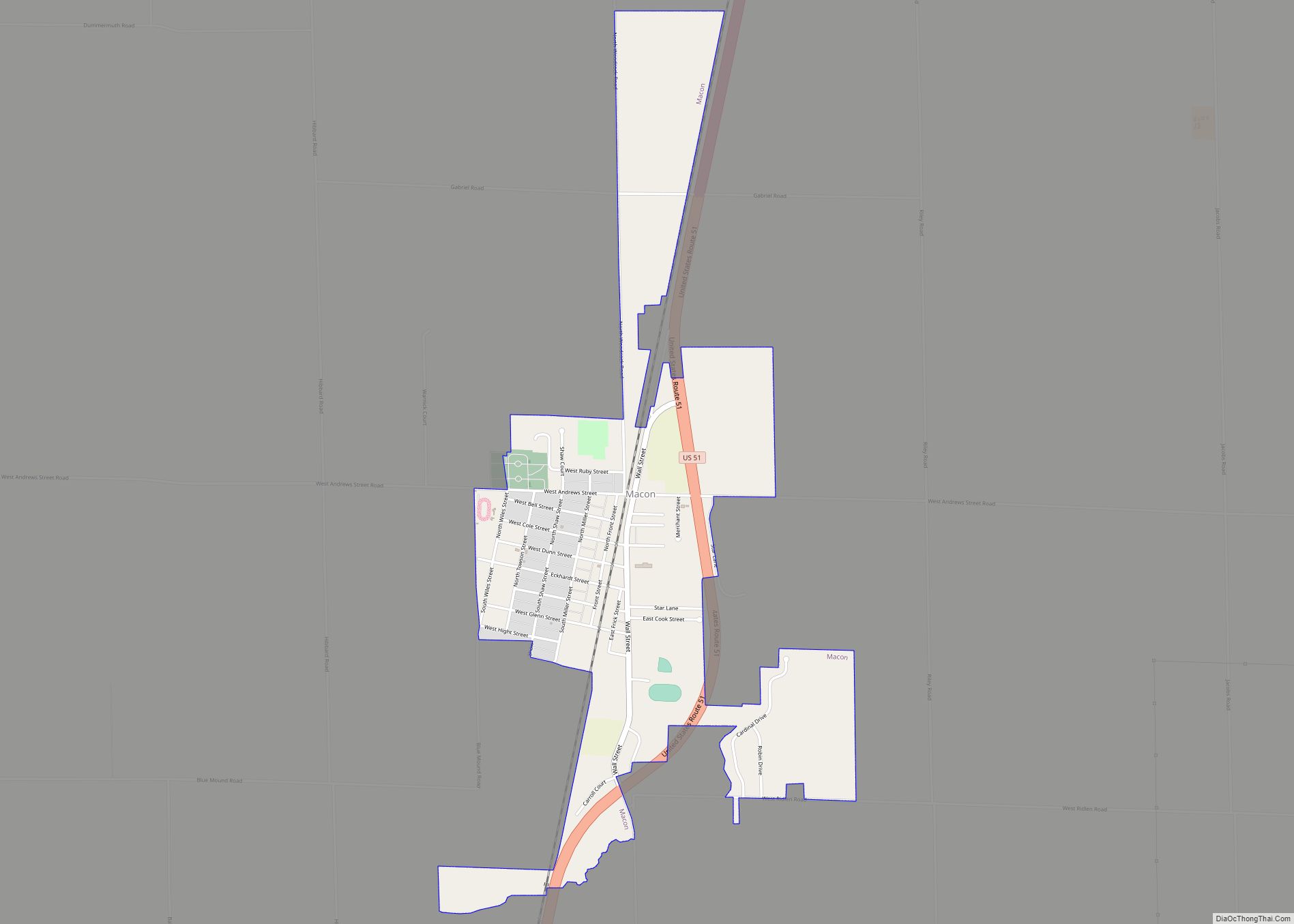
Harristown Road Map
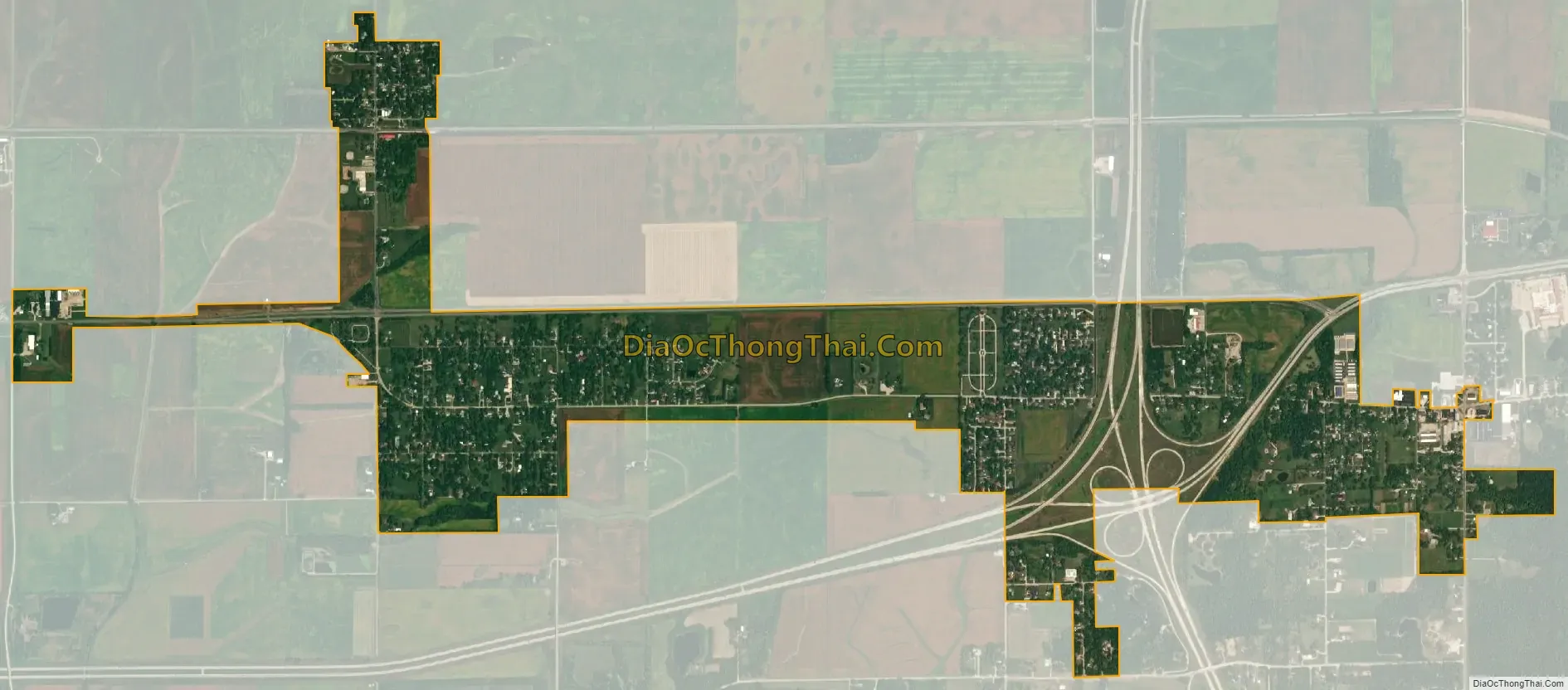
Harristown city Satellite Map
Geography
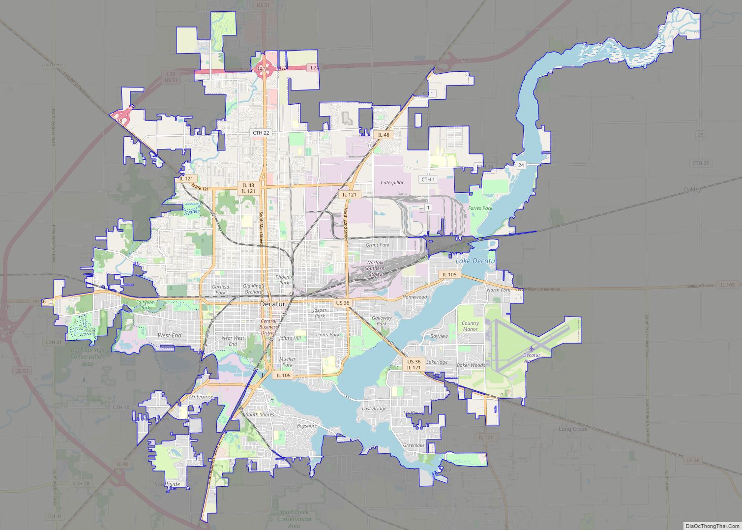
Harristown is located in western Macon County at 39°50′34″N 89°4′10″W / 39.84278°N 89.06944°W / 39.84278; -89.06944 (39.842673, −89.069495). It lies within Harristown Township and is bordered to the east by the city of Decatur, the county seat. Downtown Decatur is 7 miles (11 km) to the east, while Springfield, the state capital, is 33 miles (53 km) to the west.
According to the U.S. Census Bureau, Harristown has a total area of 1.80 square miles (4.66 km), all land. The village is drained to the south by tributaries of the Sangamon River. Abraham Lincoln’s first home in Illinois was located on the north bank of the Sangamon, 4 miles (6 km) south of the present village.
See also
Map of Illinois State and its subdivision:- Adams
- Alexander
- Bond
- Boone
- Brown
- Bureau
- Calhoun
- Carroll
- Cass
- Champaign
- Christian
- Clark
- Clay
- Clinton
- Coles
- Cook
- Crawford
- Cumberland
- De Kalb
- De Witt
- Douglas
- Dupage
- Edgar
- Edwards
- Effingham
- Fayette
- Ford
- Franklin
- Fulton
- Gallatin
- Greene
- Grundy
- Hamilton
- Hancock
- Hardin
- Henderson
- Henry
- Iroquois
- Jackson
- Jasper
- Jefferson
- Jersey
- Jo Daviess
- Johnson
- Kane
- Kankakee
- Kendall
- Knox
- La Salle
- Lake
- Lake Michigan
- Lawrence
- Lee
- Livingston
- Logan
- Macon
- Macoupin
- Madison
- Marion
- Marshall
- Mason
- Massac
- McDonough
- McHenry
- McLean
- Menard
- Mercer
- Monroe
- Montgomery
- Morgan
- Moultrie
- Ogle
- Peoria
- Perry
- Piatt
- Pike
- Pope
- Pulaski
- Putnam
- Randolph
- Richland
- Rock Island
- Saint Clair
- Saline
- Sangamon
- Schuyler
- Scott
- Shelby
- Stark
- Stephenson
- Tazewell
- Union
- Vermilion
- Wabash
- Warren
- Washington
- Wayne
- White
- Whiteside
- Will
- Williamson
- Winnebago
- Woodford
- Alabama
- Alaska
- Arizona
- Arkansas
- California
- Colorado
- Connecticut
- Delaware
- District of Columbia
- Florida
- Georgia
- Hawaii
- Idaho
- Illinois
- Indiana
- Iowa
- Kansas
- Kentucky
- Louisiana
- Maine
- Maryland
- Massachusetts
- Michigan
- Minnesota
- Mississippi
- Missouri
- Montana
- Nebraska
- Nevada
- New Hampshire
- New Jersey
- New Mexico
- New York
- North Carolina
- North Dakota
- Ohio
- Oklahoma
- Oregon
- Pennsylvania
- Rhode Island
- South Carolina
- South Dakota
- Tennessee
- Texas
- Utah
- Vermont
- Virginia
- Washington
- West Virginia
- Wisconsin
- Wyoming