Maunie is a village in White County, Illinois, United States. The population was 177 at the 2000 census.
| Name: | Maunie village |
|---|---|
| LSAD Code: | 47 |
| LSAD Description: | village (suffix) |
| State: | Illinois |
| County: | White County |
| Elevation: | 371 ft (113 m) |
| Total Area: | 0.17 sq mi (0.43 km²) |
| Land Area: | 0.16 sq mi (0.41 km²) |
| Water Area: | 0.01 sq mi (0.02 km²) |
| Total Population: | 91 |
| Population Density: | 572.33/sq mi (221.41/km²) |
| Area code: | 618 |
| FIPS code: | 1747592 |
Online Interactive Map
Click on ![]() to view map in "full screen" mode.
to view map in "full screen" mode.
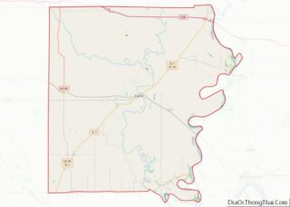
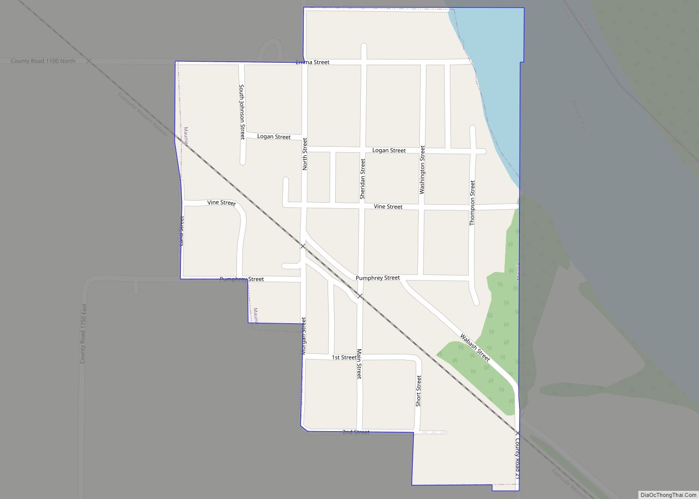
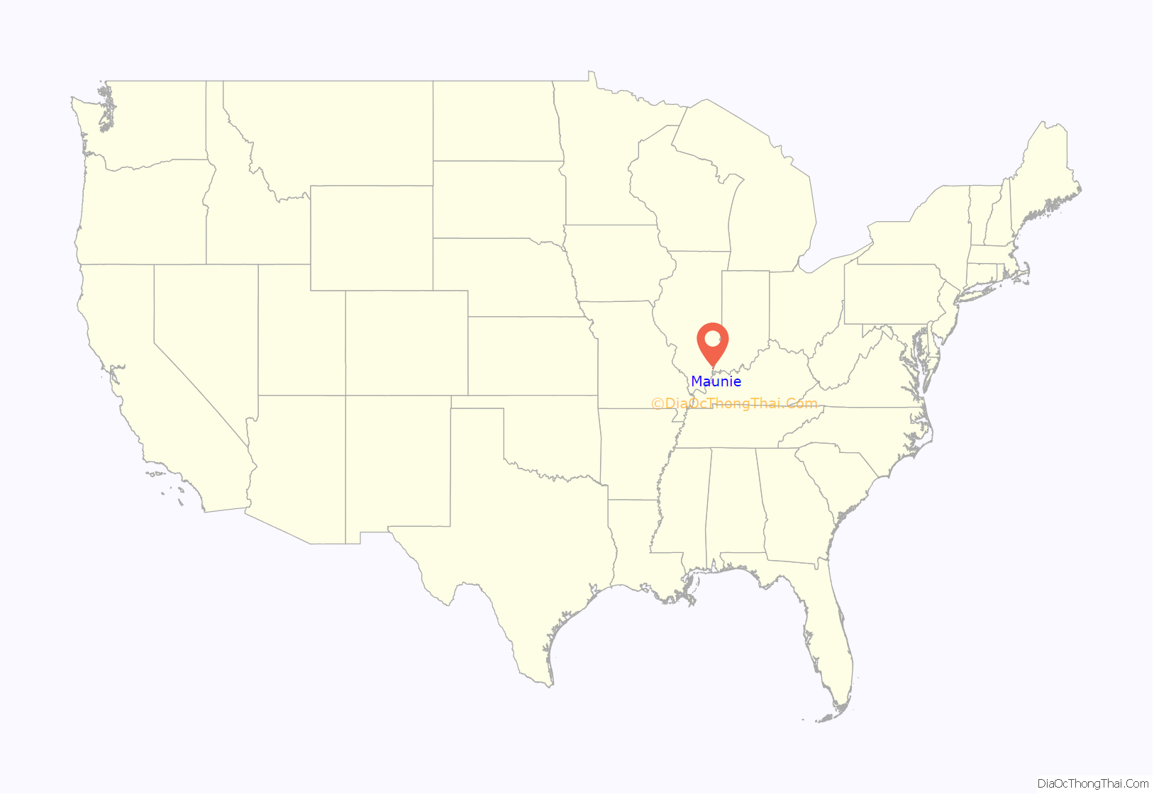
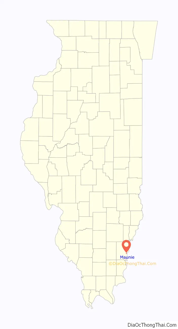
Maunie location map. Where is Maunie village?
History
The village name is a portmanteau of the first names of Maude Sheridan and Jennie Pumphrey, wives of two early settlers (John Pumphrey and G.S. Sheridan). A post office was established at Maunie in 1893. The village incorporated in 1901.
On January 18, 1929, at 11.20 a.m., a tornado hit Maunie, killing two school children.
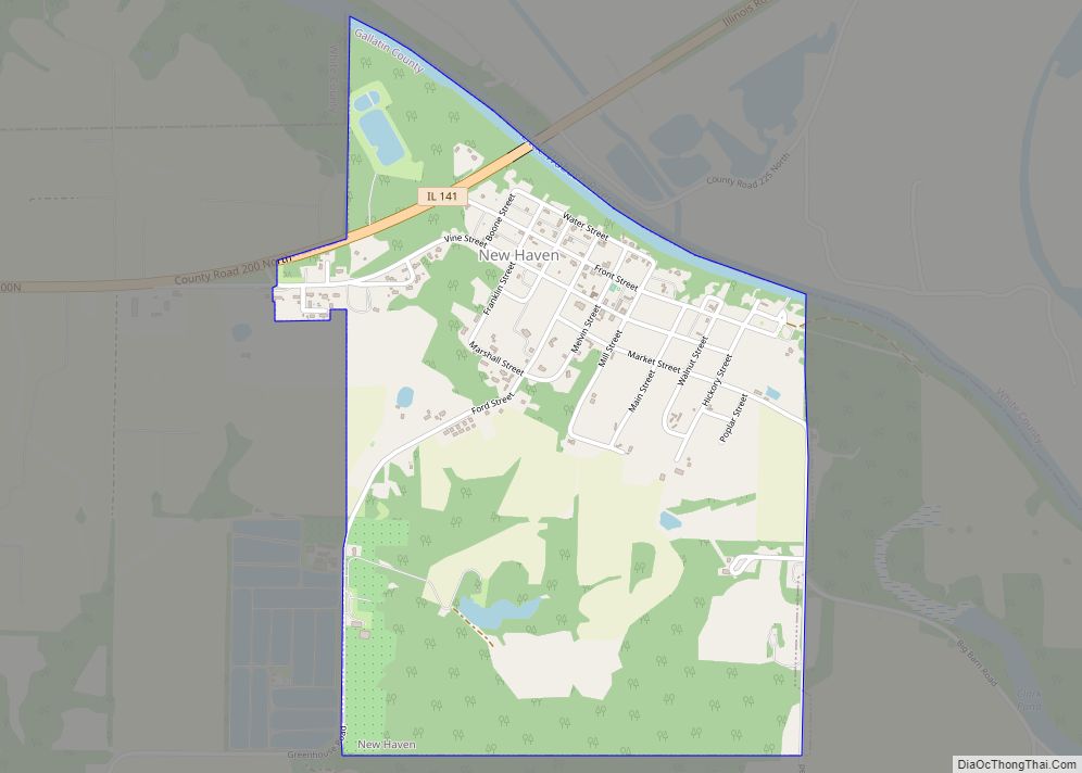
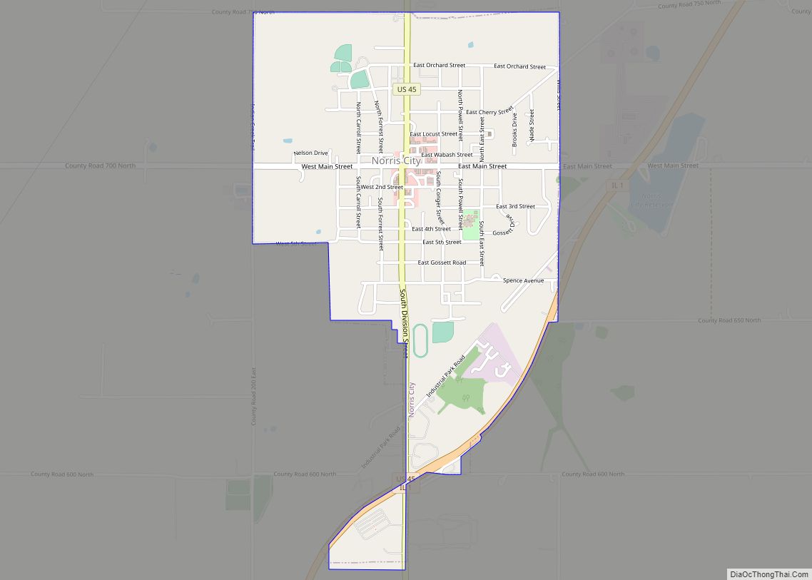
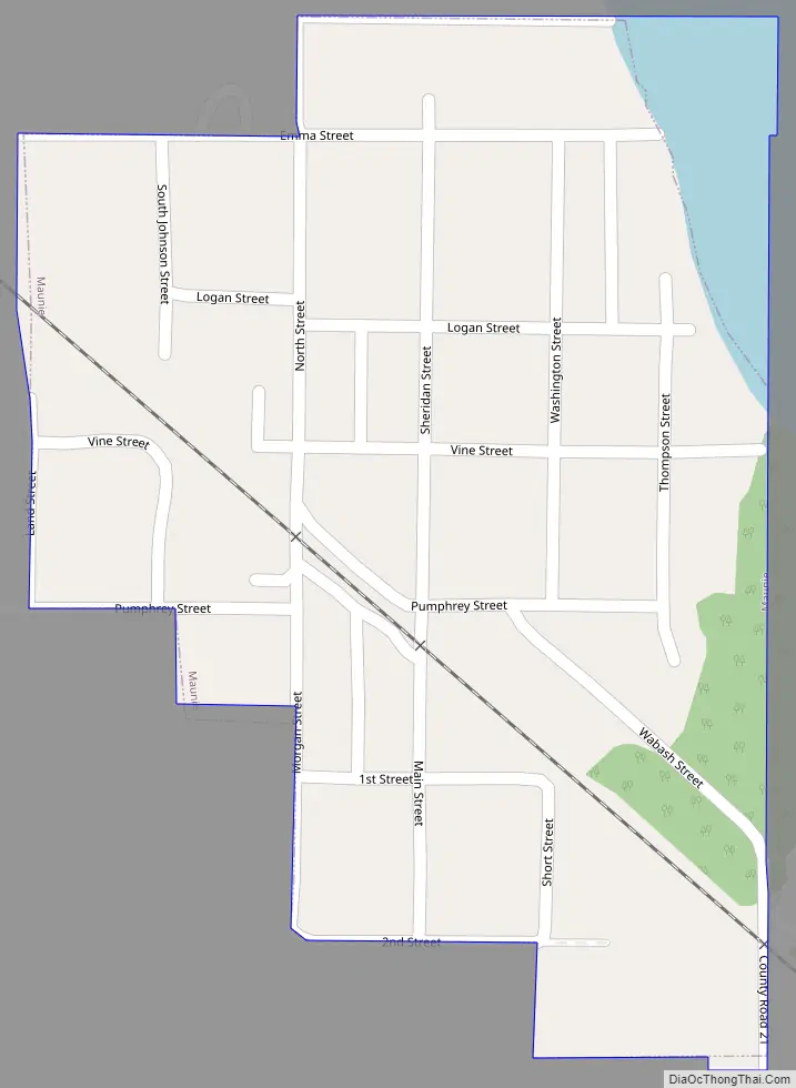
Maunie Road Map
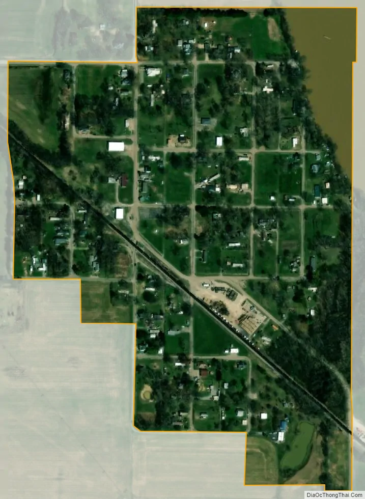
Maunie city Satellite Map
Geography
Maunie is located at 38°2′8″N 88°2′48″W / 38.03556°N 88.04667°W / 38.03556; -88.04667 (38.035493, -88.046617). The village lies in eastern Illinois along Wabash River, which marks the Illinois-Indiana state line.
According to the 2010 census, Maunie has a total area of 0.16 square miles (0.41 km), all land.
See also
Map of Illinois State and its subdivision:- Adams
- Alexander
- Bond
- Boone
- Brown
- Bureau
- Calhoun
- Carroll
- Cass
- Champaign
- Christian
- Clark
- Clay
- Clinton
- Coles
- Cook
- Crawford
- Cumberland
- De Kalb
- De Witt
- Douglas
- Dupage
- Edgar
- Edwards
- Effingham
- Fayette
- Ford
- Franklin
- Fulton
- Gallatin
- Greene
- Grundy
- Hamilton
- Hancock
- Hardin
- Henderson
- Henry
- Iroquois
- Jackson
- Jasper
- Jefferson
- Jersey
- Jo Daviess
- Johnson
- Kane
- Kankakee
- Kendall
- Knox
- La Salle
- Lake
- Lake Michigan
- Lawrence
- Lee
- Livingston
- Logan
- Macon
- Macoupin
- Madison
- Marion
- Marshall
- Mason
- Massac
- McDonough
- McHenry
- McLean
- Menard
- Mercer
- Monroe
- Montgomery
- Morgan
- Moultrie
- Ogle
- Peoria
- Perry
- Piatt
- Pike
- Pope
- Pulaski
- Putnam
- Randolph
- Richland
- Rock Island
- Saint Clair
- Saline
- Sangamon
- Schuyler
- Scott
- Shelby
- Stark
- Stephenson
- Tazewell
- Union
- Vermilion
- Wabash
- Warren
- Washington
- Wayne
- White
- Whiteside
- Will
- Williamson
- Winnebago
- Woodford
- Alabama
- Alaska
- Arizona
- Arkansas
- California
- Colorado
- Connecticut
- Delaware
- District of Columbia
- Florida
- Georgia
- Hawaii
- Idaho
- Illinois
- Indiana
- Iowa
- Kansas
- Kentucky
- Louisiana
- Maine
- Maryland
- Massachusetts
- Michigan
- Minnesota
- Mississippi
- Missouri
- Montana
- Nebraska
- Nevada
- New Hampshire
- New Jersey
- New Mexico
- New York
- North Carolina
- North Dakota
- Ohio
- Oklahoma
- Oregon
- Pennsylvania
- Rhode Island
- South Carolina
- South Dakota
- Tennessee
- Texas
- Utah
- Vermont
- Virginia
- Washington
- West Virginia
- Wisconsin
- Wyoming