Quincy (/ˈkwɪnsi/ KWIN-see), known as Illinois‘s “Gem City”, is a city in and the county seat of Adams County, Illinois, United States, located on the Mississippi River. The 2020 census counted a population of 39,463 in the city itself, down from 40,633 in 2010. As of July 1, 2015, the Quincy Micro Area had an estimated population of 77,220. During the 19th century, Quincy was a thriving transportation center as riverboats and rail service linked the city to many destinations west and along the river. It was Illinois’ second-largest city, surpassing Peoria in 1870. The city has several historic districts, including the Downtown Quincy Historic District and the South Side German Historic District, which display the architecture of Quincy’s many German immigrants from the late 19th century.
| Name: | Quincy city |
|---|---|
| LSAD Code: | 25 |
| LSAD Description: | city (suffix) |
| State: | Illinois |
| County: | Adams County |
| Elevation: | 633 ft (193 m) |
| Land Area: | 15.77 sq mi (40.83 km²) |
| Water Area: | 0.04 sq mi (0.11 km²) |
| Population Density: | 2,503.20/sq mi (966.50/km²) |
| ZIP code: | 62301, 62305, 62306 |
| FIPS code: | 1762367 |
| GNISfeature ID: | 2396301 |
| Website: | www.quincyil.gov |
Online Interactive Map
Click on ![]() to view map in "full screen" mode.
to view map in "full screen" mode.
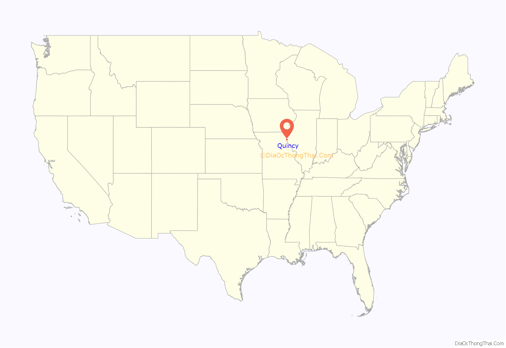
Quincy location map. Where is Quincy city?
History
Early history
Quincy’s location along the Mississippi River has attracted settlers for centuries. The French became the first European presence to colonize the region, after Louis Jolliet, Jacques Marquette, Jamison Knapp and the La Salle Expeditions explored the Upper Mississippi River Valley. Fur goods became a valuable commodity of the region, and European explorers and merchants alike were attracted to the prospects of the growing fur trade of the North American frontier. The Mississippi River, acting as a superhighway for transporting goods downstream, became the area’s most vital transportation asset.
Following the events of the Seven Years’ War, which ended in 1763, Great Britain took control of New France, including that of the Illinois Territory. The Illinois Territory changed hands again a few decades later during the American Revolutionary War.
19th century
After the War of 1812, the American government granted military tracts to veterans as a means to help populate the West. Peter Flinn, having acquired the land from veteran Mark McGowan for his military service in 1819, ended up selling 160 acres (0.65 km) of land acquisitions to Moravia, New York native John Wood for $60. John Wood later founded Quincy, which at the time was coined Bluffs, Illinois.
In 1825, Bluffs renamed their community Quincy and became the seat of government for Adams County, both named after newly elected President John Quincy Adams. In addition, they originally named the town square John Square until eventually changing it to Washington Square. In June 1834, Quincy was incorporated, with Archibald Williams, Joseph T. Holmes, S. W. Rogers, Levi Wells, and Michael Mast elected as trustees. Quincy incorporated as a city in 1840, with Ebenezer Moore elected as its first mayor.
In 1837, following the signing of Missouri Executive Order 44, which is an extermination order, many members of the Church of Jesus Christ of Latter-day Saints fled persecution in Missouri and found shelter in Quincy. Despite being vastly outnumbered by Mormon refugees, residents provided food and lodging for the displaced people. Joseph Smith then led members of the Church of Jesus Christ of Latter-day Saints 40 miles (64 km) upstream to Nauvoo, Illinois, in hopes of finding a permanent home. Also in 1838, Quincy sheltered the Pottawatomie tribe as they were forcibly relocated from Indiana to Kansas.
The 1850s and 1860s brought increased prosperity to Quincy. Steamboats and railroads began linking Quincy to places west, making the city a frequent destination for immigrants. The founding of the Chicago, Burlington and Quincy Railroad in 1855, and the construction of the Quincy Rail Bridge, were major drivers for creating a transportation hub in the region to further commerce. It is during this time that the city’s population grew enormously, from just under 7,000 residents in 1850 to 24,000 by 1870, helping Quincy surpass Peoria in becoming the second-largest city in the state (at that time).
One famous former resident of Quincy is George E. Pickett. The future Confederate general as a young man came to Quincy to live, and learn the law, from his uncle Alexander Johnson in the 1840s. Johnson was acquainted with Abraham Lincoln, and Pickett and Lincoln may have even met each other in Quincy.
In 1860, Quincy founder and Lieutenant Governor John Wood inherited the governorship after William H. Bissell died while in office. At the time, he was overseeing business interests and the construction of his mansion. The Illinois legislature allowed him to stay in Quincy during his tenure, effectively making Quincy a “second” capitol for the state. His absence from the official governor’s office in Springfield provided Abraham Lincoln a space for planning his presidential run.
The matter of slavery was a major religious and social issue in Quincy’s early years. The Illinois city’s location, separated only by the Mississippi River from the slave state of Missouri, which was a hotbed of political controversy on the issue, made Quincy itself a hotbed of political controversy on slavery. Richard Eells, who was a staunch abolitionist, built his home in Quincy in 1835 and sheltered runaway slaves on their way to Chicago. His home became a major stop on the Underground Railroad. The divide over slavery climaxed in 1858, when Quincy hosted the sixth Senatorial debate by U.S. Senator Stephen A. Douglas and his challenger, Abraham Lincoln. With a crowd of 12,000 in attendance, Quincy was the largest community at which Lincoln and Douglas debated.
Lincoln and Douglas again confronted each other in the 1860 Presidential election and the resulting campaign again divided Quincy and the surrounding region. Lincoln enthusiasts and Quincy’s chapter of the Republican Party’s para-military organization Wide Awakes, while en route to a political rally in Plainville, marched upon nearby Payson, which was a community predominantly filled with Douglas supporters. Although a confrontation was avoided while en route to Plainville, Douglas supporters shot upon the Wide Awakes on their journey back to Quincy, resulting in a skirmish known as the Stone Prairie Riots.
The Civil War brought increasing prosperity to Quincy. Although the battles took place far from the city, Quincy was the organization site for several Illinois volunteer infantry regiments, including the 16th, 50th, 78th, 84th, 119th, 137th, 138th, and 151st. Following the Reconstruction Era, Quincy was selected as the location for Illinois’ first Veteran’s Home in 1886.
Immigration to Quincy
Early immigrants to Quincy came predominately from New England, seeking better land. They brought with them progressive values, such as public education and abolitionism. Starting in the 1840s, migrants from Germany settled in Quincy to escape revolutions among the German provinces and conflicts between the European powers. German migrants mainly lived in close proximity to one another and settled predominantly in the southern parts of the city, influencing much of Quincy’s historic architecture and creating the South Side German Historic District. Collectively, the south side of Quincy became known as Calftown, due to the fact that nearly every household possessed a cow. Among the notable German-Americans from Quincy’s Southside was Louise Maertz (1837–1918), a nurse during the American Civil War.
In 1860, a group of Franciscan friars founded the St. Francis Solanus College, which later developed into Quincy University.
20th and 21st centuries
Throughout the 19th century, Quincy had grown from a backwater hamlet along the Mississippi River to become one of the state’s most important cities and ports. Activity from rail and steamboat continued to flourish and Quincy benefited from the increased traffic. It was during the early decades of the 20th century that many of the city’s historic buildings in the Downtown Quincy Historic District were constructed, including the city’s first skyscraper, the Western Catholic Union Building, in 1925.
The increasing presence of the automobile led Quincy to consider alternatives to Mississippi River crossings. Prior to the automobile, the most common means of crossing the near-mile wide river was by boat or ferry. In 1928, construction began on the Memorial Bridge which was a two-lane truss toll bridge; it opened in May 1930. By 1945, the city had repaid its outstanding bonds and eliminated the toll.
On April 12, 1945, a tornado ripped through the business district of Quincy and severely damaged the courthouse. The wind was so severe that it blew the roof off the structure, damaging it beyond repair. Because the incident occurred a few hours after news reached Quincy of President Roosevelt’s death, several residents joked that “FDR and God were just fighting over the power-up there.” Five years passed before a new courthouse was completed.
In 1987, the cable-stayed Bayview Bridge was constructed with the intent of alleviating traffic on the aging Memorial Bridge. Today, both bridges complement each other by carrying westbound (Bayview) and eastbound (Memorial) traffic. Although the lighting was originally intended for the Bayview Bridge during its construction phase, the actual installation of lights didn’t occur until 2015.
During the Mississippi River flood of 1993, riverside businesses and industries suffered extensive damage when the river crested at a record 32.2 feet (9.81 m), 15 feet (4.6 m) above flood stage. For a time, the Bayview Bridge, one of Quincy’s two bridges, was the only bridge open across the Mississippi River between Alton, Illinois and Burlington, Iowa. The Memorial Bridge was closed from the end of June, due to water over its western approach. On July 16, 1993, the Bayview Bridge closed when the river submerged the land on the west side of the Mississippi River at Taylor, Missouri; Quincy’s bridges reopened 73 days later on September 26, 1993.
On November 19, 1996, the United Express Flight 5925 collided on landing at Quincy with another Beechcraft, a private King Air, that was taking off from an intersecting runway. All occupants of both planes, twelve on board the 5925 and two on board the King Air, were killed as a result.
A flood in June 2008 submerged much of Quincy’s riverfront and low-lying regions not protected by the bluffs. Record Mississippi River levels occurred on June 22, 2008. The Red Cross accepted donations for Quincy and other communities in Adams County, as natural disaster funds were depleted in 2010.
Quincy has been twice recognized as an All-America City and is a participant in the Tree City USA program. In the fall of 2010, Forbes Magazine listed Quincy as the eighth “Best Small City To Raise A Family.”
Quincy Road Map
Quincy city Satellite Map
Geography
Quincy is located at 39°55′56″N 91°23′19″W / 39.93222°N 91.38861°W / 39.93222; -91.38861 (39.932335, -91.388737). It is adjacent to the Mississippi River and Quincy Bay, a large inlet of water fed by Cedar and Homan Creeks. According to the 2021 census gazetteer files, Quincy has a total area of 15.81 square miles (40.95 km), of which 15.77 square miles (40.84 km) (or 99.73%) is land and 0.04 square miles (0.10 km) (or 0.27%) is water.
The city is situated on bluffs overlooking the Mississippi River. Adjacent to Quincy, on the Missouri side of the river, is West Quincy, Missouri and a vast floodplain used primarily for farming. East of Quincy lies the Quincy Hills geographic region, a region of hills that are similar to the Lincoln Hills in Missouri, where a mixture of rolling hills, woods, and farming shape the landscape. Flat prairie lie north of Quincy and, as the Mississippi turns sharply to the southwest; bluffs, floodplain, and farmland lie to the south and southwest of the city.
The Quincy micropolitan area includes Adams County, Illinois and Lewis County, Missouri and together hold a population of 75,546. Due to its proximity to Hannibal, Missouri, the two communities have been bulked into Quincy-Hannibal, IL-MO Combined Statistical Area which holds approximately 116,000 residents. As of the 2010 Census, it is currently ranked as the 156th most populated CSA in the United States.
Geographically, Quincy is the largest city and central hub of the Tri-State region, encompassing western Illinois, northeastern Missouri, and southeastern Iowa.
Quincy has several suburbs. North Quincy is the city’s most populated suburb and lies to the north, beyond a rail line and a large creek. Hickory Grove, Illinois is an edge town and lies adjacent to Quincy to its east, bordered by Interstate 172. The town of Marblehead lies to the south, and West Quincy to the west.
The Hannibal–Quincy micropolitan area is also technically not located within the nearby St. Louis metropolitan, but are regionally associated due to their proximity and accessibility to Greater St. Louis.
Sister cities
Quincy, Illinois has two sister cities.
- Herford, Germany
- Jiaxing, Zhejiang, China
See also
Map of Illinois State and its subdivision:- Adams
- Alexander
- Bond
- Boone
- Brown
- Bureau
- Calhoun
- Carroll
- Cass
- Champaign
- Christian
- Clark
- Clay
- Clinton
- Coles
- Cook
- Crawford
- Cumberland
- De Kalb
- De Witt
- Douglas
- Dupage
- Edgar
- Edwards
- Effingham
- Fayette
- Ford
- Franklin
- Fulton
- Gallatin
- Greene
- Grundy
- Hamilton
- Hancock
- Hardin
- Henderson
- Henry
- Iroquois
- Jackson
- Jasper
- Jefferson
- Jersey
- Jo Daviess
- Johnson
- Kane
- Kankakee
- Kendall
- Knox
- La Salle
- Lake
- Lake Michigan
- Lawrence
- Lee
- Livingston
- Logan
- Macon
- Macoupin
- Madison
- Marion
- Marshall
- Mason
- Massac
- McDonough
- McHenry
- McLean
- Menard
- Mercer
- Monroe
- Montgomery
- Morgan
- Moultrie
- Ogle
- Peoria
- Perry
- Piatt
- Pike
- Pope
- Pulaski
- Putnam
- Randolph
- Richland
- Rock Island
- Saint Clair
- Saline
- Sangamon
- Schuyler
- Scott
- Shelby
- Stark
- Stephenson
- Tazewell
- Union
- Vermilion
- Wabash
- Warren
- Washington
- Wayne
- White
- Whiteside
- Will
- Williamson
- Winnebago
- Woodford
- Alabama
- Alaska
- Arizona
- Arkansas
- California
- Colorado
- Connecticut
- Delaware
- District of Columbia
- Florida
- Georgia
- Hawaii
- Idaho
- Illinois
- Indiana
- Iowa
- Kansas
- Kentucky
- Louisiana
- Maine
- Maryland
- Massachusetts
- Michigan
- Minnesota
- Mississippi
- Missouri
- Montana
- Nebraska
- Nevada
- New Hampshire
- New Jersey
- New Mexico
- New York
- North Carolina
- North Dakota
- Ohio
- Oklahoma
- Oregon
- Pennsylvania
- Rhode Island
- South Carolina
- South Dakota
- Tennessee
- Texas
- Utah
- Vermont
- Virginia
- Washington
- West Virginia
- Wisconsin
- Wyoming
