Venice is a city in Madison County, Illinois, United States. The population was 1,498 at the 2020 census, down from 1,890 in 2010.
| Name: | Venice city |
|---|---|
| LSAD Code: | 25 |
| LSAD Description: | city (suffix) |
| State: | Illinois |
| County: | Madison County |
| Elevation: | 413 ft (126 m) |
| Total Area: | 1.85 sq mi (4.79 km²) |
| Land Area: | 1.85 sq mi (4.79 km²) |
| Water Area: | 0.00 sq mi (0.00 km²) |
| Total Population: | 1,498 |
| Population Density: | 810.17/sq mi (312.89/km²) |
| ZIP code: | 62090 (Venice) 62060 (Madison) |
| Area code: | 618 |
| FIPS code: | 1777473 |
| GNISfeature ID: | 2397123 |
Online Interactive Map
Click on ![]() to view map in "full screen" mode.
to view map in "full screen" mode.
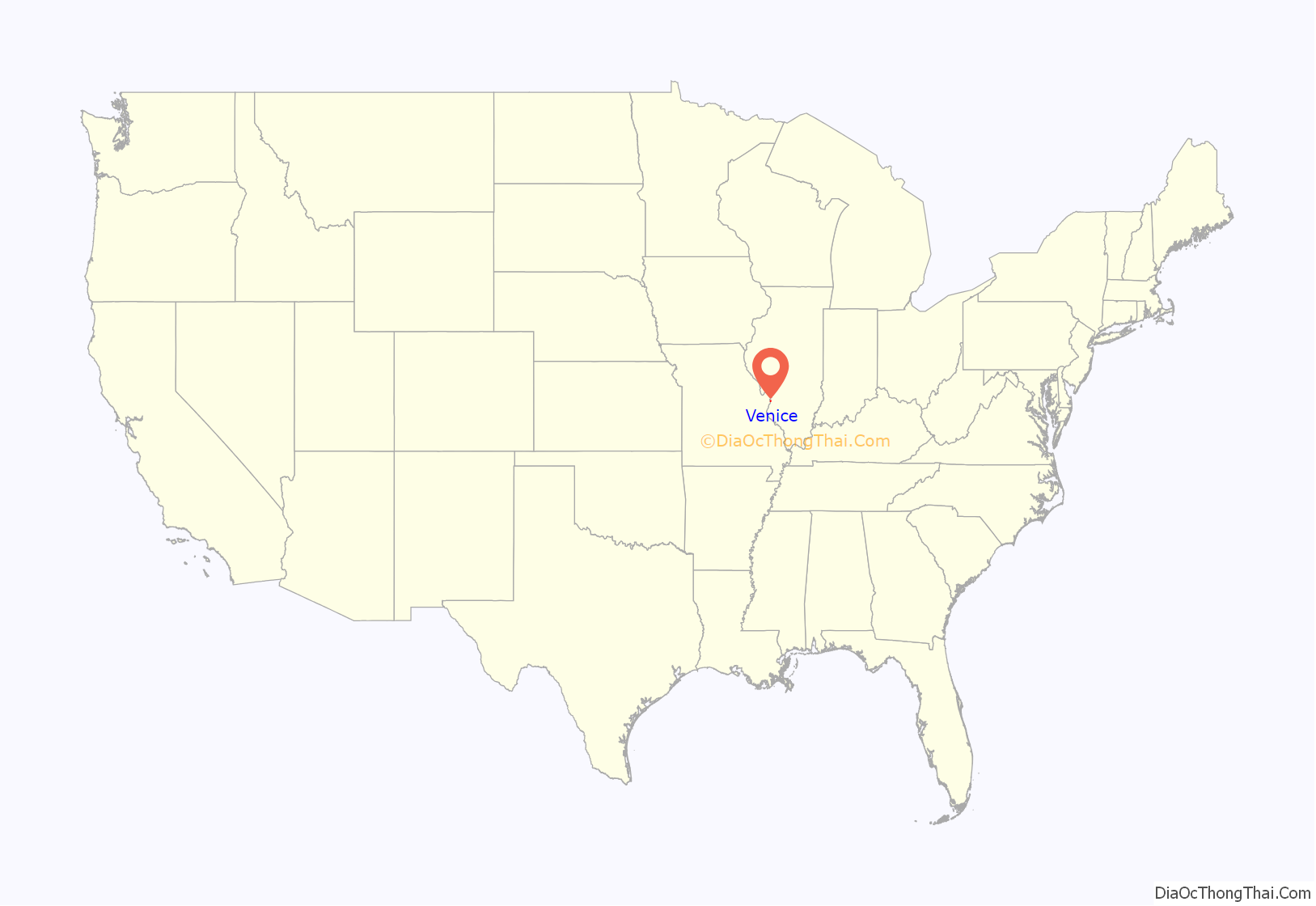
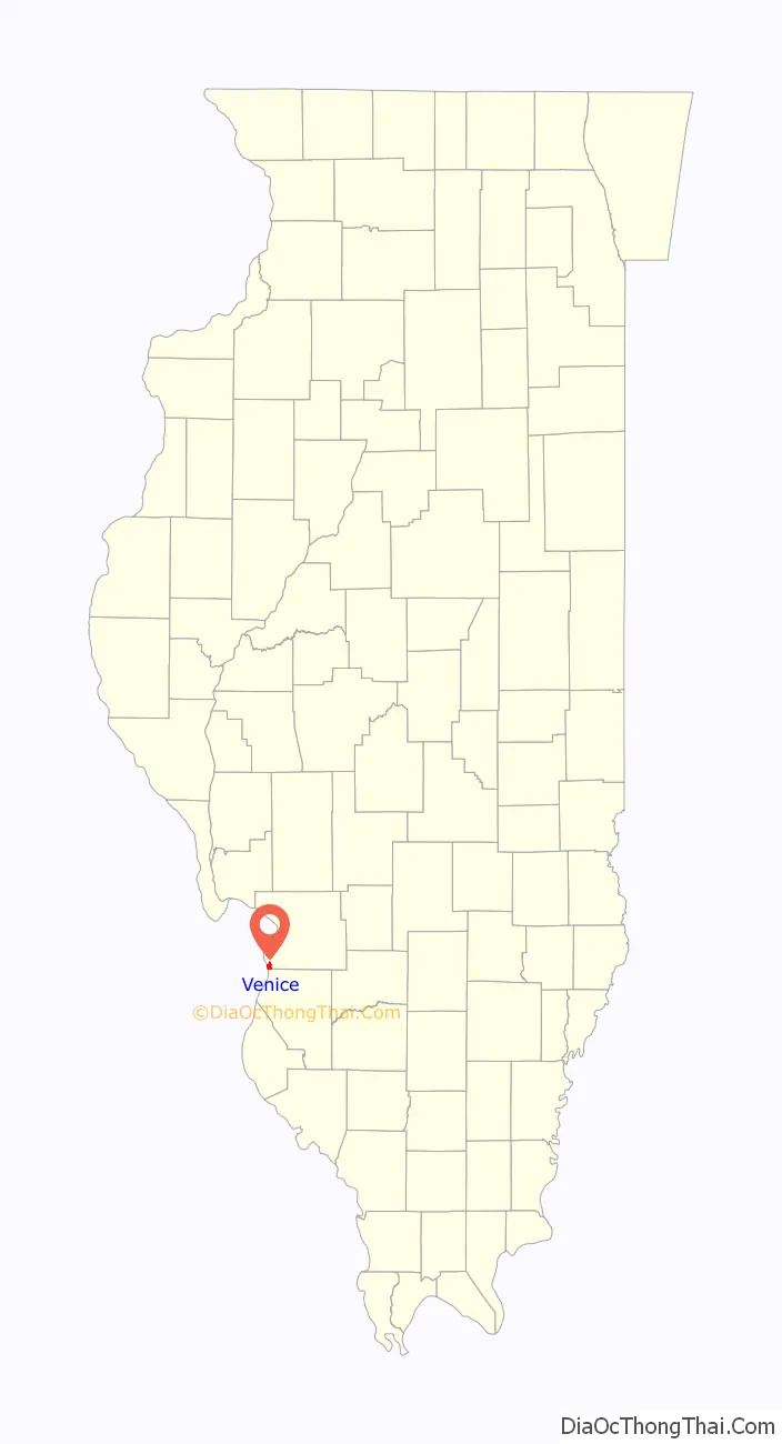
Venice location map. Where is Venice city?
History
Venice was platted in 1841.
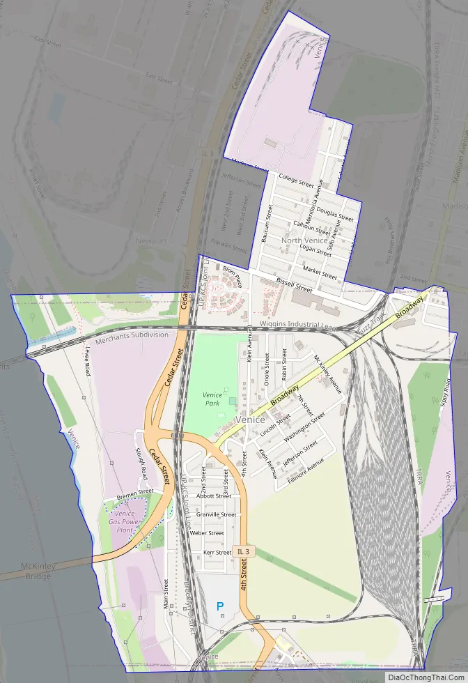
Venice Road Map
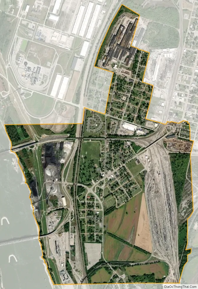
Venice city Satellite Map
Geography
Venice is located in the southwest corner of Madison County at 38°40′26″N 90°10′4″W / 38.67389°N 90.16778°W / 38.67389; -90.16778 (38.673796, -90.167885). It is bordered to the north and east by the city of Madison, to the south by the city of Brooklyn in St. Clair County, and to the west by the Mississippi River, across which is the city of St. Louis, Missouri.
According to the U.S. Census Bureau, Venice has a total area of 1.85 square miles (4.79 km), of which 0.002 square miles (0.005 km), or 0.11%, are water.
Illinois Route 3 passes through the west side of Venice, leading north 19 miles (31 km) to Alton and south 4 miles (6 km) to East St. Louis. The McKinley Bridge crosses the Mississippi River from Route 3 in Venice to Interstate 70 in St. Louis.
See also
Map of Illinois State and its subdivision:- Adams
- Alexander
- Bond
- Boone
- Brown
- Bureau
- Calhoun
- Carroll
- Cass
- Champaign
- Christian
- Clark
- Clay
- Clinton
- Coles
- Cook
- Crawford
- Cumberland
- De Kalb
- De Witt
- Douglas
- Dupage
- Edgar
- Edwards
- Effingham
- Fayette
- Ford
- Franklin
- Fulton
- Gallatin
- Greene
- Grundy
- Hamilton
- Hancock
- Hardin
- Henderson
- Henry
- Iroquois
- Jackson
- Jasper
- Jefferson
- Jersey
- Jo Daviess
- Johnson
- Kane
- Kankakee
- Kendall
- Knox
- La Salle
- Lake
- Lake Michigan
- Lawrence
- Lee
- Livingston
- Logan
- Macon
- Macoupin
- Madison
- Marion
- Marshall
- Mason
- Massac
- McDonough
- McHenry
- McLean
- Menard
- Mercer
- Monroe
- Montgomery
- Morgan
- Moultrie
- Ogle
- Peoria
- Perry
- Piatt
- Pike
- Pope
- Pulaski
- Putnam
- Randolph
- Richland
- Rock Island
- Saint Clair
- Saline
- Sangamon
- Schuyler
- Scott
- Shelby
- Stark
- Stephenson
- Tazewell
- Union
- Vermilion
- Wabash
- Warren
- Washington
- Wayne
- White
- Whiteside
- Will
- Williamson
- Winnebago
- Woodford
- Alabama
- Alaska
- Arizona
- Arkansas
- California
- Colorado
- Connecticut
- Delaware
- District of Columbia
- Florida
- Georgia
- Hawaii
- Idaho
- Illinois
- Indiana
- Iowa
- Kansas
- Kentucky
- Louisiana
- Maine
- Maryland
- Massachusetts
- Michigan
- Minnesota
- Mississippi
- Missouri
- Montana
- Nebraska
- Nevada
- New Hampshire
- New Jersey
- New Mexico
- New York
- North Carolina
- North Dakota
- Ohio
- Oklahoma
- Oregon
- Pennsylvania
- Rhode Island
- South Carolina
- South Dakota
- Tennessee
- Texas
- Utah
- Vermont
- Virginia
- Washington
- West Virginia
- Wisconsin
- Wyoming


