Madison is a city in Madison and St. Clair counties in the U.S. state of Illinois. The population was 3,171 at the 2020 census, down from 3,891 in 2010. It is home to World Wide Technology Raceway at Gateway and the first Bulgarian Orthodox church in the United States.
| Name: | Madison city |
|---|---|
| LSAD Code: | 25 |
| LSAD Description: | city (suffix) |
| State: | Illinois |
| County: | Madison County, St. Clair County |
| Elevation: | 410 ft (120 m) |
| Total Area: | 17.88 sq mi (46.32 km²) |
| Land Area: | 14.14 sq mi (36.64 km²) |
| Water Area: | 3.74 sq mi (9.68 km²) |
| Total Population: | 3,171 |
| Population Density: | 224.18/sq mi (86.56/km²) |
| ZIP code: | 62060 (Madison) 62040 (Granite City) 62048 (Hartford) 62201 (East St. Louis) |
| Area code: | 618 |
| FIPS code: | 1745993 |
| GNISfeature ID: | 2395806 |
| Website: | cityofmadisonil.com |
Online Interactive Map
Click on ![]() to view map in "full screen" mode.
to view map in "full screen" mode.
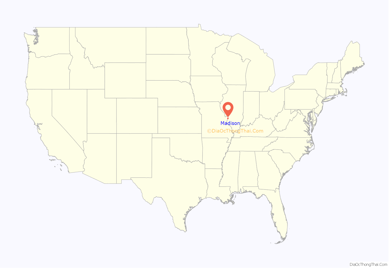
Madison location map. Where is Madison city?
History
Madison was founded in 1820. There have been three villages named Madison.
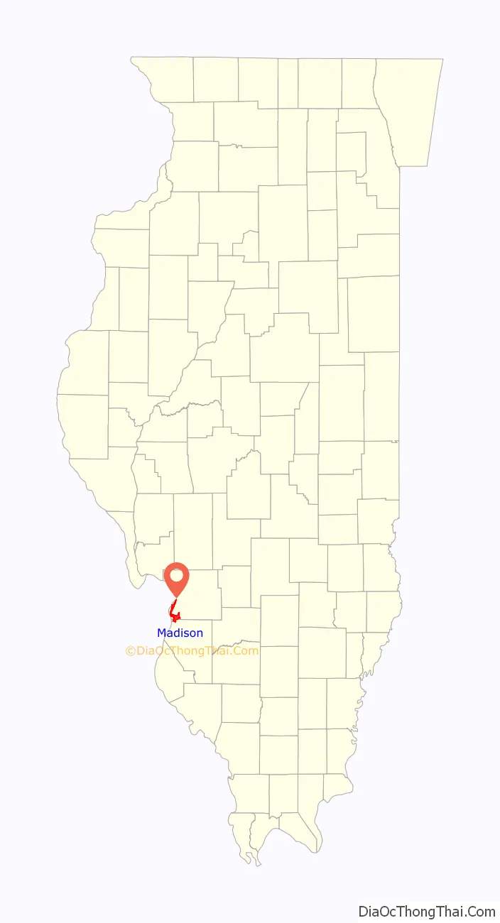
Madison Road Map
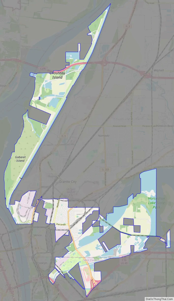
Madison city Satellite Map

Geography
Madison is located in southwestern Madison County at 38°41′1″N 90°9′4″W / 38.68361°N 90.15111°W / 38.68361; -90.15111 (38.683700, -90.151047). The central city area is bordered by Granite City to the north and Venice to the southwest. However, the Madison city limits now extend 3 miles (5 km) south, 4 miles (6 km) east, and 8 miles (13 km) north of the city center, so that it is also bordered by Hartford to the extreme north, Pontoon Beach to the east, Fairmont City to the southeast, and Brooklyn to the southwest. The Mississippi River forms the western boundary of Madison north of Venice, with St. Louis, Missouri, across the river.
Illinois Route 203 passes through the center of Madison as MC Cambridge Avenue and Edwardsville Road, leading north into Granite City and south to Interstates 55 and 70 at their Exit 4 in the southernmost part of town. Illinois Route 3 (Cedar Street) crosses the western part of Madison, leading south into Venice before crossing the Mississippi into St. Louis, and north through Granite City to Hartford.
According to the U.S. Census Bureau, Madison has a total area of 17.88 square miles (46.31 km), of which 14.15 square miles (36.65 km) are land and 3.74 square miles (9.69 km), or 20.91%, are water.
See also
Map of Illinois State and its subdivision:- Adams
- Alexander
- Bond
- Boone
- Brown
- Bureau
- Calhoun
- Carroll
- Cass
- Champaign
- Christian
- Clark
- Clay
- Clinton
- Coles
- Cook
- Crawford
- Cumberland
- De Kalb
- De Witt
- Douglas
- Dupage
- Edgar
- Edwards
- Effingham
- Fayette
- Ford
- Franklin
- Fulton
- Gallatin
- Greene
- Grundy
- Hamilton
- Hancock
- Hardin
- Henderson
- Henry
- Iroquois
- Jackson
- Jasper
- Jefferson
- Jersey
- Jo Daviess
- Johnson
- Kane
- Kankakee
- Kendall
- Knox
- La Salle
- Lake
- Lake Michigan
- Lawrence
- Lee
- Livingston
- Logan
- Macon
- Macoupin
- Madison
- Marion
- Marshall
- Mason
- Massac
- McDonough
- McHenry
- McLean
- Menard
- Mercer
- Monroe
- Montgomery
- Morgan
- Moultrie
- Ogle
- Peoria
- Perry
- Piatt
- Pike
- Pope
- Pulaski
- Putnam
- Randolph
- Richland
- Rock Island
- Saint Clair
- Saline
- Sangamon
- Schuyler
- Scott
- Shelby
- Stark
- Stephenson
- Tazewell
- Union
- Vermilion
- Wabash
- Warren
- Washington
- Wayne
- White
- Whiteside
- Will
- Williamson
- Winnebago
- Woodford
- Alabama
- Alaska
- Arizona
- Arkansas
- California
- Colorado
- Connecticut
- Delaware
- District of Columbia
- Florida
- Georgia
- Hawaii
- Idaho
- Illinois
- Indiana
- Iowa
- Kansas
- Kentucky
- Louisiana
- Maine
- Maryland
- Massachusetts
- Michigan
- Minnesota
- Mississippi
- Missouri
- Montana
- Nebraska
- Nevada
- New Hampshire
- New Jersey
- New Mexico
- New York
- North Carolina
- North Dakota
- Ohio
- Oklahoma
- Oregon
- Pennsylvania
- Rhode Island
- South Carolina
- South Dakota
- Tennessee
- Texas
- Utah
- Vermont
- Virginia
- Washington
- West Virginia
- Wisconsin
- Wyoming


