West Salem is a village in Edwards County, Illinois, United States. The population was 786 at the 2020 census, down from 897 at the 2010 census.
| Name: | West Salem village |
|---|---|
| LSAD Code: | 47 |
| LSAD Description: | village (suffix) |
| State: | Illinois |
| County: | Edwards County |
| Elevation: | 518 ft (158 m) |
| Total Area: | 1.56 sq mi (4.04 km²) |
| Land Area: | 1.56 sq mi (4.04 km²) |
| Water Area: | 0.00 sq mi (0.00 km²) |
| Total Population: | 786 |
| Population Density: | 503.85/sq mi (194.57/km²) |
| Area code: | 618 |
| FIPS code: | 1780853 |
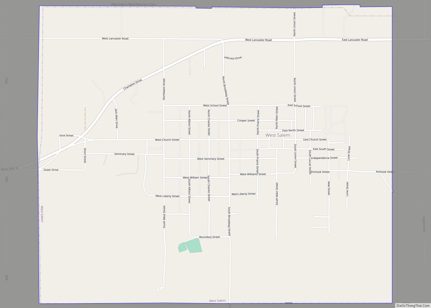
Online Interactive Map
Click on ![]() to view map in "full screen" mode.
to view map in "full screen" mode.
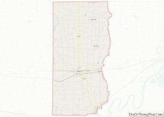
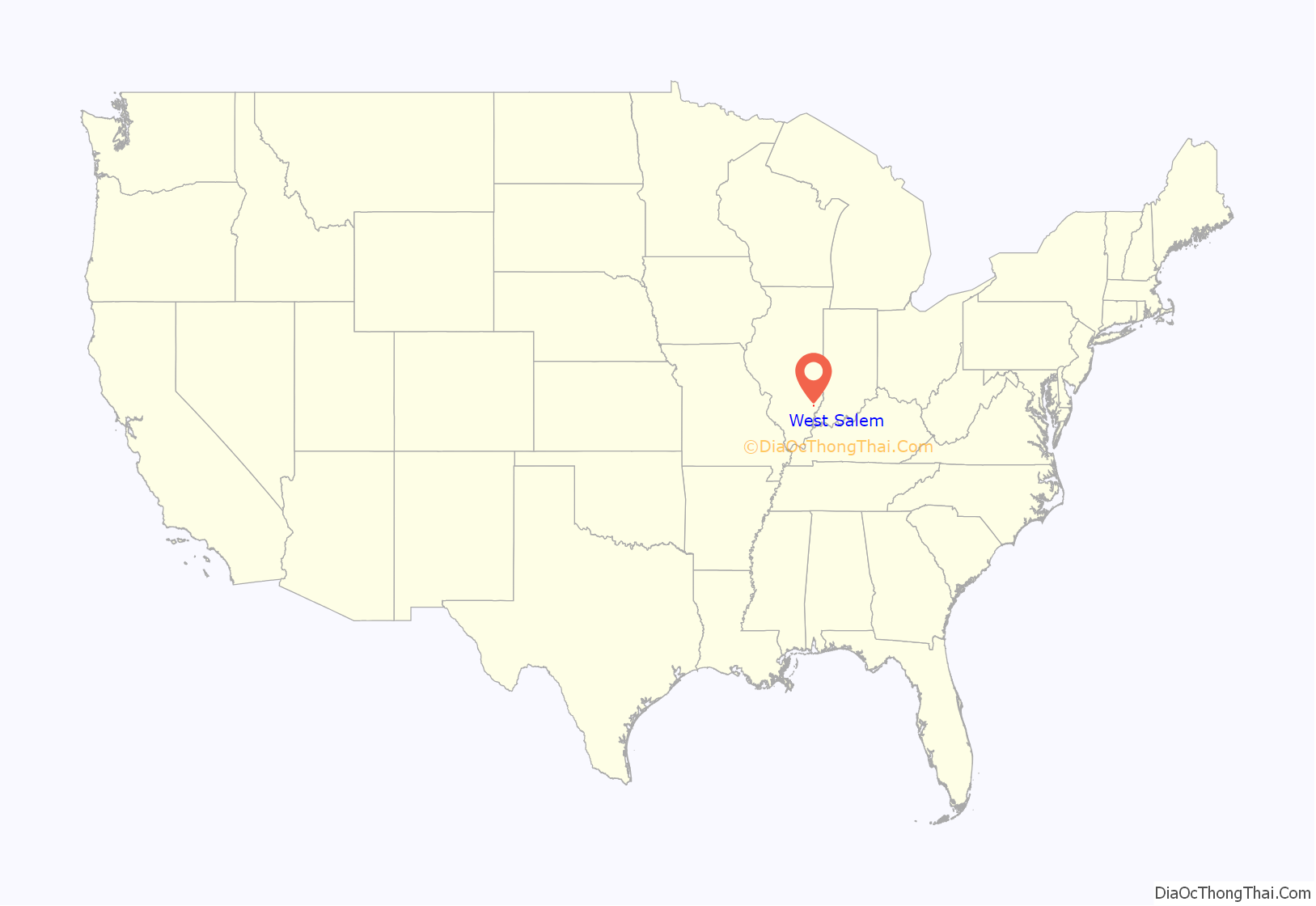
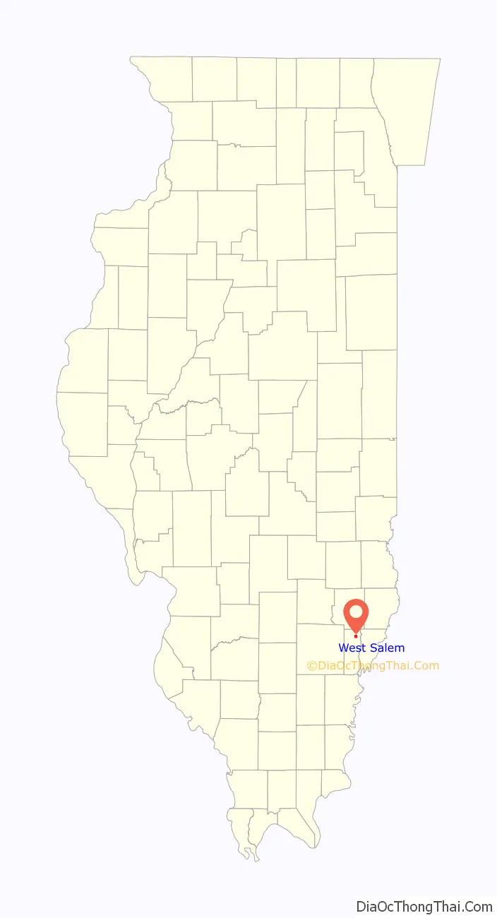
West Salem location map. Where is West Salem village?
History
The West Salem area was settled in the 1830s and early 1840s by Moravians primarily from Salem, North Carolina, and Hope, Indiana. Among the early settlers were Adam Hedrick and Peter Hinkle.
From 1841 to 1846 the new Moravian settlers were working with the headquarters of the southern province of the Moravian Church in Salem (Old Salem), North Carolina, in establishing a congregation. William Eberman, the Moravian pastor at Hope, Indiana, was sent to visit and preach for them in the fall of 1841. Many other settlers followed, until by 1843, more than 80 families lived within a 3-mile (4.8 km) radius of what was to become West Salem, most of them Moravians. But in 1843, it was Martin Hauser, a Moravian home missionary also from Hope, Indiana, who would be instrumental not only in starting a Moravian Church, but also in helping to establish the town. On Saturday, May 25, 1844, a meeting was held in Peter Hinkle’s barn, where heads of 15 families came forward and signed the Brotherly Agreement and Constitution that formed the new Moravian congregation. On his way home to Hope, in 1845, Hauser stopped at the federal land Office in Palestine, Illinois, to buy, in the name of the church, 120 acres (0.49 km) of land on which West Salem is presently located. He was acting as attorney-in-fact for Rev. Charles Kluge, President of the Synod of the Southern Provincial Conference of the Moravian Church of North America.
In the years that followed, the new community of West Salem began to thrive but also to experience challenges as well. In 1849, more than 60 immigrants from Germany arrived, hoping to build homes and gravitating towards the Moravian Church. They were warmly received, but before long trouble developed between the Germans and the original English-speaking settlers. Language differences caused part of the difficulty, but the old German ideas and customs added to it. The congregations separated into “divisions”, one English and one German, each with its own official board and its own pastor, but sharing the use of the church building and cemetery. After nine years of this arrangement, they became two separate congregations on February 7, 1858. The Germans retained the old church, and the English built a new church on the south side of the public square. This building was dedicated on August 14, 1859. The English retained the old cemetery, while the Germans laid out a cemetery adjacent to it. On April 10, 1892, the German congregation dedicated a new building, the present Moravian Church. Eventually the German American group began using the English language and gradually came to accept American ways. On June 13, 1925, the two congregations were reunited. The two cemeteries, which were gradually growing together, also were united at that time.
West Salem was not incorporated until 1857. When the Moravians first began arriving in the area, and Martin Hauser realized there was potential for a settlement, the group chose the name “New Salem”, since they had traveled to Illinois from Salem, North Carolina. However, when it came time to establish a post office, it was discovered that Illinois already had a New Salem located near Springfield, where Abraham Lincoln had lived and operated a store. Accordingly, the settlers had to choose a new name and decided to call their village “West Salem”, because it lay west of Salem, North Carolina, where they had come from. To the confusion of travelers ever since, this left West Salem east of Salem, Illinois, incorporated two years earlier. Records of the Illinois Secretary of State show that the official incorporation of West Salem took place on February 8, 1857.
The settlement was organized as a village on February 5, 1898, with 69 voting for organization and two voting against. Its first recorded Board of Trustees was William Foster Sr. (president), J.H. McDowell, J.B. Michael, E.G. Altner, George Pixley (clerk), A.L. Hammaker (treasurer), and J.B. Michel.
The first recorded organized board meeting of the village of West Salem took place on August 24, 1914. Those taking office were President Charles Pixley and Trustees James Fry, Leona Voigt, Dow Harrison, Arthur Clodfelter, E. Greathouse, and Charles Couch. Stuart Walser was clerk. Records in Village Hall do not show how these persons became the first officers, but they do not show an election of April 1915. At that time, those elected drew lots for one- or two-year terms. At the August 1914 meeting an attorney, John A. McNeil, was hired for $50 to draft a complete set of ordinances. These ordinances set boundaries and territories, set the fiscal year and meeting times, approve a corporate seal, set rules for committees and village officers, street labor, concerning peace, special elections, tax levies, annual appropriations, gaming, local improvements, establishing a prison, fines, traffic laws, etc. Thirty-one ordinances were approved by the end of 1915.
In 1951 a much needed water system was put into operation. Water was supplied from the shale pit and a lake. In 1962 a sewer system was completed, and outhouses finally went away for good. In March 2002 the village of West Salem signed a 40-year water purchase contract with RE Water Corporation. A 150,000 water storage tank was erected at the water plant.
In 1957 the West Salem Centennial Committee used funds to purchase land to be used as a park and baseball recreation area since the prior area was now being used for industrial development. The new park was called Centennial Park. The area has been used for youth baseball, as well as for circuses and other community events. One of the most popular events is the annual fireworks display held around the 4th of July every year and sponsored by the West Salem Volunteer Fire Department.
In 1965 property was bought for a village hall at 106 East South Street. A building was erected housing the volunteer fire department and the office for the clerk and treasurer, as well as a meeting room and the police department. In 1998 property just east of the village hall was purchased and the building was extended. In 1967, the West Salem Public Library opened their doors.
West Salem celebrated its centennial in 1957 and its sesquicentennial on June 29-July 1 of 2007.
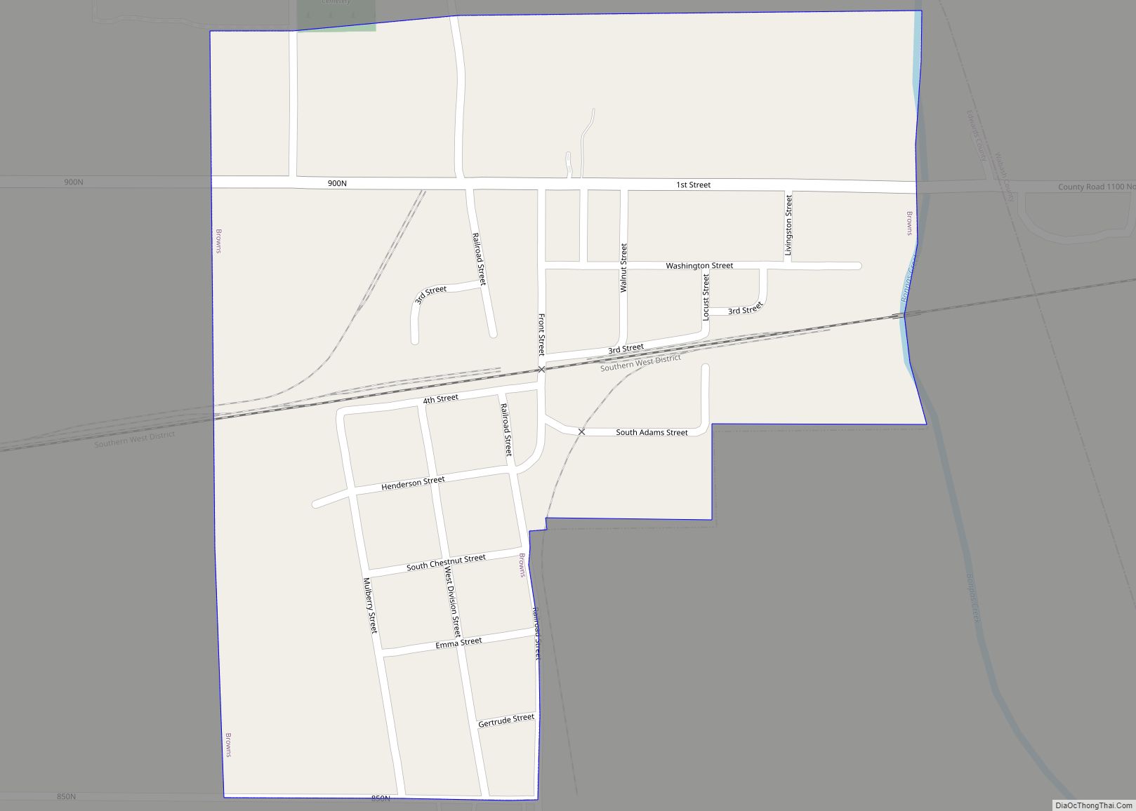
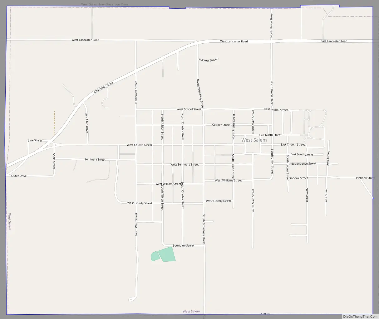
West Salem Road Map
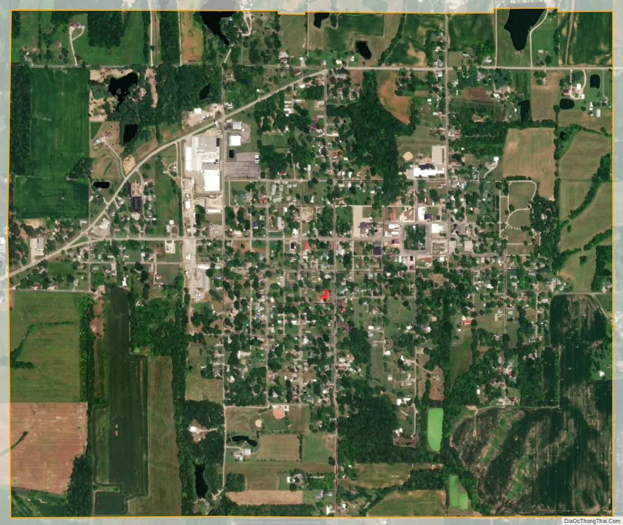
West Salem city Satellite Map
Geography
West Salem is located in northeastern Edwards County, 12 miles (19 km) northeast of Albion, the county seat. Illinois State Route 130 passes just west of the village.
According to the 2010 census, West Salem has a total area of 1.56 square miles (4.04 km), all land.
See also
Map of Illinois State and its subdivision:- Adams
- Alexander
- Bond
- Boone
- Brown
- Bureau
- Calhoun
- Carroll
- Cass
- Champaign
- Christian
- Clark
- Clay
- Clinton
- Coles
- Cook
- Crawford
- Cumberland
- De Kalb
- De Witt
- Douglas
- Dupage
- Edgar
- Edwards
- Effingham
- Fayette
- Ford
- Franklin
- Fulton
- Gallatin
- Greene
- Grundy
- Hamilton
- Hancock
- Hardin
- Henderson
- Henry
- Iroquois
- Jackson
- Jasper
- Jefferson
- Jersey
- Jo Daviess
- Johnson
- Kane
- Kankakee
- Kendall
- Knox
- La Salle
- Lake
- Lake Michigan
- Lawrence
- Lee
- Livingston
- Logan
- Macon
- Macoupin
- Madison
- Marion
- Marshall
- Mason
- Massac
- McDonough
- McHenry
- McLean
- Menard
- Mercer
- Monroe
- Montgomery
- Morgan
- Moultrie
- Ogle
- Peoria
- Perry
- Piatt
- Pike
- Pope
- Pulaski
- Putnam
- Randolph
- Richland
- Rock Island
- Saint Clair
- Saline
- Sangamon
- Schuyler
- Scott
- Shelby
- Stark
- Stephenson
- Tazewell
- Union
- Vermilion
- Wabash
- Warren
- Washington
- Wayne
- White
- Whiteside
- Will
- Williamson
- Winnebago
- Woodford
- Alabama
- Alaska
- Arizona
- Arkansas
- California
- Colorado
- Connecticut
- Delaware
- District of Columbia
- Florida
- Georgia
- Hawaii
- Idaho
- Illinois
- Indiana
- Iowa
- Kansas
- Kentucky
- Louisiana
- Maine
- Maryland
- Massachusetts
- Michigan
- Minnesota
- Mississippi
- Missouri
- Montana
- Nebraska
- Nevada
- New Hampshire
- New Jersey
- New Mexico
- New York
- North Carolina
- North Dakota
- Ohio
- Oklahoma
- Oregon
- Pennsylvania
- Rhode Island
- South Carolina
- South Dakota
- Tennessee
- Texas
- Utah
- Vermont
- Virginia
- Washington
- West Virginia
- Wisconsin
- Wyoming