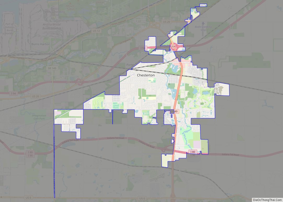
Chesterton is a town in Westchester, Jackson and Liberty townships in Porter County, in the U.S. state of Indiana. The population was 14,241 at the 2020 Census. The three towns of Chesterton, Burns Harbor, and Porter are known as the Duneland area.
| Name: | Chesterton town |
|---|---|
| LSAD Code: | 43 |
| LSAD Description: | town (suffix) |
| State: | Indiana |
| County: | Porter County |
| Elevation: | 640 ft (195 m) |
| Total Area: | 9.49 sq mi (24.59 km²) |
| Land Area: | 9.38 sq mi (24.30 km²) |
| Water Area: | 0.11 sq mi (0.29 km²) |
| Total Population: | 14,241 |
| Population Density: | 1,517.91/sq mi (586.09/km²) |
| ZIP code: | 46304 |
| Area code: | 219 |
| FIPS code: | 1812412 |
| GNISfeature ID: | 432457 |
| Website: | http://www.chestertonin.org/ |
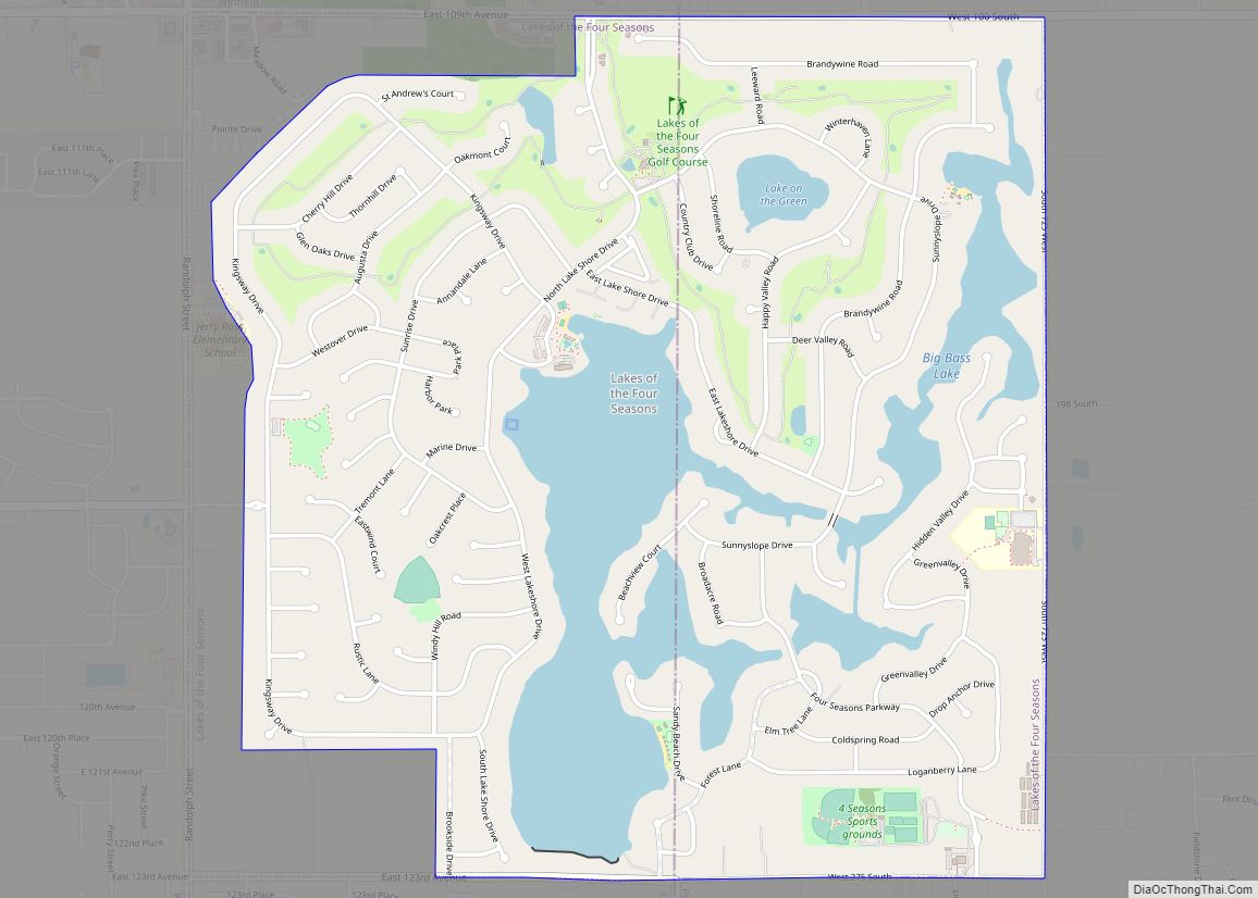
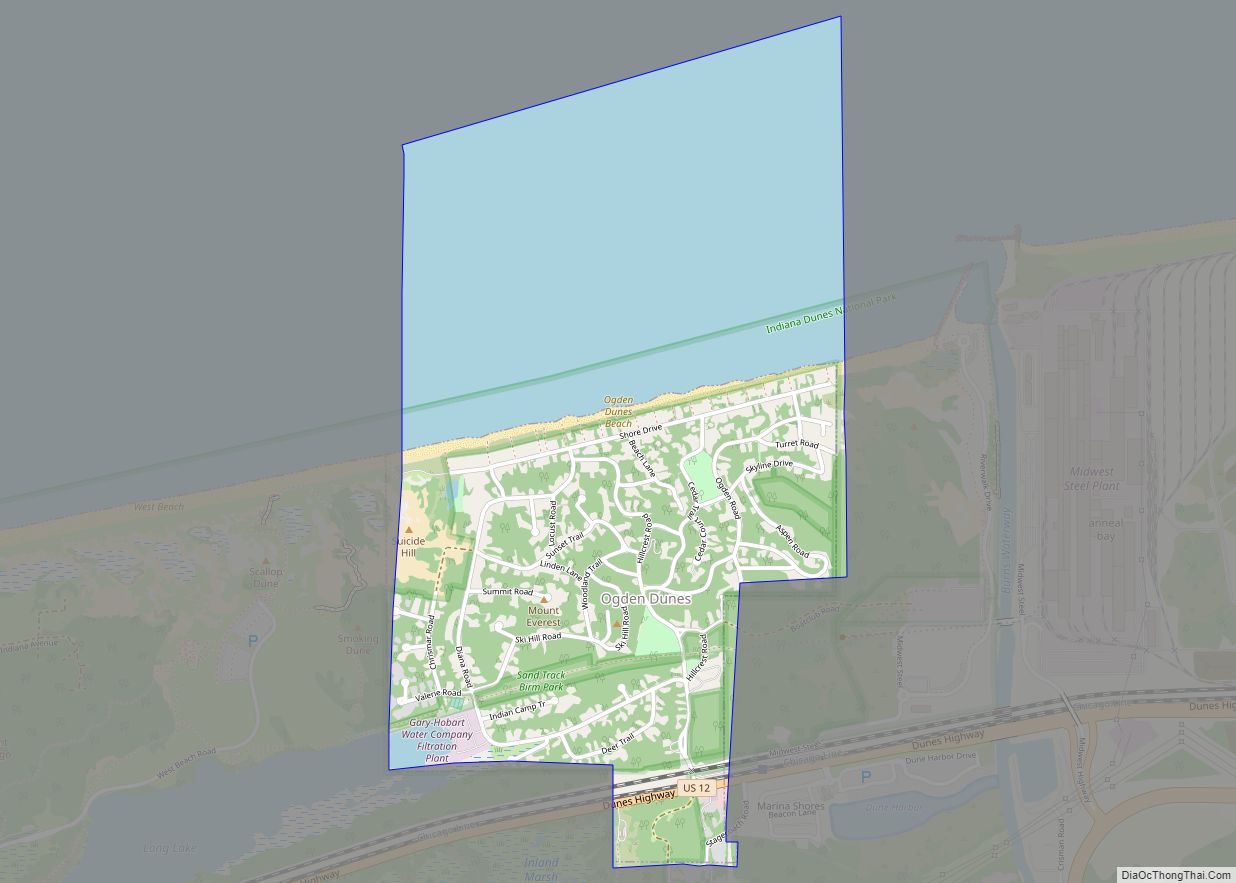
Online Interactive Map
Click on ![]() to view map in "full screen" mode.
to view map in "full screen" mode.
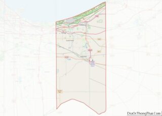
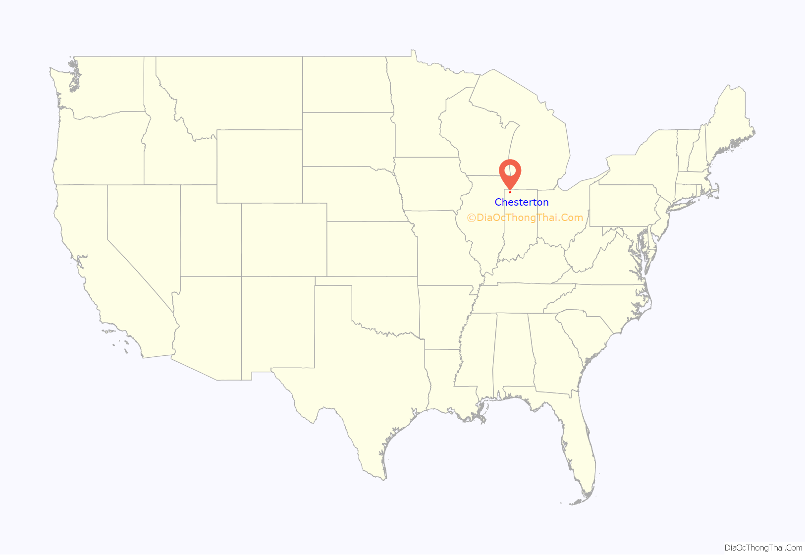
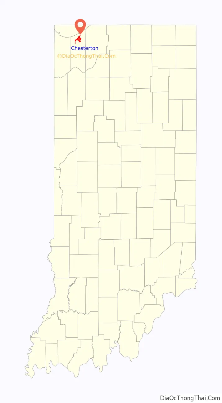
Chesterton location map. Where is Chesterton town?
History
Chesterton was first settled under the name Coffee Creek in 1833, with its post office being established in 1835. The post office would eventually be renamed to Calumet in 1850, as which the town was platted when the railroad was extended to that point in 1852. Due to a town on the same railroad also being named Calumet, the name would finally be changed to Chesterton in 1870 and it was reincorporated as a town in 1899 after a failed incorporation in 1869, with its population of 788 being the second-largest in Porter County at the time.
In 1933, a United Airlines NC13304 flight became the first known case of an attack against an aircraft. It was downed by a nitroglycerine bomb above Chesterton on October 10, 1933. All 7 people aboard the aircraft—four passengers and a crew of three—were killed in the crash.
In 1962, United Tractor moved to the town.
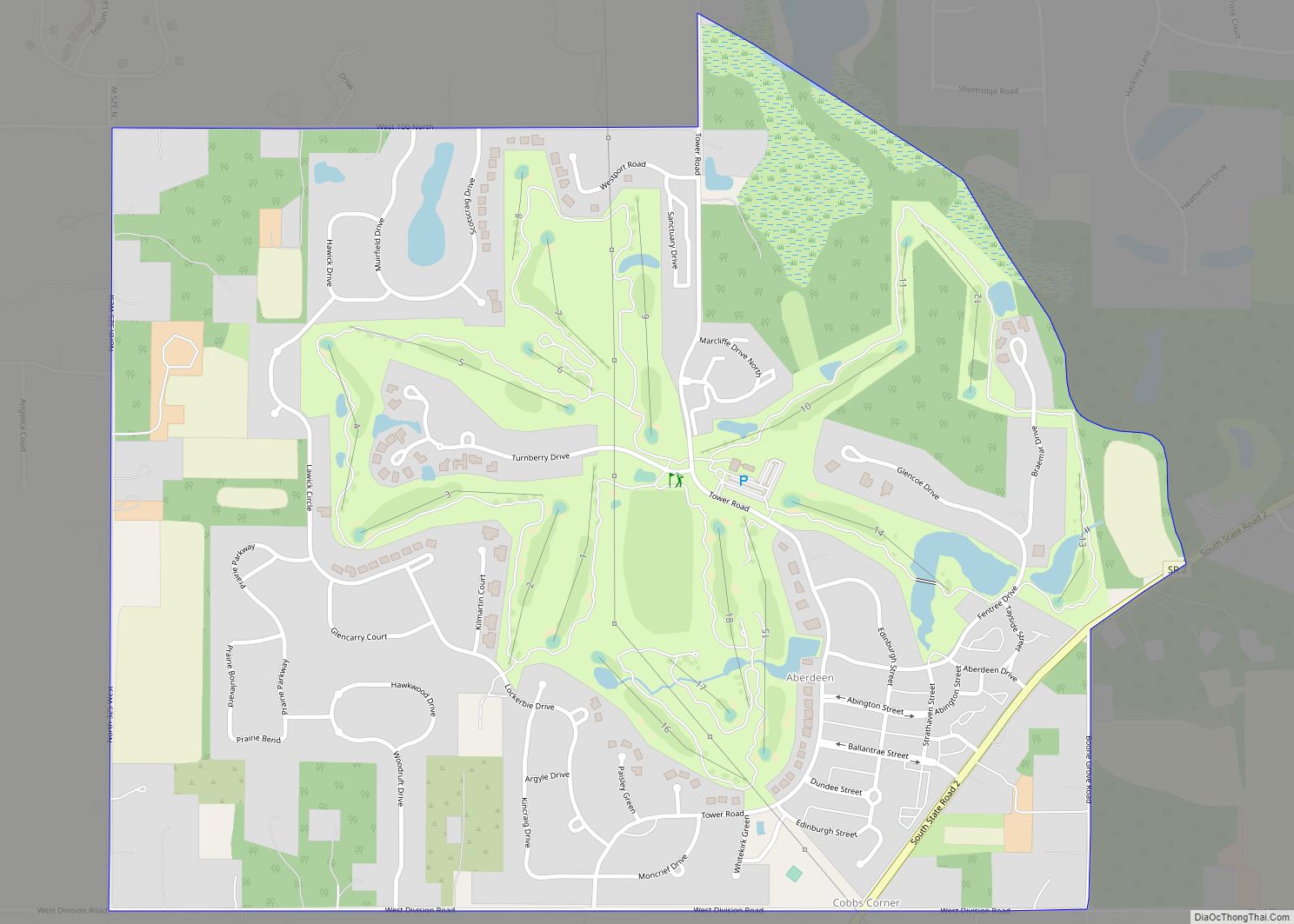
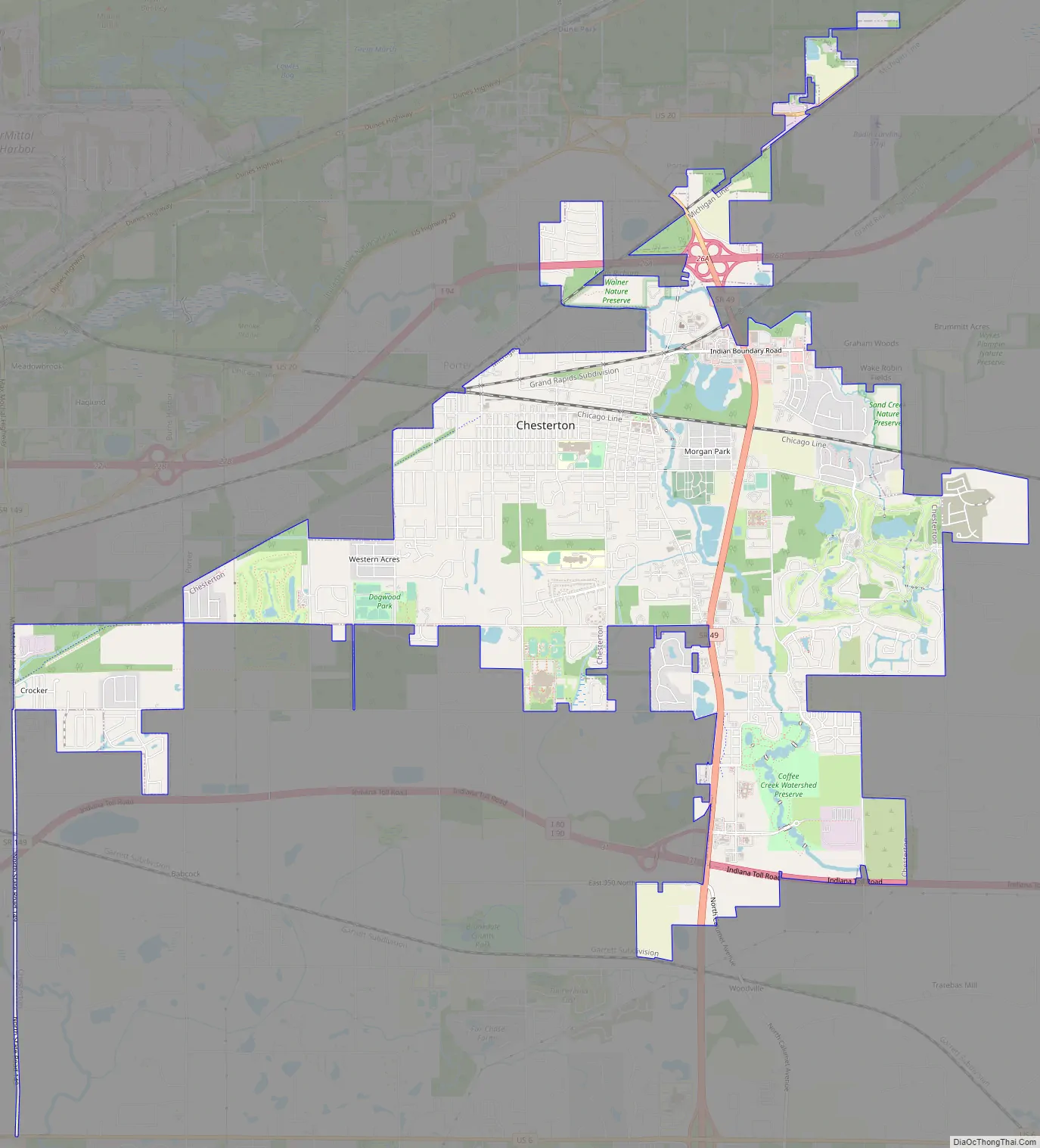
Chesterton Road Map
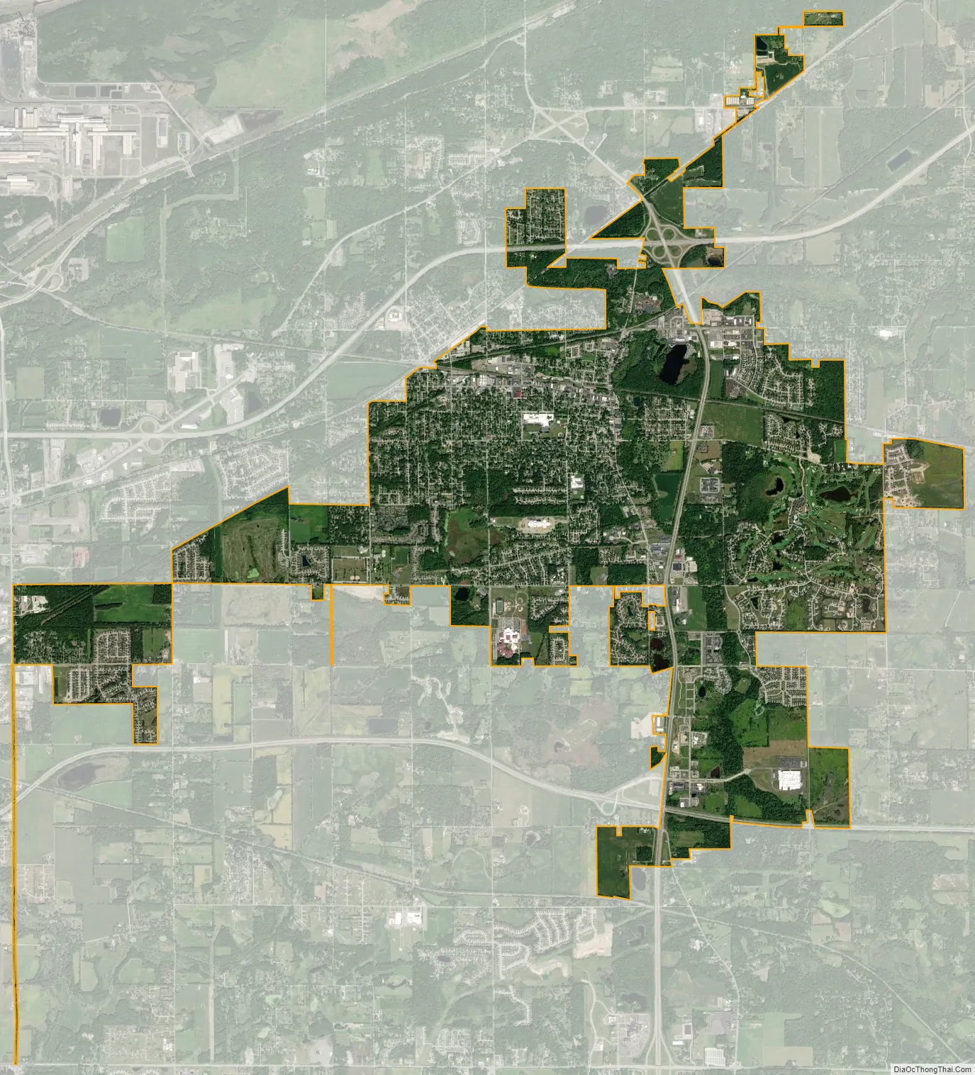
Chesterton city Satellite Map
Geography
Chesterton is located at 41°36′15″N 87°3′30″W / 41.60417°N 87.05833°W / 41.60417; -87.05833 (41.604251, -87.058442)
Just north of the town is Indiana Dunes State Park and Indiana Dunes National Park. Most of the town is flat. However, going south into the city on the Route 49 overpass, one can see the Valparaiso Moraine in the distance.
According to the 2010 census, Chesterton has a total area of 9.44 square miles (24.45 km), of which 9.33 square miles (24.16 km) (or 98.83%) is land and 0.11 square miles (0.28 km) (or 1.17%) is water.
Climate
See also
Map of Indiana State and its subdivision:- Adams
- Allen
- Bartholomew
- Benton
- Blackford
- Boone
- Brown
- Carroll
- Cass
- Clark
- Clay
- Clinton
- Crawford
- Daviess
- De Kalb
- Dearborn
- Decatur
- Delaware
- Dubois
- Elkhart
- Fayette
- Floyd
- Fountain
- Franklin
- Fulton
- Gibson
- Grant
- Greene
- Hamilton
- Hancock
- Harrison
- Hendricks
- Henry
- Howard
- Huntington
- Jackson
- Jasper
- Jay
- Jefferson
- Jennings
- Johnson
- Knox
- Kosciusko
- LaGrange
- Lake
- Lake Michigan
- LaPorte
- Lawrence
- Madison
- Marion
- Marshall
- Martin
- Miami
- Monroe
- Montgomery
- Morgan
- Newton
- Noble
- Ohio
- Orange
- Owen
- Parke
- Perry
- Pike
- Porter
- Posey
- Pulaski
- Putnam
- Randolph
- Ripley
- Rush
- Saint Joseph
- Scott
- Shelby
- Spencer
- Starke
- Steuben
- Sullivan
- Switzerland
- Tippecanoe
- Tipton
- Union
- Vanderburgh
- Vermillion
- Vigo
- Wabash
- Warren
- Warrick
- Washington
- Wayne
- Wells
- White
- Whitley
- Alabama
- Alaska
- Arizona
- Arkansas
- California
- Colorado
- Connecticut
- Delaware
- District of Columbia
- Florida
- Georgia
- Hawaii
- Idaho
- Illinois
- Indiana
- Iowa
- Kansas
- Kentucky
- Louisiana
- Maine
- Maryland
- Massachusetts
- Michigan
- Minnesota
- Mississippi
- Missouri
- Montana
- Nebraska
- Nevada
- New Hampshire
- New Jersey
- New Mexico
- New York
- North Carolina
- North Dakota
- Ohio
- Oklahoma
- Oregon
- Pennsylvania
- Rhode Island
- South Carolina
- South Dakota
- Tennessee
- Texas
- Utah
- Vermont
- Virginia
- Washington
- West Virginia
- Wisconsin
- Wyoming