Fillmore is a town in Marion Township, Putnam County, in the U.S. state of Indiana. The population was 533 at the 2010 census.
The town is part of the South Putnam Community Schools school district.
| Name: | Fillmore town |
|---|---|
| LSAD Code: | 43 |
| LSAD Description: | town (suffix) |
| State: | Indiana |
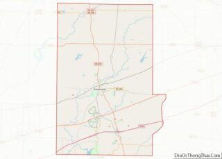
| County: | Putnam County |
| Elevation: | 837 ft (255 m) |
| Total Area: | 1.95 sq mi (5.05 km²) |
| Land Area: | 1.95 sq mi (5.05 km²) |
| Water Area: | 0.00 sq mi (0.00 km²) |
| Total Population: | 532 |
| Population Density: | 273.10/sq mi (105.42/km²) |
| ZIP code: | 46128 |
| Area code: | 765 |
| FIPS code: | 1823188 |
| GNISfeature ID: | 434479 |
| Website: | fillmoreindiana.com |
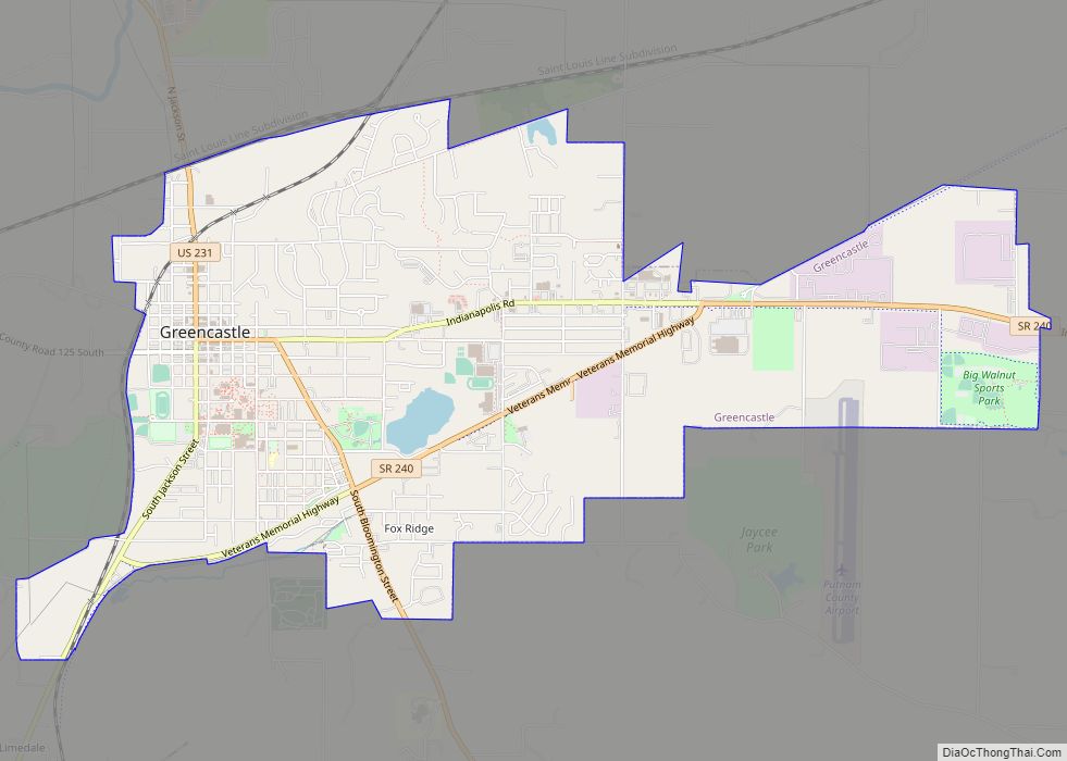
Online Interactive Map
Click on ![]() to view map in "full screen" mode.
to view map in "full screen" mode.
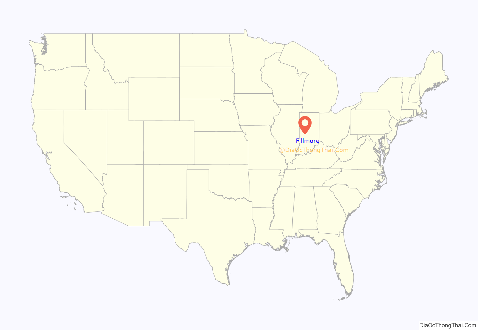
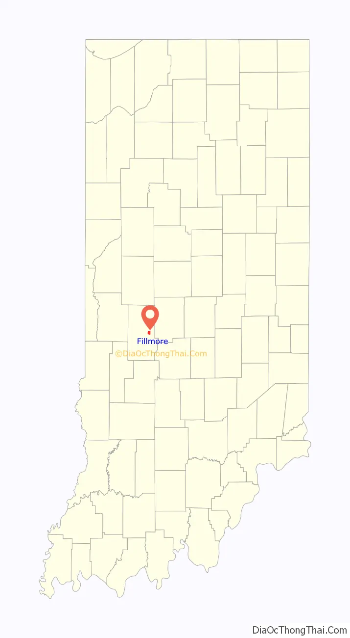
Fillmore location map. Where is Fillmore town?
History
An old variant name of the community was called Nicholsonville. A post office was established under this name in 1849, and was renamed to Fillmore in 1861, where it is still currently operating.
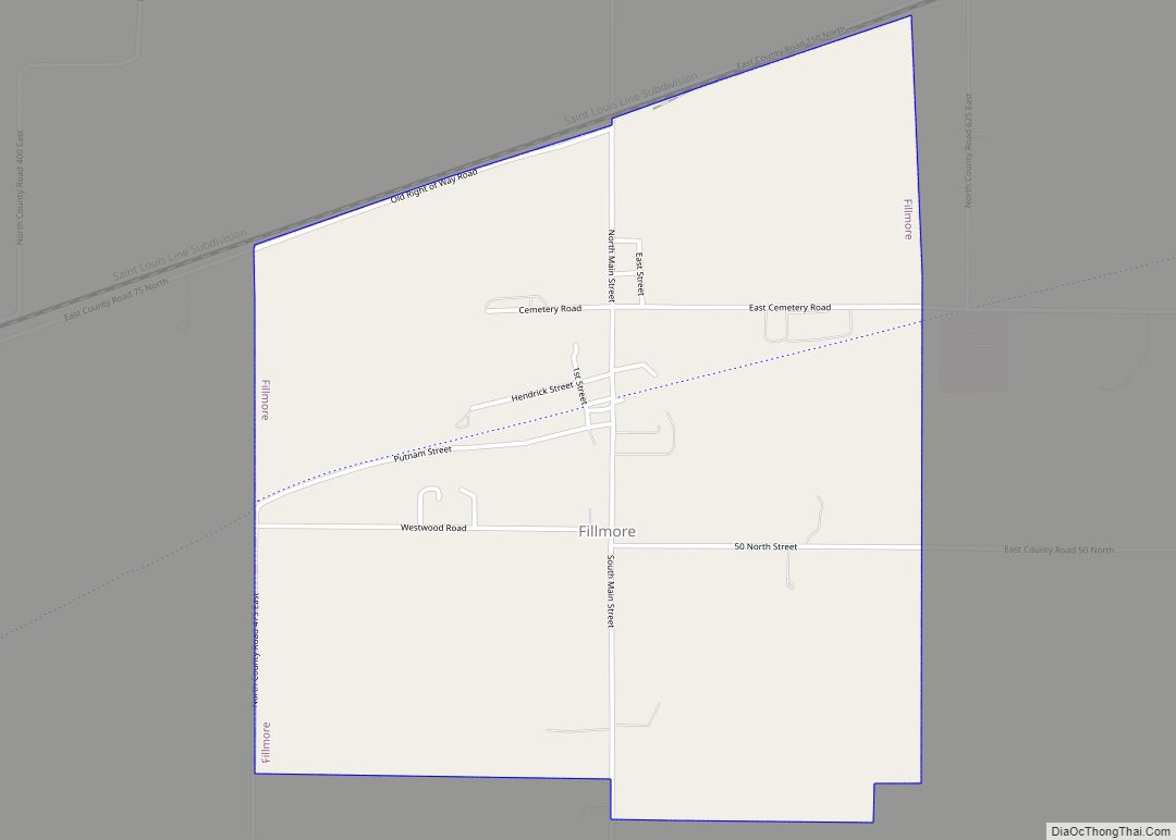
Fillmore Road Map
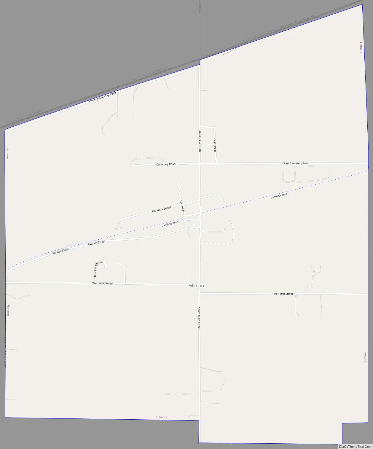
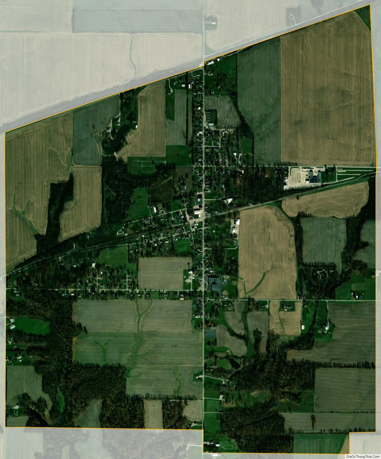
Fillmore city Satellite Map
Geography
Fillmore is located at 39°40′19″N 86°45′13″W / 39.671859°N 86.753742°W / 39.671859; -86.753742.
According to the 2010 census, Fillmore has a total area of 1.95 square miles (5.05 km), all land.
Fillmore lies between east–west highways US Route 36 and US Route 40 and east of north–south highway US Route 231.
See also
Map of Indiana State and its subdivision:- Adams
- Allen
- Bartholomew
- Benton
- Blackford
- Boone
- Brown
- Carroll
- Cass
- Clark
- Clay
- Clinton
- Crawford
- Daviess
- De Kalb
- Dearborn
- Decatur
- Delaware
- Dubois
- Elkhart
- Fayette
- Floyd
- Fountain
- Franklin
- Fulton
- Gibson
- Grant
- Greene
- Hamilton
- Hancock
- Harrison
- Hendricks
- Henry
- Howard
- Huntington
- Jackson
- Jasper
- Jay
- Jefferson
- Jennings
- Johnson
- Knox
- Kosciusko
- LaGrange
- Lake
- Lake Michigan
- LaPorte
- Lawrence
- Madison
- Marion
- Marshall
- Martin
- Miami
- Monroe
- Montgomery
- Morgan
- Newton
- Noble
- Ohio
- Orange
- Owen
- Parke
- Perry
- Pike
- Porter
- Posey
- Pulaski
- Putnam
- Randolph
- Ripley
- Rush
- Saint Joseph
- Scott
- Shelby
- Spencer
- Starke
- Steuben
- Sullivan
- Switzerland
- Tippecanoe
- Tipton
- Union
- Vanderburgh
- Vermillion
- Vigo
- Wabash
- Warren
- Warrick
- Washington
- Wayne
- Wells
- White
- Whitley
- Alabama
- Alaska
- Arizona
- Arkansas
- California
- Colorado
- Connecticut
- Delaware
- District of Columbia
- Florida
- Georgia
- Hawaii
- Idaho
- Illinois
- Indiana
- Iowa
- Kansas
- Kentucky
- Louisiana
- Maine
- Maryland
- Massachusetts
- Michigan
- Minnesota
- Mississippi
- Missouri
- Montana
- Nebraska
- Nevada
- New Hampshire
- New Jersey
- New Mexico
- New York
- North Carolina
- North Dakota
- Ohio
- Oklahoma
- Oregon
- Pennsylvania
- Rhode Island
- South Carolina
- South Dakota
- Tennessee
- Texas
- Utah
- Vermont
- Virginia
- Washington
- West Virginia
- Wisconsin
- Wyoming