Mentone is a town in Harrison and Franklin townships, Kosciusko County, in the U.S. state of Indiana. Mentone is the self-proclaimed “Egg Basket of the Midwest” because of prolific commercial egg production in the area, and holds an Egg Festival annually in early June to celebrate its heritage. A large concrete egg stands near the town center and is considered locally to be the “Largest Egg in the World”. The Lawrence D. Bell Aircraft Museum, is located within the town limits. The population was 1,001 at the 2010 census.
| Name: | Mentone town |
|---|---|
| LSAD Code: | 43 |
| LSAD Description: | town (suffix) |
| State: | Indiana |
| County: | Kosciusko County |
| Elevation: | 840 ft (256 m) |
| Total Area: | 0.59 sq mi (1.54 km²) |
| Land Area: | 0.58 sq mi (1.51 km²) |
| Water Area: | 0.01 sq mi (0.03 km²) |
| Total Population: | 943 |
| Population Density: | 1,617.50/sq mi (624.55/km²) |
| ZIP code: | 46539 |
| Area code: | 574 |
| FIPS code: | 1848402 |
| GNISfeature ID: | 439013 |
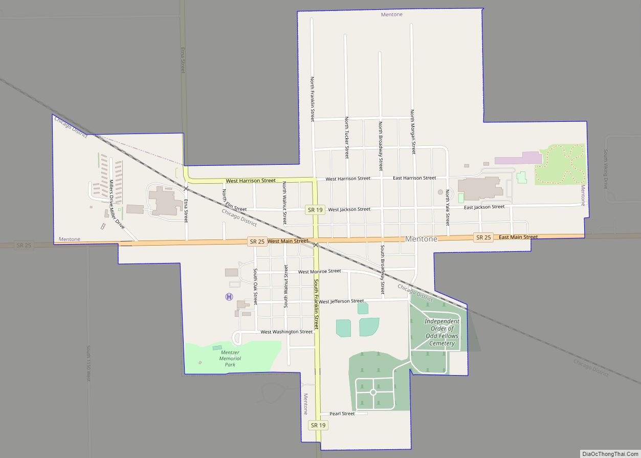
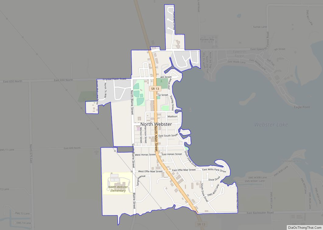
Online Interactive Map
Click on ![]() to view map in "full screen" mode.
to view map in "full screen" mode.
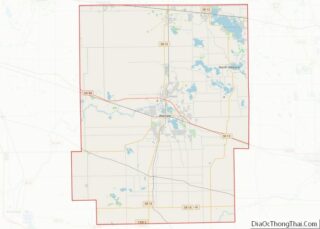
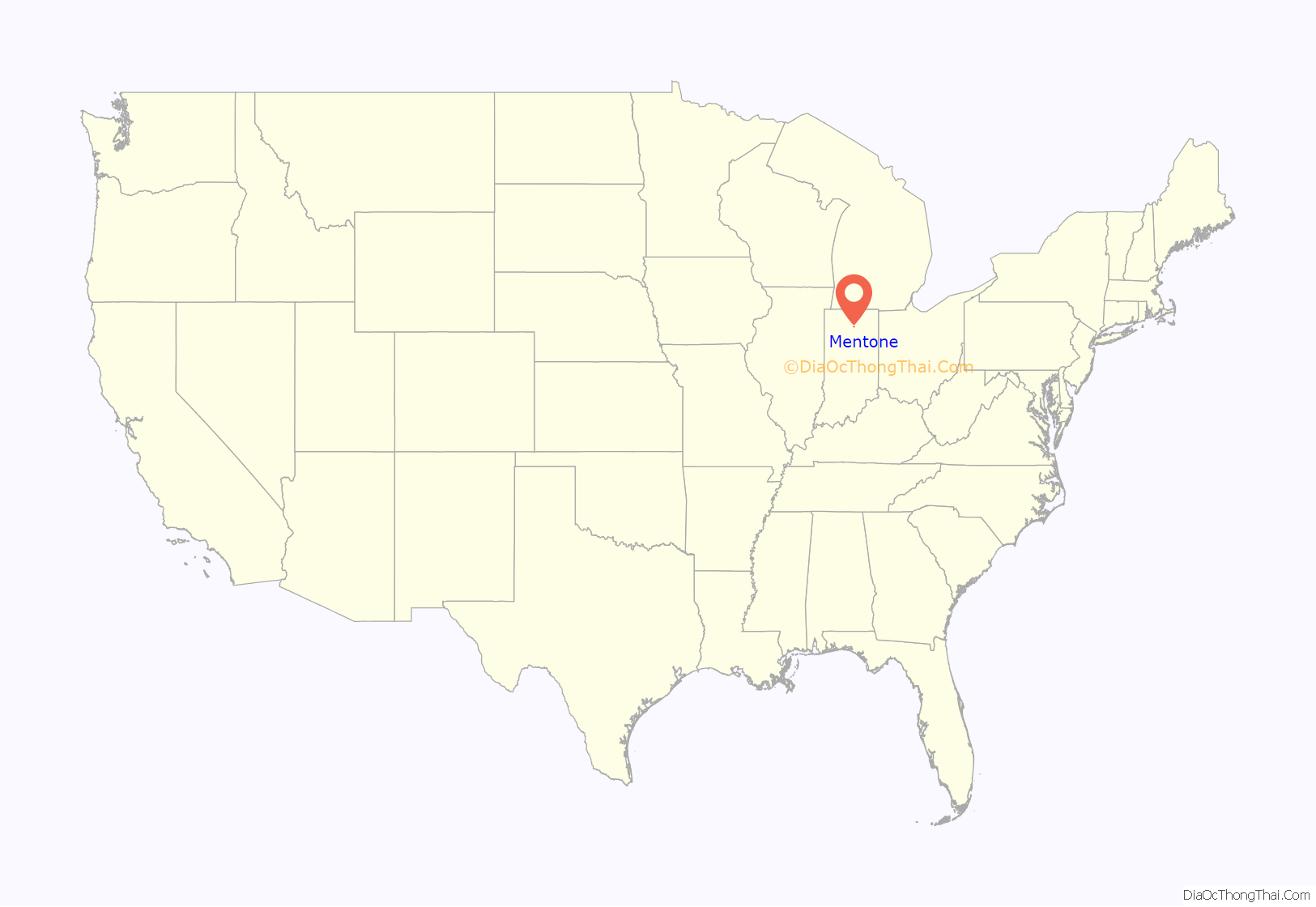
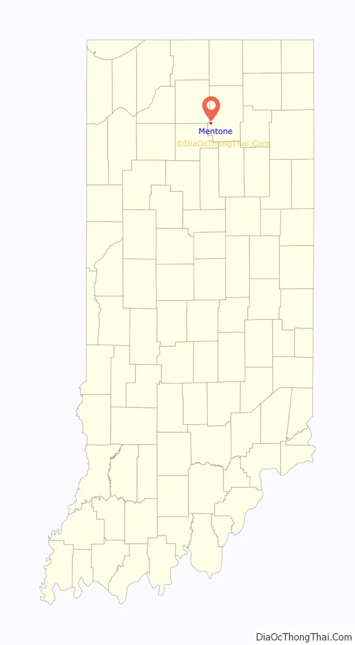
Mentone location map. Where is Mentone town?
History
Mentone was platted in 1882. It was likely named after Menton, in France. The Mentone post office was established in 1882.
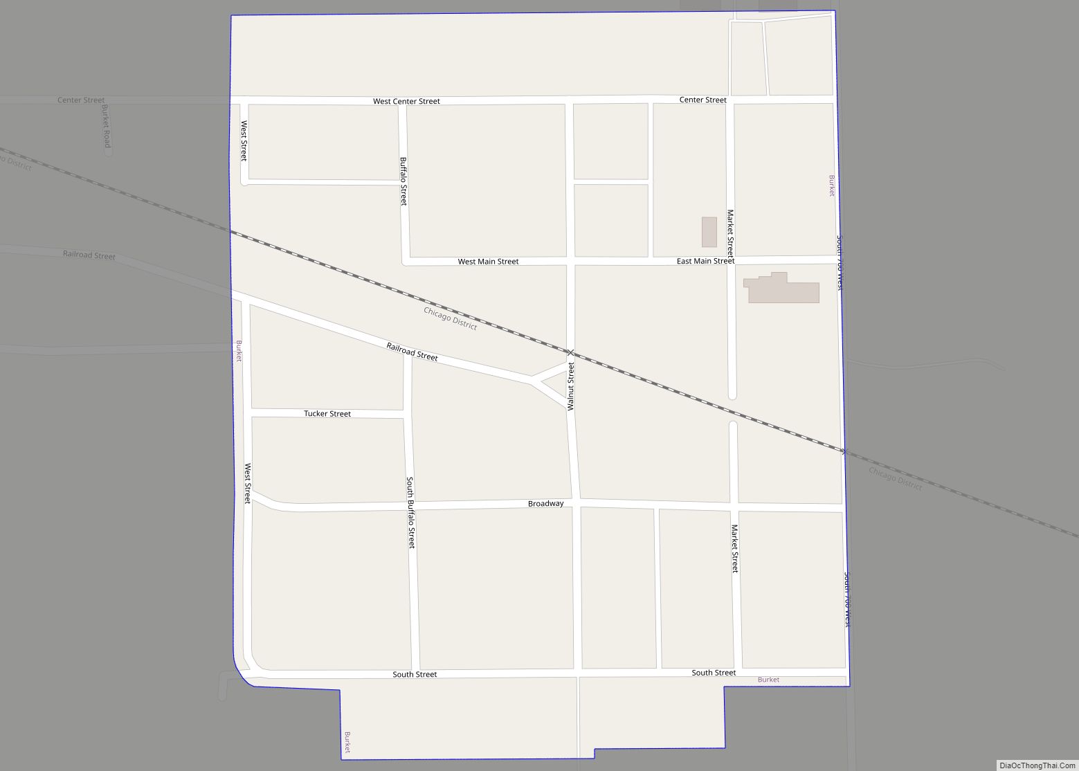
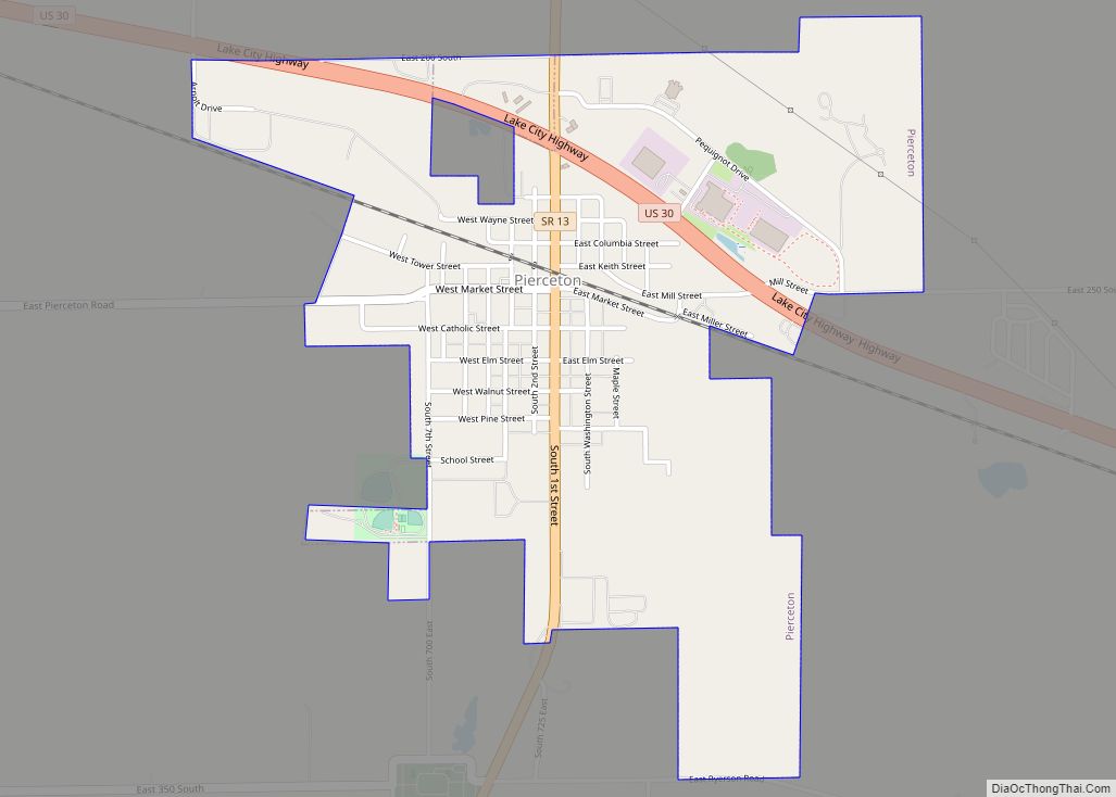
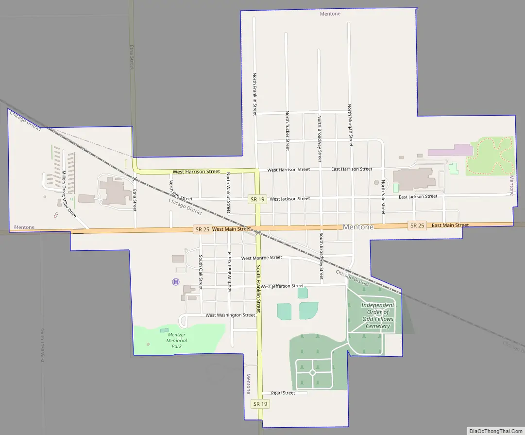
Mentone Road Map
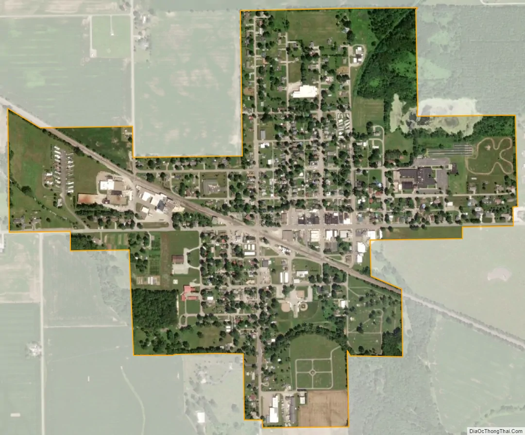
Mentone city Satellite Map
Geography
Mentone is located at 41°10′23″N 86°2′21″W / 41.17306°N 86.03917°W / 41.17306; -86.03917 (41.173171, -86.039227).
According to the 2010 census, Mentone has a total area of 0.59 square miles (1.53 km), of which 0.58 square miles (1.50 km) (or 98.31%) is land and 0.01 square miles (0.03 km) (or 1.69%) is water.
See also
Map of Indiana State and its subdivision:- Adams
- Allen
- Bartholomew
- Benton
- Blackford
- Boone
- Brown
- Carroll
- Cass
- Clark
- Clay
- Clinton
- Crawford
- Daviess
- De Kalb
- Dearborn
- Decatur
- Delaware
- Dubois
- Elkhart
- Fayette
- Floyd
- Fountain
- Franklin
- Fulton
- Gibson
- Grant
- Greene
- Hamilton
- Hancock
- Harrison
- Hendricks
- Henry
- Howard
- Huntington
- Jackson
- Jasper
- Jay
- Jefferson
- Jennings
- Johnson
- Knox
- Kosciusko
- LaGrange
- Lake
- Lake Michigan
- LaPorte
- Lawrence
- Madison
- Marion
- Marshall
- Martin
- Miami
- Monroe
- Montgomery
- Morgan
- Newton
- Noble
- Ohio
- Orange
- Owen
- Parke
- Perry
- Pike
- Porter
- Posey
- Pulaski
- Putnam
- Randolph
- Ripley
- Rush
- Saint Joseph
- Scott
- Shelby
- Spencer
- Starke
- Steuben
- Sullivan
- Switzerland
- Tippecanoe
- Tipton
- Union
- Vanderburgh
- Vermillion
- Vigo
- Wabash
- Warren
- Warrick
- Washington
- Wayne
- Wells
- White
- Whitley
- Alabama
- Alaska
- Arizona
- Arkansas
- California
- Colorado
- Connecticut
- Delaware
- District of Columbia
- Florida
- Georgia
- Hawaii
- Idaho
- Illinois
- Indiana
- Iowa
- Kansas
- Kentucky
- Louisiana
- Maine
- Maryland
- Massachusetts
- Michigan
- Minnesota
- Mississippi
- Missouri
- Montana
- Nebraska
- Nevada
- New Hampshire
- New Jersey
- New Mexico
- New York
- North Carolina
- North Dakota
- Ohio
- Oklahoma
- Oregon
- Pennsylvania
- Rhode Island
- South Carolina
- South Dakota
- Tennessee
- Texas
- Utah
- Vermont
- Virginia
- Washington
- West Virginia
- Wisconsin
- Wyoming