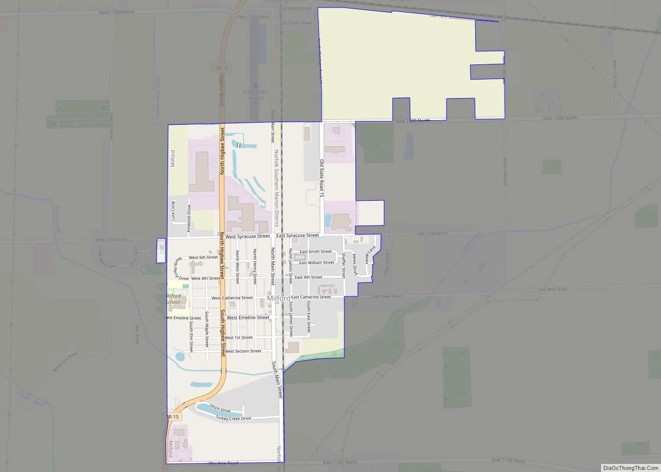
Milford is a town in Van Buren Township, Kosciusko County, in the U.S. state of Indiana. The population was 1,614 at the 2020 census.
| Name: | Milford town |
|---|---|
| LSAD Code: | 43 |
| LSAD Description: | town (suffix) |
| State: | Indiana |
| County: | Kosciusko County |
| Elevation: | 833 ft (254 m) |
| Total Area: | 1.47 sq mi (3.82 km²) |
| Land Area: | 1.45 sq mi (3.76 km²) |
| Water Area: | 0.02 sq mi (0.06 km²) |
| Total Population: | 1,614 |
| Population Density: | 1,111.57/sq mi (429.08/km²) |
| ZIP code: | 46542 |
| Area code: | 574 |
| FIPS code: | 1849320 |
| GNISfeature ID: | 439139 |
Online Interactive Map
Click on ![]() to view map in "full screen" mode.
to view map in "full screen" mode.
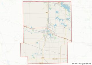
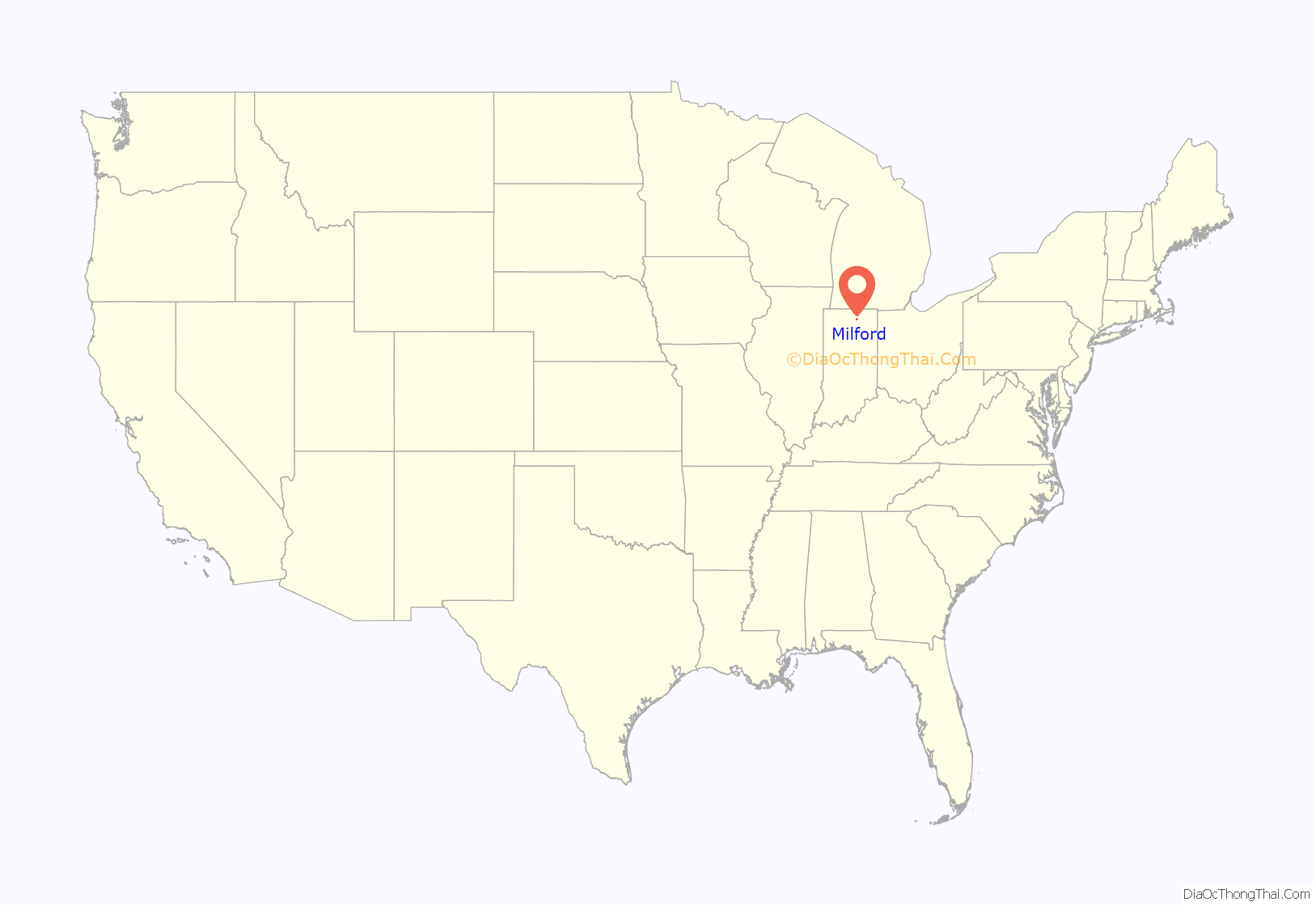
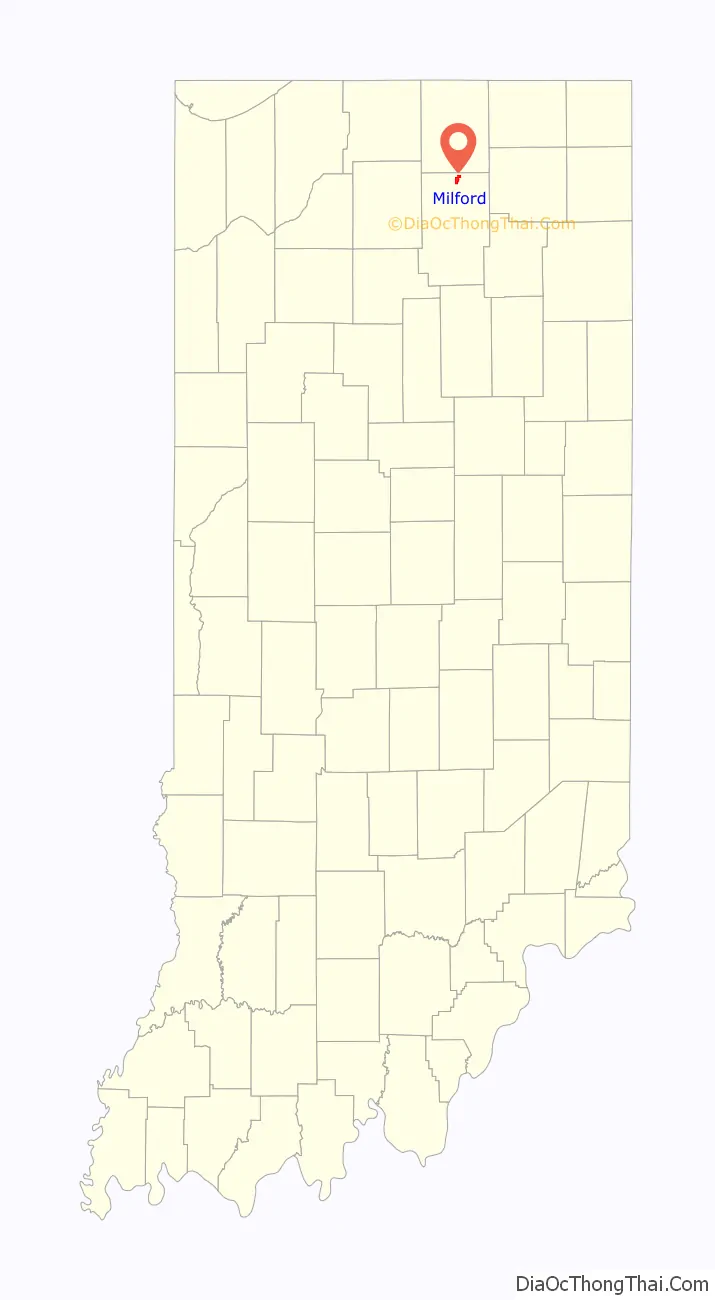
Milford location map. Where is Milford town?
History
Milford was laid out by Judge Aaron M. Perine on April 10, 1836, who had settled the area with his family in 1834. It was named for a mill which stood near a ford. The post office at Milford has been in operation since 1837. In 1880, Milford was officially incorporated as a town.
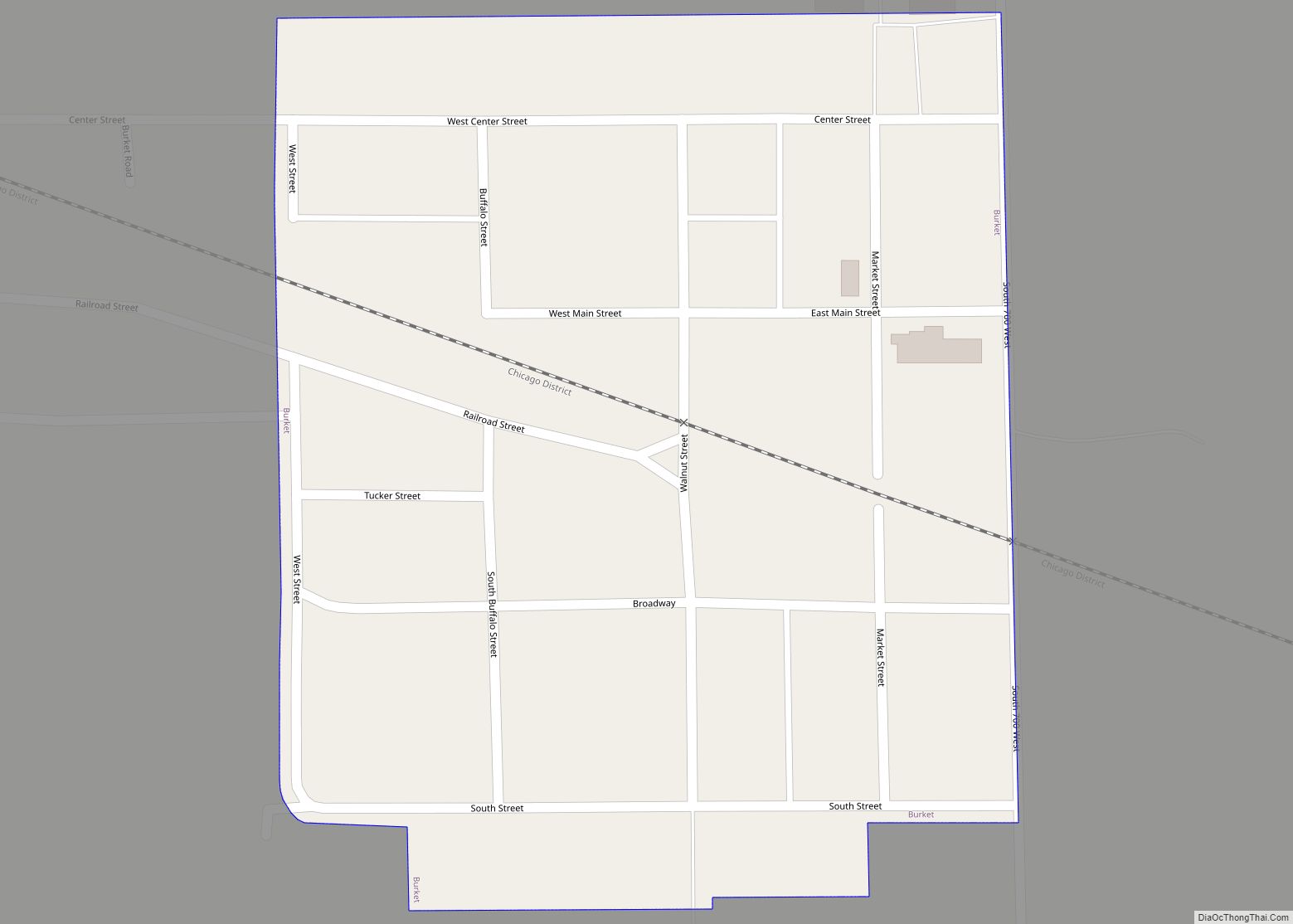
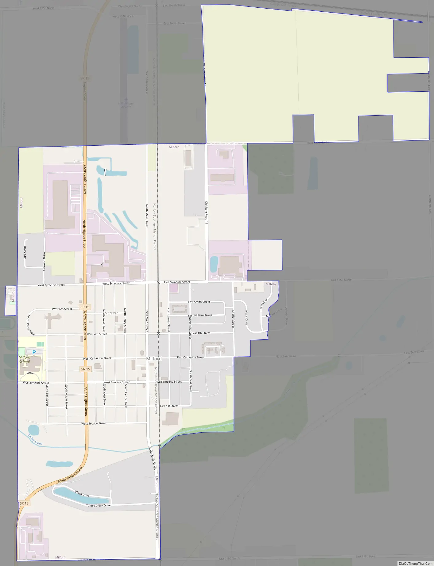
Milford Road Map
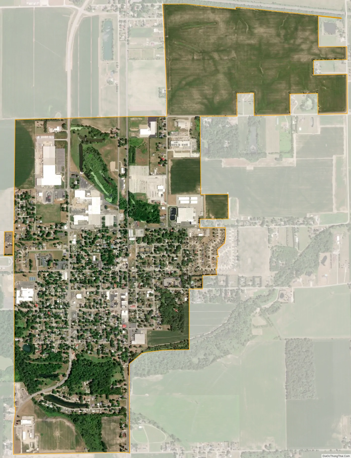
Milford city Satellite Map
Geography
According to the 2010 census, Milford has a total area of 1.12 square miles (2.90 km), of which 1.1 square miles (2.85 km) (or 98.21%) is land and 0.02 square miles (0.05 km) (or 1.79%) is water.
See also
Map of Indiana State and its subdivision:- Adams
- Allen
- Bartholomew
- Benton
- Blackford
- Boone
- Brown
- Carroll
- Cass
- Clark
- Clay
- Clinton
- Crawford
- Daviess
- De Kalb
- Dearborn
- Decatur
- Delaware
- Dubois
- Elkhart
- Fayette
- Floyd
- Fountain
- Franklin
- Fulton
- Gibson
- Grant
- Greene
- Hamilton
- Hancock
- Harrison
- Hendricks
- Henry
- Howard
- Huntington
- Jackson
- Jasper
- Jay
- Jefferson
- Jennings
- Johnson
- Knox
- Kosciusko
- LaGrange
- Lake
- Lake Michigan
- LaPorte
- Lawrence
- Madison
- Marion
- Marshall
- Martin
- Miami
- Monroe
- Montgomery
- Morgan
- Newton
- Noble
- Ohio
- Orange
- Owen
- Parke
- Perry
- Pike
- Porter
- Posey
- Pulaski
- Putnam
- Randolph
- Ripley
- Rush
- Saint Joseph
- Scott
- Shelby
- Spencer
- Starke
- Steuben
- Sullivan
- Switzerland
- Tippecanoe
- Tipton
- Union
- Vanderburgh
- Vermillion
- Vigo
- Wabash
- Warren
- Warrick
- Washington
- Wayne
- Wells
- White
- Whitley
- Alabama
- Alaska
- Arizona
- Arkansas
- California
- Colorado
- Connecticut
- Delaware
- District of Columbia
- Florida
- Georgia
- Hawaii
- Idaho
- Illinois
- Indiana
- Iowa
- Kansas
- Kentucky
- Louisiana
- Maine
- Maryland
- Massachusetts
- Michigan
- Minnesota
- Mississippi
- Missouri
- Montana
- Nebraska
- Nevada
- New Hampshire
- New Jersey
- New Mexico
- New York
- North Carolina
- North Dakota
- Ohio
- Oklahoma
- Oregon
- Pennsylvania
- Rhode Island
- South Carolina
- South Dakota
- Tennessee
- Texas
- Utah
- Vermont
- Virginia
- Washington
- West Virginia
- Wisconsin
- Wyoming