Oolitic is a town in Indian Creek and Shawswick townships, Lawrence County, Indiana, United States. The population was 1,184 at the 2010 census.
| Name: | Oolitic town |
|---|---|
| LSAD Code: | 43 |
| LSAD Description: | town (suffix) |
| State: | Indiana |
| County: | Lawrence County |
| Elevation: | 600 ft (183 m) |
| Total Area: | 0.67 sq mi (1.73 km²) |
| Land Area: | 0.67 sq mi (1.73 km²) |
| Water Area: | 0.00 sq mi (0.00 km²) |
| Total Population: | 1,137 |
| Population Density: | 1,704.65/sq mi (658.18/km²) |
| ZIP code: | 47451 |
| Area code: | 812 |
| FIPS code: | 1856682 |
| GNISfeature ID: | 0451301 |
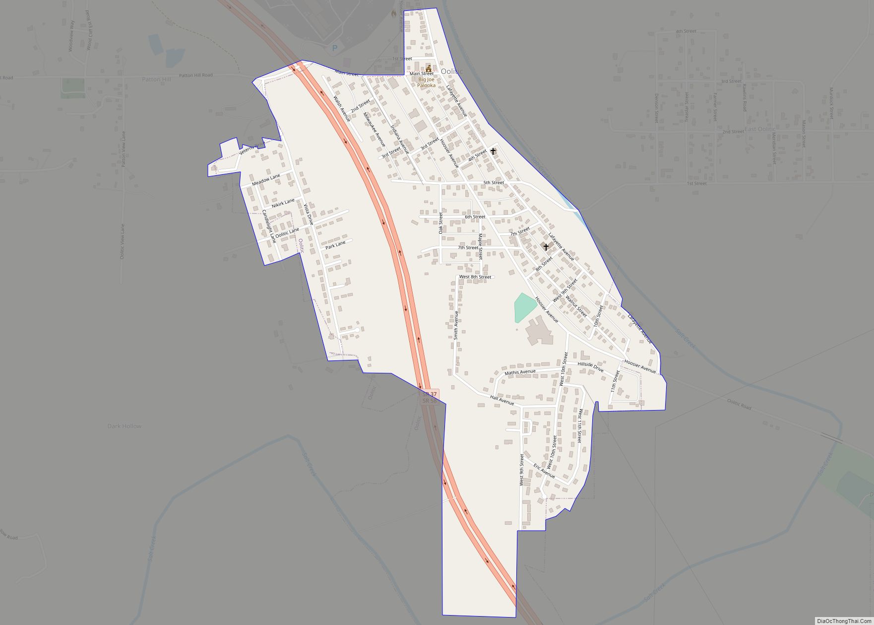
Online Interactive Map
Click on ![]() to view map in "full screen" mode.
to view map in "full screen" mode.
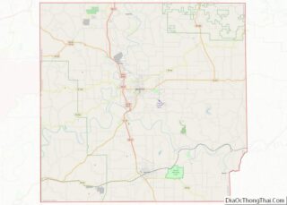
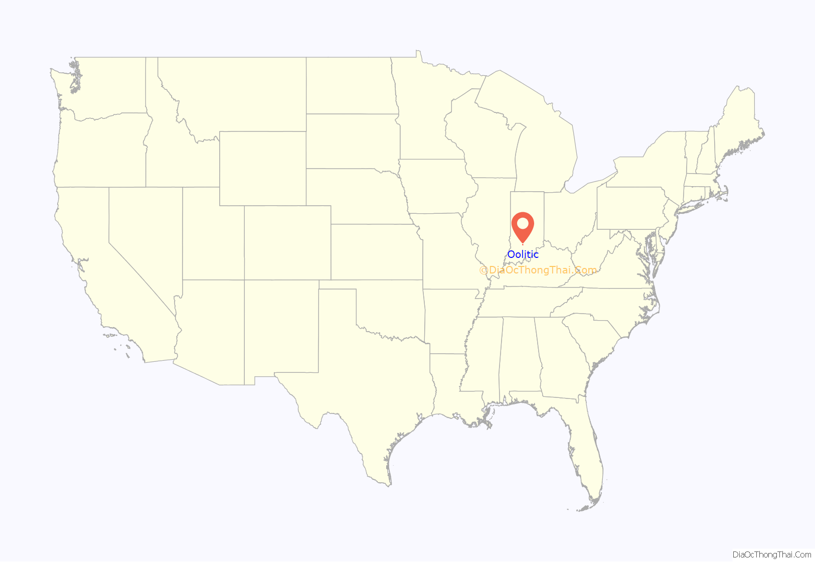
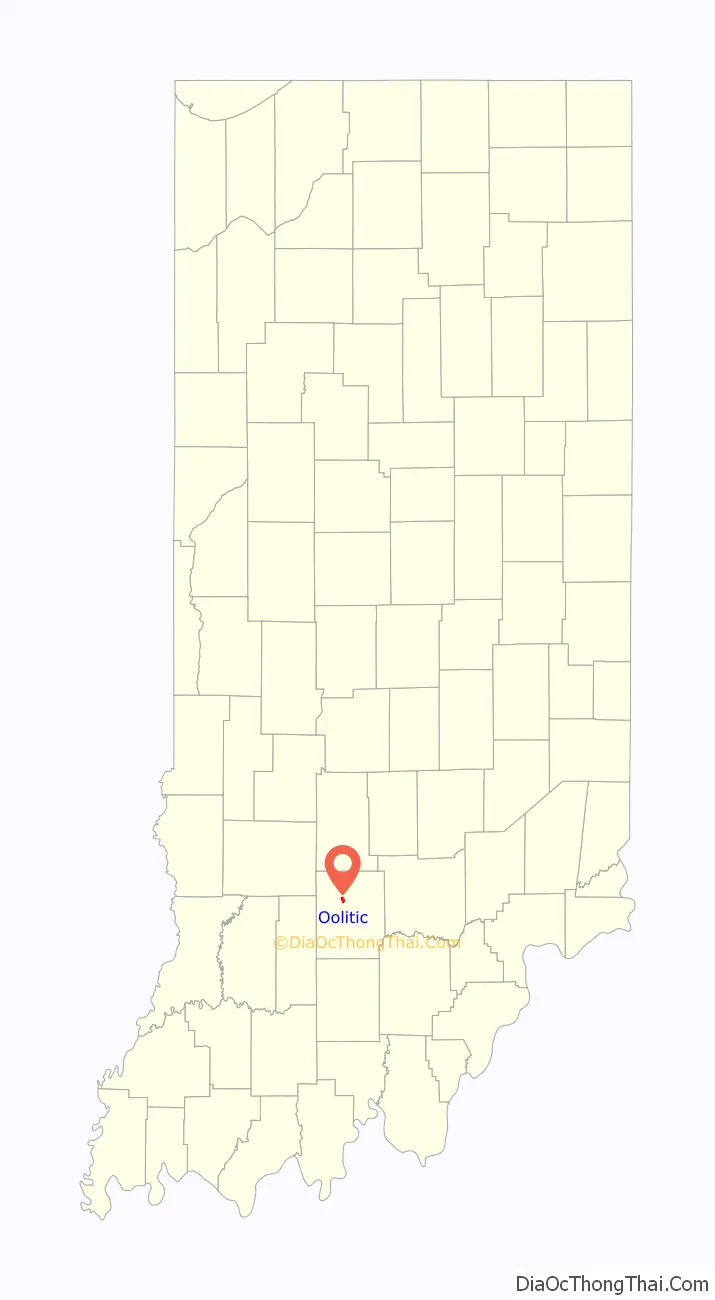
Oolitic location map. Where is Oolitic town?
History
Oolitic was platted on March 23, 1896, by the Bedford Quarries Company. It was incorporated in 1900. In 1910, its population was 1,079; in 1914 it had risen to about 2,000. Oolite is a type of limestone found in Indiana.
Oolitic is the site of a limestone statue of comic-strip boxer Joe Palooka, moved there from Bedford in 1984.
Oolitic is the opposing basketball team during the season opener in the film Hoosiers.
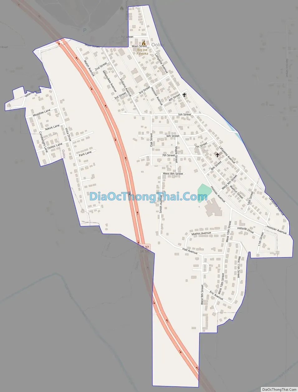
Oolitic Road Map
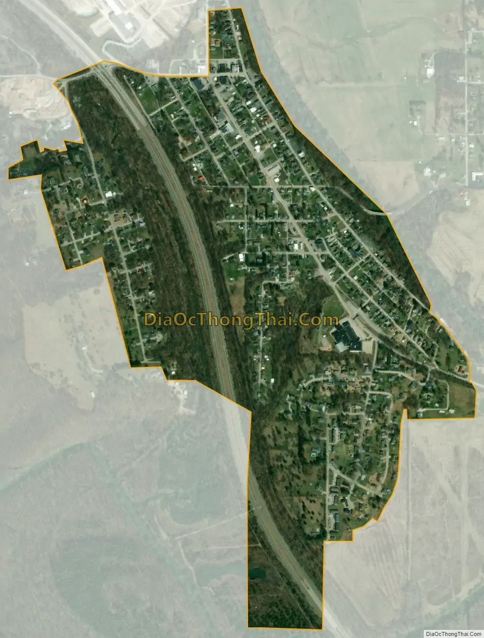
Oolitic city Satellite Map
Geography
Oolitic is located at 38°53′44″N 86°31′29″W / 38.89556°N 86.52472°W / 38.89556; -86.52472 (38.895513, -86.524696).
According to the 2010 census, Oolitic has a total area of 0.78 square miles (2.02 km), all land.
Climate
The climate in this area is characterized by hot, humid summers and generally mild to cool winters. According to the Köppen Climate Classification system, Oolitic has a humid subtropical climate, abbreviated “Cfa” on climate maps.
See also
Map of Indiana State and its subdivision:- Adams
- Allen
- Bartholomew
- Benton
- Blackford
- Boone
- Brown
- Carroll
- Cass
- Clark
- Clay
- Clinton
- Crawford
- Daviess
- De Kalb
- Dearborn
- Decatur
- Delaware
- Dubois
- Elkhart
- Fayette
- Floyd
- Fountain
- Franklin
- Fulton
- Gibson
- Grant
- Greene
- Hamilton
- Hancock
- Harrison
- Hendricks
- Henry
- Howard
- Huntington
- Jackson
- Jasper
- Jay
- Jefferson
- Jennings
- Johnson
- Knox
- Kosciusko
- LaGrange
- Lake
- Lake Michigan
- LaPorte
- Lawrence
- Madison
- Marion
- Marshall
- Martin
- Miami
- Monroe
- Montgomery
- Morgan
- Newton
- Noble
- Ohio
- Orange
- Owen
- Parke
- Perry
- Pike
- Porter
- Posey
- Pulaski
- Putnam
- Randolph
- Ripley
- Rush
- Saint Joseph
- Scott
- Shelby
- Spencer
- Starke
- Steuben
- Sullivan
- Switzerland
- Tippecanoe
- Tipton
- Union
- Vanderburgh
- Vermillion
- Vigo
- Wabash
- Warren
- Warrick
- Washington
- Wayne
- Wells
- White
- Whitley
- Alabama
- Alaska
- Arizona
- Arkansas
- California
- Colorado
- Connecticut
- Delaware
- District of Columbia
- Florida
- Georgia
- Hawaii
- Idaho
- Illinois
- Indiana
- Iowa
- Kansas
- Kentucky
- Louisiana
- Maine
- Maryland
- Massachusetts
- Michigan
- Minnesota
- Mississippi
- Missouri
- Montana
- Nebraska
- Nevada
- New Hampshire
- New Jersey
- New Mexico
- New York
- North Carolina
- North Dakota
- Ohio
- Oklahoma
- Oregon
- Pennsylvania
- Rhode Island
- South Carolina
- South Dakota
- Tennessee
- Texas
- Utah
- Vermont
- Virginia
- Washington
- West Virginia
- Wisconsin
- Wyoming