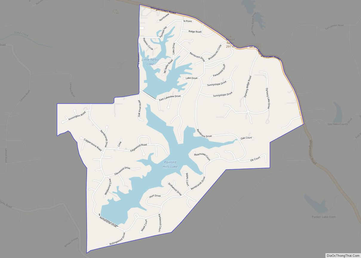
Painted Hills is an unincorporated community and census-designated place (CDP) in Jackson Township, Morgan County, in the U.S. state of Indiana. Its population was 766 as of the 2020 census, up from 677 in 2010. The community is located on the shores of Lake Holiday and Lake Nebo southeast of Martinsville, the Morgan county seat. The two lakes are a combined 196 acres (79 ha) in size.
The community has one pub/restaurant mix and an office in the “Clubhouse”.
| Name: | Painted Hills CDP |
|---|---|
| LSAD Code: | 57 |
| LSAD Description: | CDP (suffix) |
| State: | Indiana |
| County: | Morgan County |
| Elevation: | 722 ft (220 m) |
| Total Area: | 1.95 sq mi (5.05 km²) |
| Land Area: | 1.73 sq mi (4.48 km²) |
| Water Area: | 0.22 sq mi (0.57 km²) |
| Total Population: | 766 |
| Population Density: | 442.77/sq mi (171.01/km²) |
| ZIP code: | 46151 (Martinsville) |
| Area code: | 765 |
| FIPS code: | 1857632 |
| GNISfeature ID: | 2629901 |
Online Interactive Map
Click on ![]() to view map in "full screen" mode.
to view map in "full screen" mode.
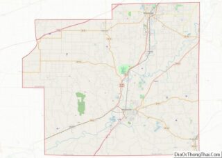
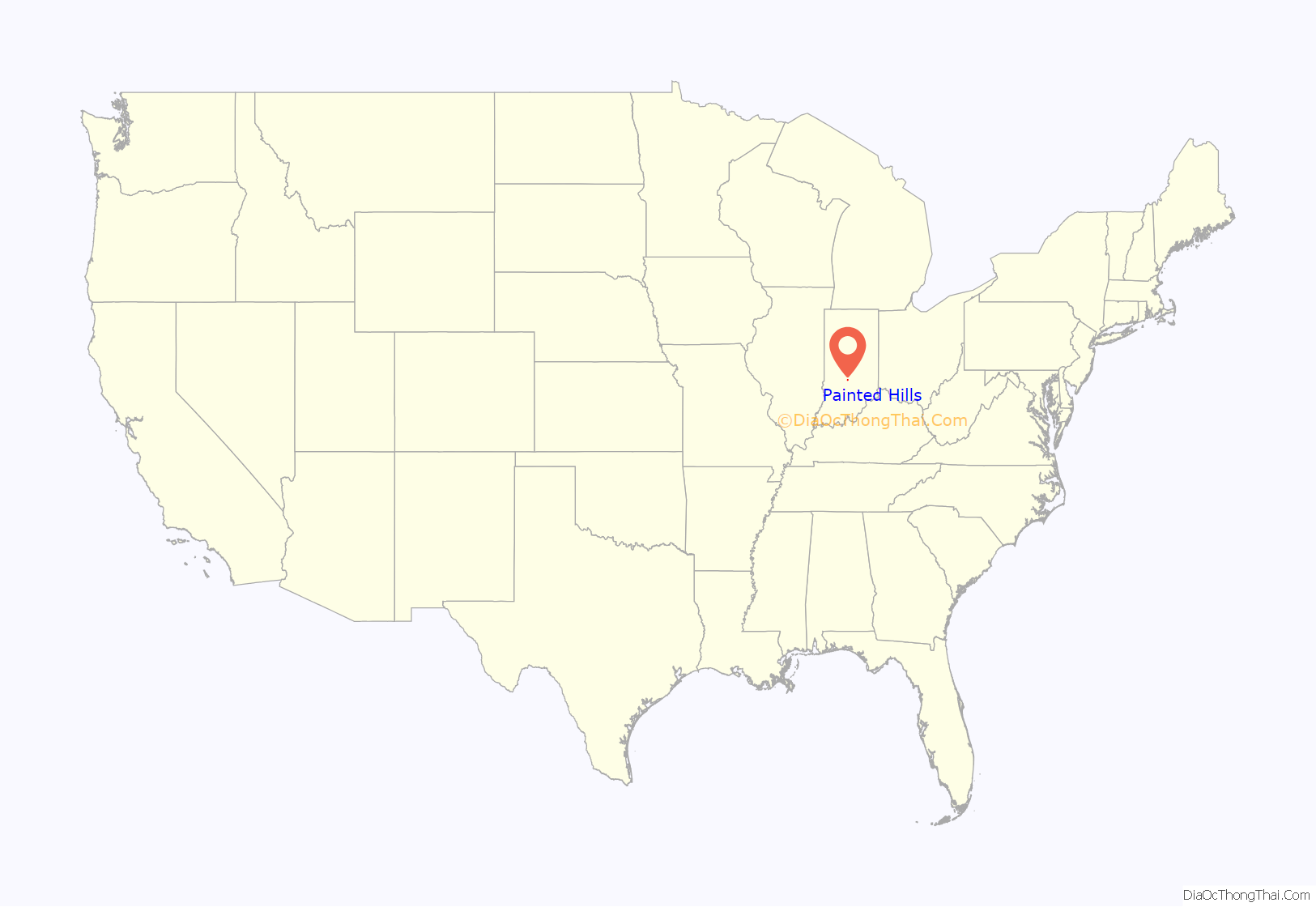
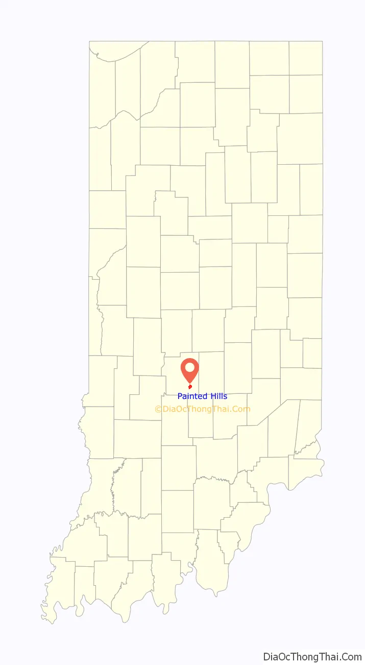
Painted Hills location map. Where is Painted Hills CDP?
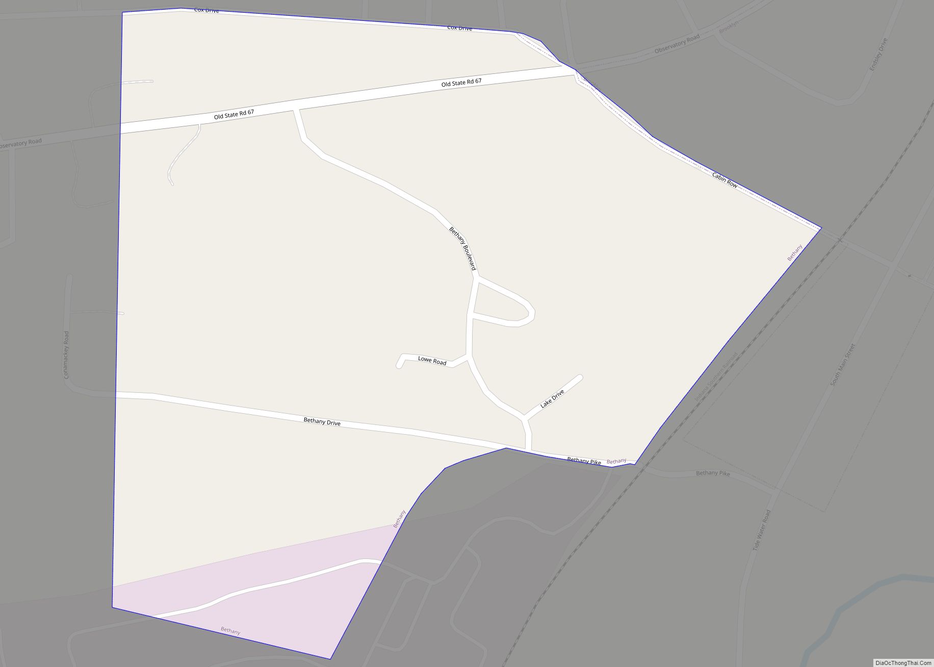
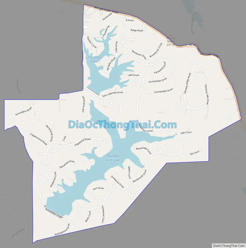
Painted Hills Road Map
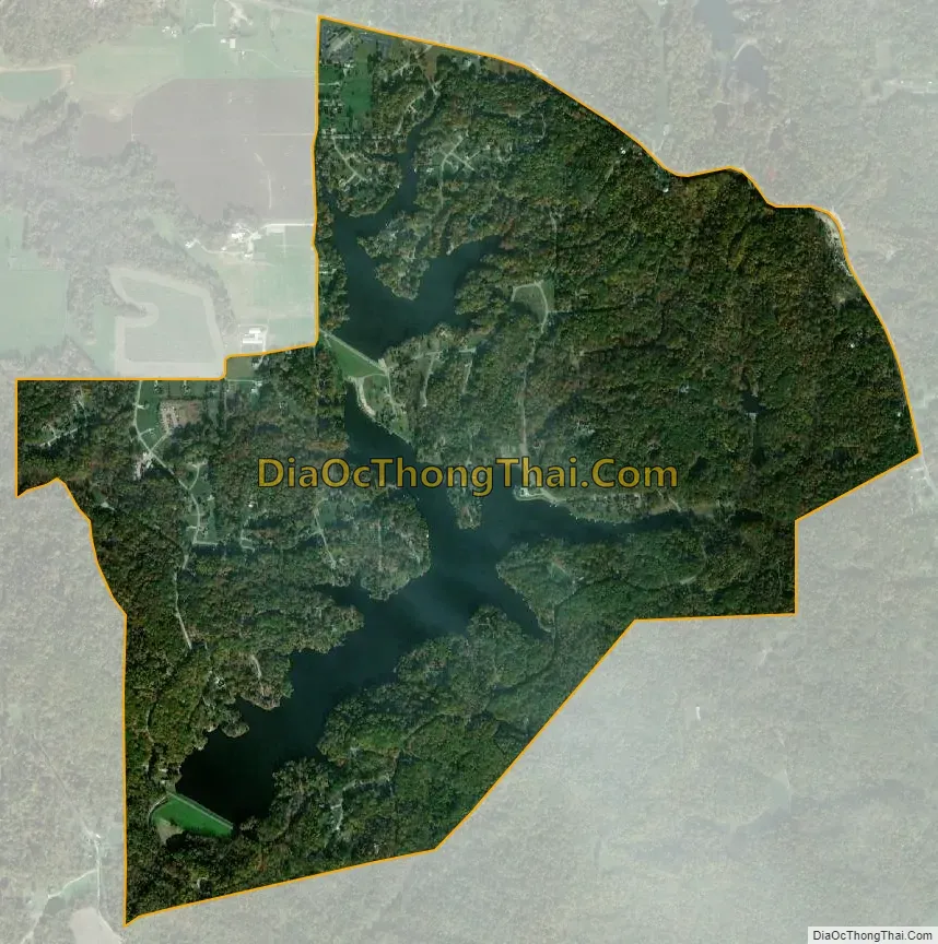
Painted Hills city Satellite Map
Geography
Painted Hills is located in southeastern Morgan County at 39°23′44″N 86°20′46″W / 39.39568°N 86.34603°W / 39.39568; -86.34603. Indiana State Road 252 forms the northeast border of the community, leading northwest 5 miles (8 km) to Martinsville and southeast the same distance to Morgantown.
According to the U.S. Census Bureau, the community has an area of 1.95 square miles (5.05 km), of which 1.73 square miles (4.48 km) are land and 0.22 square miles (0.57 km), or 11.37%, are water. The lakes in the community, shown as Painted Hills Lake and Little Nebo Lake on federal maps, are built on Camp Creek, a south-flowing tributary of Indian Creek, which leads northwest to the White River south of Martinsville.
See also
Map of Indiana State and its subdivision:- Adams
- Allen
- Bartholomew
- Benton
- Blackford
- Boone
- Brown
- Carroll
- Cass
- Clark
- Clay
- Clinton
- Crawford
- Daviess
- De Kalb
- Dearborn
- Decatur
- Delaware
- Dubois
- Elkhart
- Fayette
- Floyd
- Fountain
- Franklin
- Fulton
- Gibson
- Grant
- Greene
- Hamilton
- Hancock
- Harrison
- Hendricks
- Henry
- Howard
- Huntington
- Jackson
- Jasper
- Jay
- Jefferson
- Jennings
- Johnson
- Knox
- Kosciusko
- LaGrange
- Lake
- Lake Michigan
- LaPorte
- Lawrence
- Madison
- Marion
- Marshall
- Martin
- Miami
- Monroe
- Montgomery
- Morgan
- Newton
- Noble
- Ohio
- Orange
- Owen
- Parke
- Perry
- Pike
- Porter
- Posey
- Pulaski
- Putnam
- Randolph
- Ripley
- Rush
- Saint Joseph
- Scott
- Shelby
- Spencer
- Starke
- Steuben
- Sullivan
- Switzerland
- Tippecanoe
- Tipton
- Union
- Vanderburgh
- Vermillion
- Vigo
- Wabash
- Warren
- Warrick
- Washington
- Wayne
- Wells
- White
- Whitley
- Alabama
- Alaska
- Arizona
- Arkansas
- California
- Colorado
- Connecticut
- Delaware
- District of Columbia
- Florida
- Georgia
- Hawaii
- Idaho
- Illinois
- Indiana
- Iowa
- Kansas
- Kentucky
- Louisiana
- Maine
- Maryland
- Massachusetts
- Michigan
- Minnesota
- Mississippi
- Missouri
- Montana
- Nebraska
- Nevada
- New Hampshire
- New Jersey
- New Mexico
- New York
- North Carolina
- North Dakota
- Ohio
- Oklahoma
- Oregon
- Pennsylvania
- Rhode Island
- South Carolina
- South Dakota
- Tennessee
- Texas
- Utah
- Vermont
- Virginia
- Washington
- West Virginia
- Wisconsin
- Wyoming