Pierceton is a town in Washington Township, Kosciusko County, in the U.S. state of Indiana. The population was 1,015 at the 2010 census.
| Name: | Pierceton town |
|---|---|
| LSAD Code: | 43 |
| LSAD Description: | town (suffix) |
| State: | Indiana |
| County: | Kosciusko County |
| Elevation: | 928 ft (283 m) |
| Total Area: | 1.25 sq mi (3.23 km²) |
| Land Area: | 1.25 sq mi (3.23 km²) |
| Water Area: | 0.00 sq mi (0.00 km²) |
| Total Population: | 928 |
| Population Density: | 744.19/sq mi (287.37/km²) |
| ZIP code: | 46562 |
| Area code: | 574 |
| FIPS code: | 1859598 |
| GNISfeature ID: | 441110 |
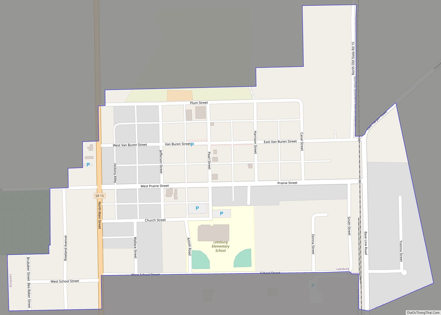
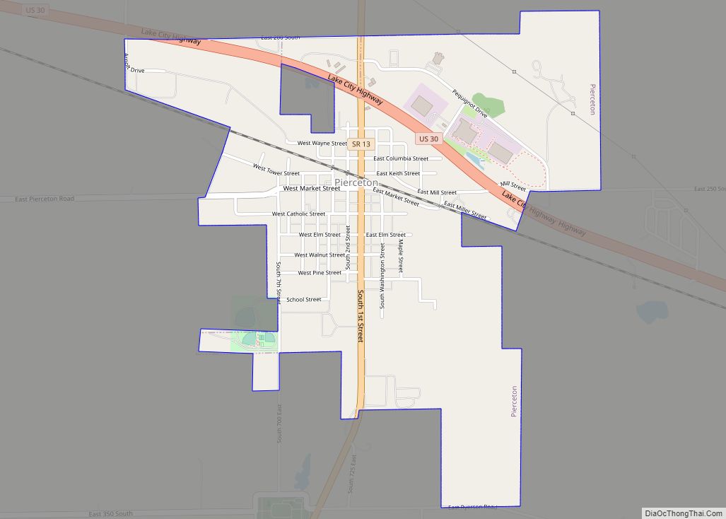
Online Interactive Map
Click on ![]() to view map in "full screen" mode.
to view map in "full screen" mode.
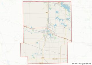
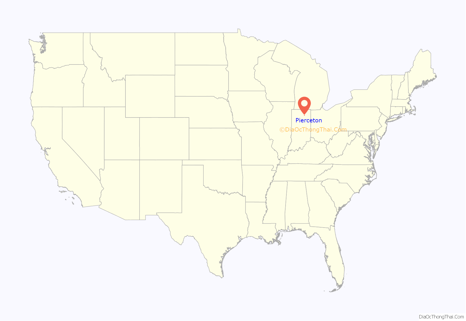
Pierceton location map. Where is Pierceton town?
History
In 1853, John Butler Chapman and Lewis Keith, his father-in-law, employed Otho Means, a surveyor, to lay out Pierceton as it is located today, christened in honor of President Franklin Pierce. The Pierceton post office was established in 1853.
Pierceton was incorporated as a town in 1866.
The Pierceton Historic District was listed on the National Register of Historic Places in 1992.
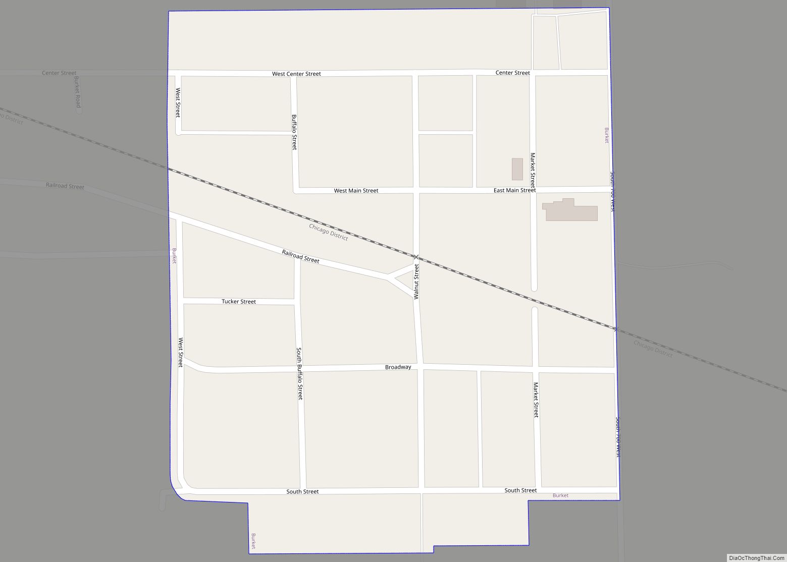
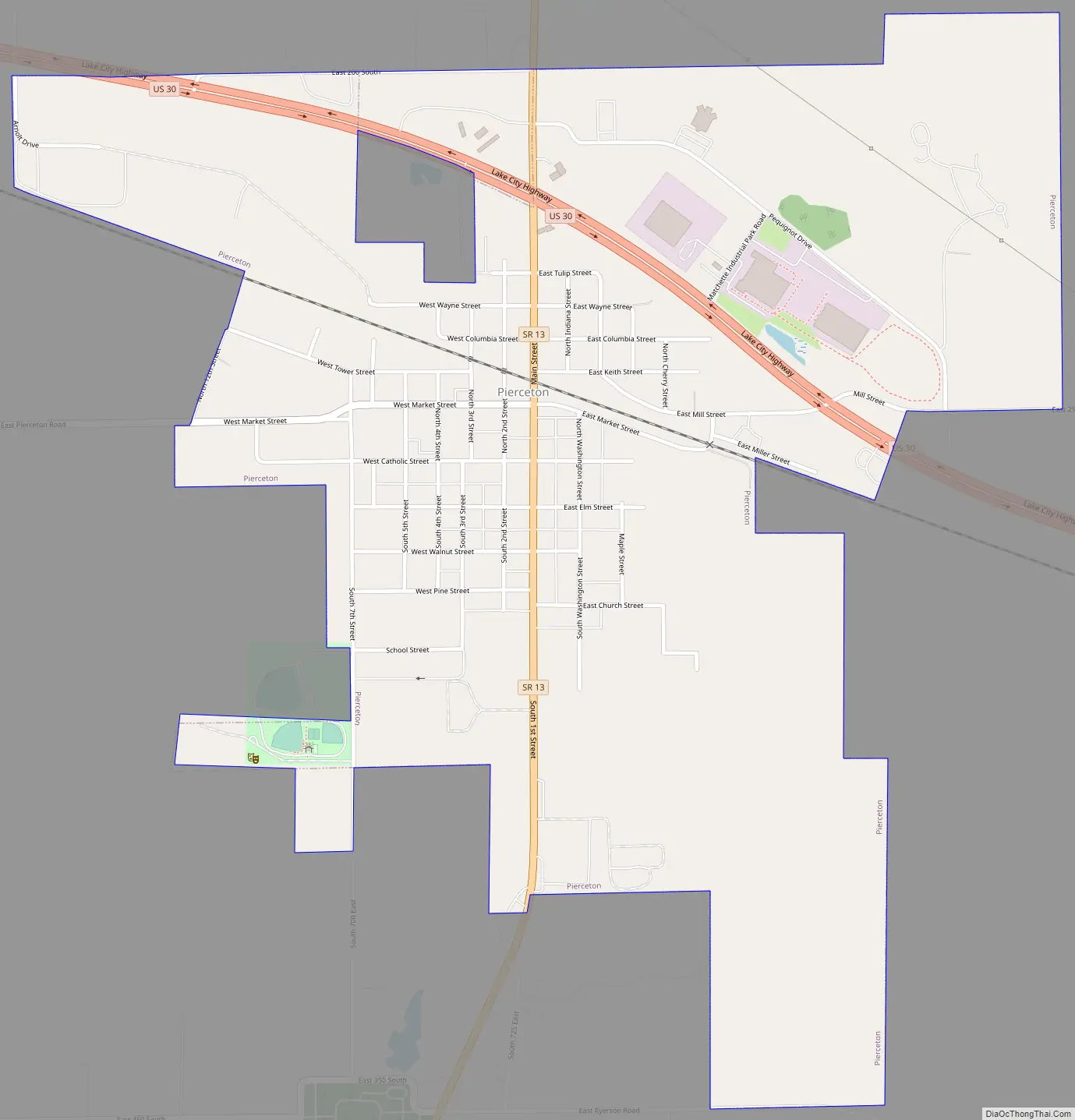
Pierceton Road Map
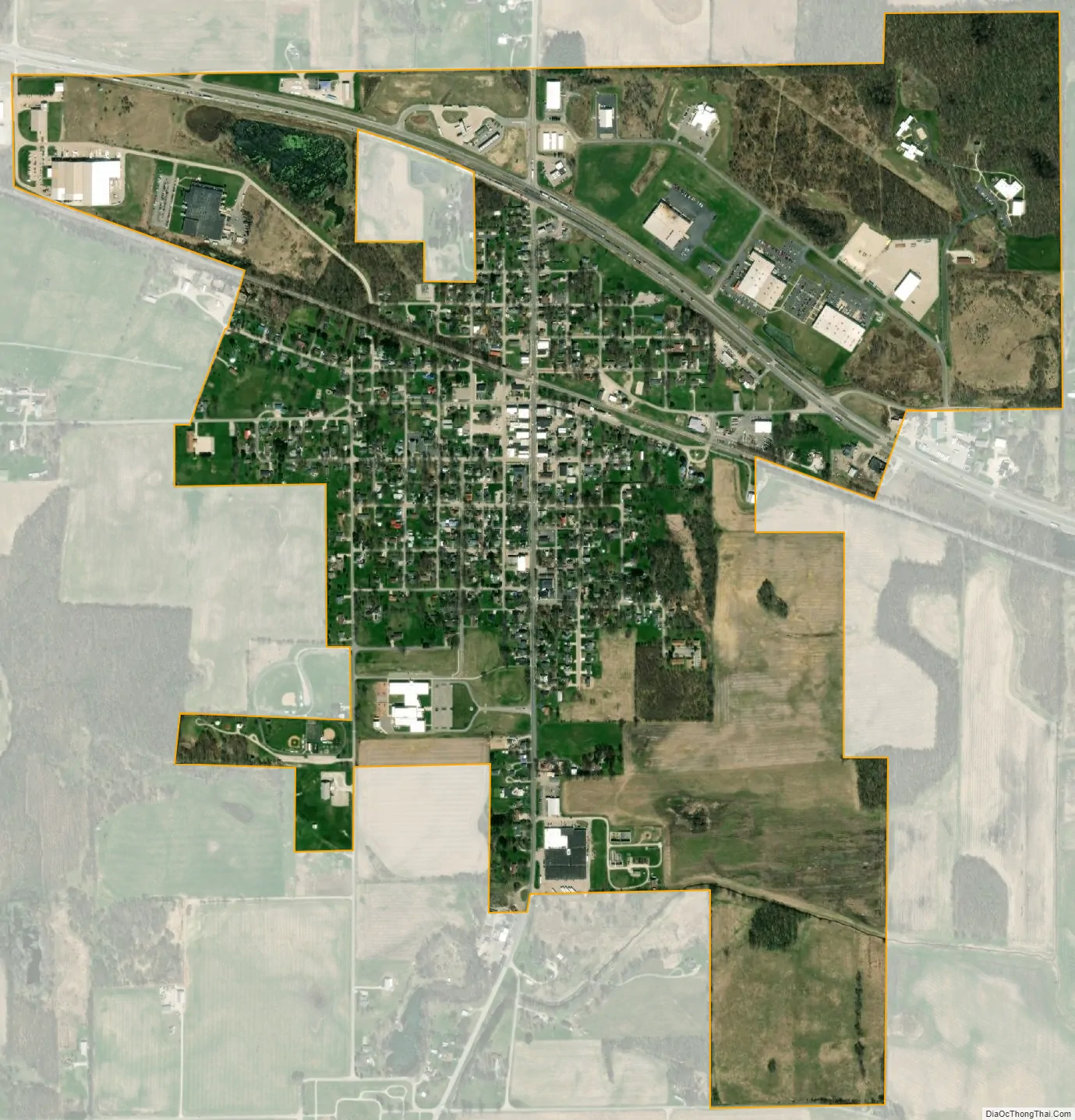
Pierceton city Satellite Map
Geography
Pierceton is located at 41°11′59″N 85°42′24″W / 41.19972°N 85.70667°W / 41.19972; -85.70667 (41.199617, -85.706733). It lies at the intersection of US 30 and Indiana state route 13.
According to the 2010 census, Pierceton has a total area of 1.2 square miles (3.11 km), all land.
See also
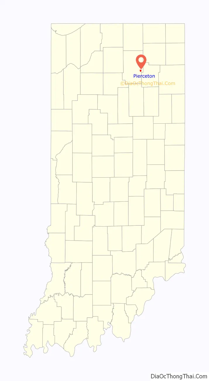
Map of Indiana State and its subdivision:- Adams
- Allen
- Bartholomew
- Benton
- Blackford
- Boone
- Brown
- Carroll
- Cass
- Clark
- Clay
- Clinton
- Crawford
- Daviess
- De Kalb
- Dearborn
- Decatur
- Delaware
- Dubois
- Elkhart
- Fayette
- Floyd
- Fountain
- Franklin
- Fulton
- Gibson
- Grant
- Greene
- Hamilton
- Hancock
- Harrison
- Hendricks
- Henry
- Howard
- Huntington
- Jackson
- Jasper
- Jay
- Jefferson
- Jennings
- Johnson
- Knox
- Kosciusko
- LaGrange
- Lake
- Lake Michigan
- LaPorte
- Lawrence
- Madison
- Marion
- Marshall
- Martin
- Miami
- Monroe
- Montgomery
- Morgan
- Newton
- Noble
- Ohio
- Orange
- Owen
- Parke
- Perry
- Pike
- Porter
- Posey
- Pulaski
- Putnam
- Randolph
- Ripley
- Rush
- Saint Joseph
- Scott
- Shelby
- Spencer
- Starke
- Steuben
- Sullivan
- Switzerland
- Tippecanoe
- Tipton
- Union
- Vanderburgh
- Vermillion
- Vigo
- Wabash
- Warren
- Warrick
- Washington
- Wayne
- Wells
- White
- Whitley
- Alabama
- Alaska
- Arizona
- Arkansas
- California
- Colorado
- Connecticut
- Delaware
- District of Columbia
- Florida
- Georgia
- Hawaii
- Idaho
- Illinois
- Indiana
- Iowa
- Kansas
- Kentucky
- Louisiana
- Maine
- Maryland
- Massachusetts
- Michigan
- Minnesota
- Mississippi
- Missouri
- Montana
- Nebraska
- Nevada
- New Hampshire
- New Jersey
- New Mexico
- New York
- North Carolina
- North Dakota
- Ohio
- Oklahoma
- Oregon
- Pennsylvania
- Rhode Island
- South Carolina
- South Dakota
- Tennessee
- Texas
- Utah
- Vermont
- Virginia
- Washington
- West Virginia
- Wisconsin
- Wyoming