Porter is a town in Westchester Township, Porter County, in the U.S. state of Indiana. The population was 4,858 at the 2010 census. Porter is in the Indiana Dunes ecosystem, which played a role in the creation of The Nature Conservancy, and inspired conservation efforts.
Porter is noted for its proximity to Indiana Dunes State Park and for its railroad heritage. Porter was the southern terminus for the Chicago and West Michigan Railway.
| Name: | Porter town |
|---|---|
| LSAD Code: | 43 |
| LSAD Description: | town (suffix) |
| State: | Indiana |
| County: | Porter County |
| Elevation: | 640 ft (195 m) |
| Total Area: | 6.44 sq mi (16.69 km²) |
| Land Area: | 6.16 sq mi (15.96 km²) |
| Water Area: | 0.28 sq mi (0.74 km²) |
| Total Population: | 5,210 |
| Population Density: | 845.64/sq mi (326.50/km²) |
| ZIP code: | 46304, 46369 |
| Area code: | 219 |
| FIPS code: | 1861164 |
| GNISfeature ID: | 441459 |
| Website: | http://www.townofporter.com/ |
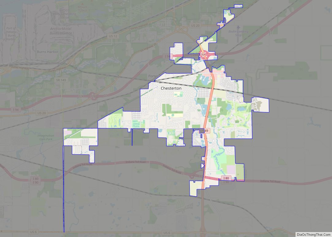
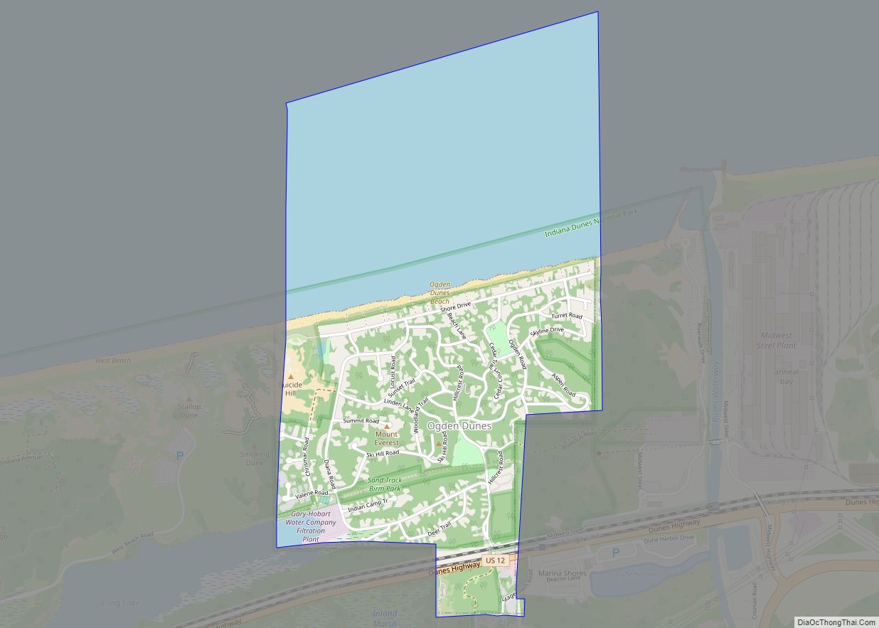
Online Interactive Map
Click on ![]() to view map in "full screen" mode.
to view map in "full screen" mode.
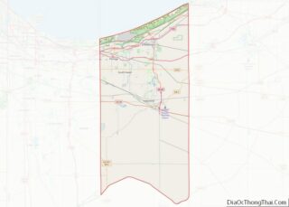
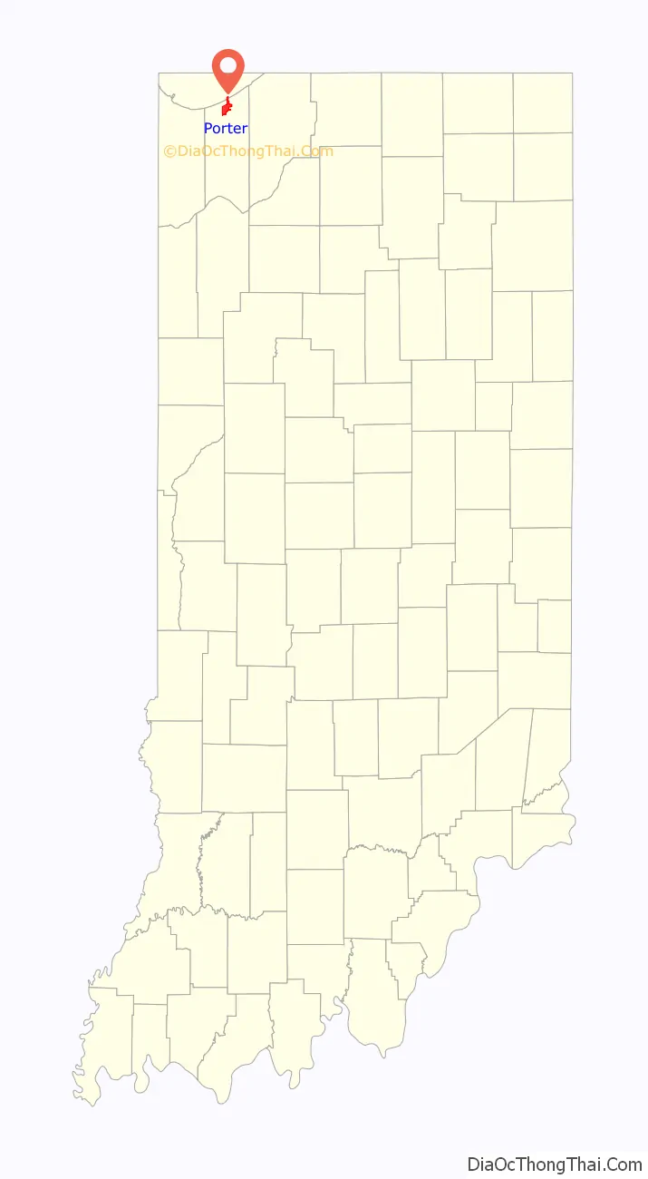
Porter location map. Where is Porter town?

History
Porter had its start in the 1850s when the railroad was extended to that point.
Historic sites
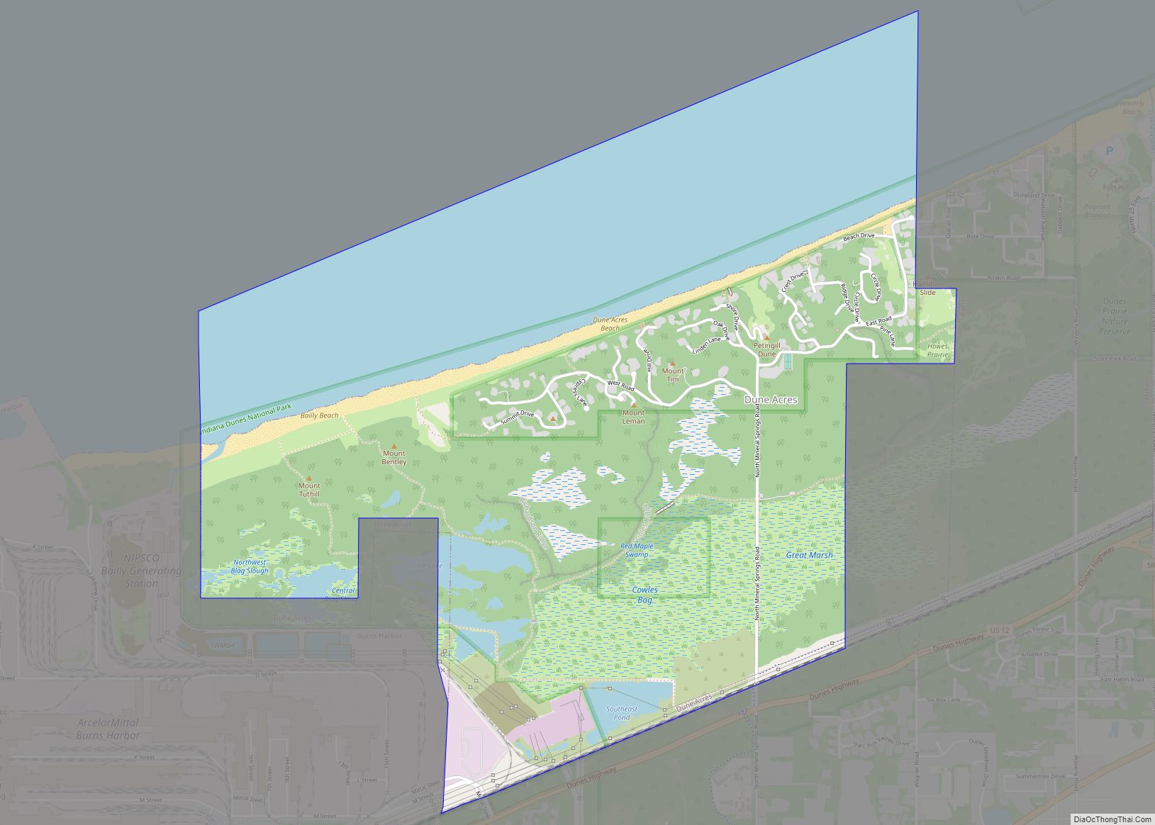
The Joseph Bailly Homestead is located in Indiana Dunes National Park on Howe Road, just north of U.S. 20. It is the residence of three generations of the Bailly family. Joseph and Marie Bailly arrived here in 1822 from the St. Joseph River in Michigan. He had been a fur trader on Lake Michigan for nearly 30 years when he set up his family home along the Little Calumet River.
The Chellberg Farm is also a three generation home, but of the family of Anders Kjellburg (Chellberg). He brought his family to this Swedish community in 1869, purchasing 80 acres (32 ha) from the Bailly descendants. The farm is located on Mineral Springs Road, north of U.S. 20.
The Augsburg Swedish Lutheran Church and Cemetery are located on Beam Street, west of town. The cemetery was founded in 1878.
The Willow Creek Confrontation, an altercation between railroads, occurred in Willow Creek which is in Porter, and is memorialized with a historical marker.
North of Willow Creek is the site of another significant event involving the town’s railroads. Porter Junction is where the New York Central Railroad and its subsidiary, the Michigan Central Railroad, crossed each other at grade. (Michigan Central was also involved in the Willow Creek Confrontation noted above. The Pere Marquette Railway also diverted from this location just east of the level crossing, also known as a “diamond”.)
In 1921, the crew of a northbound MIC passenger train missed a signal to stop before the “diamonds” in order to let a westbound NYC passenger train through. As a result, the MIC train struck a derail device meant for such a situation so as to prevent the trains from colliding, but in spite of derailing, the MIC train didn’t completely stop until after part of it was already obstructing the diamonds. The crew of the NYC train couldn’t stop in time, and smashed through one of the MIC’s coaches between 45 and 55 mph before derailing itself.
The collision resulted in the deaths of 35 passengers on the MIC train, as well as the deaths of the engineer and fireman on the NYC train. The crash gained such notoriety due to the graphic aftermath that it eventually pushed Congress to mandate the installation of cab signaling in locomotives throughout the United States. The diamond crossing, meanwhile, was removed sometime during the Conrail era.
In addition to the Joseph Bailly Homestead, the Good Fellow Club Youth Camp and Porter Town Hall are listed on the National Register of Historic Places.
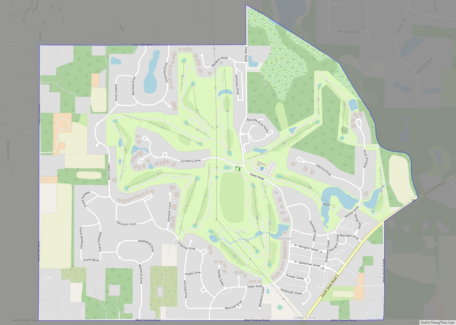
Porter Road Map
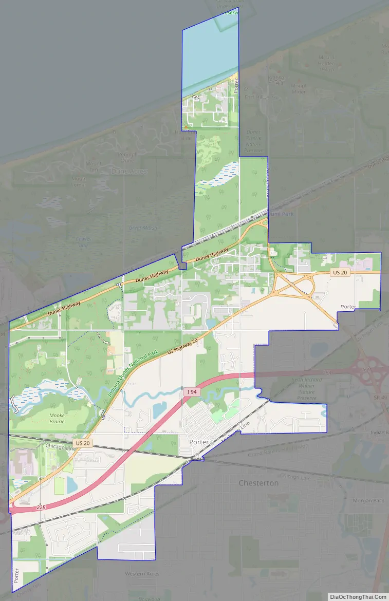
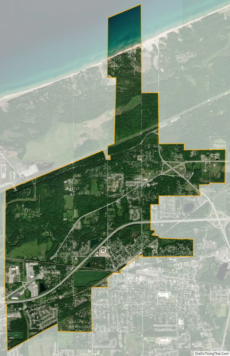
Porter city Satellite Map
Geography
Porter is located at 41°37′34″N 87°4′18″W / 41.62611°N 87.07167°W / 41.62611; -87.07167 (41.626005, -87.071798).
According to the 2010 census, Porter has a total area of 6.48 square miles (16.78 km), of which 6.2 square miles (16.06 km) (or 95.68%) is land and 0.28 square miles (0.73 km) (or 4.32%) is water.
See also
Map of Indiana State and its subdivision:- Adams
- Allen
- Bartholomew
- Benton
- Blackford
- Boone
- Brown
- Carroll
- Cass
- Clark
- Clay
- Clinton
- Crawford
- Daviess
- De Kalb
- Dearborn
- Decatur
- Delaware
- Dubois
- Elkhart
- Fayette
- Floyd
- Fountain
- Franklin
- Fulton
- Gibson
- Grant
- Greene
- Hamilton
- Hancock
- Harrison
- Hendricks
- Henry
- Howard
- Huntington
- Jackson
- Jasper
- Jay
- Jefferson
- Jennings
- Johnson
- Knox
- Kosciusko
- LaGrange
- Lake
- Lake Michigan
- LaPorte
- Lawrence
- Madison
- Marion
- Marshall
- Martin
- Miami
- Monroe
- Montgomery
- Morgan
- Newton
- Noble
- Ohio
- Orange
- Owen
- Parke
- Perry
- Pike
- Porter
- Posey
- Pulaski
- Putnam
- Randolph
- Ripley
- Rush
- Saint Joseph
- Scott
- Shelby
- Spencer
- Starke
- Steuben
- Sullivan
- Switzerland
- Tippecanoe
- Tipton
- Union
- Vanderburgh
- Vermillion
- Vigo
- Wabash
- Warren
- Warrick
- Washington
- Wayne
- Wells
- White
- Whitley
- Alabama
- Alaska
- Arizona
- Arkansas
- California
- Colorado
- Connecticut
- Delaware
- District of Columbia
- Florida
- Georgia
- Hawaii
- Idaho
- Illinois
- Indiana
- Iowa
- Kansas
- Kentucky
- Louisiana
- Maine
- Maryland
- Massachusetts
- Michigan
- Minnesota
- Mississippi
- Missouri
- Montana
- Nebraska
- Nevada
- New Hampshire
- New Jersey
- New Mexico
- New York
- North Carolina
- North Dakota
- Ohio
- Oklahoma
- Oregon
- Pennsylvania
- Rhode Island
- South Carolina
- South Dakota
- Tennessee
- Texas
- Utah
- Vermont
- Virginia
- Washington
- West Virginia
- Wisconsin
- Wyoming