Sweetser is a town in Franklin, Pleasant and Richland townships, Grant County, Indiana, United States. The population was 1,229 at the 2010 census.
| Name: | Sweetser town |
|---|---|
| LSAD Code: | 43 |
| LSAD Description: | town (suffix) |
| State: | Indiana |
| County: | Grant County |
| Elevation: | 843 ft (257 m) |
| Total Area: | 1.01 sq mi (2.62 km²) |
| Land Area: | 1.01 sq mi (2.61 km²) |
| Water Area: | 0.00 sq mi (0.01 km²) |
| Total Population: | 1,075 |
| Population Density: | 1,066.47/sq mi (411.67/km²) |
| ZIP code: | 46987 |
| Area code: | 765 |
| FIPS code: | 1874546 |
| GNISfeature ID: | 0444483 |
| Website: | http://www.sweetserin.com/ |
Online Interactive Map
Click on ![]() to view map in "full screen" mode.
to view map in "full screen" mode.
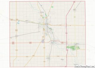
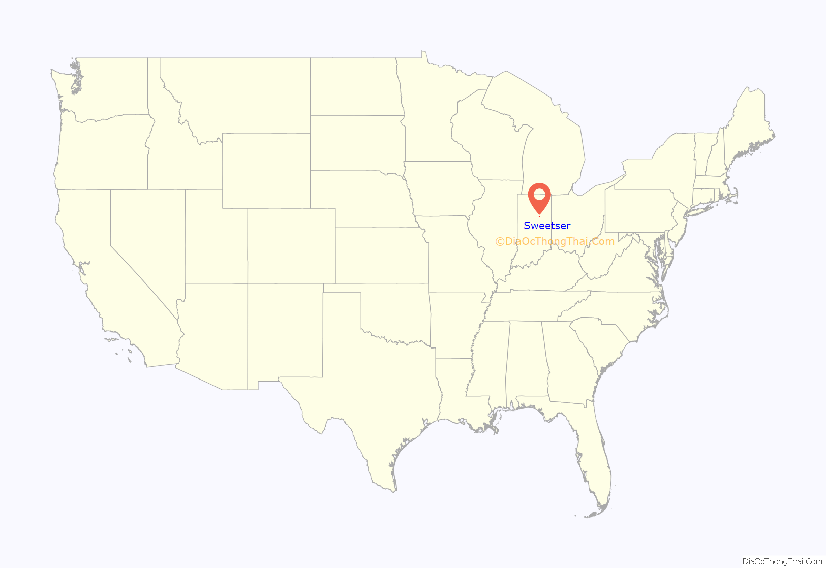
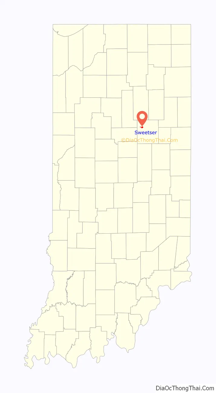
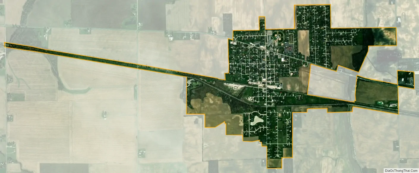
Sweetser location map. Where is Sweetser town?
History
The Pittsburgh, Cincinnati, Chicago and St. Louis Railroad was built through the area in 1867. Around 1869, a half-mile long switch was built to haul wood to a train refueling station. This switch would become the nucleus of the town. Railroadmen began calling it “Switch” and soon thereafter, the area was known as “Switzer” and then “Sweetser”.
The original plat of town of Sweetser was entered on October 14, 1871, by Sanford Prater, John Hubert, James H. Vinson, Urich Mars and H.B. Bragg with the Grant County Recorder’s office. The land which formed the original plat of Sweetser had been entered in the District Land Office in Fort Wayne, Indiana on May 22, 1848 by Samuel Blinn.
Additional plats to the town were Nuzum’s in 1873, and the Wilcut’s, McGee’s, Bishop’s and Nuzum’s 2nd, all platted in 1874.
The early business section was north of the railroad on the west side of Main street. A saw mill was located at what is now the site of the Methodist church (413 N. Main). Sweetser had several dry goods stores, a blacksmith shop, a jeweler and a saloon.
As the population grew, the saw mill was torn down and a new school house was built where it once stood. The old school house by the railroad (104 N. Meridian) was replaced by a grain elevator built by Gilbert and William Baum.
When natural gas was struck around Sweetser in 1885, the town was ready for development. The Brickner Window Glass Company, established in 1893, attracted many people not only living nearby but from other states to come to work and live here. The glass factory was located on the west side of town, being situated just west of what is now 319 W. Hubert Street. The factory was also known as Schick & Hawkins Window Glass Company.
From 1884 to 1894 there were five additions platted to Sweetser, namely Thompson’s, Sherron’s, Sherron’s 2nd, Sherron’s 3rd and Hawkins.
A hotel, known as the Vardaman Hotel, was located at 103 Main Street in lots number 27-29 of the original plat. This hotel was built to accommodate the number of persons working at the glass factory.
The Friermood Tile Factory was started in 1888 and was located at the end of Walnut Street. It made tile for draining the lands around Sweetser into Pipe Creek.
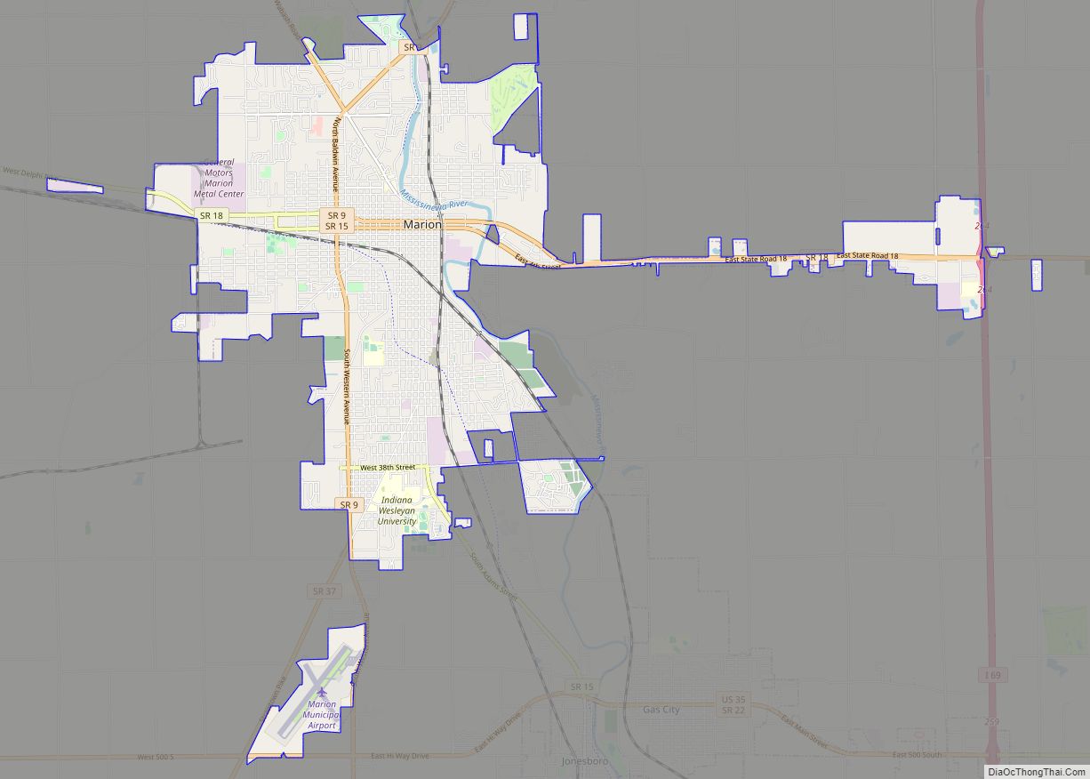
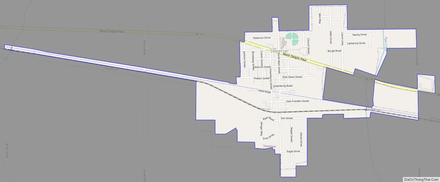
Sweetser Road Map
Sweetser city Satellite Map
Geography
Sweetser is located at 40°34′11″N 85°46′1″W / 40.56972°N 85.76694°W / 40.56972; -85.76694 (40.569731, -85.766972) on State Road 18 between the town of Converse and the city of Marion. According to the 2010 census, Sweetser has a total area of 1.013 square miles (2.62 km), of which 1.01 square miles (2.62 km) (or 99.7%) is land and 0.003 square miles (0.01 km) (or 0.3%) is water.
Running through the edge of Sweetser is a small body of water, or creek, known as Pipe Creek. Pipe Creek is one of the sites that can be seen from the Sweetser Switch Trail. Known as one of Sweetser’s main attractions, the trail is a walking trail that stretches throughout the whole town and is expanded three miles outside of the town’s outer limits. Although this trail is intended for walking, there are signs posted that allow bicyclists, cross country skiers, runners, wheel chairs and various other ways of exercise permitted on the trail. A new addition to the trail is a statue of one of Grant County’s celebrities, Garfield.
See also
Map of Indiana State and its subdivision:- Adams
- Allen
- Bartholomew
- Benton
- Blackford
- Boone
- Brown
- Carroll
- Cass
- Clark
- Clay
- Clinton
- Crawford
- Daviess
- De Kalb
- Dearborn
- Decatur
- Delaware
- Dubois
- Elkhart
- Fayette
- Floyd
- Fountain
- Franklin
- Fulton
- Gibson
- Grant
- Greene
- Hamilton
- Hancock
- Harrison
- Hendricks
- Henry
- Howard
- Huntington
- Jackson
- Jasper
- Jay
- Jefferson
- Jennings
- Johnson
- Knox
- Kosciusko
- LaGrange
- Lake
- Lake Michigan
- LaPorte
- Lawrence
- Madison
- Marion
- Marshall
- Martin
- Miami
- Monroe
- Montgomery
- Morgan
- Newton
- Noble
- Ohio
- Orange
- Owen
- Parke
- Perry
- Pike
- Porter
- Posey
- Pulaski
- Putnam
- Randolph
- Ripley
- Rush
- Saint Joseph
- Scott
- Shelby
- Spencer
- Starke
- Steuben
- Sullivan
- Switzerland
- Tippecanoe
- Tipton
- Union
- Vanderburgh
- Vermillion
- Vigo
- Wabash
- Warren
- Warrick
- Washington
- Wayne
- Wells
- White
- Whitley
- Alabama
- Alaska
- Arizona
- Arkansas
- California
- Colorado
- Connecticut
- Delaware
- District of Columbia
- Florida
- Georgia
- Hawaii
- Idaho
- Illinois
- Indiana
- Iowa
- Kansas
- Kentucky
- Louisiana
- Maine
- Maryland
- Massachusetts
- Michigan
- Minnesota
- Mississippi
- Missouri
- Montana
- Nebraska
- Nevada
- New Hampshire
- New Jersey
- New Mexico
- New York
- North Carolina
- North Dakota
- Ohio
- Oklahoma
- Oregon
- Pennsylvania
- Rhode Island
- South Carolina
- South Dakota
- Tennessee
- Texas
- Utah
- Vermont
- Virginia
- Washington
- West Virginia
- Wisconsin
- Wyoming