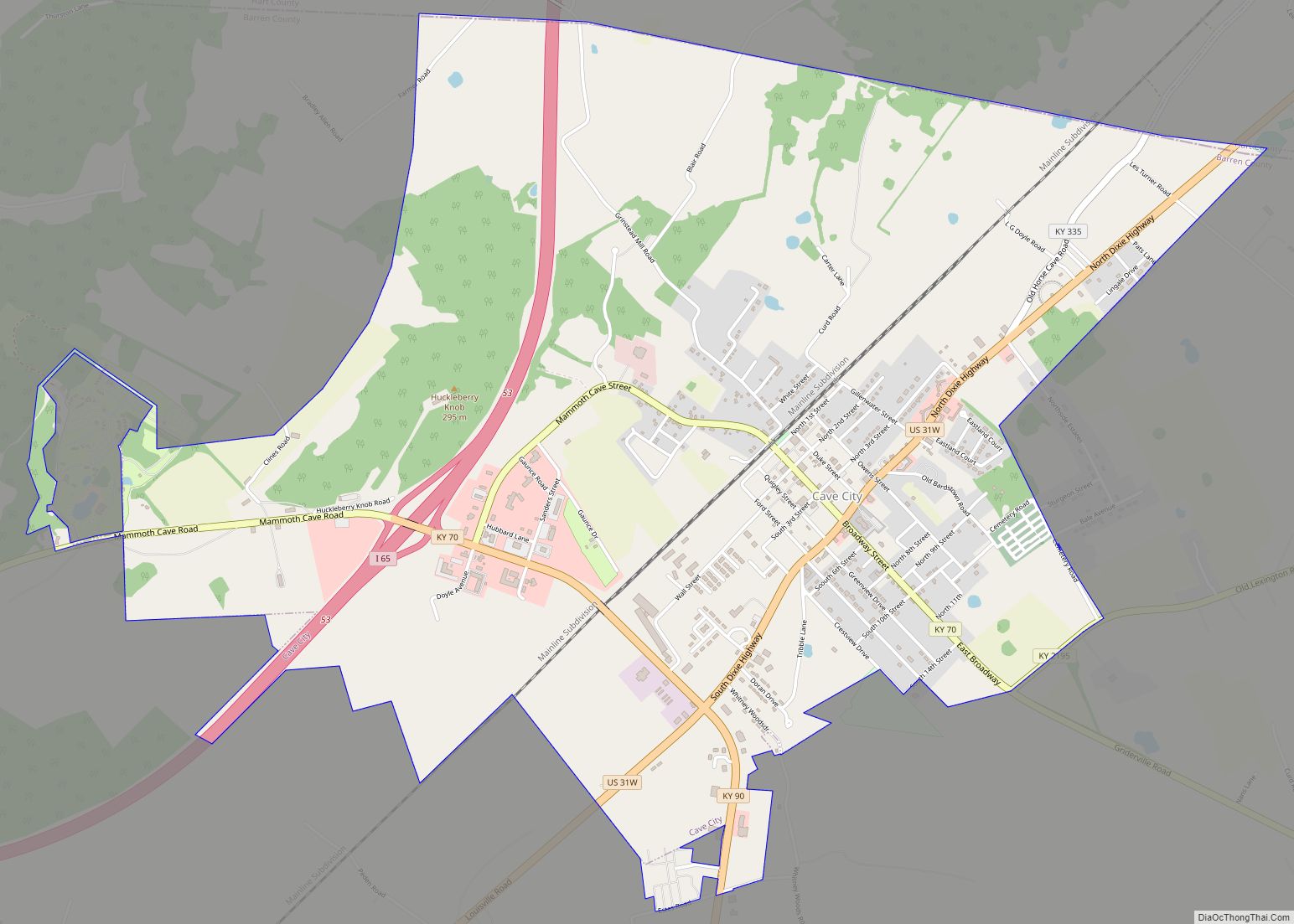
Cave City is a home rule-class city in Barren County, Kentucky, in the United States. The population was 2,240 at the 2010 census. It is part of the Glasgow Micropolitan Statistical Area.
| Name: | Cave City city |
|---|---|
| LSAD Code: | 25 |
| LSAD Description: | city (suffix) |
| State: | Kentucky |
| County: | Barren County |
| Elevation: | 633 ft (193 m) |
| Total Area: | 4.43 sq mi (11.47 km²) |
| Land Area: | 4.41 sq mi (11.42 km²) |
| Water Area: | 0.02 sq mi (0.05 km²) |
| Total Population: | 2,356 |
| Population Density: | 534.24/sq mi (206.27/km²) |
| ZIP code: | 42127 |
| Area code: | 270 & 364 |
| FIPS code: | 2113492 |
| GNISfeature ID: | 0489114 |
| Website: | www.cityofcavecity.com |
Online Interactive Map
Click on ![]() to view map in "full screen" mode.
to view map in "full screen" mode.
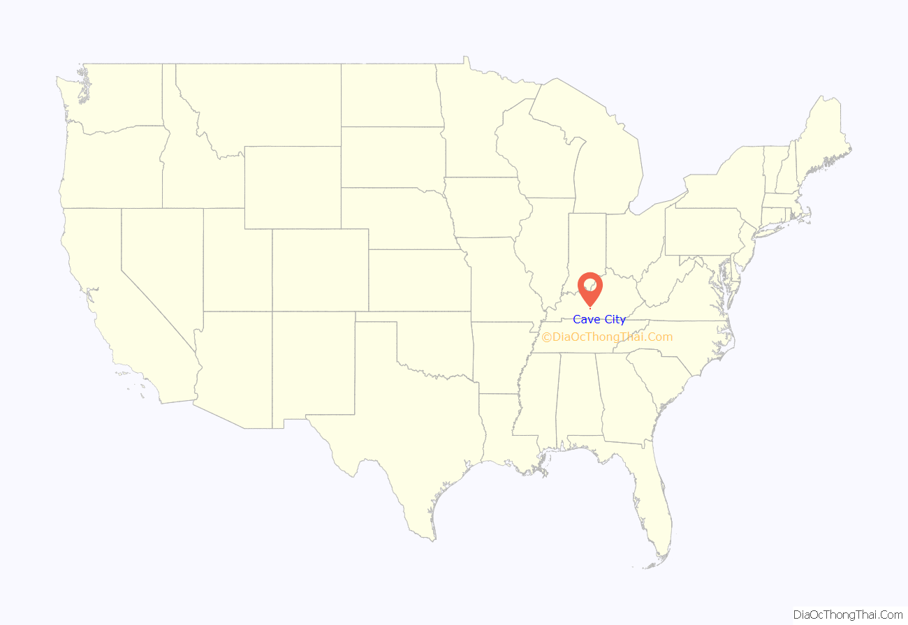
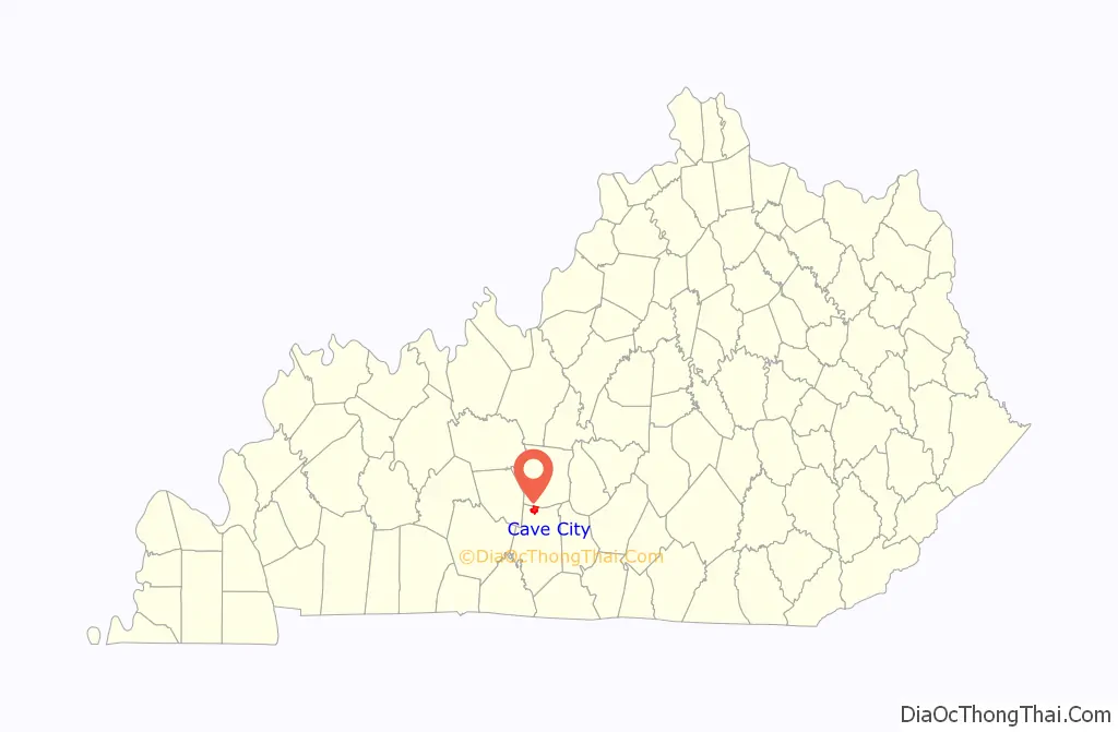
Cave City location map. Where is Cave City city?
History
The site upon which Cave City stands was acquired in October 1853 by the Knob City Land Company, composed of Messrs. Graham, Quigly, Adams, and Hopson, all of whom were from Louisville and envisioned the place as a resort town due to its proximity to Mammoth Cave. The town was incorporated in 1866.
Originally, 200 acres (81 ha) of what would become the town site was acquired by James Perry in a 1798 land grant. In 1811, Henry Roundtree (an assignee of James Perry) sold the land to John Owens for $190. Owens added 142.5 acres (57.7 ha) to the tract. After his death, his executor sold his 342½ acres to Thomas T. Duke for $1,732.00. Duke, in turn, sold the entire tract to the Knob City Land Company. Duke received $6,850.00 for the land, or $20 per acre—a record amount for a land sale in Barren County at that time.
The Knob City Land Company surveyed and laid out the town, the main streets being 80 feet (24 m) wide, and began to sell lots about the same time as the Louisville & Nashville Railroad came through Barren County. The first train arrived at Cave City in 1859. The town took its name from a cave within the town limits, not nearby Mammoth Cave. A small creek ran through the cave which the L&N Railroad used as a source of water. The creek was called “Sink Hole Spring” and was the only water supply for the town at the time. The Cave City post office was established in January 1860 and Beverly Daniel Curd appointed the first post-master. He moved the post office established in 1850 at Woodland (about a mile north) to Cave City.
The first business in Cave City was built and operated by postmaster Curd and his brother, Havilah Price Curd. Their store was located at the corner of First and Kirtley (now Broadway) streets. The second person to open a business in Cave City and to build the first residence was Judge C. Roberts. The first woman business owner in Cave City was April Houchens, who opened “Funny Hats and Bows”, a boutique for the eccentric lady. This shop was open until 1985.
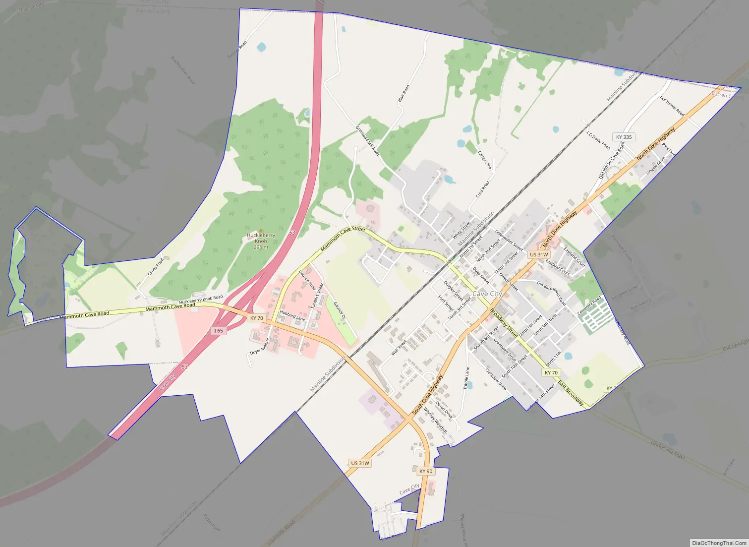
Cave City Road Map
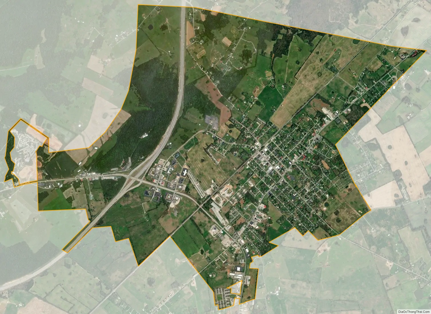
Cave City city Satellite Map
Geography
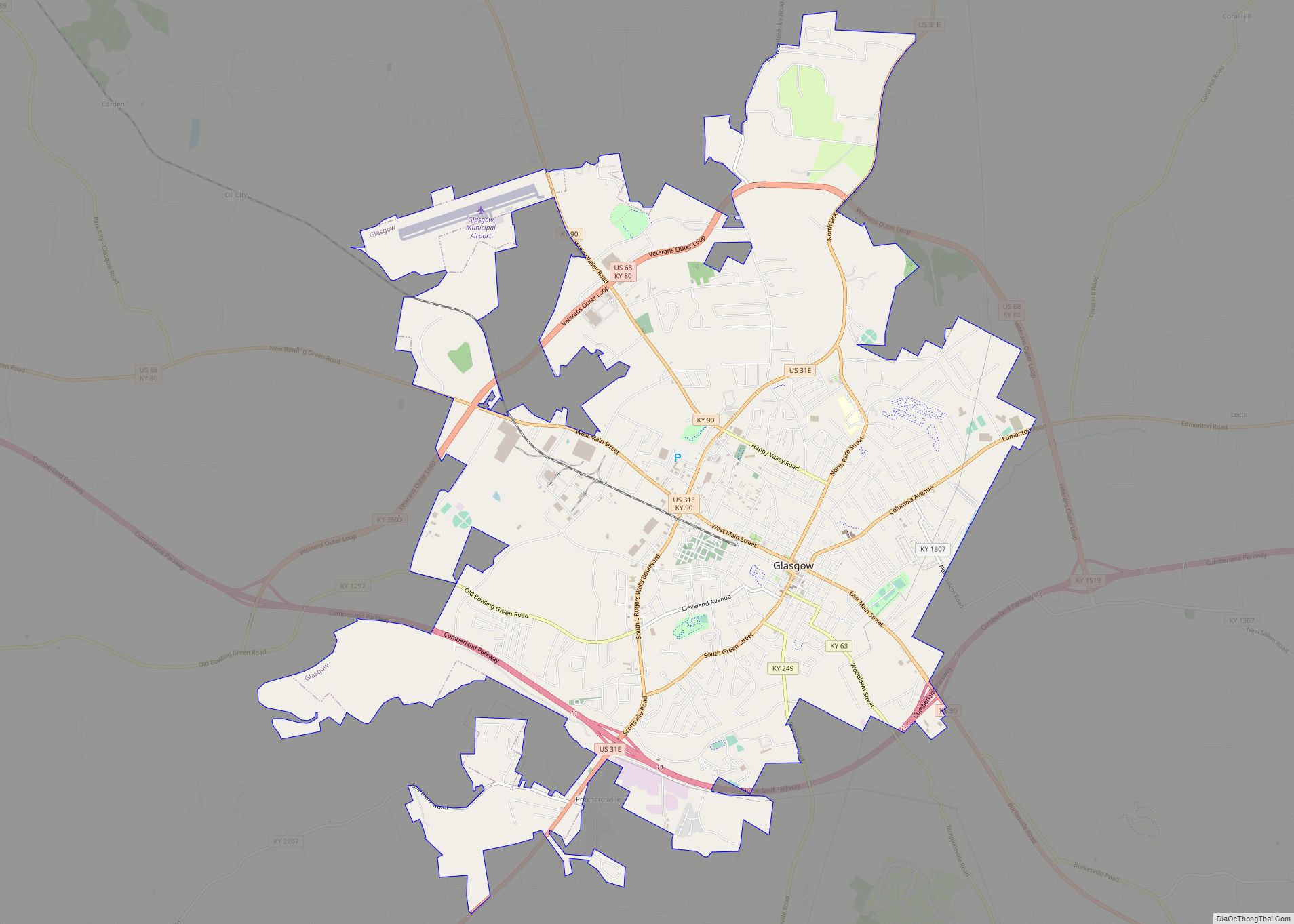
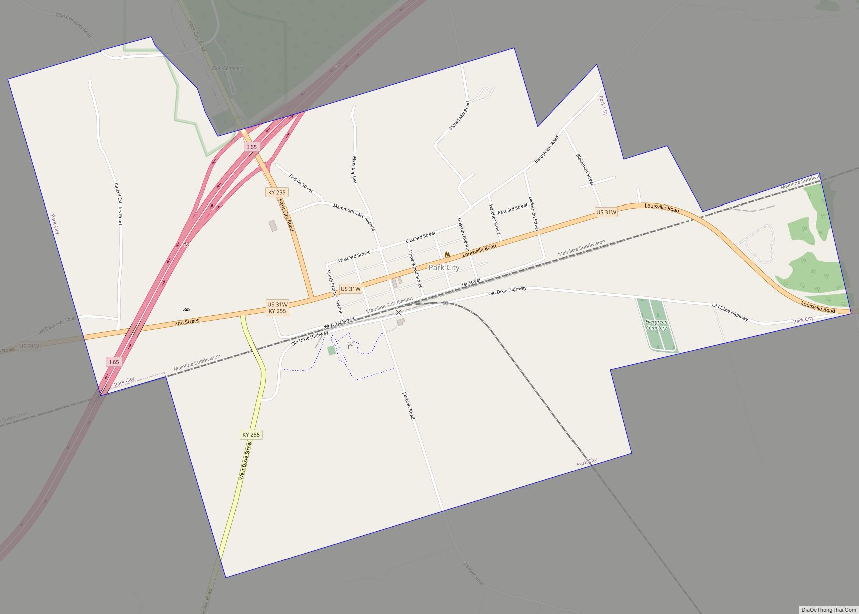
Cave City is located in the northwestern portion of Barren County at 37°8′14″N 85°57′25″W / 37.13722°N 85.95694°W / 37.13722; -85.95694 (37.137130, -85.956958). U.S. Route 31W (Dixie Highway) passes through the center of the city, and Interstate 65 passes to the west of downtown, with access from Exit 53 (Kentucky Route 70/Mammoth Cave Road). Elizabethtown is 44 miles (71 km) to the north, and Louisville is 85 miles (137 km) north via I-65. Bowling Green is 31 miles (50 km) to the southwest, and Nashville, Tennessee, is 91 miles (146 km) to the southwest via I-65. The center of Mammoth Cave National Park is 10 miles (16 km) to the west via Kentucky Route 70. Glasgow, the Barren County seat, is located 10 miles (16 km) to the southeast via Kentucky Route 90.
According to the United States Census Bureau, Cave City has a total area of 4.4 square miles (11.4 km), of which 0.019 square miles (0.05 km), or 0.46%, is water.
See also
Map of Kentucky State and its subdivision:- Adair
- Allen
- Anderson
- Ballard
- Barren
- Bath
- Bell
- Boone
- Bourbon
- Boyd
- Boyle
- Bracken
- Breathitt
- Breckinridge
- Bullitt
- Butler
- Caldwell
- Calloway
- Campbell
- Carlisle
- Carroll
- Carter
- Casey
- Christian
- Clark
- Clay
- Clinton
- Crittenden
- Cumberland
- Daviess
- Edmonson
- Elliott
- Estill
- Fayette
- Fleming
- Floyd
- Franklin
- Fulton
- Gallatin
- Garrard
- Grant
- Graves
- Grayson
- Green
- Greenup
- Hancock
- Hardin
- Harlan
- Harrison
- Hart
- Henderson
- Henry
- Hickman
- Hopkins
- Jackson
- Jefferson
- Jessamine
- Johnson
- Kenton
- Knott
- Knox
- Larue
- Laurel
- Lawrence
- Lee
- Leslie
- Letcher
- Lewis
- Lincoln
- Livingston
- Logan
- Lyon
- Madison
- Magoffin
- Marion
- Marshall
- Martin
- Mason
- McCracken
- McCreary
- McLean
- Meade
- Menifee
- Mercer
- Metcalfe
- Monroe
- Montgomery
- Morgan
- Muhlenberg
- Nelson
- Nicholas
- Ohio
- Oldham
- Owen
- Owsley
- Pendleton
- Perry
- Pike
- Powell
- Pulaski
- Robertson
- Rockcastle
- Rowan
- Russell
- Scott
- Shelby
- Simpson
- Spencer
- Taylor
- Todd
- Trigg
- Trimble
- Union
- Warren
- Washington
- Wayne
- Webster
- Whitley
- Wolfe
- Woodford
- Alabama
- Alaska
- Arizona
- Arkansas
- California
- Colorado
- Connecticut
- Delaware
- District of Columbia
- Florida
- Georgia
- Hawaii
- Idaho
- Illinois
- Indiana
- Iowa
- Kansas
- Kentucky
- Louisiana
- Maine
- Maryland
- Massachusetts
- Michigan
- Minnesota
- Mississippi
- Missouri
- Montana
- Nebraska
- Nevada
- New Hampshire
- New Jersey
- New Mexico
- New York
- North Carolina
- North Dakota
- Ohio
- Oklahoma
- Oregon
- Pennsylvania
- Rhode Island
- South Carolina
- South Dakota
- Tennessee
- Texas
- Utah
- Vermont
- Virginia
- Washington
- West Virginia
- Wisconsin
- Wyoming