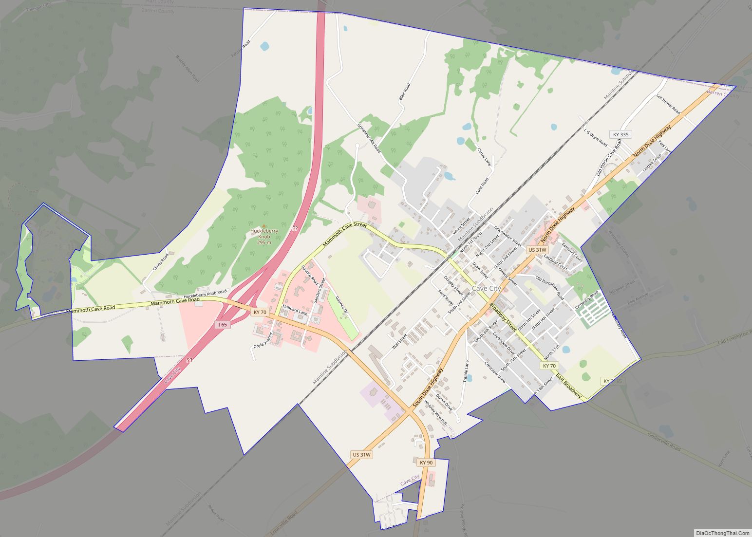
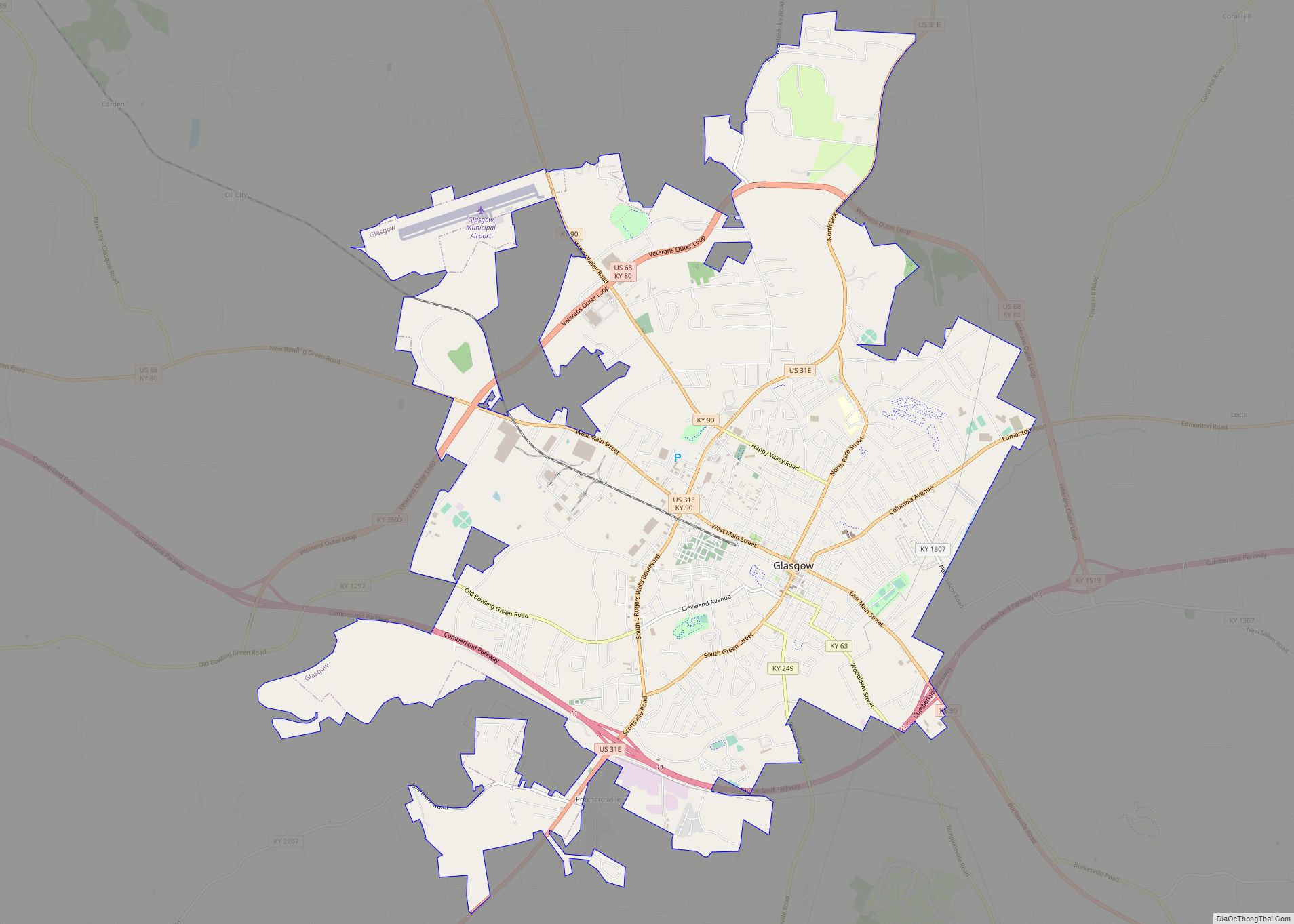
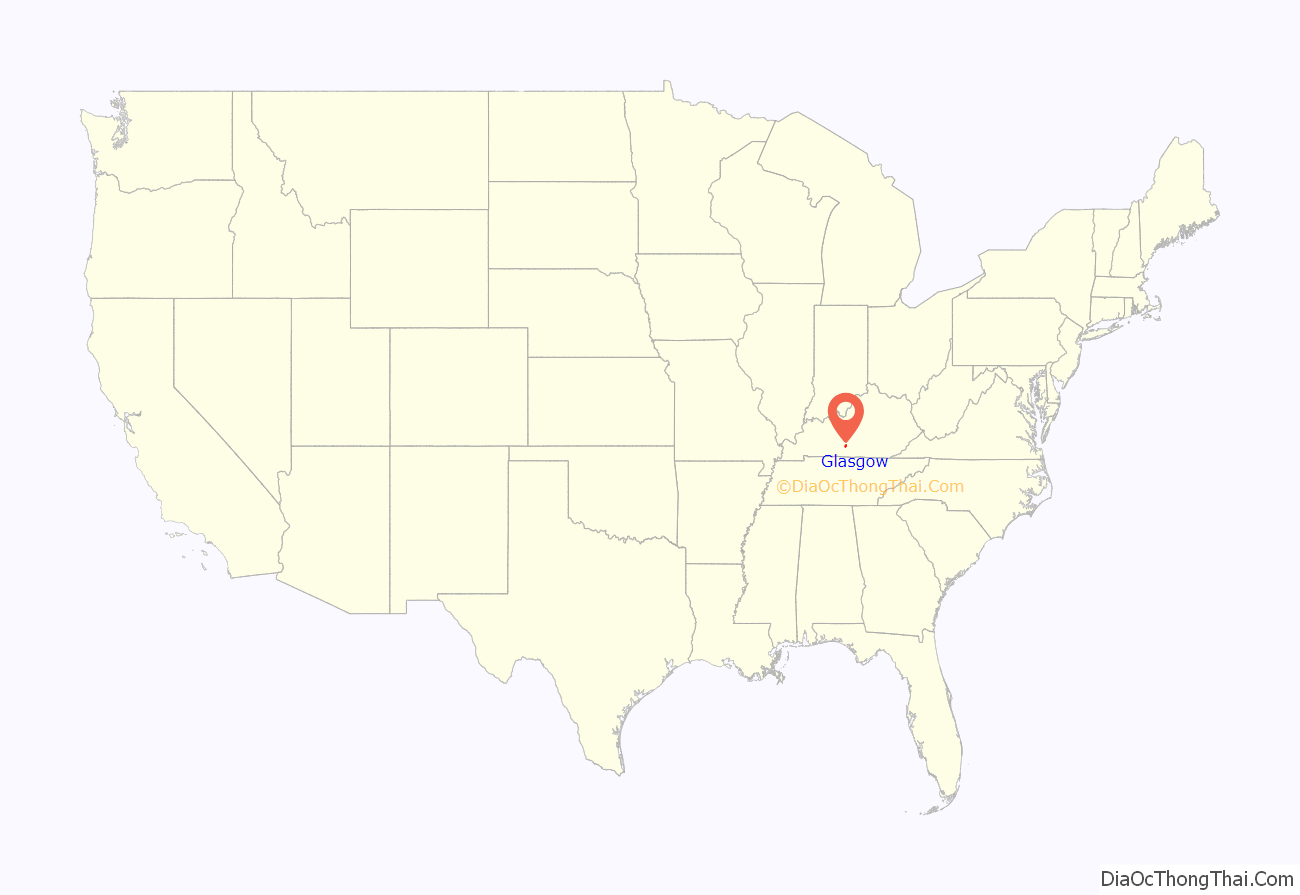
Glasgow is a home rule-class city in Barren County, Kentucky, United States. It is the seat of its county. Glasgow is the principal city of the Glasgow micropolitan area, which comprises Barren and Metcalfe counties. The population was 14,028 at the 2010 U.S. census.
The city is well known for its annual Scottish Highland Games. In 2007, Barren County was named the number one rural place to live by The Progressive Farmer magazine.
| Name: | Glasgow city |
|---|---|
| LSAD Code: | 25 |
| LSAD Description: | city (suffix) |
| State: | Kentucky |
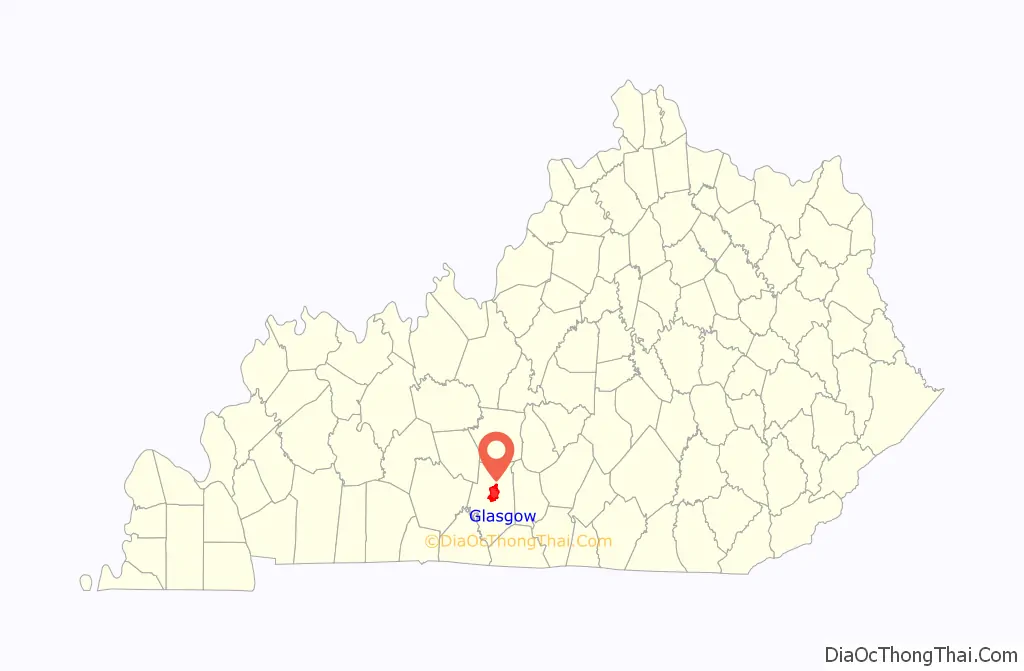
| County: | Barren County |
| Elevation: | 755 ft (230 m) |
| Total Area: | 15.95 sq mi (41.30 km²) |
| Land Area: | 15.86 sq mi (41.07 km²) |
| Water Area: | 0.09 sq mi (0.23 km²) |
| Total Population: | 15,014 |
| Population Density: | 946.72/sq mi (365.54/km²) |
| ZIP code: | 42141, 42142, 42156 |
| Area code: | 270 & 364 |
| FIPS code: | 2131114 |
| GNISfeature ID: | 0492876 |
| Website: | www.cityofglasgow.org |
Online Interactive Map
Click on ![]() to view map in "full screen" mode.
to view map in "full screen" mode.
Glasgow location map. Where is Glasgow city?
History
The city of Glasgow was established by the Kentucky state assembly in 1799. The same year, the community was selected as the seat of a new county, owing to its central location, its large spring, native John Gorin’s donation of 50 acres (20 ha) for public buildings, and its being named for the Scottish hometown of the father of William Logan, one of the two commissioners charged with selecting the county seat. A post office was established in 1803, and the town received its city rights in 1809.
Former U.S. President George Washington had a half-brother named Augustine Washington, Jr. who was the husband of Anne Aylett Washington and had a daughter named Elizabeth Washington. Elizabeth Washington married Alexander Eliot Spotswood and were given a home and land from George Washington (Elizabeth’s uncle) in Glasgow. The home, called “Spotswood” after its first owner, Alexander Spotswood, is located at 309 N Race Street.
All across Glasgow are historic homes that can date back to the early 1800s. The most popular part of town with these homes is South Green Street; this street has many historic houses that have many different architectural styles including Colonial, Federal, and Victorian.
The Civil War affected many smaller towns like Glasgow. There are many places that were part of the Underground Railroad in Glasgow, such as Big Spring Bottom for keeping horses and the Spotswood House on North Race Street for hiding enslaved people. Other places include the Old Glasgow Seminary Home on East Main Street; this house has several rooms dug out in the earth with tunnels running into them for keeping the enslaved people hidden and safe.
Western Kentucky University was originally in Glasgow when it was established in 1875, but 10 years later it moved to its present-day location in Bowling Green and serves as WKU’s main campus. Since 1998, WKU has operated a regional campus in Glasgow.
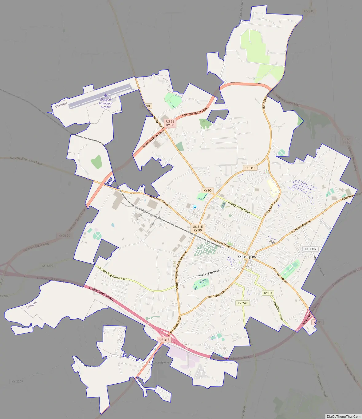
Glasgow Road Map
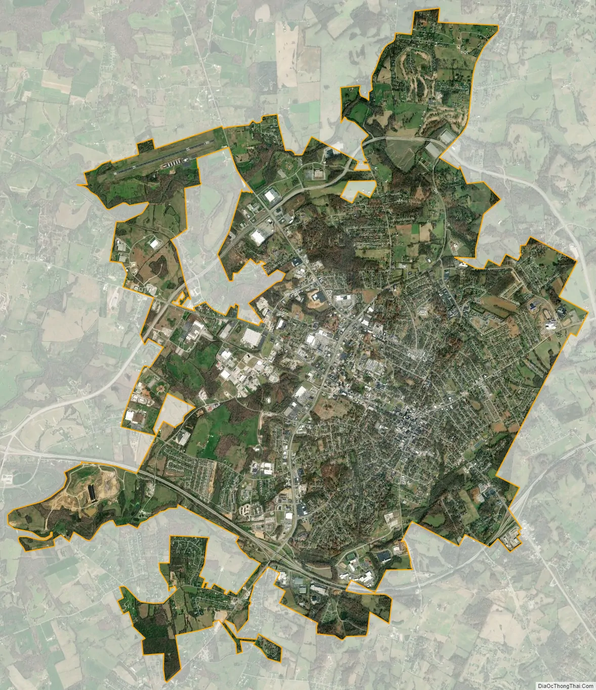
Glasgow city Satellite Map
Geography
Glasgow is located in central Barren County at 37°0′1″N 85°55′13″W / 37.00028°N 85.92028°W / 37.00028; -85.92028 (37.000375, -85.920229). U.S. Route 31E and U.S. Route 68 intersect at the center of the city, and the Louie B. Nunn Cumberland Parkway passes south of downtown, with access from three exits. Bowling Green is 32 miles (51 km) to the west, Mammoth Cave National Park is 21 miles (34 km) to the northwest, Elizabethtown is 55 miles (89 km) to the north, Columbia is 37 miles (60 km) to the east, and Scottsville is 24 miles (39 km) to the southwest.
According to the United States Census Bureau, Glasgow has a total area of 15.5 square miles (40.2 km), of which 15.4 square miles (40.0 km) is land and 0.077 square miles (0.2 km), or 0.53%, is water.
See also
Map of Kentucky State and its subdivision:- Adair
- Allen
- Anderson
- Ballard
- Barren
- Bath
- Bell
- Boone
- Bourbon
- Boyd
- Boyle
- Bracken
- Breathitt
- Breckinridge
- Bullitt
- Butler
- Caldwell
- Calloway
- Campbell
- Carlisle
- Carroll
- Carter
- Casey
- Christian
- Clark
- Clay
- Clinton
- Crittenden
- Cumberland
- Daviess
- Edmonson
- Elliott
- Estill
- Fayette
- Fleming
- Floyd
- Franklin
- Fulton
- Gallatin
- Garrard
- Grant
- Graves
- Grayson
- Green
- Greenup
- Hancock
- Hardin
- Harlan
- Harrison
- Hart
- Henderson
- Henry
- Hickman
- Hopkins
- Jackson
- Jefferson
- Jessamine
- Johnson
- Kenton
- Knott
- Knox
- Larue
- Laurel
- Lawrence
- Lee
- Leslie
- Letcher
- Lewis
- Lincoln
- Livingston
- Logan
- Lyon
- Madison
- Magoffin
- Marion
- Marshall
- Martin
- Mason
- McCracken
- McCreary
- McLean
- Meade
- Menifee
- Mercer
- Metcalfe
- Monroe
- Montgomery
- Morgan
- Muhlenberg
- Nelson
- Nicholas
- Ohio
- Oldham
- Owen
- Owsley
- Pendleton
- Perry
- Pike
- Powell
- Pulaski
- Robertson
- Rockcastle
- Rowan
- Russell
- Scott
- Shelby
- Simpson
- Spencer
- Taylor
- Todd
- Trigg
- Trimble
- Union
- Warren
- Washington
- Wayne
- Webster
- Whitley
- Wolfe
- Woodford
- Alabama
- Alaska
- Arizona
- Arkansas
- California
- Colorado
- Connecticut
- Delaware
- District of Columbia
- Florida
- Georgia
- Hawaii
- Idaho
- Illinois
- Indiana
- Iowa
- Kansas
- Kentucky
- Louisiana
- Maine
- Maryland
- Massachusetts
- Michigan
- Minnesota
- Mississippi
- Missouri
- Montana
- Nebraska
- Nevada
- New Hampshire
- New Jersey
- New Mexico
- New York
- North Carolina
- North Dakota
- Ohio
- Oklahoma
- Oregon
- Pennsylvania
- Rhode Island
- South Carolina
- South Dakota
- Tennessee
- Texas
- Utah
- Vermont
- Virginia
- Washington
- West Virginia
- Wisconsin
- Wyoming