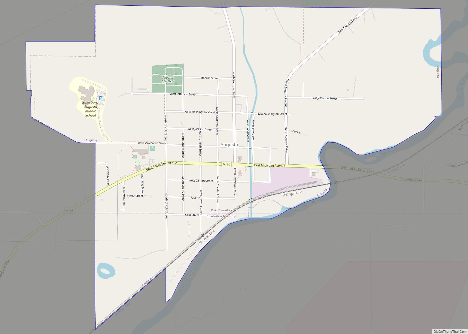
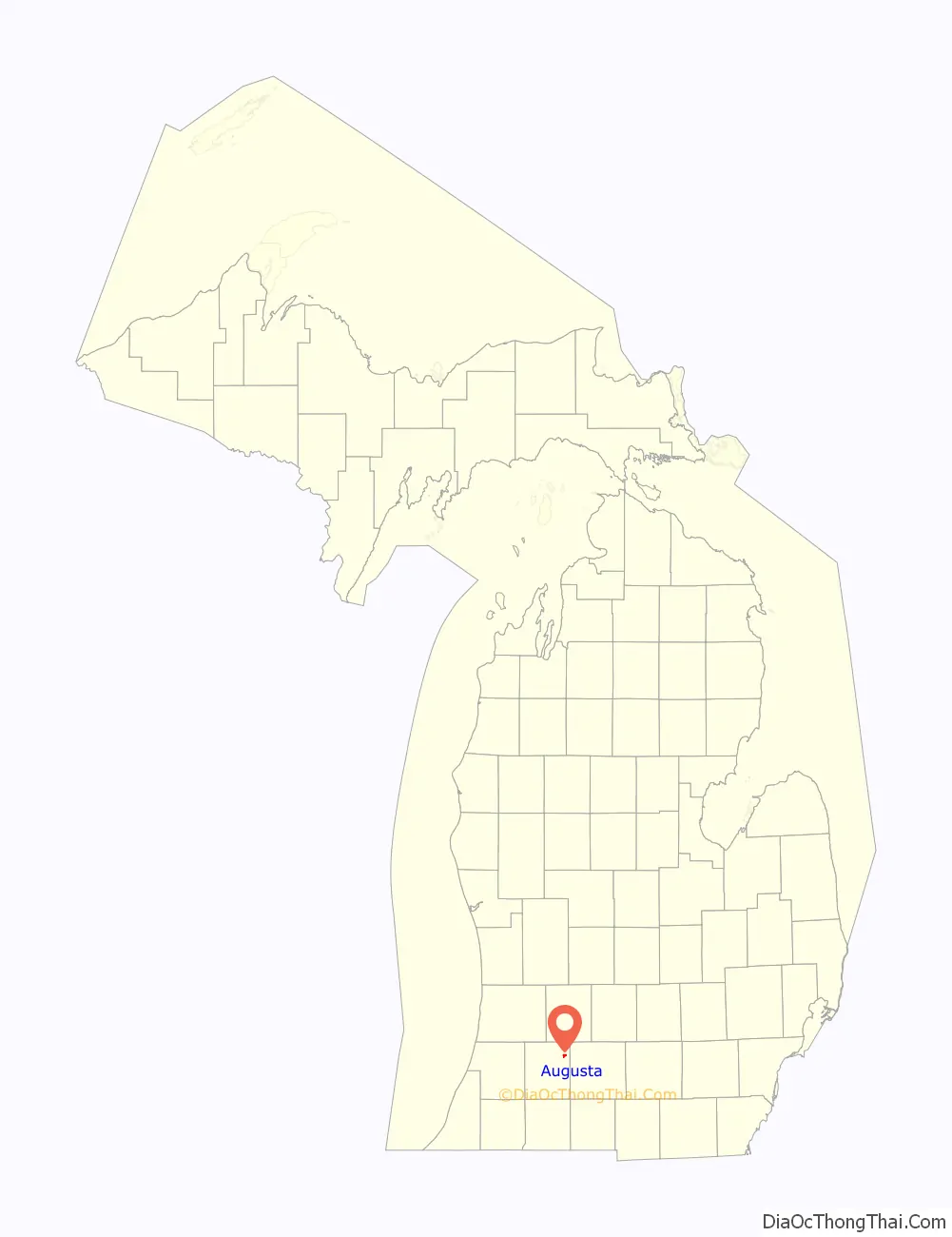
Augusta is a village in Kalamazoo County in the U.S. state of Michigan. The population was 885 at the 2010 census. The village is mostly within Ross Township, though a small portion extends south into Charleston Township.
Augusta is situated on the M-96 highway, about five miles (8.0 km) northeast of Galesburg, and about seven miles (11 km) west of downtown Battle Creek. Kalamazoo is an additional ten miles (16 km) west of Galesburg. Fort Custer Recreation Area is immediately south of the village on the east side of the Kalamazoo River.
Augusta was established in 1832.
| Name: | Augusta village |
|---|---|
| LSAD Code: | 47 |
| LSAD Description: | village (suffix) |
| State: | Michigan |
| County: | Kalamazoo County |
| Elevation: | 804 ft (245 m) |
| Total Area: | 1.04 sq mi (2.70 km²) |
| Land Area: | 1.03 sq mi (2.66 km²) |
| Water Area: | 0.02 sq mi (0.04 km²) |
| Total Population: | 864 |
| Population Density: | 841.29/sq mi (324.94/km²) |
| ZIP code: | 49012 |
| Area code: | 269 |
| FIPS code: | 2604160 |
| GNISfeature ID: | 2398009 |
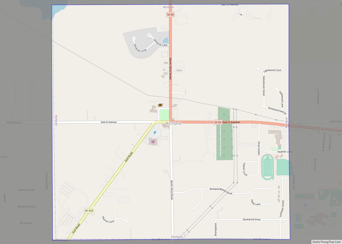
Online Interactive Map
Click on ![]() to view map in "full screen" mode.
to view map in "full screen" mode.
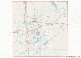
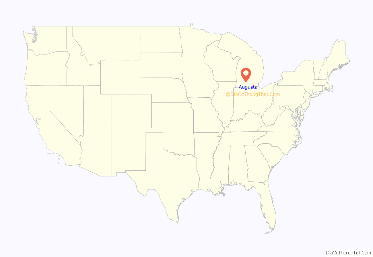
Augusta location map. Where is Augusta village?
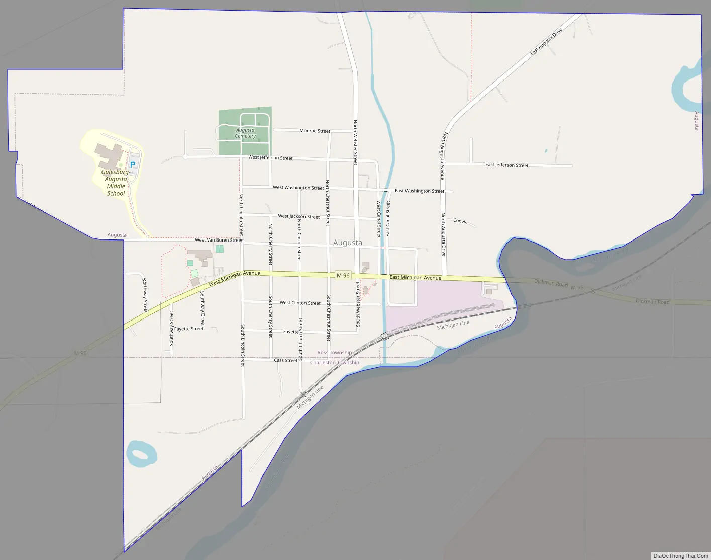
Augusta Road Map
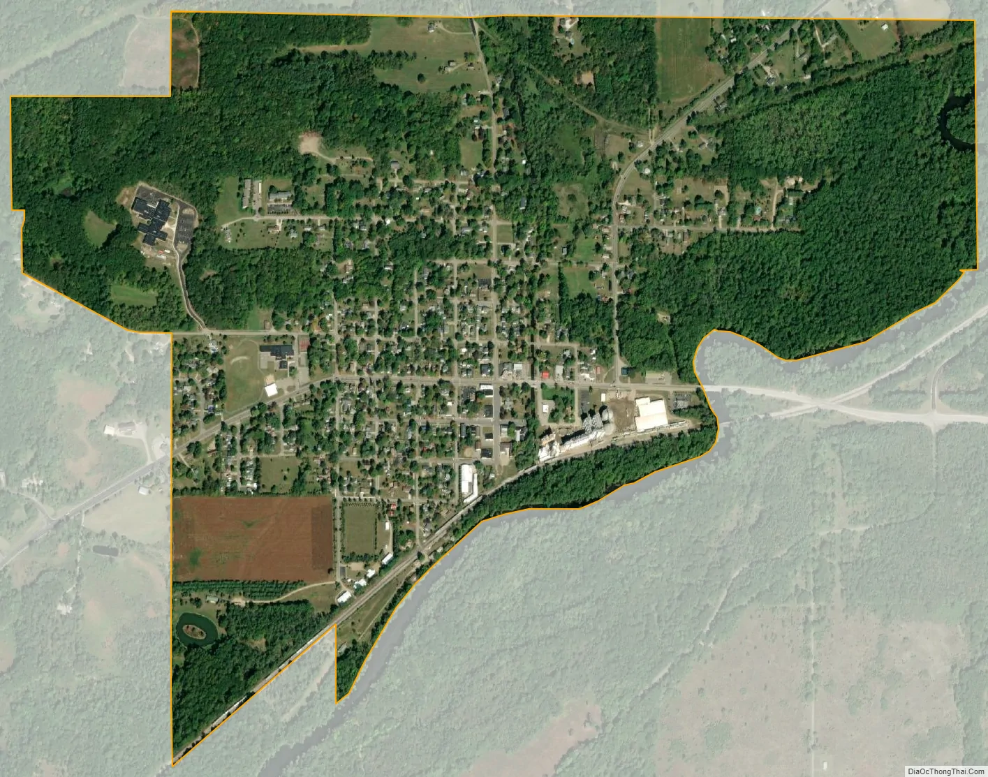
Augusta city Satellite Map
Geography
According to the United States Census Bureau, the village has a total area of 1.02 square miles (2.64 km), of which 1.01 square miles (2.62 km) is land and 0.01 square miles (0.03 km) is water.
See also
Map of Michigan State and its subdivision:- Alcona
- Alger
- Allegan
- Alpena
- Antrim
- Arenac
- Baraga
- Barry
- Bay
- Benzie
- Berrien
- Branch
- Calhoun
- Cass
- Charlevoix
- Cheboygan
- Chippewa
- Clare
- Clinton
- Crawford
- Delta
- Dickinson
- Eaton
- Emmet
- Genesee
- Gladwin
- Gogebic
- Grand Traverse
- Gratiot
- Hillsdale
- Houghton
- Huron
- Ingham
- Ionia
- Iosco
- Iron
- Isabella
- Jackson
- Kalamazoo
- Kalkaska
- Kent
- Keweenaw
- Lake
- Lake Hurron
- Lake Michigan
- Lake St. Clair
- Lake Superior
- Lapeer
- Leelanau
- Lenawee
- Livingston
- Luce
- Mackinac
- Macomb
- Manistee
- Marquette
- Mason
- Mecosta
- Menominee
- Midland
- Missaukee
- Monroe
- Montcalm
- Montmorency
- Muskegon
- Newaygo
- Oakland
- Oceana
- Ogemaw
- Ontonagon
- Osceola
- Oscoda
- Otsego
- Ottawa
- Presque Isle
- Roscommon
- Saginaw
- Saint Clair
- Saint Joseph
- Sanilac
- Schoolcraft
- Shiawassee
- Tuscola
- Van Buren
- Washtenaw
- Wayne
- Wexford
- Alabama
- Alaska
- Arizona
- Arkansas
- California
- Colorado
- Connecticut
- Delaware
- District of Columbia
- Florida
- Georgia
- Hawaii
- Idaho
- Illinois
- Indiana
- Iowa
- Kansas
- Kentucky
- Louisiana
- Maine
- Maryland
- Massachusetts
- Michigan
- Minnesota
- Mississippi
- Missouri
- Montana
- Nebraska
- Nevada
- New Hampshire
- New Jersey
- New Mexico
- New York
- North Carolina
- North Dakota
- Ohio
- Oklahoma
- Oregon
- Pennsylvania
- Rhode Island
- South Carolina
- South Dakota
- Tennessee
- Texas
- Utah
- Vermont
- Virginia
- Washington
- West Virginia
- Wisconsin
- Wyoming