Bloomfield Hills is a small city (5.04 sq. miles) in Oakland County in the U.S. state of Michigan. It is a northern suburb of Metro Detroit and is approximately 20 miles (32 km) northwest of Downtown Detroit. Except for a small southern border with the city of Birmingham, the city is almost completely surrounded by Bloomfield Township, but the city and township are administered separately. As of the 2020 census, the city’s population was 4,460.
| Name: | Bloomfield Hills city |
|---|---|
| LSAD Code: | 25 |
| LSAD Description: | city (suffix) |
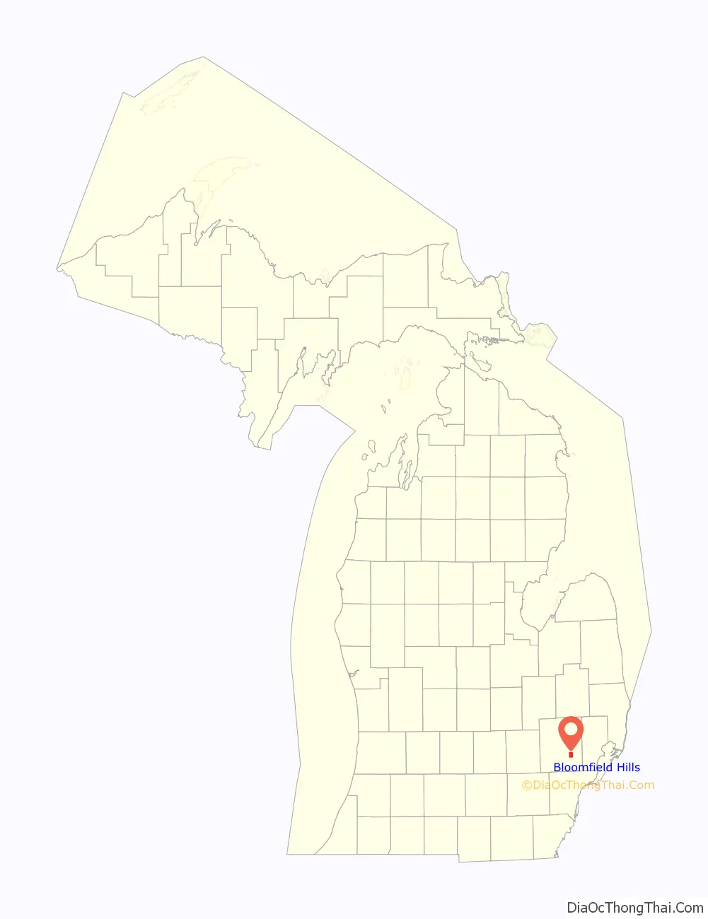
| State: | Michigan |
| County: | Oakland County |
| Elevation: | 833 ft (254 m) |
| Land Area: | 4.96 sq mi (12.84 km²) |
| Water Area: | 0.08 sq mi (0.21 km²) |
| Population Density: | 899.37/sq mi (347.25/km²) |
| FIPS code: | 2609180 |
| GNISfeature ID: | 0621616 |
Online Interactive Map
Click on ![]() to view map in "full screen" mode.
to view map in "full screen" mode.
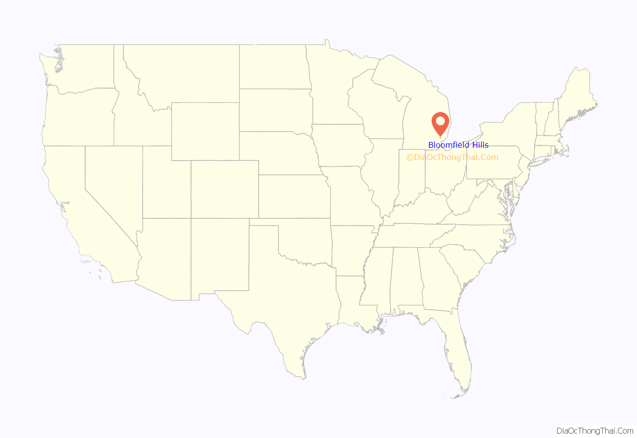
Bloomfield Hills location map. Where is Bloomfield Hills city?
History
On June 28, 1820, Oakland County was divided into two townships: Pontiac Township and Bloomfield Township, the latter covering the southern part of the county that would include West Bloomfield Township, Royal Oak and Southfield. What is now Bloomfield Hills was a farming area until the turn of the 20th century when wealthy Detroit residents bought up the land. The settlement became a village in 1927, and in 1932 residents voted to become a city to avoid being incorporated into growing Birmingham.
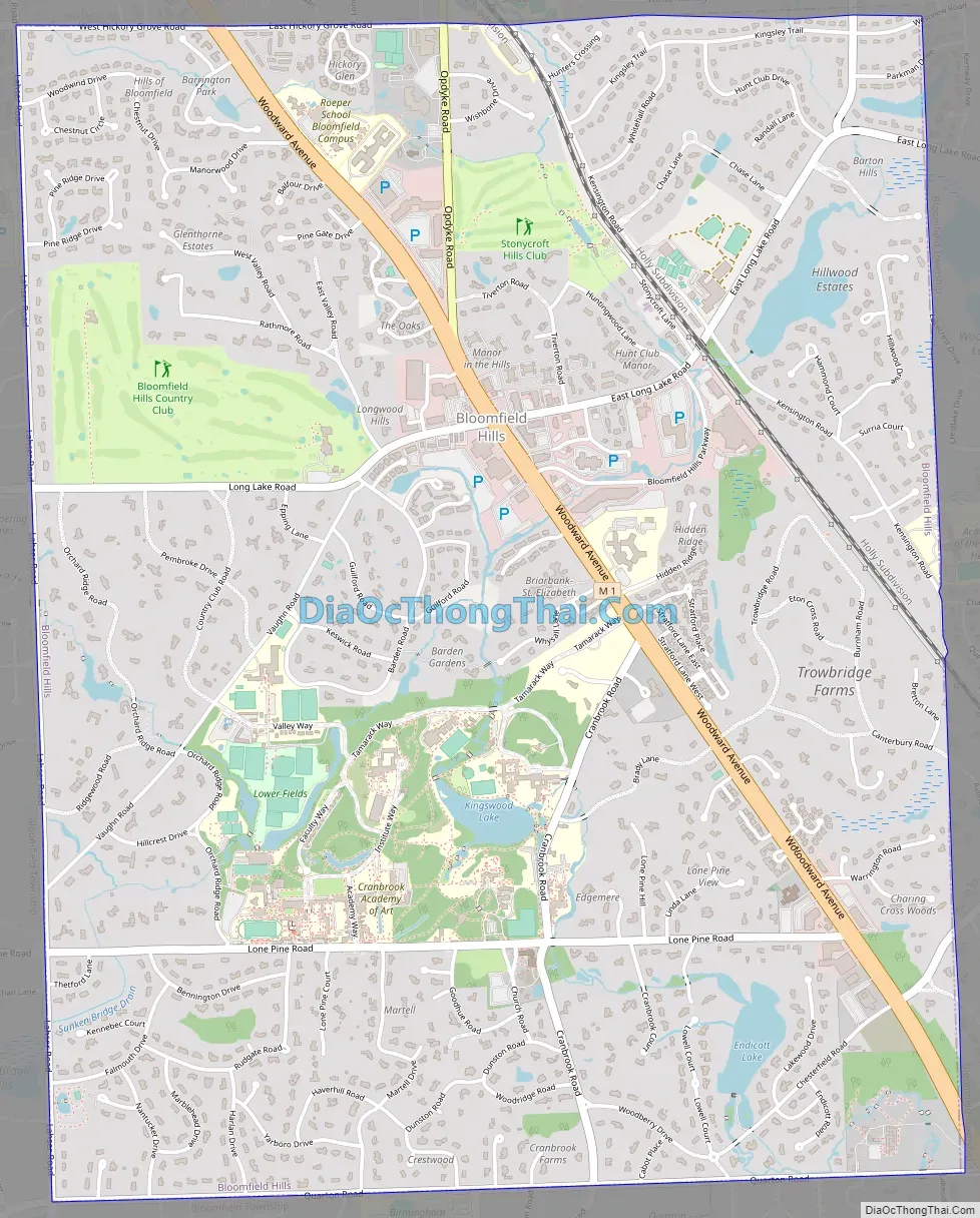
Bloomfield Hills Road Map
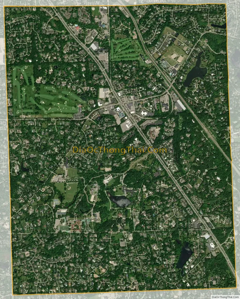
Bloomfield Hills city Satellite Map
Geography
According to the United States Census Bureau, the city has a total area of 5.04 square miles (13.05 km), of which 4.96 square miles (12.85 km) is land and 0.08 square miles (0.21 km) is water.
See also
Map of Michigan State and its subdivision:- Alcona
- Alger
- Allegan
- Alpena
- Antrim
- Arenac
- Baraga
- Barry
- Bay
- Benzie
- Berrien
- Branch
- Calhoun
- Cass
- Charlevoix
- Cheboygan
- Chippewa
- Clare
- Clinton
- Crawford
- Delta
- Dickinson
- Eaton
- Emmet
- Genesee
- Gladwin
- Gogebic
- Grand Traverse
- Gratiot
- Hillsdale
- Houghton
- Huron
- Ingham
- Ionia
- Iosco
- Iron
- Isabella
- Jackson
- Kalamazoo
- Kalkaska
- Kent
- Keweenaw
- Lake
- Lake Hurron
- Lake Michigan
- Lake St. Clair
- Lake Superior
- Lapeer
- Leelanau
- Lenawee
- Livingston
- Luce
- Mackinac
- Macomb
- Manistee
- Marquette
- Mason
- Mecosta
- Menominee
- Midland
- Missaukee
- Monroe
- Montcalm
- Montmorency
- Muskegon
- Newaygo
- Oakland
- Oceana
- Ogemaw
- Ontonagon
- Osceola
- Oscoda
- Otsego
- Ottawa
- Presque Isle
- Roscommon
- Saginaw
- Saint Clair
- Saint Joseph
- Sanilac
- Schoolcraft
- Shiawassee
- Tuscola
- Van Buren
- Washtenaw
- Wayne
- Wexford
- Alabama
- Alaska
- Arizona
- Arkansas
- California
- Colorado
- Connecticut
- Delaware
- District of Columbia
- Florida
- Georgia
- Hawaii
- Idaho
- Illinois
- Indiana
- Iowa
- Kansas
- Kentucky
- Louisiana
- Maine
- Maryland
- Massachusetts
- Michigan
- Minnesota
- Mississippi
- Missouri
- Montana
- Nebraska
- Nevada
- New Hampshire
- New Jersey
- New Mexico
- New York
- North Carolina
- North Dakota
- Ohio
- Oklahoma
- Oregon
- Pennsylvania
- Rhode Island
- South Carolina
- South Dakota
- Tennessee
- Texas
- Utah
- Vermont
- Virginia
- Washington
- West Virginia
- Wisconsin
- Wyoming


