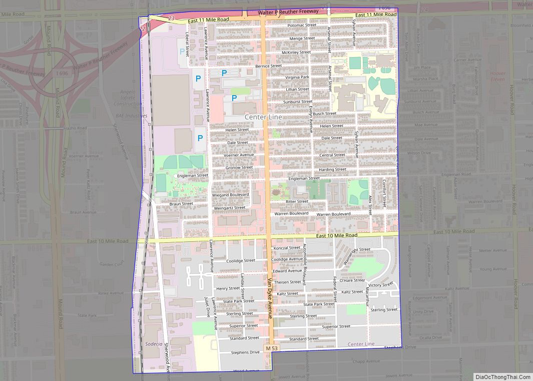
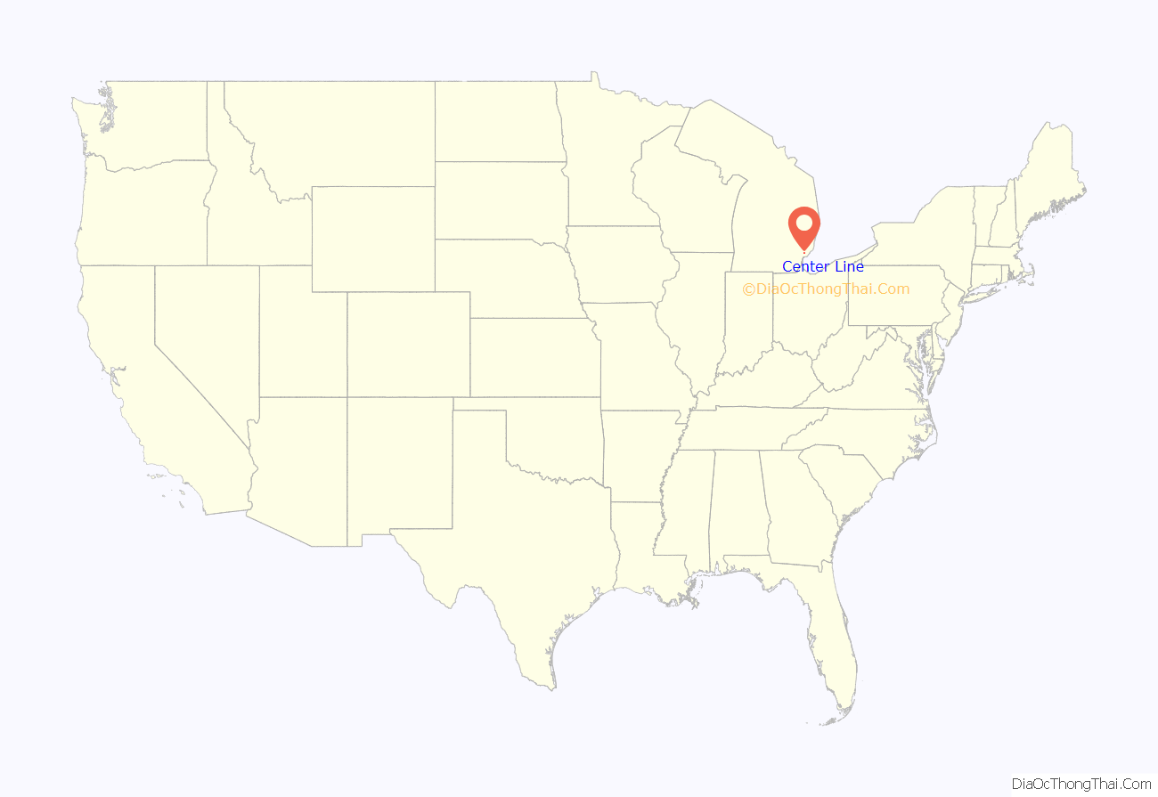
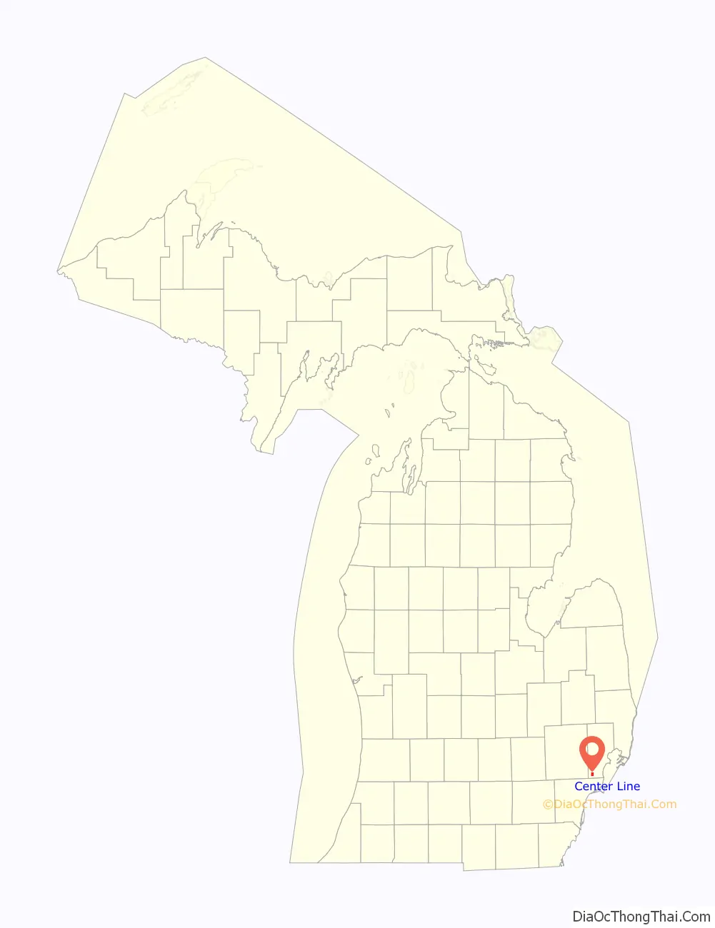
Center Line is a city in Macomb County in the U.S. state of Michigan, surrounded entirely by the city of Warren. The population was 8,257 at the 2010 census.
| Name: | Center Line city |
|---|---|
| LSAD Code: | 25 |
| LSAD Description: | city (suffix) |
| State: | Michigan |
| County: | Macomb County |
| Incorporated: | 1925 (village) 1936 (city) |
| Elevation: | 620 ft (190 m) |
| Total Area: | 1.75 sq mi (4.54 km²) |
| Land Area: | 1.75 sq mi (4.54 km²) |
| Water Area: | 0.00 sq mi (0.00 km²) |
| Total Population: | 8,552 |
| Population Density: | 4,881.28/sq mi (1,884.14/km²) |
| Area code: | 586 |
| FIPS code: | 2614320 |
| GNISfeature ID: | 0622981 |
Online Interactive Map
Click on ![]() to view map in "full screen" mode.
to view map in "full screen" mode.
Center Line location map. Where is Center Line city?
History
Historically, the land that Center Line came to occupy was swamp and wilderness until the early nineteenth century. As land became scarce, French, German, Belgian, and Irish immigrants began clearing the forests and draining the swamps. Center Line was known as Kunrod’s Corner during the mid-nineteenth century. The theory is that the French named it Center Line because it was the middle of three Potowatomi trails from Fort Detroit to northern trading posts. The ‘center line’ was the trail used from Detroit to Utica. The community received its initial start when Catholics decided to build a church so that they would not have to walk to St. Mary’s in Detroit for Sunday Mass. This church (St. Clement’s) was established in 1854 and attracted more Catholic settlers into the area. In 1863, the first general store was constructed by Joeseph Buechel. On July 19, 1878, Hieronymous Engelmann was the first postmaster, and he was succeeded in 1885 by Sophia Buechel. The “Centre Line” post office closed on July 31, 1906, and the name was restored to Center Line thereafter. In this era, street car tracks connected Detroit to Center Line along Van Dyke Road, and Ten Mile Road was the final stop of the street car. The village was incorporated in 1925 in the center of Warren Township, which is now the City of Warren, and was incorporated as a city in 1936.
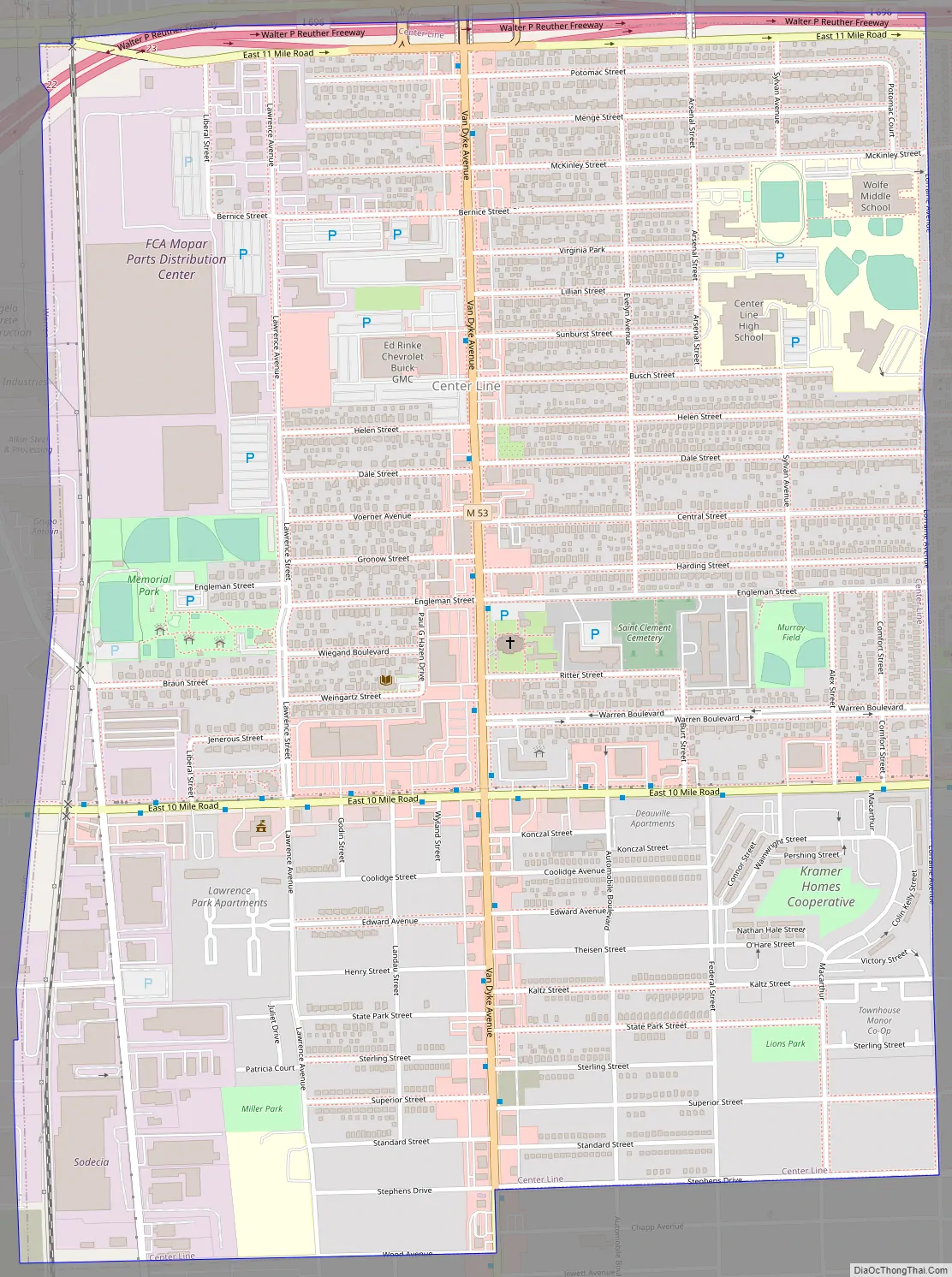
Center Line Road Map
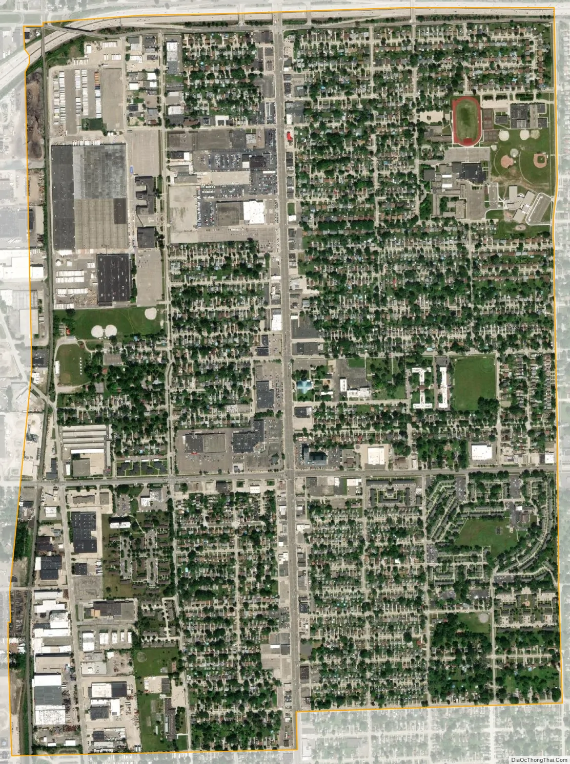
Center Line city Satellite Map
Geography
According to the United States Census Bureau, the city has a total area of 1.74 square miles (4.51 km), all land.
See also
Map of Michigan State and its subdivision:- Alcona
- Alger
- Allegan
- Alpena
- Antrim
- Arenac
- Baraga
- Barry
- Bay
- Benzie
- Berrien
- Branch
- Calhoun
- Cass
- Charlevoix
- Cheboygan
- Chippewa
- Clare
- Clinton
- Crawford
- Delta
- Dickinson
- Eaton
- Emmet
- Genesee
- Gladwin
- Gogebic
- Grand Traverse
- Gratiot
- Hillsdale
- Houghton
- Huron
- Ingham
- Ionia
- Iosco
- Iron
- Isabella
- Jackson
- Kalamazoo
- Kalkaska
- Kent
- Keweenaw
- Lake
- Lake Hurron
- Lake Michigan
- Lake St. Clair
- Lake Superior
- Lapeer
- Leelanau
- Lenawee
- Livingston
- Luce
- Mackinac
- Macomb
- Manistee
- Marquette
- Mason
- Mecosta
- Menominee
- Midland
- Missaukee
- Monroe
- Montcalm
- Montmorency
- Muskegon
- Newaygo
- Oakland
- Oceana
- Ogemaw
- Ontonagon
- Osceola
- Oscoda
- Otsego
- Ottawa
- Presque Isle
- Roscommon
- Saginaw
- Saint Clair
- Saint Joseph
- Sanilac
- Schoolcraft
- Shiawassee
- Tuscola
- Van Buren
- Washtenaw
- Wayne
- Wexford
- Alabama
- Alaska
- Arizona
- Arkansas
- California
- Colorado
- Connecticut
- Delaware
- District of Columbia
- Florida
- Georgia
- Hawaii
- Idaho
- Illinois
- Indiana
- Iowa
- Kansas
- Kentucky
- Louisiana
- Maine
- Maryland
- Massachusetts
- Michigan
- Minnesota
- Mississippi
- Missouri
- Montana
- Nebraska
- Nevada
- New Hampshire
- New Jersey
- New Mexico
- New York
- North Carolina
- North Dakota
- Ohio
- Oklahoma
- Oregon
- Pennsylvania
- Rhode Island
- South Carolina
- South Dakota
- Tennessee
- Texas
- Utah
- Vermont
- Virginia
- Washington
- West Virginia
- Wisconsin
- Wyoming