The Isle of Man (Manx: Mannin [ˈmanɪnʲ], also Ellan Vannin [ˈɛlʲan ˈvanɪnʲ]), also known as Mann (/mæn/), is a self-governing Crown Dependency in the Irish Sea between Great Britain and Ireland. As head of state, Charles III holds the title Lord of Mann and is represented by a Lieutenant Governor. The government of the United Kingdom is responsible for the isle’s military defence and represents it abroad.
Humans have lived on the island since before 6500 BC. Gaelic cultural influence began in the 5th century AD, when Irish missionaries following the teaching of St. Patrick began settling the island, and the Manx language, a branch of the Goidelic languages, emerged. In 627, King Edwin of Northumbria conquered the Isle of Man along with most of Mercia. In the 9th century, Norsemen established the thalassocratic Kingdom of the Isles, which included the Isle of Man. Magnus III, King of Norway from 1093 to 1103, reigned as King of Mann and the Isles between 1099 and 1103.
In 1266, King Magnus VI of Norway sold his suzerainty over Mann to King Alexander III of Scotland under the Treaty of Perth. After a period of alternating rule by the Kings of Scotland and England, the island came under the feudal lordship of the English Crown in 1399. The lordship revested in the British Crown in 1765, but the island did not become part of the 18th-century Kingdom of Great Britain, nor of its successors, the United Kingdom of Great Britain and Ireland and the present-day United Kingdom of Great Britain and Northern Ireland. It has always retained its internal self-government. In 1881, the Isle of Man Parliament, Tynwald, became the first national legislative body in the world to give women the right to vote in a general election, although this excluded married women.
The Manx economy is bolstered by its status as a tax haven and offshore banking destination. Insurance and online gambling each generate 17% of the GNP, followed by information and communications technology and banking with 9% each. This status has also brought the problems of money laundering, financial crime, and terrorism financing.
Internationally, the Isle of Man is known for the TT Motorcycle Races, and the Manx cat, a breed with short or no tails. In 2016, UNESCO awarded the Isle of Man biosphere reserve status.
| Flag: | 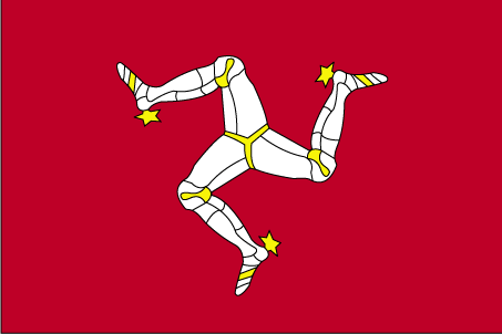 |
|---|---|
| Capital Value: | Douglas |
| Official languages: |
|
| Demonym(s): | Manx; Manxman (plural, Manxmen); Manxwoman (plural, Manxwomen) |
| Government: | Parliamentary democratic constitutional monarchy |
| Legislature: | Tynwald |
| Density: | 148/km (383.3/sq mi) (86th) |
| Currency Value: | Pound sterlingManx pound (£) (GBP) |
| Driving side: | left |
| Calling code: | +44 |
| Internet TLD: | .im |
Online Interactive Political Map
Click on ![]() to view map in "full screen" mode.
to view map in "full screen" mode.
Location Maps
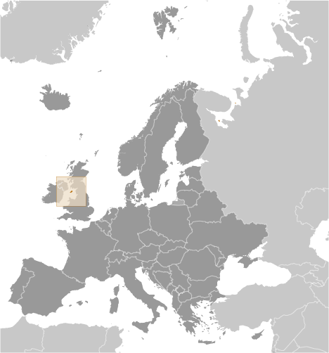
Where is Isle of Man?
History
The island was cut off from the surrounding islands around 8000 BC as sea levels rose following the end of the ice age. Humans colonised it by travelling by sea some time before 6500 BC. The first occupants were hunter-gatherers and fishermen. Examples of their tools are kept at the Manx Museum.
The Neolithic Period marked the beginning of farming, and the people began to build megalithic monuments, such as Cashtal yn Ard near Maughold, King Orry’s Grave at Laxey, Mull Hill near Cregneash, and Ballaharra Stones at St John’s. There were also the local Ronaldsway and Bann cultures.
During the Bronze Age, the size of burial mounds decreased. The people put bodies into stone-lined graves with ornamental containers. The Bronze Age burial mounds survived as long-lasting markers around the countryside.
The ancient Romans knew of the island and called it Insula Manavia. During the four centuries when Rome ruled the Province of Britannia, the Roman military controlled the Irish Sea, providing safe passage of agricultural goods from the productive farms of Anglesey to Roman settlements at the English – Scottish frontier. Only a few Roman artifacts have been found on Mann, suggesting a lack of strategic value of Mann during the era of Britannia. No Roman lighthouses or signal towers have yet been found on Mann.
Around the 5th century AD, large-scale migration from Ireland precipitated a process of Gaelicisation, evidenced by Ogham inscriptions, and the Manx language developed. It is a Goidelic language closely related to Irish and Scottish Gaelic.
In the 7th century, Mann came under Anglo-Saxon control, specifically King Edwin of Northumbria, from which he launched raids into Ireland. How much influence the Northumbrians exerted on Mann is unknown, but very few place names on Mann are of Old English origin.
Vikings arrived at the end of the 8th century. They established Tynwald and introduced many land divisions that still exist. In 1266 King Magnus VI of Norway ceded the islands to Alexander III, King of Scots, in the Treaty of Perth. But Scottish rule over Mann did not become firmly established until 1275, when the Manx were defeated in the Battle of Ronaldsway, near Castletown.
In 1290 King Edward I of England sent Walter de Huntercombe to take possession of Mann. It remained in English hands until 1313, when Robert I, King of Scots, took it after besieging Castle Rushen for five weeks. In 1314, it was retaken for the English by John Bacach of Argyll. In 1317, it was retaken for the Scots by Thomas Randolph, 1st Earl of Moray and Lord of the Isle of Man. It was held by the Scots until 1333. For some years thereafter control passed back and forth between the two kingdoms until the English took it for the final time in 1346. The English Crown delegated its rule of the island to a series of lords and magnates. Tynwald passed laws concerning the government of the island in all respects and had control over its finances, but was subject to the approval of the Lord of Mann.
In 1866, the Isle of Man obtained limited home rule, with partly democratic elections to the House of Keys, but the Legislative Council was appointed by the Crown. Since then, democratic government has been gradually extended.
The Isle of Man has designated more than 250 historic sites as registered buildings.
In July 2022 the 19th International Linguistics Olympiad was held in Castletown on the island.
Geography
The Isle of Man is an island located in the middle of the northern Irish Sea, almost equidistant from England to the east, Northern Ireland to the west, and Scotland (closest) to the north; while Wales to the south is almost the distance of the Republic of Ireland to the southwest. It is 52 kilometres (32 mi) long and, at its widest point, 22 kilometres (14 mi) wide. It has an area of around 572 square kilometres (221 sq mi). Besides the island of Mann itself, the political unit of the Isle of Man includes some nearby small islands: the seasonally inhabited Calf of Man, Chicken Rock (on which stands an unstaffed lighthouse), St Patrick’s Isle and St Michael’s Isle. The last two of these are connected to the main island by permanent roads/causeways.
Ranges of hills in the north and south are separated by a central valley. The northern plain, by contrast, is relatively flat, consisting mainly of deposits from glacial advances from western Scotland during colder times. There are more recently deposited shingle beaches at the northernmost point, the Point of Ayre. The island has one mountain higher than 600 metres (2,000 ft), Snaefell, with a height of 620 metres (2,034 ft). According to an old saying, from the summit one can see six kingdoms: those of Mann, Scotland, England, Ireland, Wales, and Heaven. Some versions add a seventh kingdom, that of the sea, or Neptune.
Population
At the 2021 census, the Isle of Man was home to 84,069 people, of whom 26,677 resided in the island’s capital, Douglas. The population increased by 755 persons between the 2016 and 2021 censuses.
The Isle of Man Full Census, last held in 2021, has been a decennial occurrence since 1821, with interim censuses being introduced from 1966. It is separate from, but similar to, the Census in the United Kingdom.