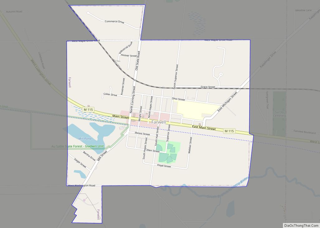
Farwell is a village in Clare County in the U.S. state of Michigan. The population was 880 at the 2020 census. The village is located within Surrey Township about 4.0 miles (6.4 km) west of the city of Clare.
| Name: | Farwell village |
|---|---|
| LSAD Code: | 47 |
| LSAD Description: | village (suffix) |
| State: | Michigan |
| County: | Clare County |
| Incorporated: | 1879 |
| Elevation: | 928 ft (283 m) |
| Total Area: | 1.41 sq mi (3.65 km²) |
| Land Area: | 1.37 sq mi (3.55 km²) |
| Water Area: | 0.04 sq mi (0.10 km²) |
| Total Population: | 880 |
| Population Density: | 644.22/sq mi (248.77/km²) |
| Area code: | 989 |
| FIPS code: | 2627500 |
| GNISfeature ID: | 0625851 |
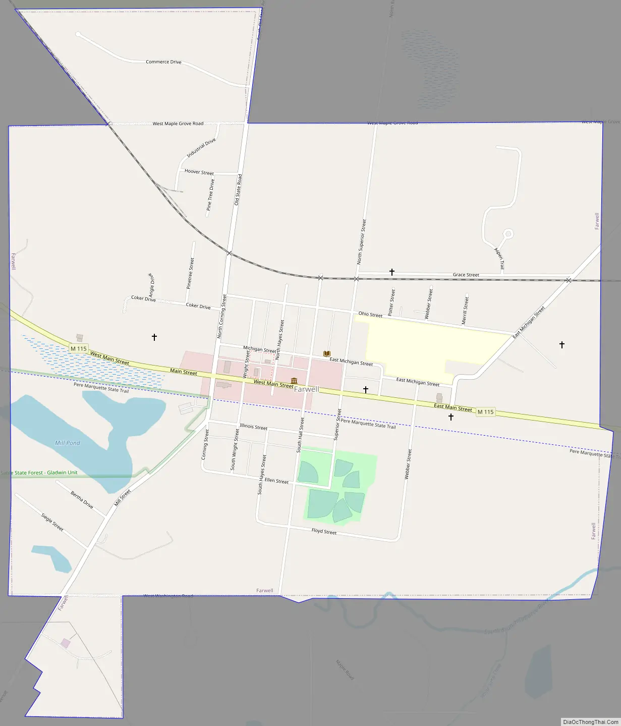
Online Interactive Map
Click on ![]() to view map in "full screen" mode.
to view map in "full screen" mode.
Farwell location map. Where is Farwell village?


History
Farwell was founded in 1870 by Edmund Hall, John Van Riper, and George Hitchcock. The Farwell post office opened on January 20, 1871, with George Hitchcock serving as the first postmaster. It was informally platted in 1871 and officially platted the following year by Josiah Littlefield of Ann Arbor. The Flint and Pere Marquette Railroad had plans of expanding into the area on a new route connecting Saginaw to Ludington, which was completed by the end of the decade. The new community was named after New York native Samuel Farwell, who had an interest in the railroad and was a construction contractor. In 1871, Farwell became the first county seat of Clare County but lost the seat of government to Harrison in 1879 after the Farwell courthouse burned down two years earlier. Farwell incorporated as a village in 1879.
In 1982, the Rock Road massacre occurred to the west of Farwell in Garfield Township. Due to its proximity to the village, it became known as the “Farwell Murders” and brought national attention to the area.
Farwell Road Map
Farwell city Satellite Map

Geography
According to the U.S. Census Bureau, the village has a total area of 1.41 square miles (3.65 km), of which 1.37 square miles (3.55 km) is land and 0.04 square miles (0.10 km) (2.84) is water.
The south branch of the Tobacco River flows through the village and contains the Mill Pond reservoir.
Major highways
- M-115 (Main Street) runs west–east through the center of the village.
See also
Map of Michigan State and its subdivision:- Alcona
- Alger
- Allegan
- Alpena
- Antrim
- Arenac
- Baraga
- Barry
- Bay
- Benzie
- Berrien
- Branch
- Calhoun
- Cass
- Charlevoix
- Cheboygan
- Chippewa
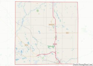
- Clare
- Clinton
- Crawford
- Delta
- Dickinson
- Eaton
- Emmet
- Genesee
- Gladwin
- Gogebic
- Grand Traverse
- Gratiot
- Hillsdale
- Houghton
- Huron
- Ingham
- Ionia
- Iosco
- Iron
- Isabella
- Jackson
- Kalamazoo
- Kalkaska
- Kent
- Keweenaw
- Lake
- Lake Hurron
- Lake Michigan
- Lake St. Clair
- Lake Superior
- Lapeer
- Leelanau
- Lenawee
- Livingston
- Luce
- Mackinac
- Macomb
- Manistee
- Marquette
- Mason
- Mecosta
- Menominee
- Midland
- Missaukee
- Monroe
- Montcalm
- Montmorency
- Muskegon
- Newaygo
- Oakland
- Oceana
- Ogemaw
- Ontonagon
- Osceola
- Oscoda
- Otsego
- Ottawa
- Presque Isle
- Roscommon
- Saginaw
- Saint Clair
- Saint Joseph
- Sanilac
- Schoolcraft
- Shiawassee
- Tuscola
- Van Buren
- Washtenaw
- Wayne
- Wexford
- Alabama
- Alaska
- Arizona
- Arkansas
- California
- Colorado
- Connecticut
- Delaware
- District of Columbia
- Florida
- Georgia
- Hawaii
- Idaho
- Illinois
- Indiana
- Iowa
- Kansas
- Kentucky
- Louisiana
- Maine
- Maryland
- Massachusetts
- Michigan
- Minnesota
- Mississippi
- Missouri
- Montana
- Nebraska
- Nevada
- New Hampshire
- New Jersey
- New Mexico
- New York
- North Carolina
- North Dakota
- Ohio
- Oklahoma
- Oregon
- Pennsylvania
- Rhode Island
- South Carolina
- South Dakota
- Tennessee
- Texas
- Utah
- Vermont
- Virginia
- Washington
- West Virginia
- Wisconsin
- Wyoming