South Gull Lake is a census-designated place (CDP) in Ross Township, Kalamazoo County, in the U.S. state of Michigan. It includes the unincorporated communities of Yorkville, Gull Lake, and Midland Park and does not have any legal status as an incorporated municipality. The population of the CDP was 1,182 at the 2010 census, down from 1,526 at the 2000 census.
| Name: | South Gull Lake CDP |
|---|---|
| LSAD Code: | 57 |
| LSAD Description: | CDP (suffix) |
| State: | Michigan |
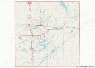
| County: | Kalamazoo County |
| Elevation: | 879 ft (268 m) |
| Total Area: | 3.15 sq mi (8.15 km²) |
| Land Area: | 1.35 sq mi (3.50 km²) |
| Water Area: | 1.80 sq mi (4.66 km²) |
| Total Population: | 1,179 |
| Population Density: | 872.69/sq mi (337.06/km²) |
| FIPS code: | 2674975 |
| GNISfeature ID: | 1867323 |
Online Interactive Map
Click on ![]() to view map in "full screen" mode.
to view map in "full screen" mode.
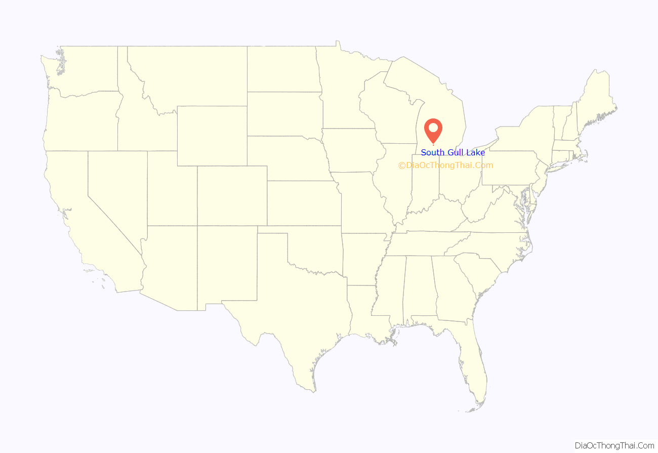
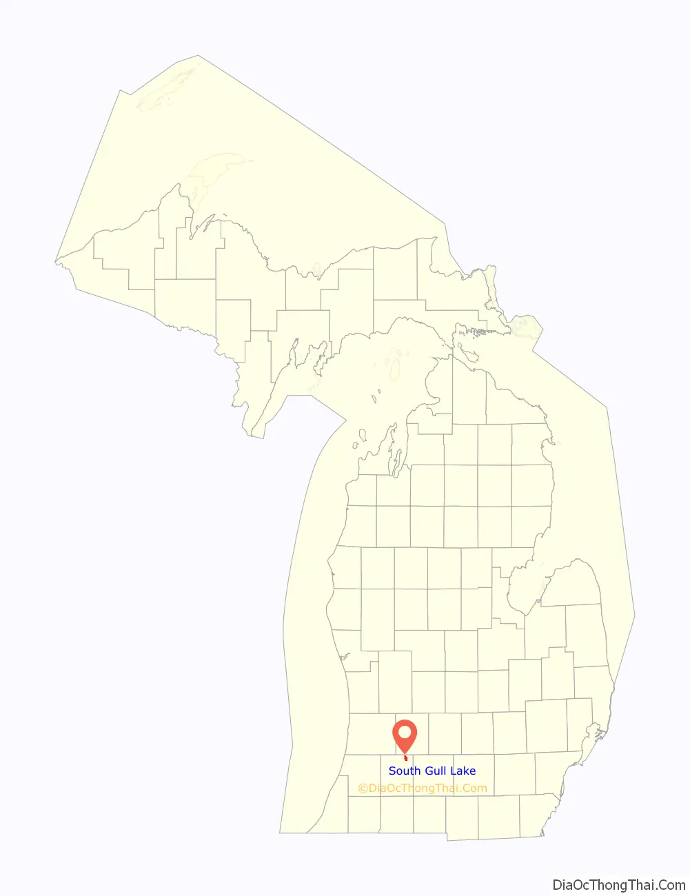
South Gull Lake location map. Where is South Gull Lake CDP?
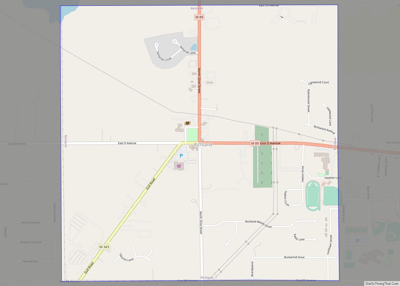
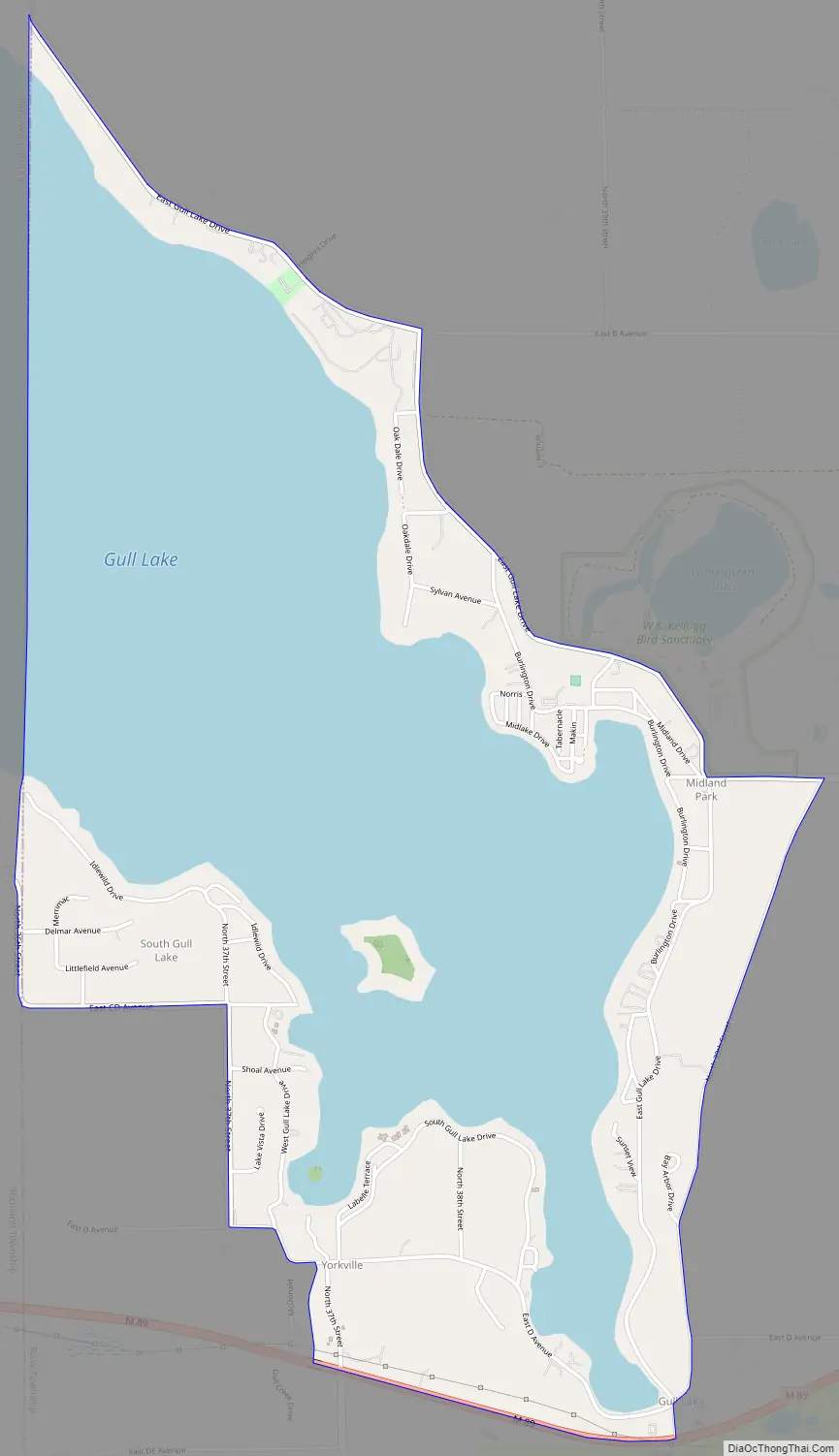
South Gull Lake Road Map
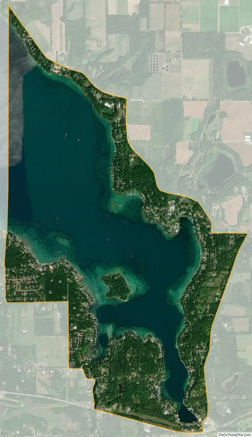
South Gull Lake city Satellite Map
Geography
The CDP is in northeastern Kalamazoo County, in the northwest part of Ross Township, and comprises area around the southern and eastern shores of Gull Lake. The lake extends into Richland Township to the west, and the northern tip crosses into Barry County, areas which are outside the CDP. The community of Yorkville is in the southern part of the CDP at the outlet of the lake (42°22′31″N 85°24′06″W / 42.37528°N 85.40167°W / 42.37528; -85.40167 (Yorkville)), Gull Lake is at the southeast tip of the lake at 42°22′15″N 85°23′12″W / 42.37083°N 85.38667°W / 42.37083; -85.38667 (Gull Lake), and Midland Park is on the eastern side of the lake at 42°23′27″N 85°23′08″W / 42.39083°N 85.38556°W / 42.39083; -85.38556 (Midland Park). A summer post office named “Yorkville” operated from 1917 to 1939.
M-89 is a state highway that forms the southern edge of the CDP, leading west 3.5 miles (5.6 km) to Richland and east 12 miles (19 km) to Battle Creek. Kalamazoo is 12 miles to the southwest via Richland.
According to the United States Census Bureau, the South Gull Lake CDP has a total area of 3.2 square miles (8.2 km), of which 1.8 square miles (4.7 km), or 57.10%, are water. South Gull Lake drains from its outlet at Yorkville via Gull Creek south to the Kalamazoo River.
See also
Map of Michigan State and its subdivision:- Alcona
- Alger
- Allegan
- Alpena
- Antrim
- Arenac
- Baraga
- Barry
- Bay
- Benzie
- Berrien
- Branch
- Calhoun
- Cass
- Charlevoix
- Cheboygan
- Chippewa
- Clare
- Clinton
- Crawford
- Delta
- Dickinson
- Eaton
- Emmet
- Genesee
- Gladwin
- Gogebic
- Grand Traverse
- Gratiot
- Hillsdale
- Houghton
- Huron
- Ingham
- Ionia
- Iosco
- Iron
- Isabella
- Jackson
- Kalamazoo
- Kalkaska
- Kent
- Keweenaw
- Lake
- Lake Hurron
- Lake Michigan
- Lake St. Clair
- Lake Superior
- Lapeer
- Leelanau
- Lenawee
- Livingston
- Luce
- Mackinac
- Macomb
- Manistee
- Marquette
- Mason
- Mecosta
- Menominee
- Midland
- Missaukee
- Monroe
- Montcalm
- Montmorency
- Muskegon
- Newaygo
- Oakland
- Oceana
- Ogemaw
- Ontonagon
- Osceola
- Oscoda
- Otsego
- Ottawa
- Presque Isle
- Roscommon
- Saginaw
- Saint Clair
- Saint Joseph
- Sanilac
- Schoolcraft
- Shiawassee
- Tuscola
- Van Buren
- Washtenaw
- Wayne
- Wexford
- Alabama
- Alaska
- Arizona
- Arkansas
- California
- Colorado
- Connecticut
- Delaware
- District of Columbia
- Florida
- Georgia
- Hawaii
- Idaho
- Illinois
- Indiana
- Iowa
- Kansas
- Kentucky
- Louisiana
- Maine
- Maryland
- Massachusetts
- Michigan
- Minnesota
- Mississippi
- Missouri
- Montana
- Nebraska
- Nevada
- New Hampshire
- New Jersey
- New Mexico
- New York
- North Carolina
- North Dakota
- Ohio
- Oklahoma
- Oregon
- Pennsylvania
- Rhode Island
- South Carolina
- South Dakota
- Tennessee
- Texas
- Utah
- Vermont
- Virginia
- Washington
- West Virginia
- Wisconsin
- Wyoming