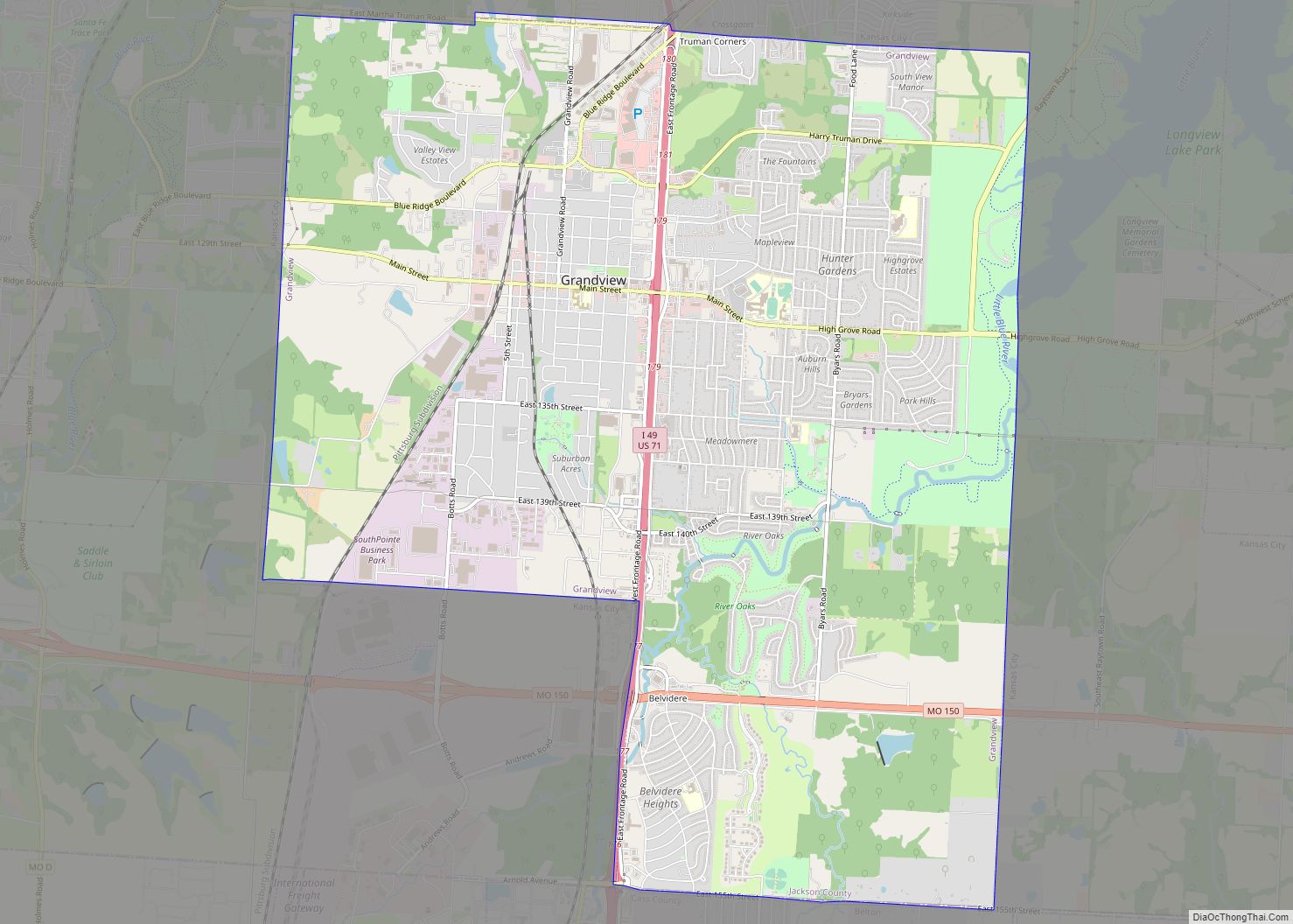
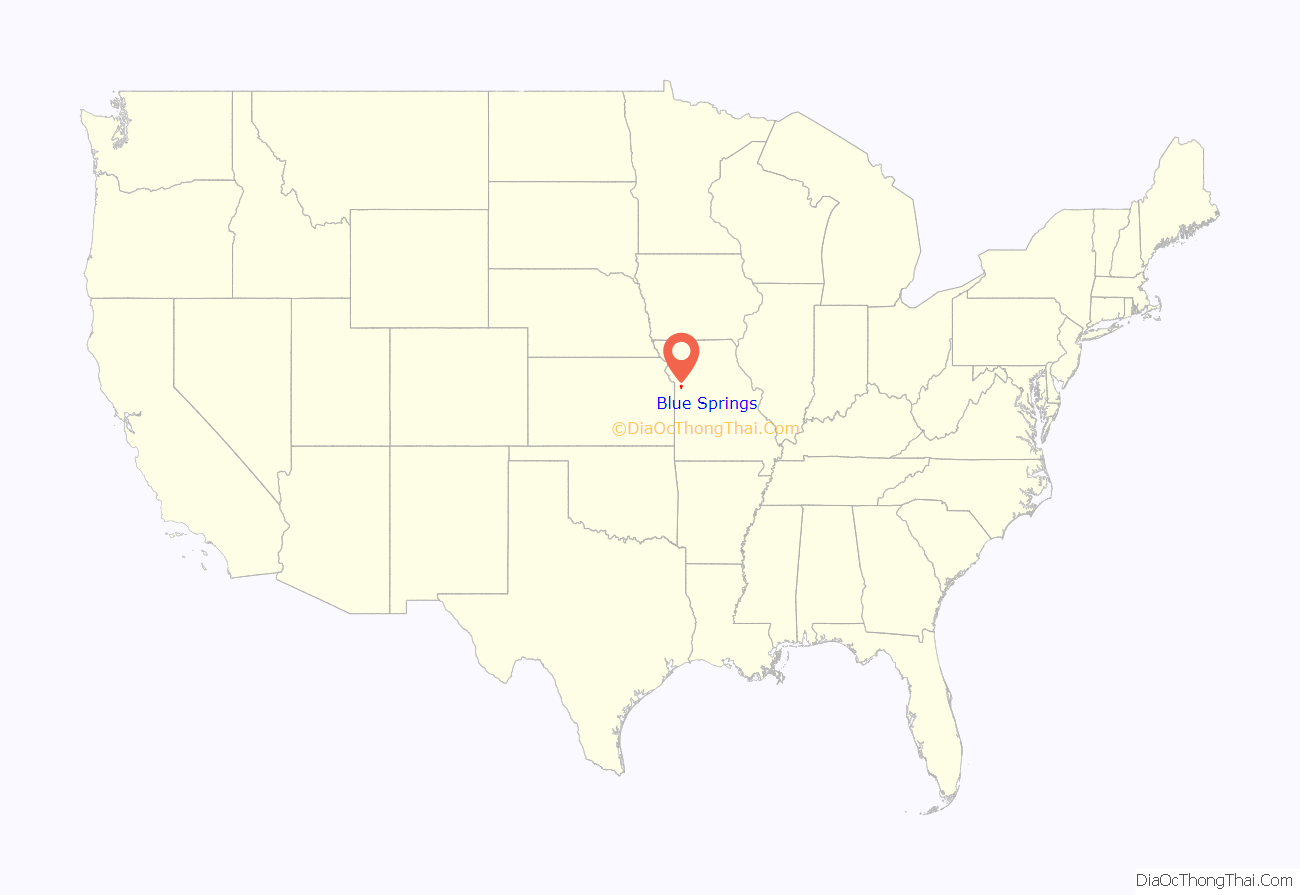
Blue Springs is a city located in the U.S. state of Missouri within Jackson County. Blue Springs is located 19 miles (31 km) east of downtown Kansas City. Blue Springs is the 9th largest city in the Kansas City Metropolitan Area and 10th largest city in the state of Missouri. As of the 2020 census, the population was 58,604, and per the United States Census of estimates from July 2021 the population of Blue Springs is 59,430.
| Name: | Blue Springs city |
|---|---|
| LSAD Code: | 25 |
| LSAD Description: | city (suffix) |
| State: | Missouri |
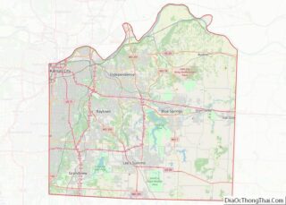
| County: | Jackson County |
| Founded: | 1845 |
| Incorporated: | 1880 |
| Elevation: | 974 ft (297 m) |
| Total Area: | 22.54 sq mi (58.37 km²) |
| Land Area: | 22.46 sq mi (58.17 km²) |
| Water Area: | 0.08 sq mi (0.20 km²) |
| Total Population: | 58,603 |
| Population Density: | 2,609.33/sq mi (1,007.45/km²) |
| ZIP code: | 64013-64015, 64029, 64064 |
| Area code: | 816 |
| FIPS code: | 2906652 |
| GNISfeature ID: | 0714434 |
| Website: | www.bluespringsgov.com |
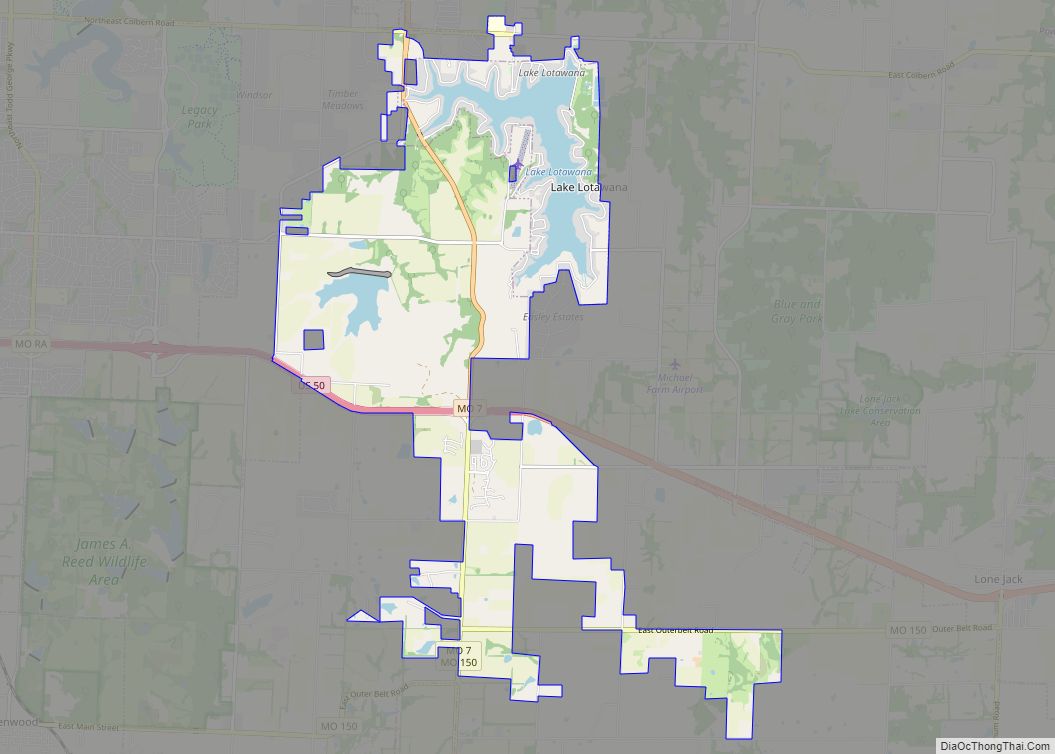
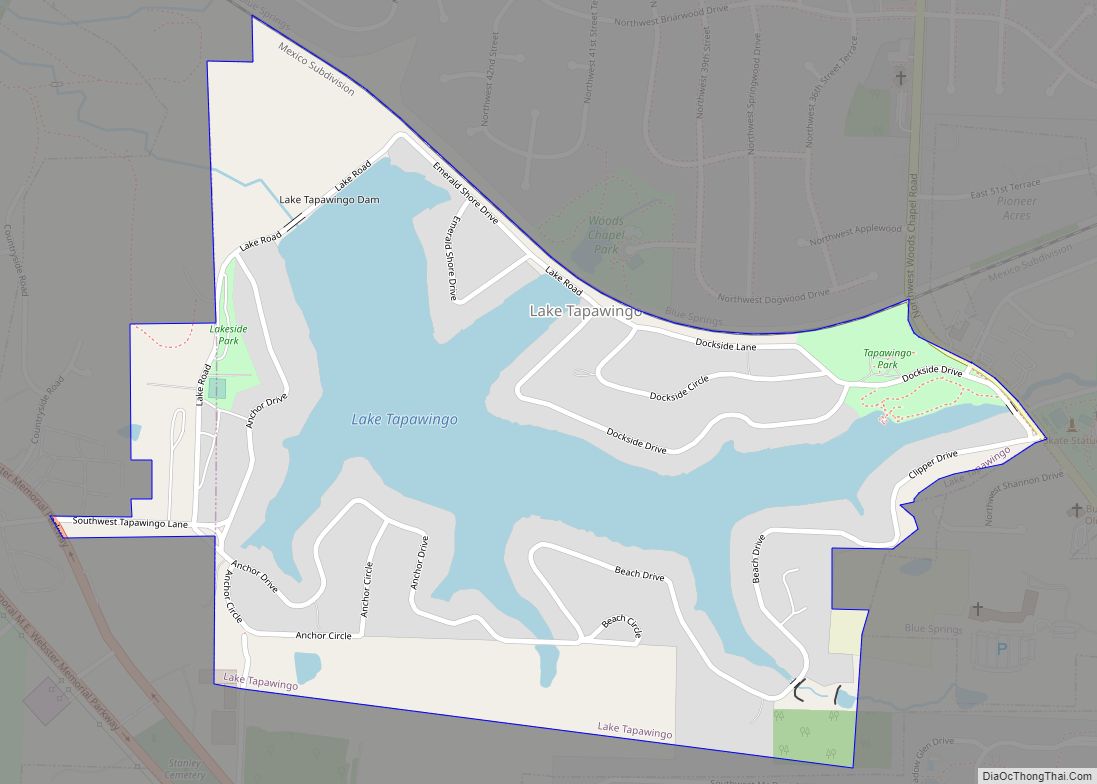
Online Interactive Map
Click on ![]() to view map in "full screen" mode.
to view map in "full screen" mode.
Blue Springs location map. Where is Blue Springs city?
History
Blue Springs’ history is tied to the migration of settlers on their westward journey. Pioneers found the area to be an ideal stopover due to the abundance of cool, clean water from a spring of the Little Blue River—hence the name Blue Springs. The presence of water and a need for pioneer supplies led to the construction of a grist mill and permanent settlement at the current site of the city’s Burrus Old Mill Park on Woods Chapel Road.
An early settler, Franklin Smith, arrived in Blue Springs from Virginia in 1838 and became a leading figure in the community’s development. He established the first post office in 1845, naming it after the well-known springs.
The settlement continued to grow near the springs until March 1878, when the Chicago and Alton Railroad announced plans to build a station about one mile east of the original settlement. To take advantage of the commerce the railroad would bring, the town moved its center to the site of the new station and continued its development as a rural trading center. The Jackson County Court granted the incorpation of Blue Springs on September 7, 1880, making the city the fourth settlement in the county to be incorporated. The Chicago & Alton Hotel built in 1878, located on Main Street west of the railroad tracks is the oldest business in the City of Blue Springs.
Historical attractions near or in Blue Springs include: Missouri Town 1855, Fort Osage National Historic Landmark, Dillingham-Lewis House Museum, Chicago & Alton Hotel Museum, and the Lone Jack Civil War Museum.
City Hall History
Until 1965, the Blue Springs City Hall was located in a very small block building under the old water tower on the northwest corner of 11th and Walnut Streets. City Hall and the water tower were torn down not long after vacating the buildings. From 1965 to 1968, the City Hall was a metal building located in the 200 block of NW 11th Street, across the street from the former Blue Springs Post Office. In 1968 the current City Hall was built at 903 W. Main Street as the Blue Springs Municipal Building. The Blue Springs Municipal Building held the Blue Springs Police Department in the lower level and city hall functions on the main level until 1988, when the Police Department moved to a new police station at 1100 SW Smith Street. The Municipal Building was remodeled in 1989 and was renamed the Blue Springs City Hall.
The June 1911 issue of Technical World magazine published an article claiming that Blue Springs “boasts of possessing the world’s champion marble players,” and published a picture of a competition. It named Dan Stanley, George Webb, George Binger and Lynn Pryor as the best.
In 2010, CNN/Money Magazine ranked Blue Springs 49th on its list of the 100 Best Places to Live in the United States.
On May 24, 2012, Chris Oberholtz and Dave Jordan of KCTV5 reported that several residents had seen strange lights in the evening sky above Blue Springs.
Past Mayors of Blue Springs
- 1881 John A. Webb (Deceased) elected first mayor of Blue Springs
- Term Unknown John K. Dodson (Deceased)
- Term Unknown D.C. Herrinton (Deceased)
- 1910-1918 Benjamin Franklin Boley (Deceased)
- 1918-1924 Joseph Edward Quinn (Deceased)
- 1924-1940 R.J. Lowe (Deceased)
- 1940-1944 J.L. Wells (Deceased)
- 1944-1948 Hansel Lowe (Deceased)
- 1948-1950 W.E. Calloway (Deceased)
- 1950-1952 G.G. “Chief” Garrett (Deceased)
- 1952-1954 W.C. Hatfield (Deceased)
- 1954-1955 W.E. Galloway (Deceased)
- 1955-1956 G.G. “Chief” Garrett (Deceased)
- 1956-1958 Wilson P. Edmonds (Deceased)
- 1958-1960 William H. Risler (Deceased)
- 1960-1962 G.G. “Chief” Garrett (Deceased)
- 1962-1966 J.O. Jackson (Deceased)
- 1966-1970 Virgil L. Wills (Deceased)
- 1970-1978 Dale Baumgardner (Deceased)
- 1979-1982 Thomas E. Woods
- 1982-1990 John R. Michael
- 1990-2004 Gregory Grounds
- 2004-2008 Steve Steiner
- 2008–Present Carson Ross
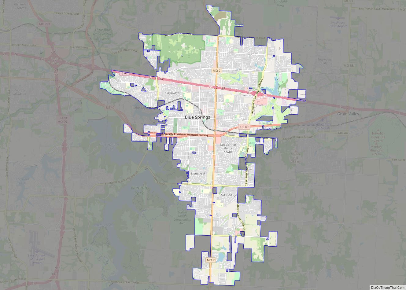
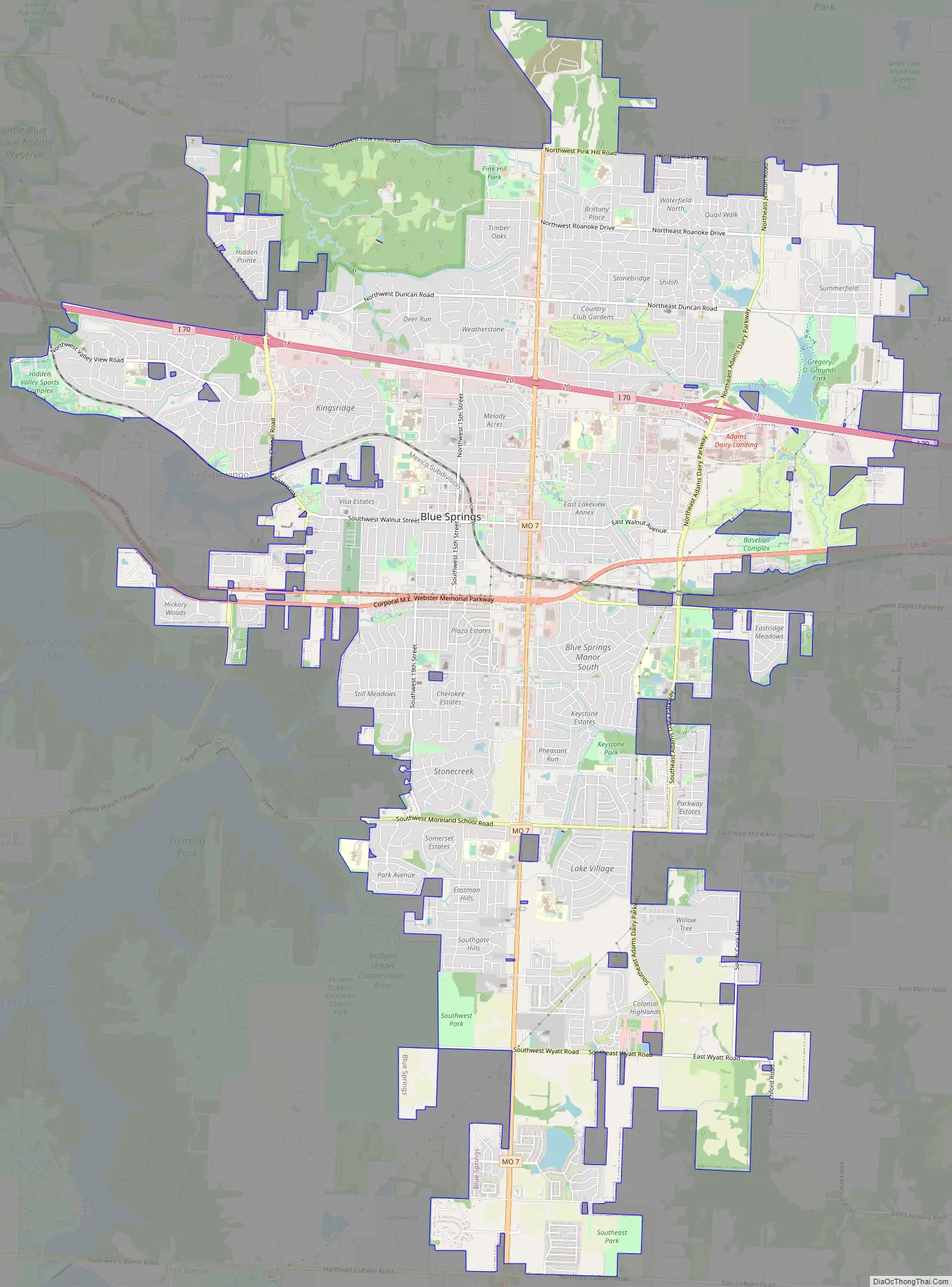
Blue Springs Road Map
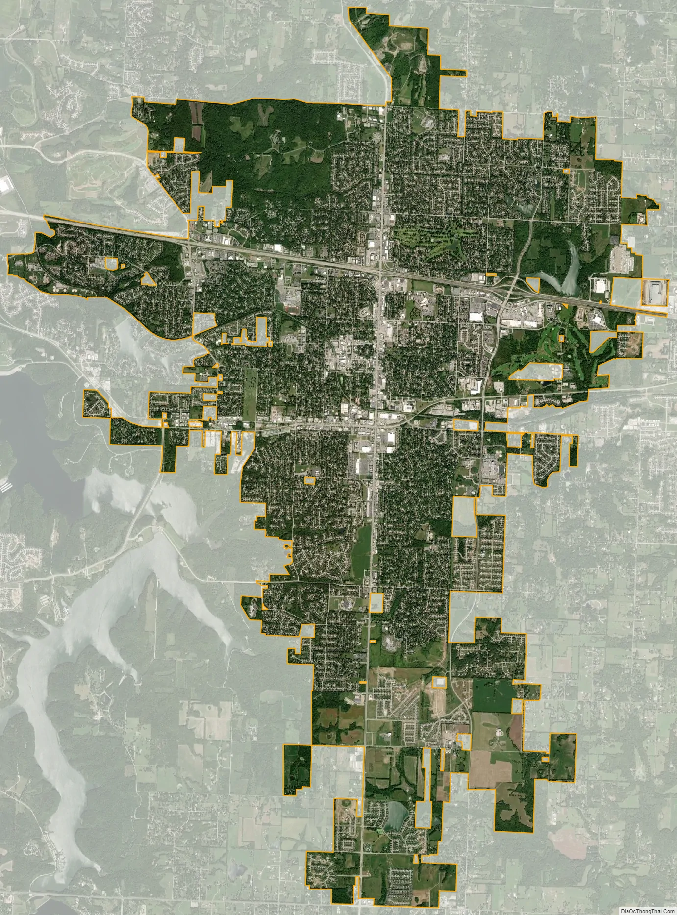
Blue Springs city Satellite Map
Geography
Blue Springs is located at 39°1′4″N 94°16′28″W / 39.01778°N 94.27444°W / 39.01778; -94.27444 (39.017778, -94.274444). According to the United States Census Bureau, the city has a total area of 22.35 square miles (57.89 km), of which 22.27 square miles (57.68 km) is land and 0.08 square miles (0.21 km) is water.
See also
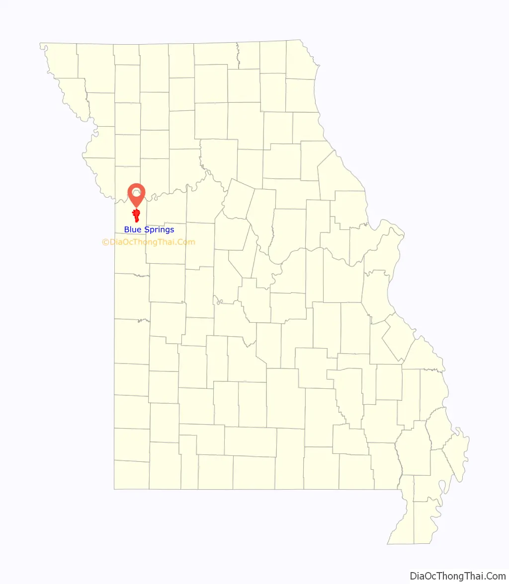
Map of Missouri State and its subdivision:- Adair
- Andrew
- Atchison
- Audrain
- Barry
- Barton
- Bates
- Benton
- Bollinger
- Boone
- Buchanan
- Butler
- Caldwell
- Callaway
- Camden
- Cape Girardeau
- Carroll
- Carter
- Cass
- Cedar
- Chariton
- Christian
- Clark
- Clay
- Clinton
- Cole
- Cooper
- Crawford
- Dade
- Dallas
- Daviess
- De Kalb
- Dent
- Douglas
- Dunklin
- Franklin
- Gasconade
- Gentry
- Greene
- Grundy
- Harrison
- Henry
- Hickory
- Holt
- Howard
- Howell
- Iron
- Jackson
- Jasper
- Jefferson
- Johnson
- Knox
- Laclede
- Lafayette
- Lawrence
- Lewis
- Lincoln
- Linn
- Livingston
- Macon
- Madison
- Maries
- Marion
- McDonald
- Mercer
- Miller
- Mississippi
- Moniteau
- Monroe
- Montgomery
- Morgan
- New Madrid
- Newton
- Nodaway
- Oregon
- Osage
- Ozark
- Pemiscot
- Perry
- Pettis
- Phelps
- Pike
- Platte
- Polk
- Pulaski
- Putnam
- Ralls
- Randolph
- Ray
- Reynolds
- Ripley
- Saint Charles
- Saint Clair
- Saint Francois
- Saint Louis
- Sainte Genevieve
- Saline
- Schuyler
- Scotland
- Scott
- Shannon
- Shelby
- Stoddard
- Stone
- Sullivan
- Taney
- Texas
- Vernon
- Warren
- Washington
- Wayne
- Webster
- Worth
- Wright
- Alabama
- Alaska
- Arizona
- Arkansas
- California
- Colorado
- Connecticut
- Delaware
- District of Columbia
- Florida
- Georgia
- Hawaii
- Idaho
- Illinois
- Indiana
- Iowa
- Kansas
- Kentucky
- Louisiana
- Maine
- Maryland
- Massachusetts
- Michigan
- Minnesota
- Mississippi
- Missouri
- Montana
- Nebraska
- Nevada
- New Hampshire
- New Jersey
- New Mexico
- New York
- North Carolina
- North Dakota
- Ohio
- Oklahoma
- Oregon
- Pennsylvania
- Rhode Island
- South Carolina
- South Dakota
- Tennessee
- Texas
- Utah
- Vermont
- Virginia
- Washington
- West Virginia
- Wisconsin
- Wyoming