Cuba is a city in Crawford County, Missouri, United States. The population was 3,356 at the 2010 census. Cuba is the largest city situated entirely in Crawford County.
| Name: | Cuba city |
|---|---|
| LSAD Code: | 25 |
| LSAD Description: | city (suffix) |
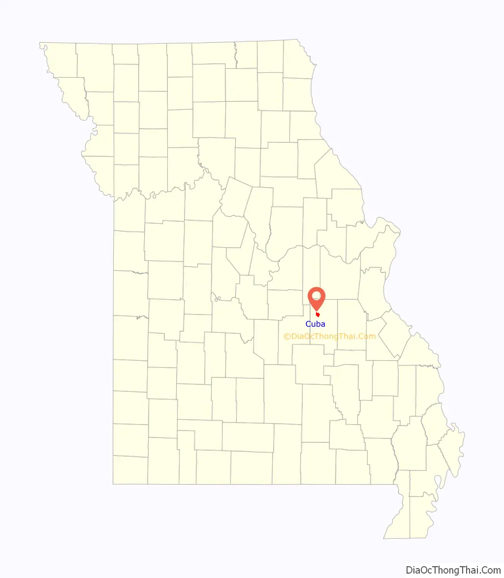
| State: | Missouri |
| County: | Crawford County |
| Founded: | 1857 |
| Elevation: | 1,017 ft (310 m) |
| Total Area: | 3.19 sq mi (8.27 km²) |
| Land Area: | 3.19 sq mi (8.27 km²) |
| Water Area: | 0.00 sq mi (0.00 km²) |
| Total Population: | 3,181 |
| Population Density: | 996.24/sq mi (384.65/km²) |
| ZIP code: | 65453 |
| Area code: | 573 |
| FIPS code: | 2917668 |
| GNISfeature ID: | 2393690 |
| Website: | https://cityofcubamo.com/ |
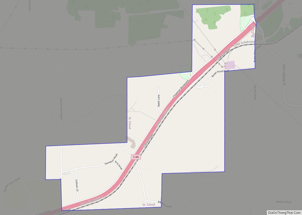
Online Interactive Map
Click on ![]() to view map in "full screen" mode.
to view map in "full screen" mode.
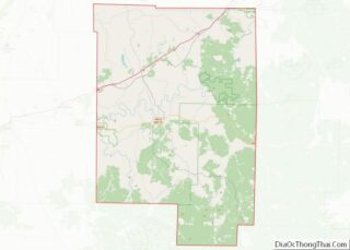
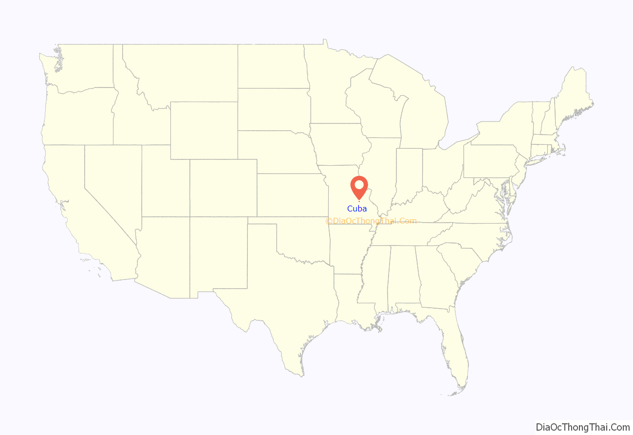
Cuba location map. Where is Cuba city?
History
Cuba was platted in 1857 when it was certain the railroad would be extended to that point. It was named after the island of Cuba.
President Harry S. Truman visited Cuba during a tour of U.S. Route 66. He surveyed the property that would eventually become Indian Hills Lake. Indian Hills Lake was originally known as “Indian Head Lake” because the skull of a Native American was found during excavation.
Bette Davis and Amelia Earhart also visited the town. Their visits are commemorated in the Viva Cuba Mural Project.
Cuba was designated as the Route 66 Mural City by the Missouri legislature in recognition of Viva Cuba’s Outdoor Mural Project. The beautification group consulted with Michelle Loughery, a Canadian muralist who helped create the vision and two of the murals. The group commissioned twelve outdoor murals along the Route 66 corridor. Interstate 44 now runs through Cuba.
Cuba was also the site of the first Adopt a Highway program in Missouri.
The Cuba City Jail, Cuba High School Annex, Cuba Lodge No. 312 A.F. and A.M., George B. Hamilton House, Hotel Cuba, John Manson Munro House, Uptown Cuba Historic District, and Wagon Wheel Motel, Cafe and Station are listed on the National Register of Historic Places.
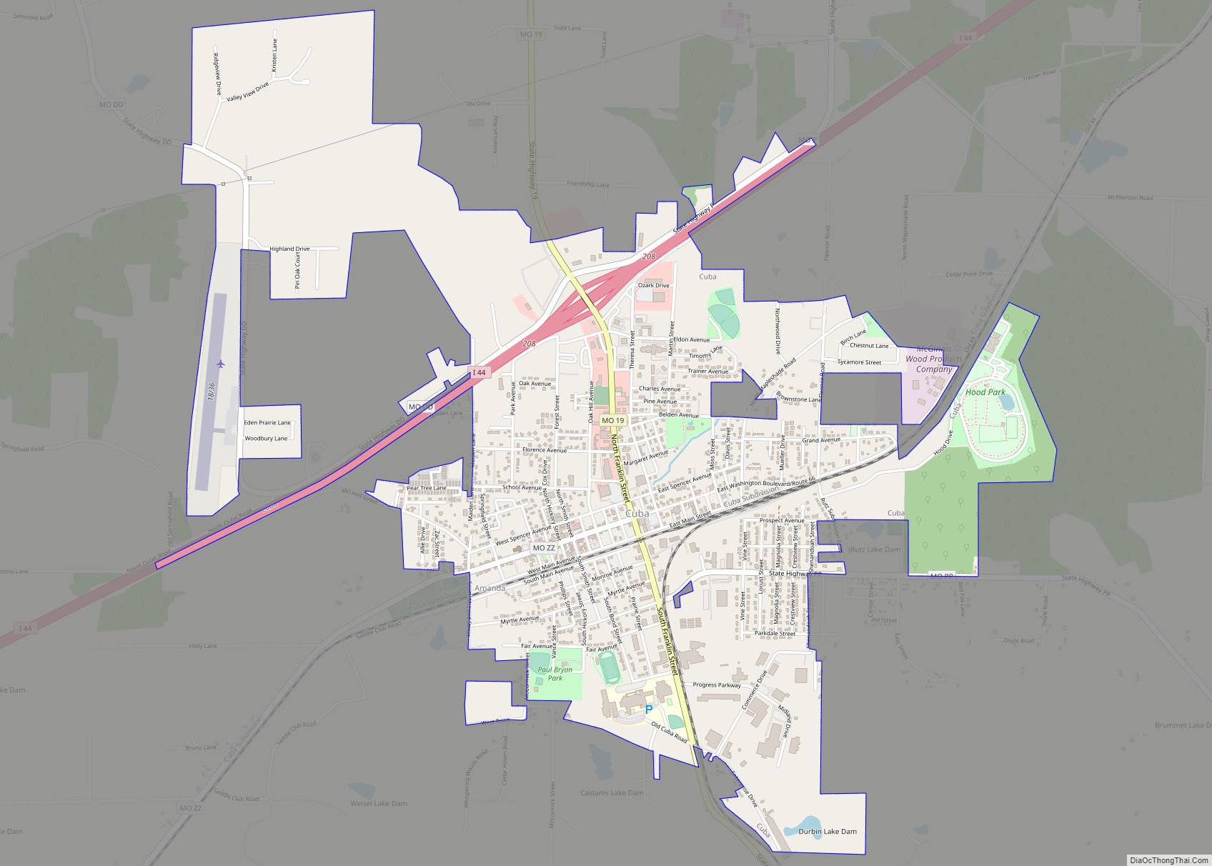
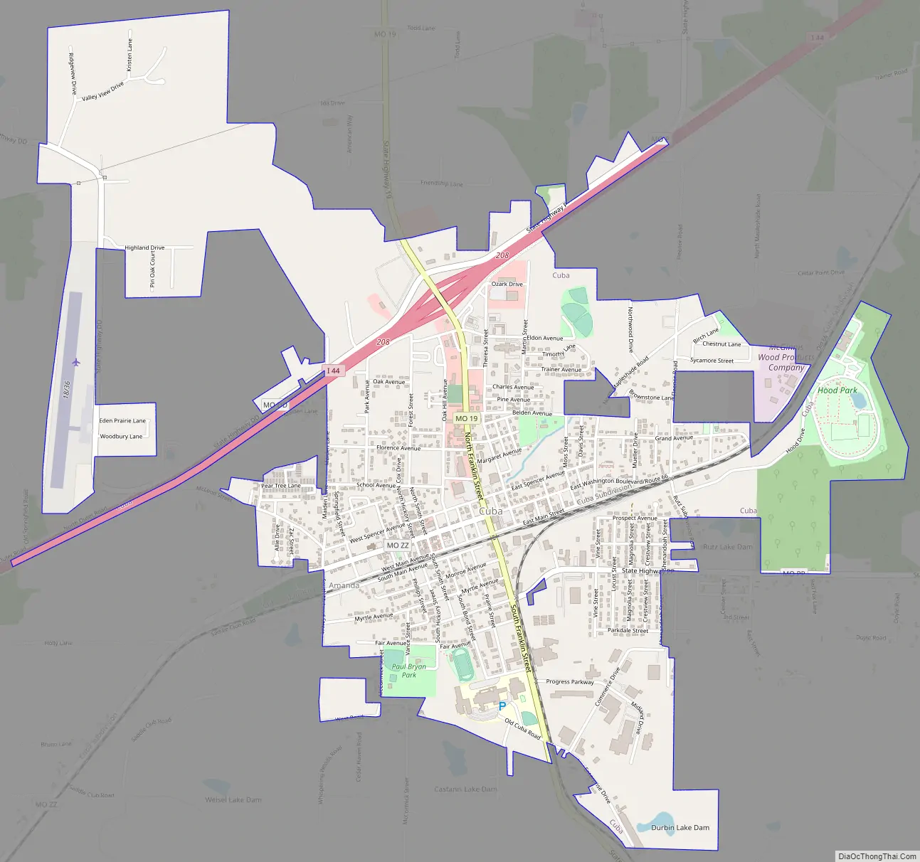
Cuba Road Map
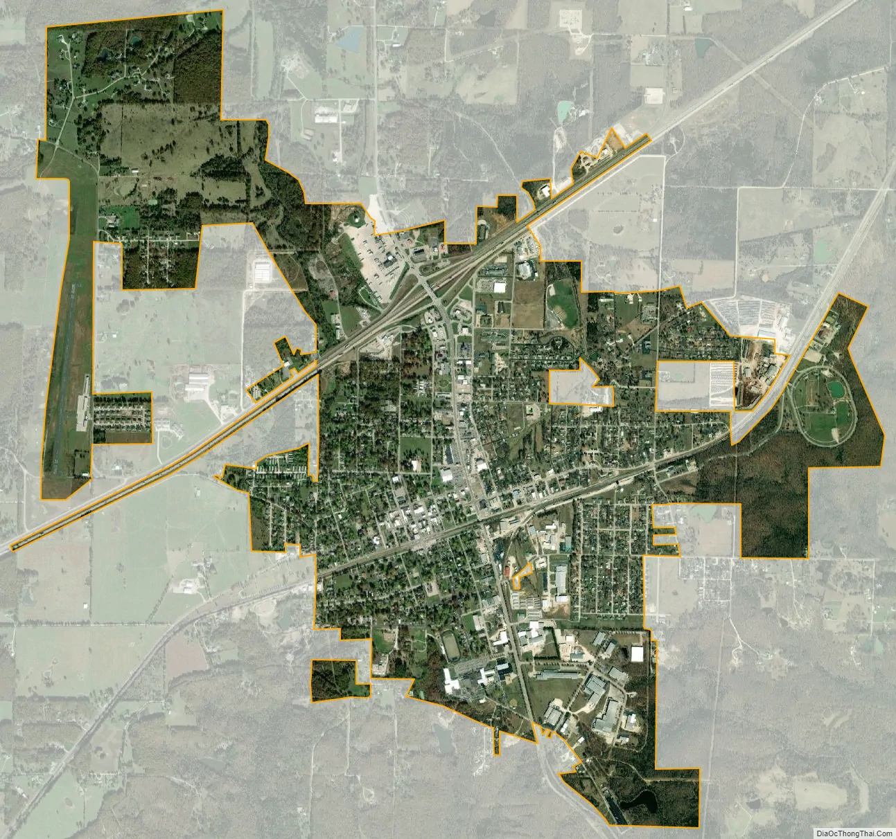
Cuba city Satellite Map
Geography
Cuba is located on Missouri Route 19 approximately seven miles northeast of Steelville. I-44 passes the north side of the town.
According to the United States Census Bureau, the city has a total area of 3.20 square miles (8.29 km), all land.
See also
Map of Missouri State and its subdivision:- Adair
- Andrew
- Atchison
- Audrain
- Barry
- Barton
- Bates
- Benton
- Bollinger
- Boone
- Buchanan
- Butler
- Caldwell
- Callaway
- Camden
- Cape Girardeau
- Carroll
- Carter
- Cass
- Cedar
- Chariton
- Christian
- Clark
- Clay
- Clinton
- Cole
- Cooper
- Crawford
- Dade
- Dallas
- Daviess
- De Kalb
- Dent
- Douglas
- Dunklin
- Franklin
- Gasconade
- Gentry
- Greene
- Grundy
- Harrison
- Henry
- Hickory
- Holt
- Howard
- Howell
- Iron
- Jackson
- Jasper
- Jefferson
- Johnson
- Knox
- Laclede
- Lafayette
- Lawrence
- Lewis
- Lincoln
- Linn
- Livingston
- Macon
- Madison
- Maries
- Marion
- McDonald
- Mercer
- Miller
- Mississippi
- Moniteau
- Monroe
- Montgomery
- Morgan
- New Madrid
- Newton
- Nodaway
- Oregon
- Osage
- Ozark
- Pemiscot
- Perry
- Pettis
- Phelps
- Pike
- Platte
- Polk
- Pulaski
- Putnam
- Ralls
- Randolph
- Ray
- Reynolds
- Ripley
- Saint Charles
- Saint Clair
- Saint Francois
- Saint Louis
- Sainte Genevieve
- Saline
- Schuyler
- Scotland
- Scott
- Shannon
- Shelby
- Stoddard
- Stone
- Sullivan
- Taney
- Texas
- Vernon
- Warren
- Washington
- Wayne
- Webster
- Worth
- Wright
- Alabama
- Alaska
- Arizona
- Arkansas
- California
- Colorado
- Connecticut
- Delaware
- District of Columbia
- Florida
- Georgia
- Hawaii
- Idaho
- Illinois
- Indiana
- Iowa
- Kansas
- Kentucky
- Louisiana
- Maine
- Maryland
- Massachusetts
- Michigan
- Minnesota
- Mississippi
- Missouri
- Montana
- Nebraska
- Nevada
- New Hampshire
- New Jersey
- New Mexico
- New York
- North Carolina
- North Dakota
- Ohio
- Oklahoma
- Oregon
- Pennsylvania
- Rhode Island
- South Carolina
- South Dakota
- Tennessee
- Texas
- Utah
- Vermont
- Virginia
- Washington
- West Virginia
- Wisconsin
- Wyoming