Gilman City is a city in southeastern Harrison and extending into northeastern Daviess counties in the U.S. state of Missouri. The population was 329 at the 2020 census.
| Name: | Gilman City city |
|---|---|
| LSAD Code: | 25 |
| LSAD Description: | city (suffix) |
| State: | Missouri |
| County: | Daviess County, Harrison County |
| Elevation: | 981 ft (299 m) |
| Total Area: | 0.84 sq mi (2.18 km²) |
| Land Area: | 0.84 sq mi (2.18 km²) |
| Water Area: | 0.00 sq mi (0.00 km²) |
| Total Population: | 329 |
| Population Density: | 391.20/sq mi (151.04/km²) |
| ZIP code: | 64642 |
| Area code: | 660 |
| FIPS code: | 2927064 |
| GNISfeature ID: | 2394901 |
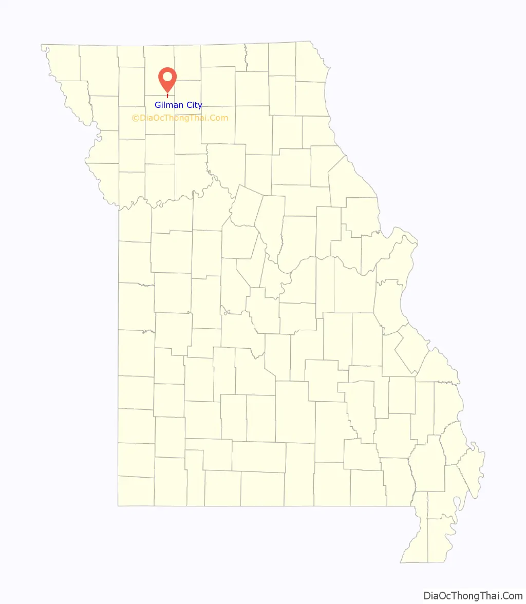
Online Interactive Map
Click on ![]() to view map in "full screen" mode.
to view map in "full screen" mode.
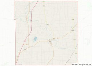
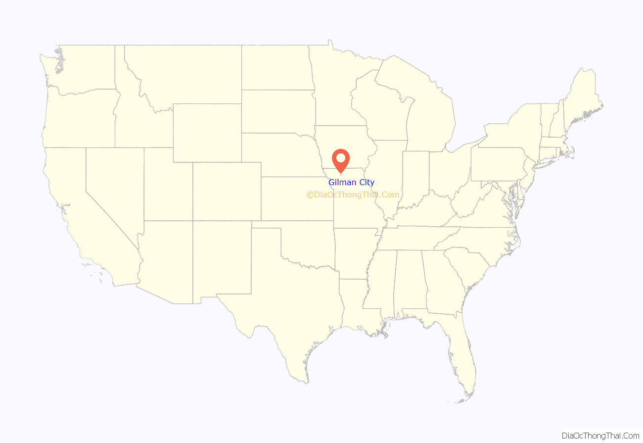
Gilman City location map. Where is Gilman City city?
History
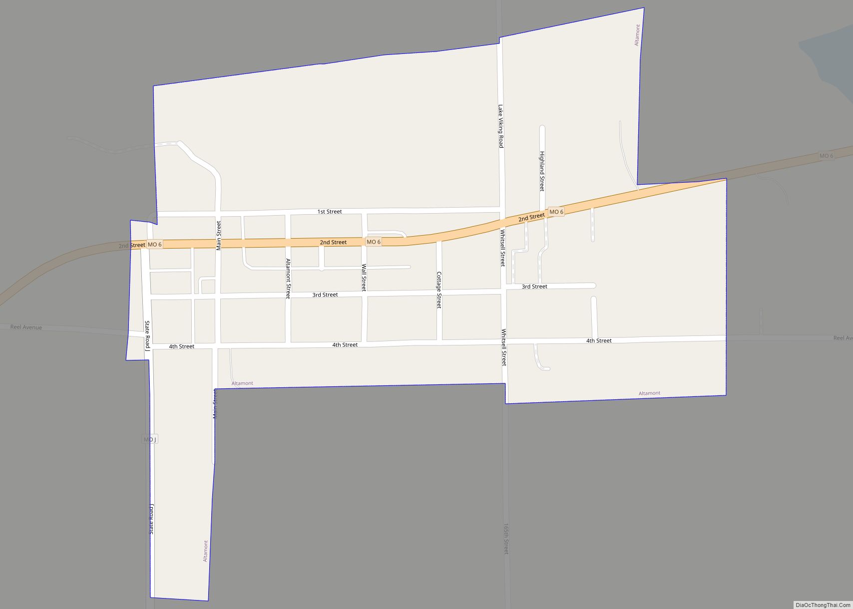
Gilman City was platted in 1897 when the railroad was extended to that point. A post office called Gilman City has been in operation since 1897. The city has the name of Theodore Gilman, a railroad banker.
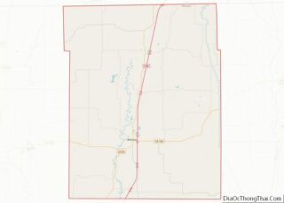
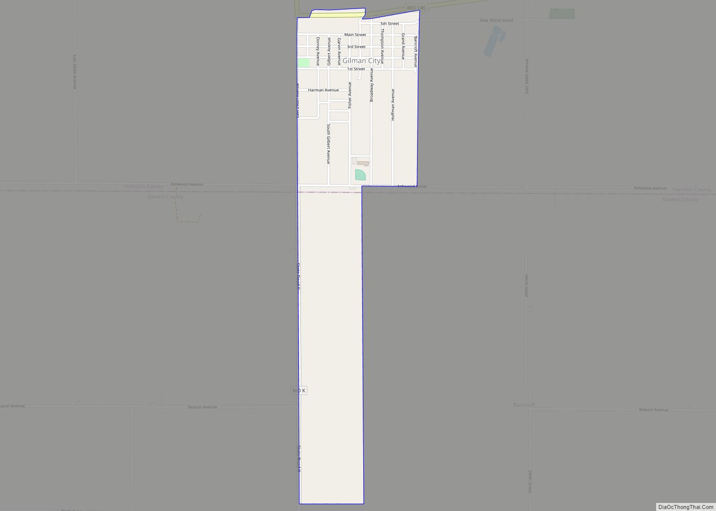
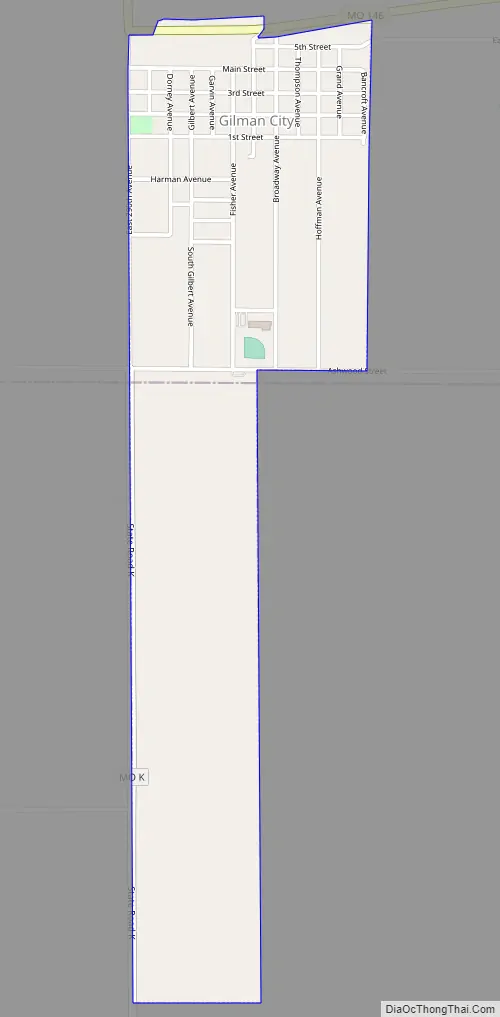
Gilman City Road Map
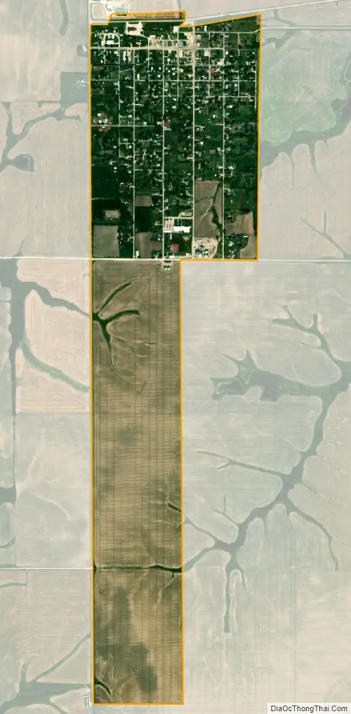
Gilman City city Satellite Map
Geography
Gilman City is located on Missouri Route 146 approximately eleven miles southeast of Bethany and 16 northwest of Trenton, Missouri. The community of Melbourne is 4.5 miles to the east.
According to the United States Census Bureau, the city has a total area of 0.84 square miles (2.18 km), all land.
See also
Map of Missouri State and its subdivision:- Adair
- Andrew
- Atchison
- Audrain
- Barry
- Barton
- Bates
- Benton
- Bollinger
- Boone
- Buchanan
- Butler
- Caldwell
- Callaway
- Camden
- Cape Girardeau
- Carroll
- Carter
- Cass
- Cedar
- Chariton
- Christian
- Clark
- Clay
- Clinton
- Cole
- Cooper
- Crawford
- Dade
- Dallas
- Daviess
- De Kalb
- Dent
- Douglas
- Dunklin
- Franklin
- Gasconade
- Gentry
- Greene
- Grundy
- Harrison
- Henry
- Hickory
- Holt
- Howard
- Howell
- Iron
- Jackson
- Jasper
- Jefferson
- Johnson
- Knox
- Laclede
- Lafayette
- Lawrence
- Lewis
- Lincoln
- Linn
- Livingston
- Macon
- Madison
- Maries
- Marion
- McDonald
- Mercer
- Miller
- Mississippi
- Moniteau
- Monroe
- Montgomery
- Morgan
- New Madrid
- Newton
- Nodaway
- Oregon
- Osage
- Ozark
- Pemiscot
- Perry
- Pettis
- Phelps
- Pike
- Platte
- Polk
- Pulaski
- Putnam
- Ralls
- Randolph
- Ray
- Reynolds
- Ripley
- Saint Charles
- Saint Clair
- Saint Francois
- Saint Louis
- Sainte Genevieve
- Saline
- Schuyler
- Scotland
- Scott
- Shannon
- Shelby
- Stoddard
- Stone
- Sullivan
- Taney
- Texas
- Vernon
- Warren
- Washington
- Wayne
- Webster
- Worth
- Wright
- Alabama
- Alaska
- Arizona
- Arkansas
- California
- Colorado
- Connecticut
- Delaware
- District of Columbia
- Florida
- Georgia
- Hawaii
- Idaho
- Illinois
- Indiana
- Iowa
- Kansas
- Kentucky
- Louisiana
- Maine
- Maryland
- Massachusetts
- Michigan
- Minnesota
- Mississippi
- Missouri
- Montana
- Nebraska
- Nevada
- New Hampshire
- New Jersey
- New Mexico
- New York
- North Carolina
- North Dakota
- Ohio
- Oklahoma
- Oregon
- Pennsylvania
- Rhode Island
- South Carolina
- South Dakota
- Tennessee
- Texas
- Utah
- Vermont
- Virginia
- Washington
- West Virginia
- Wisconsin
- Wyoming