Grain Valley is a city in Jackson County, Missouri, United States. Grain Valley is located in the Kansas City Metropolitan Area and is a suburb of Kansas City. The population was 12,854 at the 2010 census and an estimated 14,526 in 2019. It is 23 miles (37 km) east of downtown Kansas City.
| Name: | Grain Valley city |
|---|---|
| LSAD Code: | 25 |
| LSAD Description: | city (suffix) |
| State: | Missouri |
| County: | Jackson County |
| Incorporated: | 1945 |
| Elevation: | 794 ft (242 m) |
| Total Area: | 6.17 sq mi (15.98 km²) |
| Land Area: | 6.16 sq mi (15.96 km²) |
| Water Area: | 0.01 sq mi (0.02 km²) |
| Total Population: | 15,627 |
| Population Density: | 2,536.03/sq mi (979.13/km²) |
| ZIP code: | 64029 |
| Area code: | 816 |
| FIPS code: | 2928090 |
| GNISfeature ID: | 0718661 |
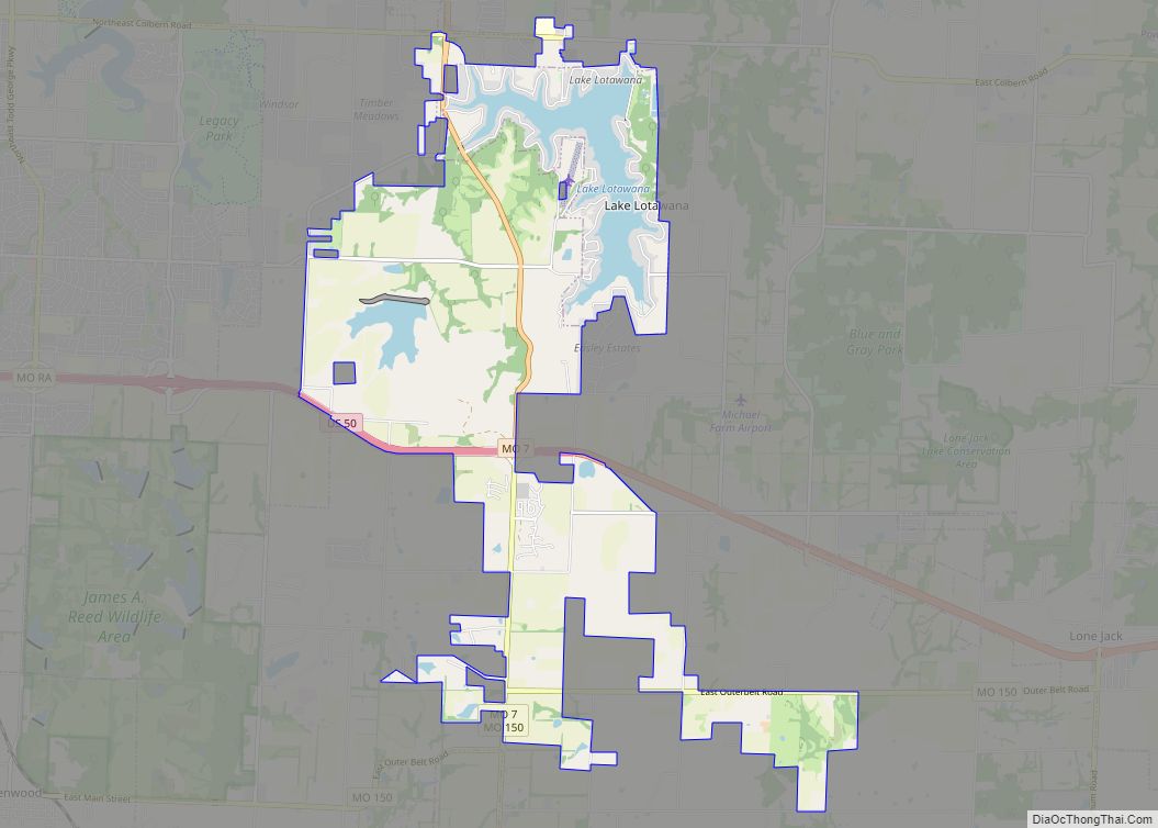
Online Interactive Map
Click on ![]() to view map in "full screen" mode.
to view map in "full screen" mode.
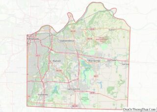
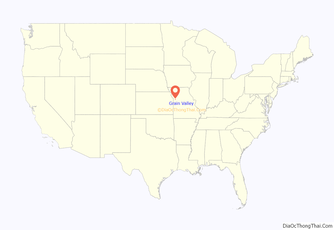
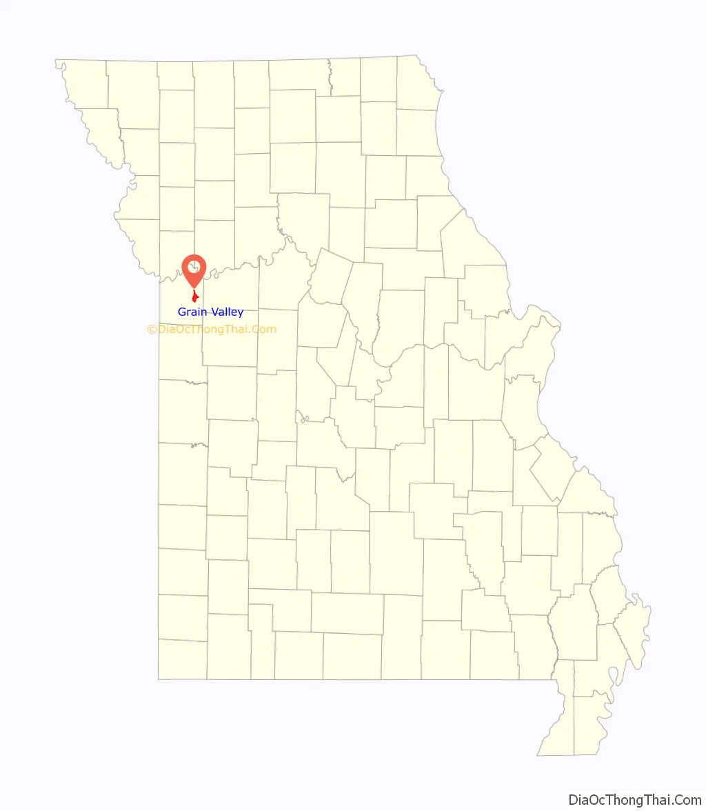
Grain Valley location map. Where is Grain Valley city?
History
Grain Valley was founded in the late 1870s. The city was named for the general character of the grain-producing region. A post office called Grain Valley has been in operation since 1879. Grain Valley was founded primarily by former residents and business owners of Pink Hill, Missouri who moved to this area after the Chicago and Alton Railroad built a railway through this area in 1878, bypassing the former community of Pink Hill, Missouri. The townspeople needed to take advantage of the commerce that the railroad would provide during this era.
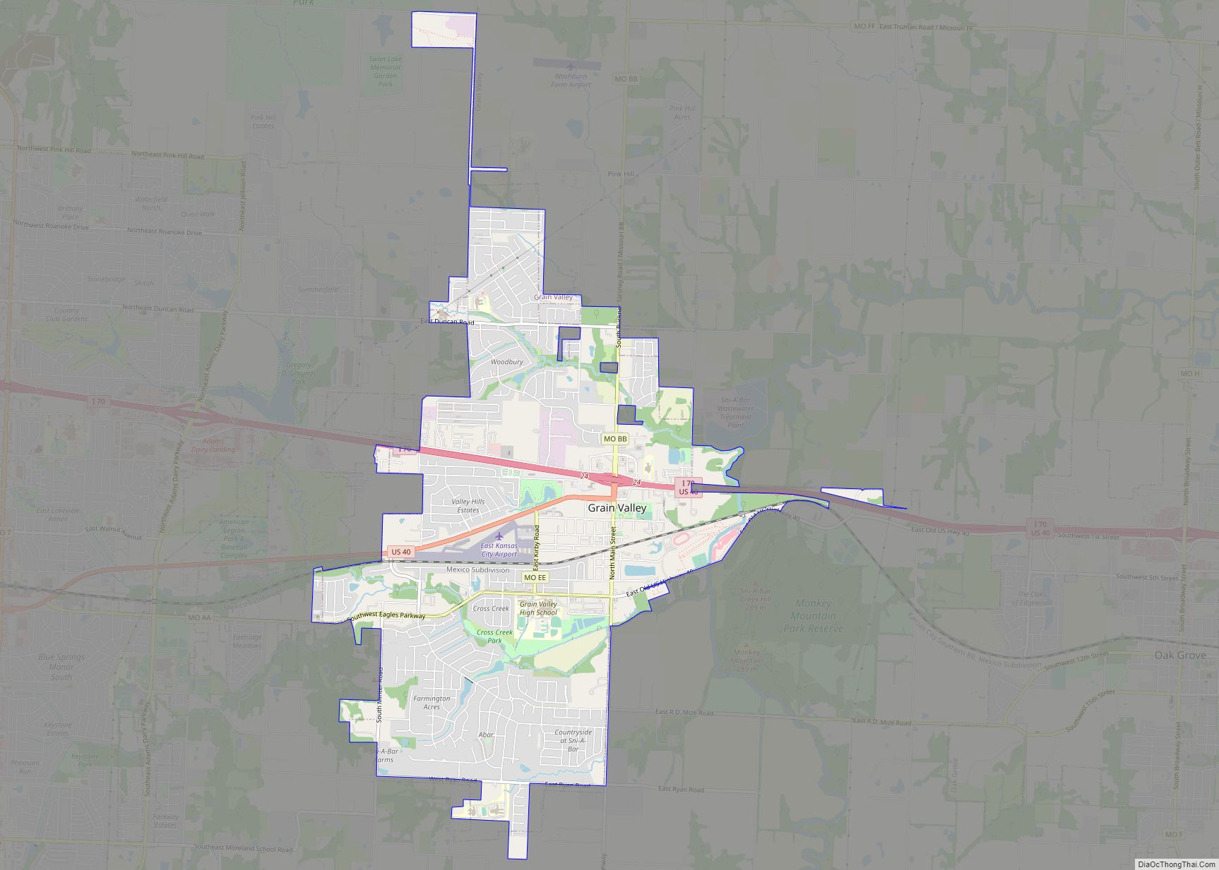
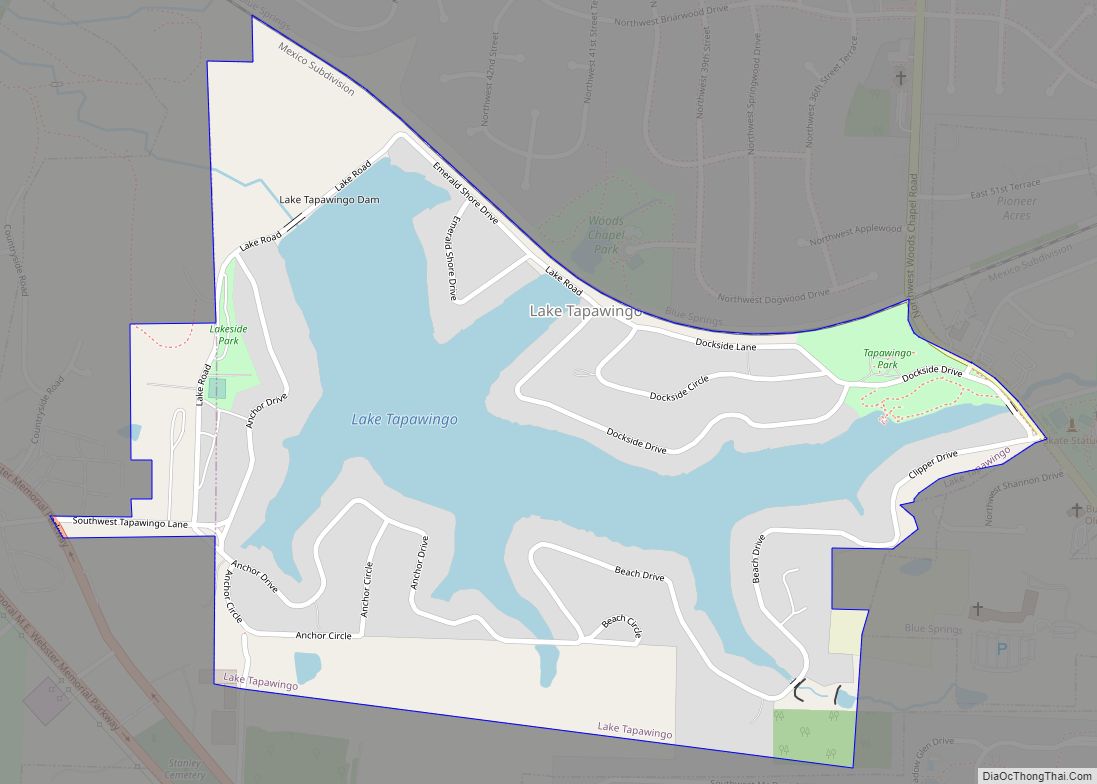
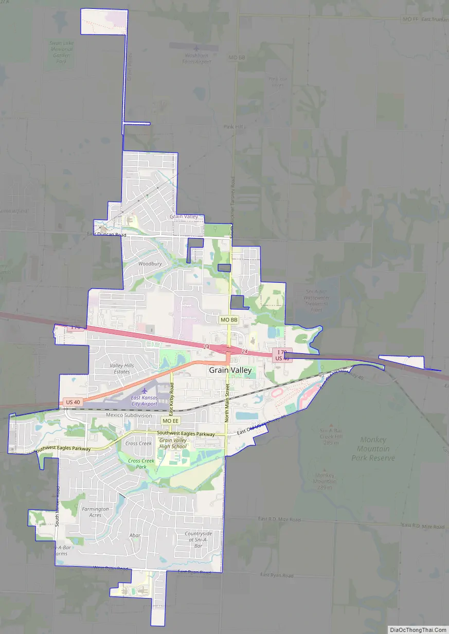
Grain Valley Road Map
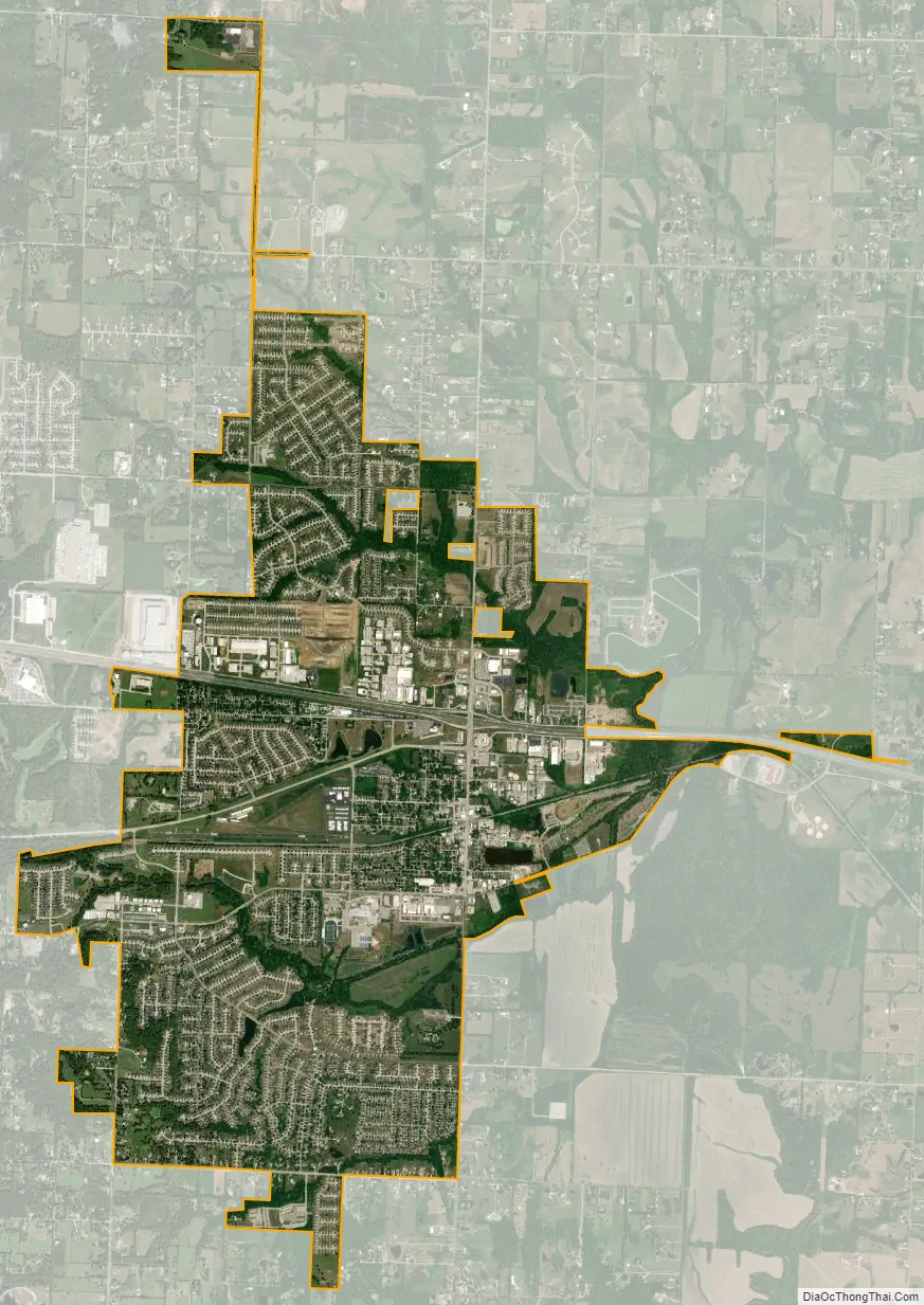
Grain Valley city Satellite Map
Geography
Grain Valley is located at 39°0′31″N 94°12′27″W / 39.00861°N 94.20750°W / 39.00861; -94.20750 (39.008733, -94.207465).
According to the United States Census Bureau, the city has a total area of 6.07 square miles (15.72 km), of which 6.06 square miles (15.70 km) is land and 0.01 square miles (0.03 km) is water.
See also
Map of Missouri State and its subdivision:- Adair
- Andrew
- Atchison
- Audrain
- Barry
- Barton
- Bates
- Benton
- Bollinger
- Boone
- Buchanan
- Butler
- Caldwell
- Callaway
- Camden
- Cape Girardeau
- Carroll
- Carter
- Cass
- Cedar
- Chariton
- Christian
- Clark
- Clay
- Clinton
- Cole
- Cooper
- Crawford
- Dade
- Dallas
- Daviess
- De Kalb
- Dent
- Douglas
- Dunklin
- Franklin
- Gasconade
- Gentry
- Greene
- Grundy
- Harrison
- Henry
- Hickory
- Holt
- Howard
- Howell
- Iron
- Jackson
- Jasper
- Jefferson
- Johnson
- Knox
- Laclede
- Lafayette
- Lawrence
- Lewis
- Lincoln
- Linn
- Livingston
- Macon
- Madison
- Maries
- Marion
- McDonald
- Mercer
- Miller
- Mississippi
- Moniteau
- Monroe
- Montgomery
- Morgan
- New Madrid
- Newton
- Nodaway
- Oregon
- Osage
- Ozark
- Pemiscot
- Perry
- Pettis
- Phelps
- Pike
- Platte
- Polk
- Pulaski
- Putnam
- Ralls
- Randolph
- Ray
- Reynolds
- Ripley
- Saint Charles
- Saint Clair
- Saint Francois
- Saint Louis
- Sainte Genevieve
- Saline
- Schuyler
- Scotland
- Scott
- Shannon
- Shelby
- Stoddard
- Stone
- Sullivan
- Taney
- Texas
- Vernon
- Warren
- Washington
- Wayne
- Webster
- Worth
- Wright
- Alabama
- Alaska
- Arizona
- Arkansas
- California
- Colorado
- Connecticut
- Delaware
- District of Columbia
- Florida
- Georgia
- Hawaii
- Idaho
- Illinois
- Indiana
- Iowa
- Kansas
- Kentucky
- Louisiana
- Maine
- Maryland
- Massachusetts
- Michigan
- Minnesota
- Mississippi
- Missouri
- Montana
- Nebraska
- Nevada
- New Hampshire
- New Jersey
- New Mexico
- New York
- North Carolina
- North Dakota
- Ohio
- Oklahoma
- Oregon
- Pennsylvania
- Rhode Island
- South Carolina
- South Dakota
- Tennessee
- Texas
- Utah
- Vermont
- Virginia
- Washington
- West Virginia
- Wisconsin
- Wyoming