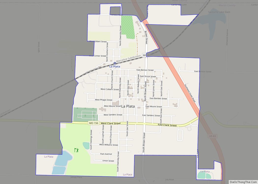
La Plata is a city in Macon County, Missouri, United States. The population was 1,257 at the 2020 census. La Plata is located next to the Adair County line and is on a mainline of the BNSF Railway. The town is best known for La Plata station, which provides passenger rail service to Chicago and Los Angeles.
| Name: | La Plata city |
|---|---|
| LSAD Code: | 25 |
| LSAD Description: | city (suffix) |
| State: | Missouri |
| County: | Macon County |
| Elevation: | 938 ft (286 m) |
| Total Area: | 1.59 sq mi (4.13 km²) |
| Land Area: | 1.59 sq mi (4.11 km²) |
| Water Area: | 0.01 sq mi (0.02 km²) |
| Total Population: | 1,257 |
| Population Density: | 791.56/sq mi (305.53/km²) |
| ZIP code: | 63549 |
| Area code: | 660 |
| FIPS code: | 2940682 |
| GNISfeature ID: | 2395569 |
| Website: | cityoflaplata.net |
Online Interactive Map
Click on ![]() to view map in "full screen" mode.
to view map in "full screen" mode.
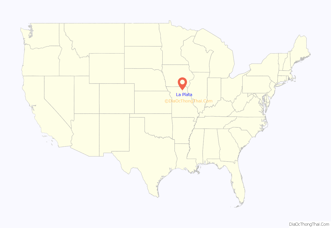
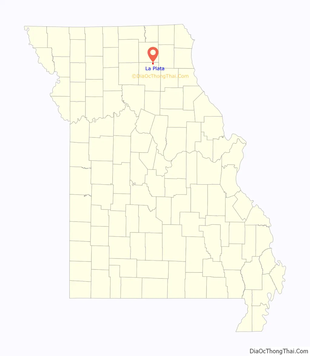
La Plata location map. Where is La Plata city?
History
The beginnings of La Plata can be traced back to March 17, 1827 when Drury Davis established a trading post near the town’s current location. The ensuing few years saw Davis joined by family and friends to create a small village that included a blacksmith shop, an inn, and stagecoach station.
La Plata was platted in 1855. It was named after the city of La Plata, in Argentina. The name is of Spanish origin meaning “silver”. Two men, Louis Gex and Thomas Saunders, were the primary force behind the town’s platting, and drew straws to choose the community’s name. Saunders wanted to name the town Charlottesville to honor a favorite sister, while Gex pushed for the name La Plata. Gex won out and the town is believed to have been first incorporated on September 29, 1856. Another of the early settlers who helped in creating the town was W. W. Moore, who erected La Plata’s first hotel. The North Missouri (later known as the Wabash Railroad) came to town in 1867, and the Santa Fe Railroad twenty years later, passing through La Plata on its route from Chicago to Kansas City. The combination of the two railroads made La Plata an ideal shipping point for timber, livestock, grains, and other goods for northern Macon County and southern portions of neighboring Adair County as well. As part of this growth, the town was incorporated as a fourth-class city on April 4, 1881 with Jacob Gilstrap serving as first mayor. La Plata’s first major industry, a creamery, was established in 1883. The facility had the capacity to produce up to 1.25 tons of butter per day. However, fire destroyed the creamery and it was never rebuilt. Other light agriculture-related industry has existed in the town over the years, including a large chicken hatchery and turkey hatchery. Two major oil pipelines pass through La Plata as well, the Prairie Pipeline being the first in 1912. A “tank farm” of large storage tanks was located for many years on the city’s northern edge. The Wabash railroad through La Plata was abandoned after it was merged in 1991 with the Norfolk and Western Railway, but the Amtrak station is still in operation on the Burlington Northern Santa Fe rail system, and the town is served by the Southwest Chief. A small but active business community still exists in the town.
The first school, named Long Branch for a nearby creek, was established in 1868. It was replaced, in 1872, by a five-room brick schoolhouse. Today, children of La Plata and the surrounding rural area are educated by the La Plata R-2 school district.
The Lester and Norma Dent House, John T. and Mary M. Doneghy House, Gilbreath-McLorn House, and La Plata Square Historic District are listed on the National Register of Historic Places.
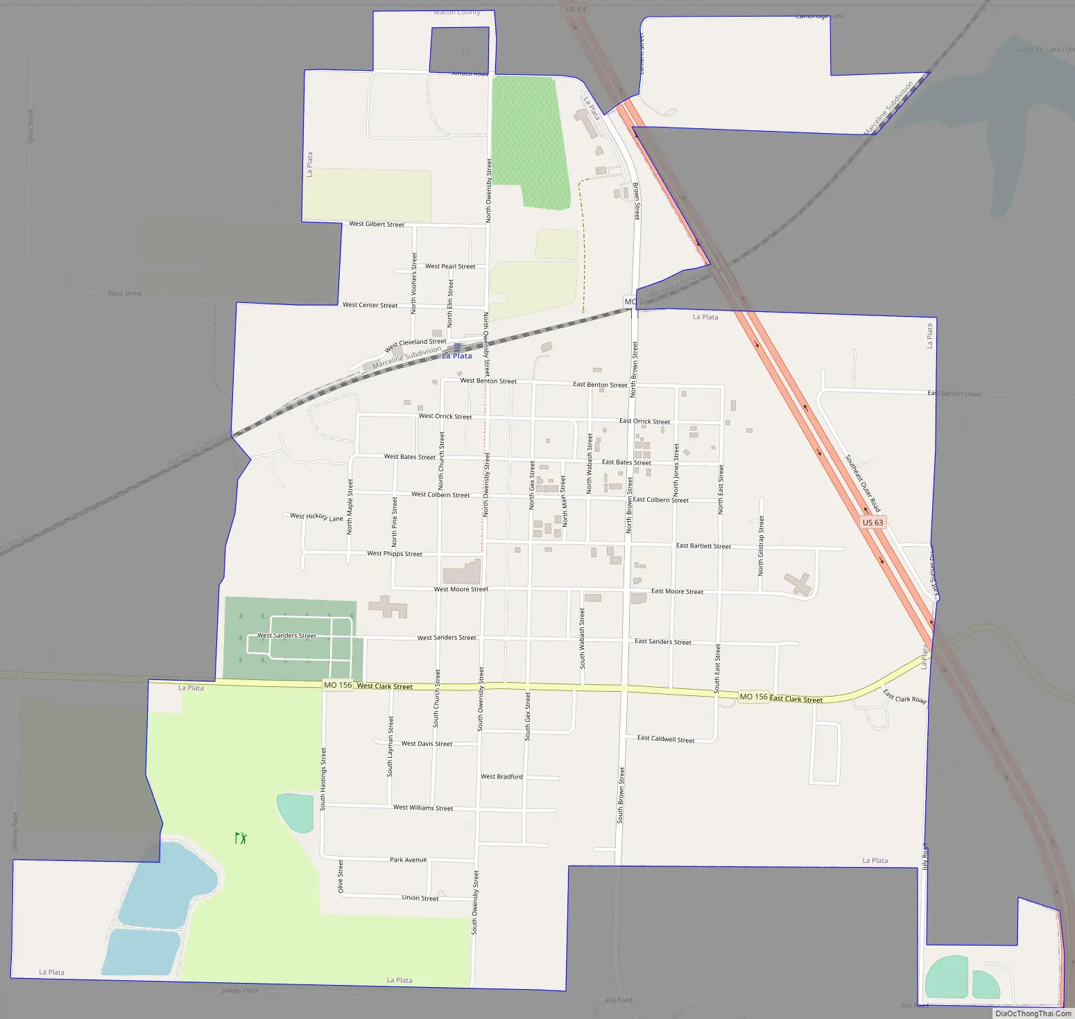
La Plata Road Map
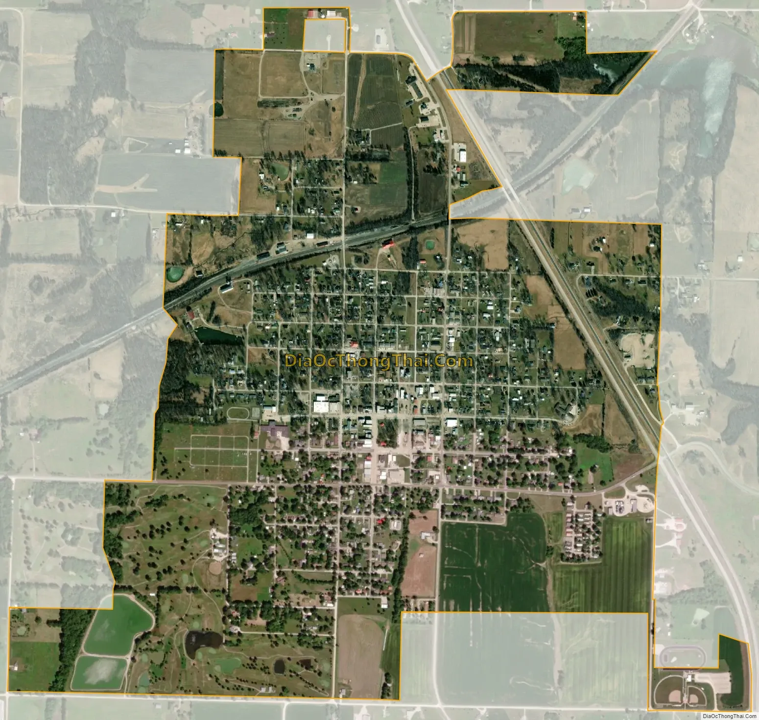
La Plata city Satellite Map
Geography
According to the United States Census Bureau, the city has a total area of 1.60 square miles (4.14 km), of which 1.59 square miles (4.12 km) is land and 0.01 square miles (0.03 km) is water.
See also
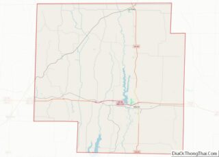
Map of Missouri State and its subdivision:- Adair
- Andrew
- Atchison
- Audrain
- Barry
- Barton
- Bates
- Benton
- Bollinger
- Boone
- Buchanan
- Butler
- Caldwell
- Callaway
- Camden
- Cape Girardeau
- Carroll
- Carter
- Cass
- Cedar
- Chariton
- Christian
- Clark
- Clay
- Clinton
- Cole
- Cooper
- Crawford
- Dade
- Dallas
- Daviess
- De Kalb
- Dent
- Douglas
- Dunklin
- Franklin
- Gasconade
- Gentry
- Greene
- Grundy
- Harrison
- Henry
- Hickory
- Holt
- Howard
- Howell
- Iron
- Jackson
- Jasper
- Jefferson
- Johnson
- Knox
- Laclede
- Lafayette
- Lawrence
- Lewis
- Lincoln
- Linn
- Livingston
- Macon
- Madison
- Maries
- Marion
- McDonald
- Mercer
- Miller
- Mississippi
- Moniteau
- Monroe
- Montgomery
- Morgan
- New Madrid
- Newton
- Nodaway
- Oregon
- Osage
- Ozark
- Pemiscot
- Perry
- Pettis
- Phelps
- Pike
- Platte
- Polk
- Pulaski
- Putnam
- Ralls
- Randolph
- Ray
- Reynolds
- Ripley
- Saint Charles
- Saint Clair
- Saint Francois
- Saint Louis
- Sainte Genevieve
- Saline
- Schuyler
- Scotland
- Scott
- Shannon
- Shelby
- Stoddard
- Stone
- Sullivan
- Taney
- Texas
- Vernon
- Warren
- Washington
- Wayne
- Webster
- Worth
- Wright
- Alabama
- Alaska
- Arizona
- Arkansas
- California
- Colorado
- Connecticut
- Delaware
- District of Columbia
- Florida
- Georgia
- Hawaii
- Idaho
- Illinois
- Indiana
- Iowa
- Kansas
- Kentucky
- Louisiana
- Maine
- Maryland
- Massachusetts
- Michigan
- Minnesota
- Mississippi
- Missouri
- Montana
- Nebraska
- Nevada
- New Hampshire
- New Jersey
- New Mexico
- New York
- North Carolina
- North Dakota
- Ohio
- Oklahoma
- Oregon
- Pennsylvania
- Rhode Island
- South Carolina
- South Dakota
- Tennessee
- Texas
- Utah
- Vermont
- Virginia
- Washington
- West Virginia
- Wisconsin
- Wyoming