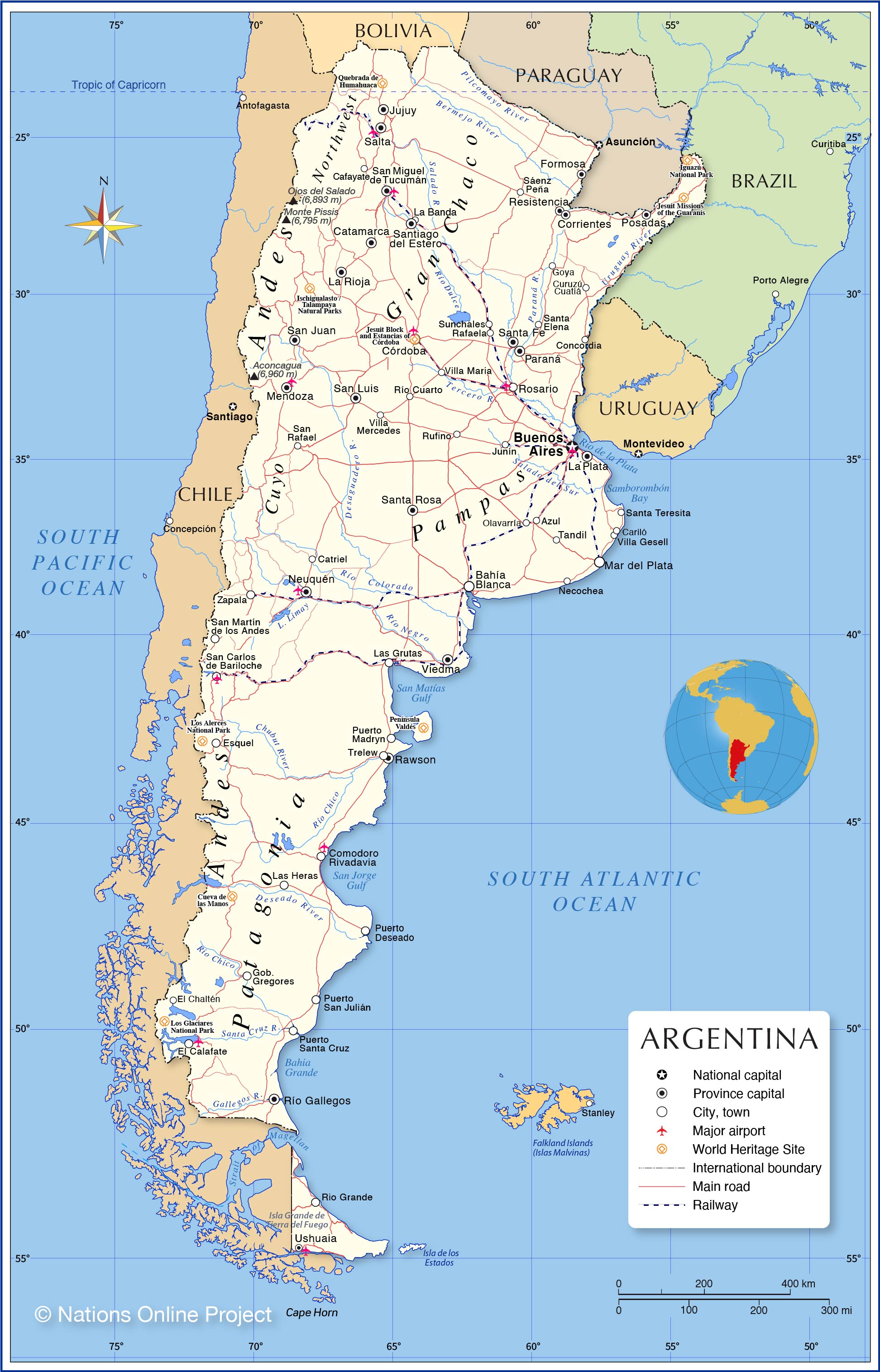
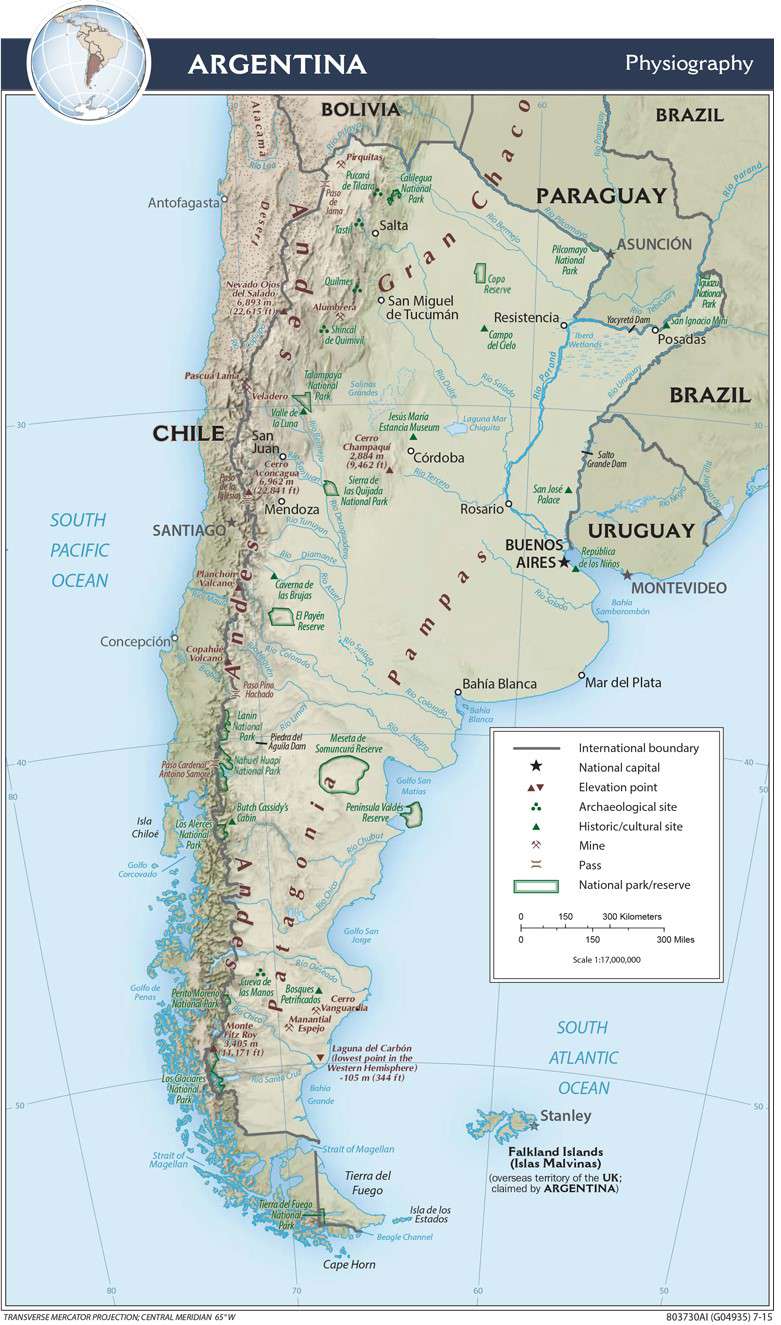
Argentina is a country located in the southern part of South America. Covering an area of 2,780,400 sq.km (1,073,500 sq mi), Argentina is the world’s 8th largest country, the 2nd largest country in South America, and the 4th largest country in the Americas. The geography of Argentina include 5 major regions, starting with the rainforest area of the far-northeast along its border with Brazil; the swampy and flat Chaco plain; the fertile (almost treeless) grasslands of the Central Pampas; the lengthy plateau of Patagonia that stretches to Tierra del Fuego; and the Andes Mountains along its western border with Chile.
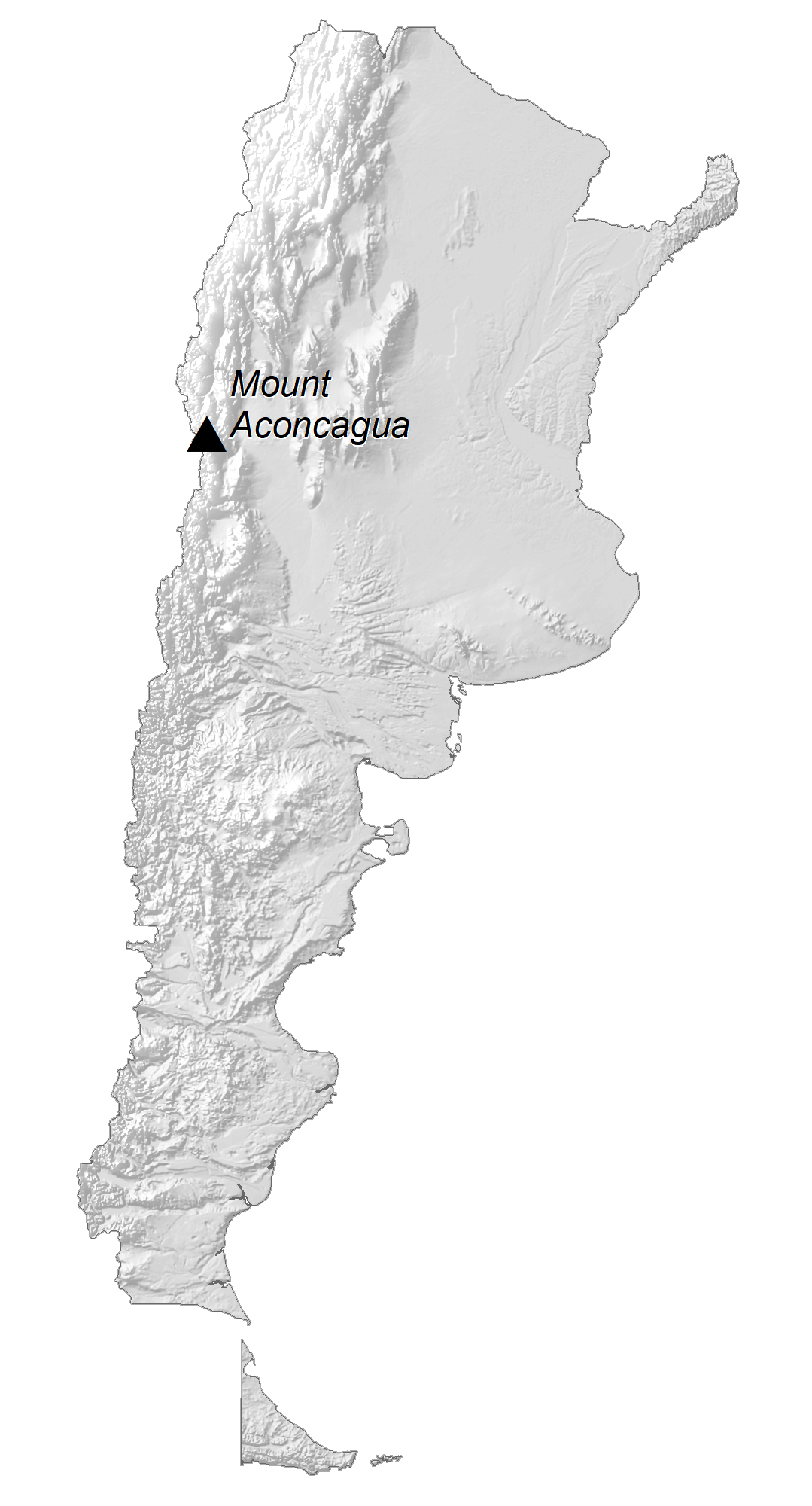
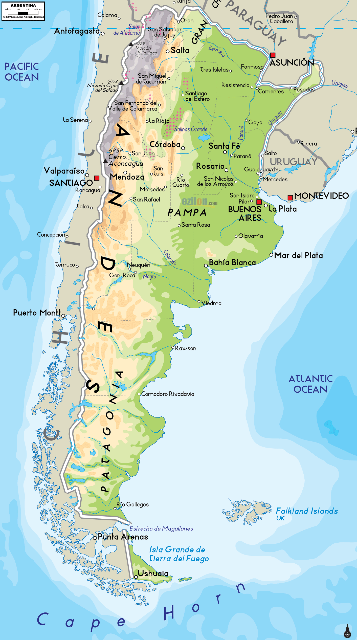
As observed on the physical map of Argentina above, the Pampas, one of the largest fertile plains in the world, covers almost one-third of Argentina’s land area.
Bordered by mountains and the Atlantic Ocean, the legendary landscape of Patagonia displays huge forests, sizeable mountains, valleys, and many cold-water lakes. The Andes Mountains in Argentina contain advancing glaciers including the Perito Moreno glacier, as well as “Cerro Aconcagua” – at 22,831ft (6,959m) is the tallest mountain in South America and in the Southern and Western hemispheres [as marked on the map as a yellow upright triangle]. The lowest point in Argentina as well as the Southern and Western hemispheres is Laguna del Carbon at -344ft (-105m), below the sea level. An inverted yellow triangle marks this extreme point on the physical map.
Argentina is also home to impressive Iguazu Falls, and over 250 additional waterfalls of size. Major rivers include the Colorado, Negro, Paraguay, Parana, Salado and Uruguay. The Uruguay and Parana flow together before meeting the Atlantic Ocean forming the basin of the Rio de la Plata.
| Flag: |  |
|---|---|
| Legal Name: | Argentine Republic |
| Capital Value: | Buenos Aires |
| Official languages: | Spanish |
| Demonym(s): |
|
| Government: | Federal presidential constitutional republic |
| Legislature: | National Congress |
| Total Area: | 2,780,400 km² |
| Land Area: | 2,736,690 km² |
| Water Area: | 43,710 km² |
| Population: | 44,938,712 |
| Density: | 14.4/km (37.3/sq mi) (214th) |
| GDP: | $449.66 Billion |
| GDP Per Capita: | $10,006.15 |
| Currency Value: | Argentine pesos (ARS) |
| Driving side: | right |
| Calling code: | +54 |
| Internet TLD: | .ar |
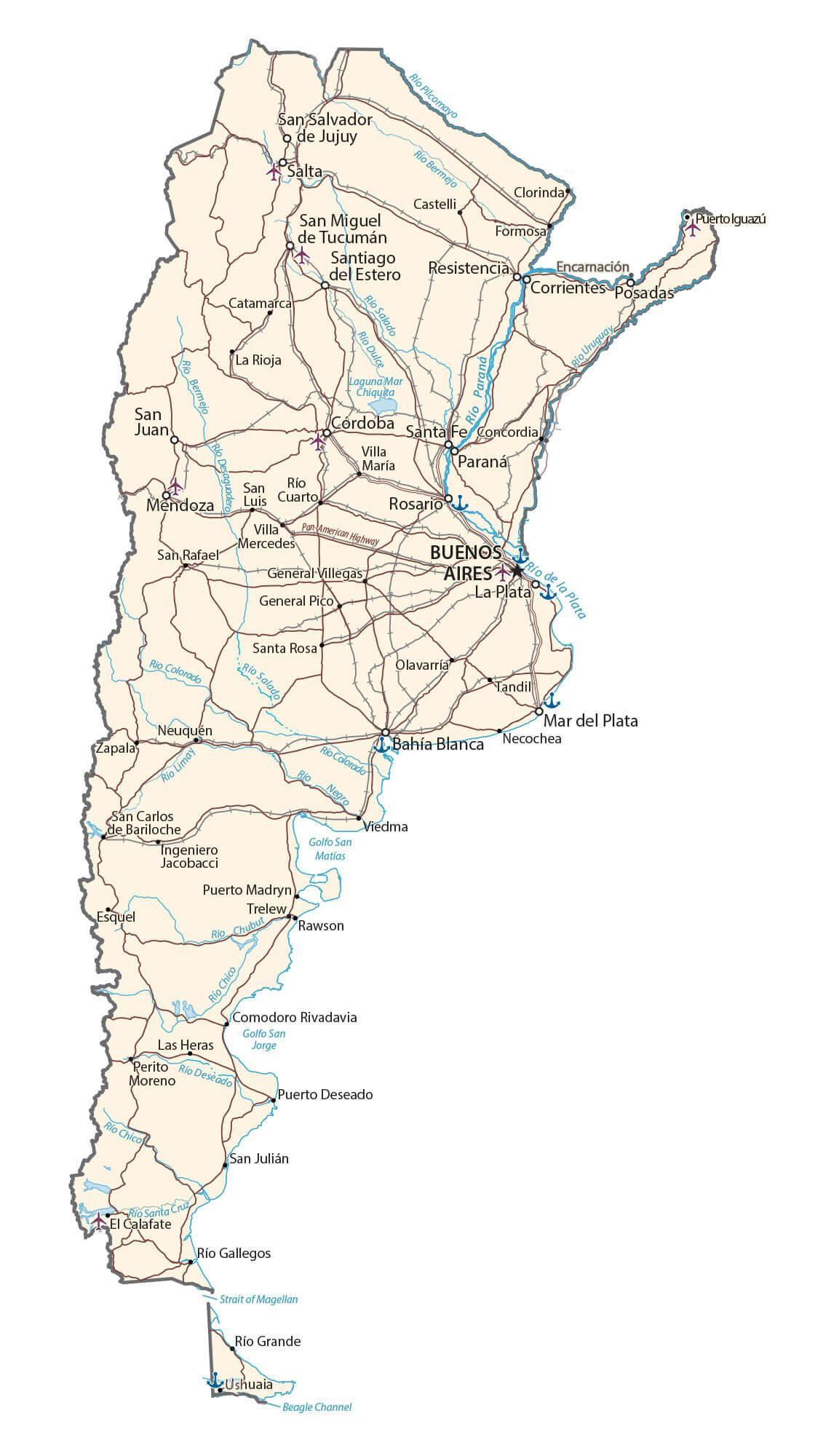
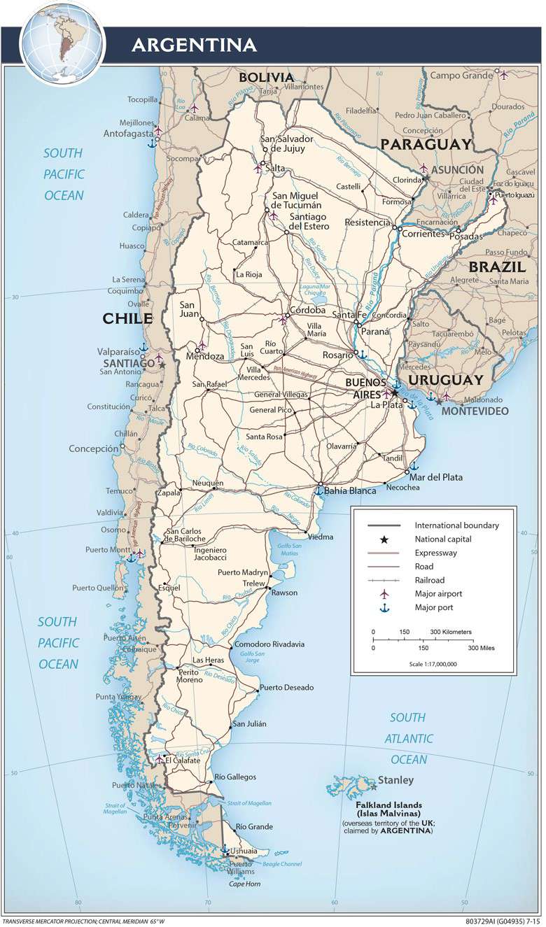
Explore Argentina with this detailed map. Discover its major cities, highways, roads, lakes, and rivers. See the elevation and satellite map with reference features like the Patagonian Desert, Gran Chaco, and Pampas. Get to know the diverse geography of Argentina today!
Online Interactive Political Map
Click on ![]() to view map in "full screen" mode.
to view map in "full screen" mode.
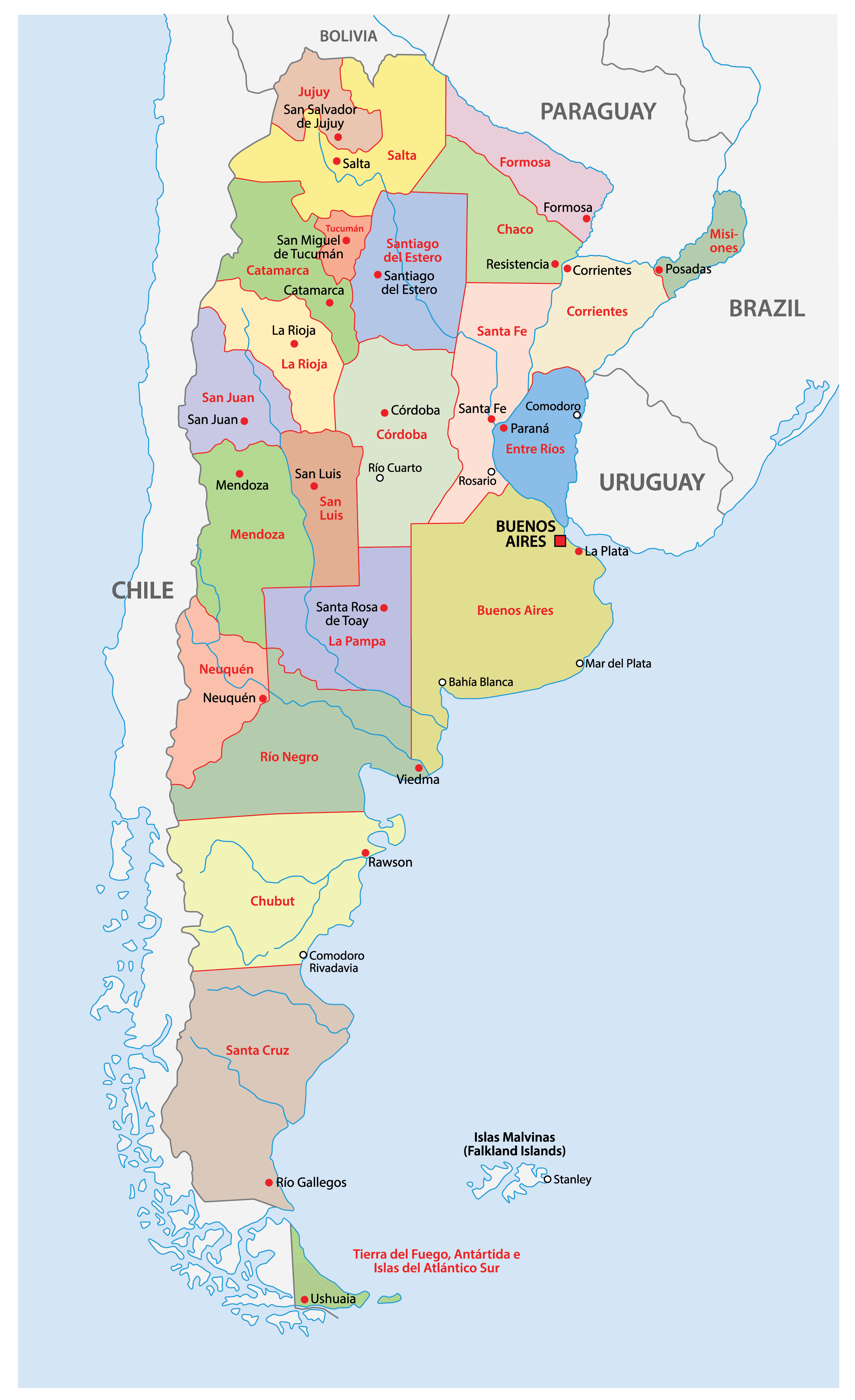
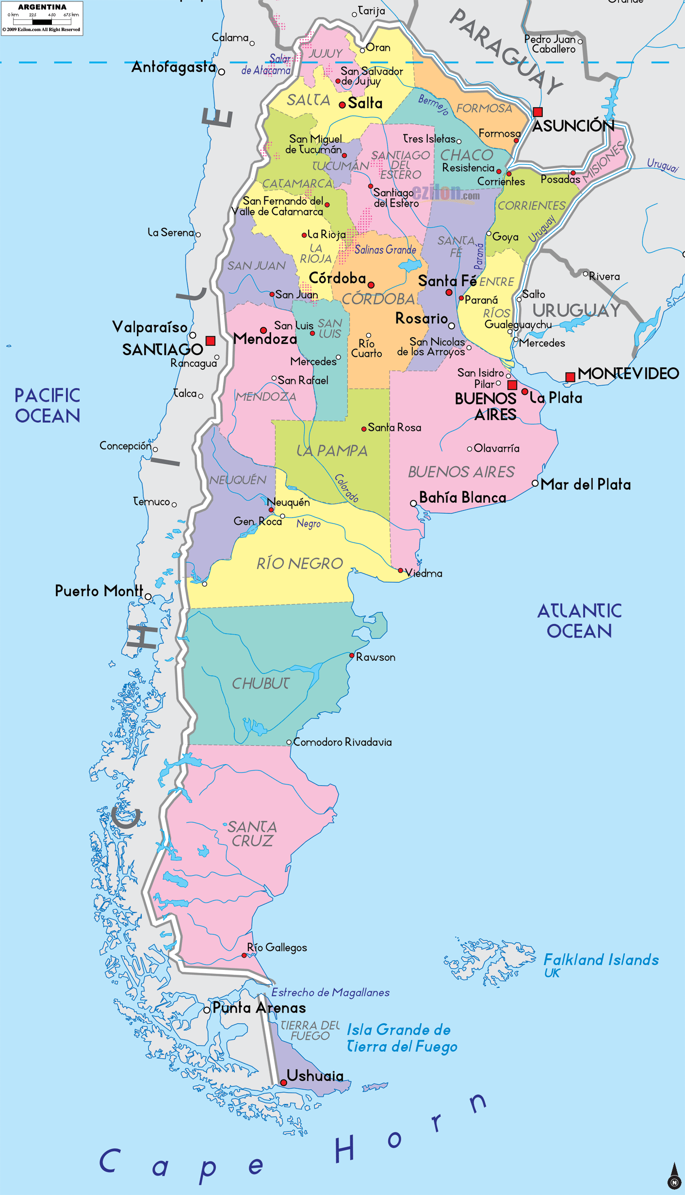
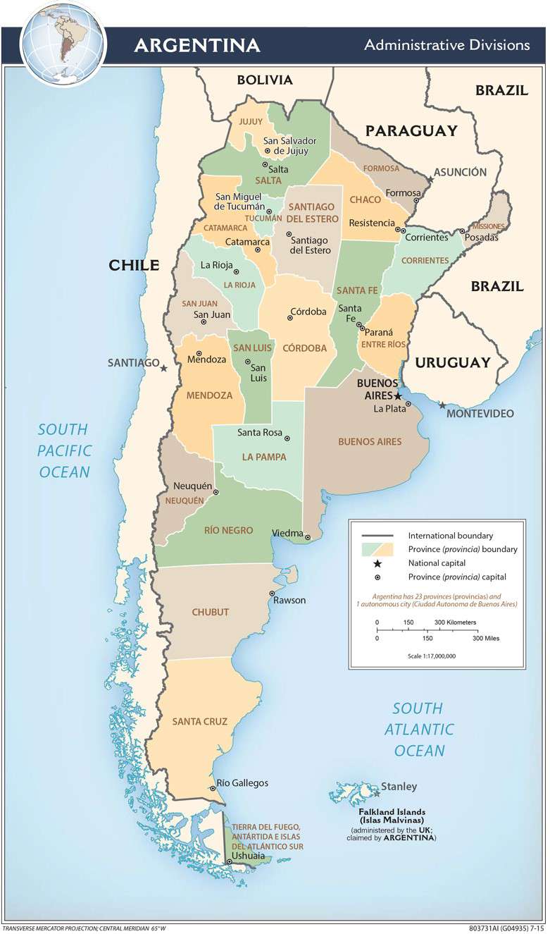
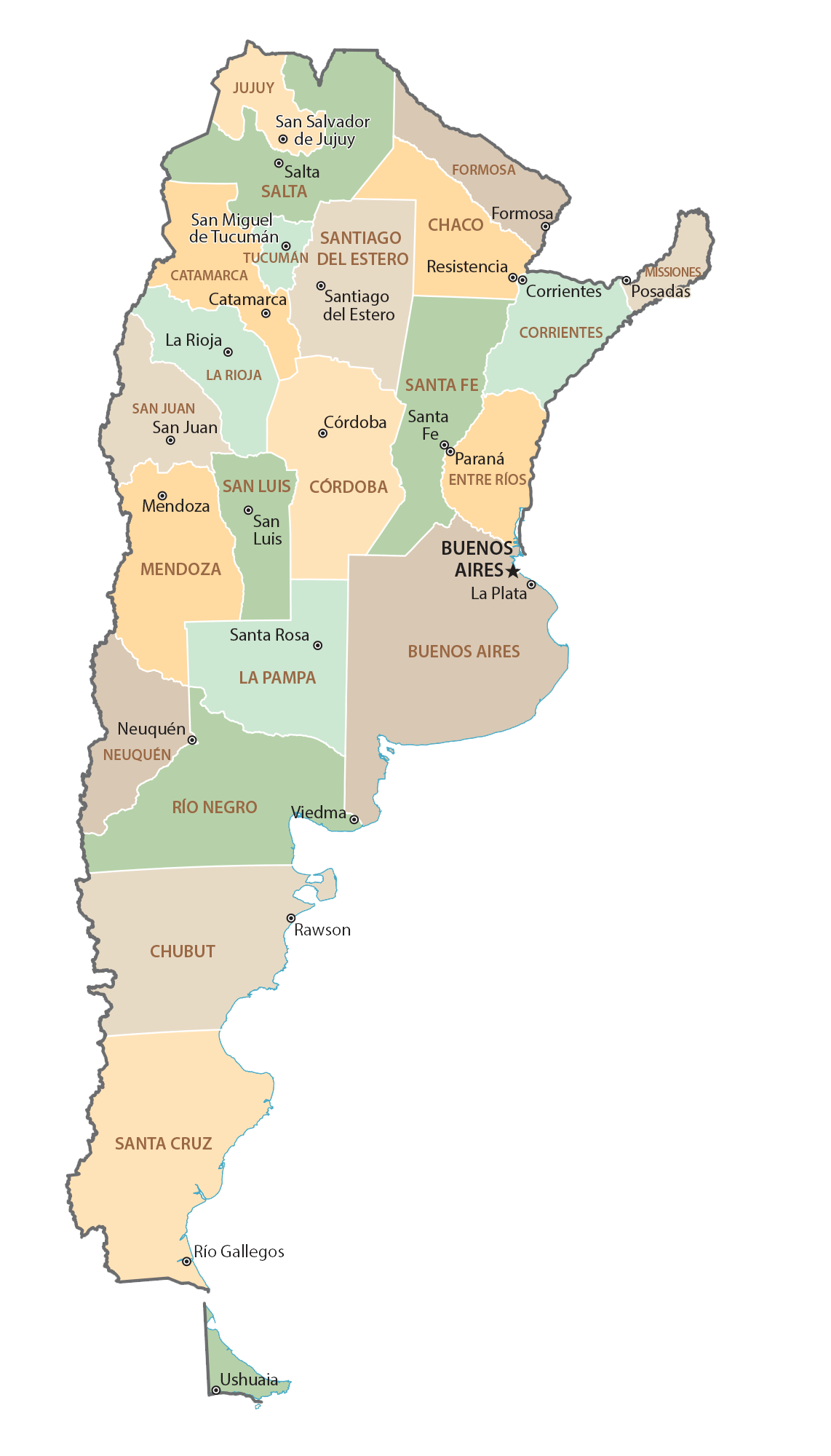
Argentina (officially, the Argentine Republic) is administratively divided into 23 provinces (provincias, sing. provincia) and 1 autonomous city. In alphabetical order, the provinces are: Buenos Aires, Catamarca, Chaco, Chubut, Cordoba, Corrientes, Entre Rios, Formosa, Jujuy, La Pampa, La Rioja, Mendoza, Misiones, Neuquen, Rio Negro, Salta, San Juan, San Luis, Santa Cruz, Santa Fe, Santiago del Estero, Tierra del Fuego – Antartida e Islas del Atlantico Sur (Tierra del Fuego – Antarctica and the South Atlantic Islands) and Tucuman. Ciudad Autonoma de Buenos Aires is an autonomous city of Argentina. These provinces are further subdivided into 378 departments and municipalities. The Buenos Aires province is subdivided into 135 partidos; while the autonomous city of Buenos Aires is subdivided into 15 communes.
Covering an area of 2,780,400 sq. km, Argentina is the 8th largest country in the world and the 2nd largest country in South America. It is also the 4th largest country in America and the largest Spanish-speaking country. Located along the western shore of Rio de La Plata estuary, on the southeastern shore of South America is, Buenos Aires – the national capital, the largest and the most populous city of Argentina. It is also the 4th largest city in the Western hemisphere and one of the most important ports in Latin America. Buenos Aires is the administrative, cultural, technological, industrial and commercial center of Argentina.
Location Maps
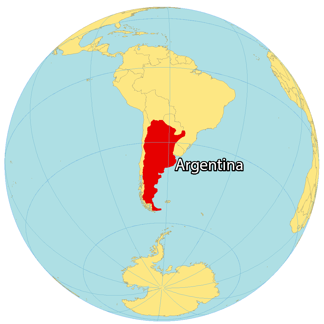
Where is Argentina?
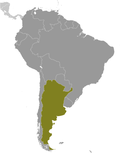
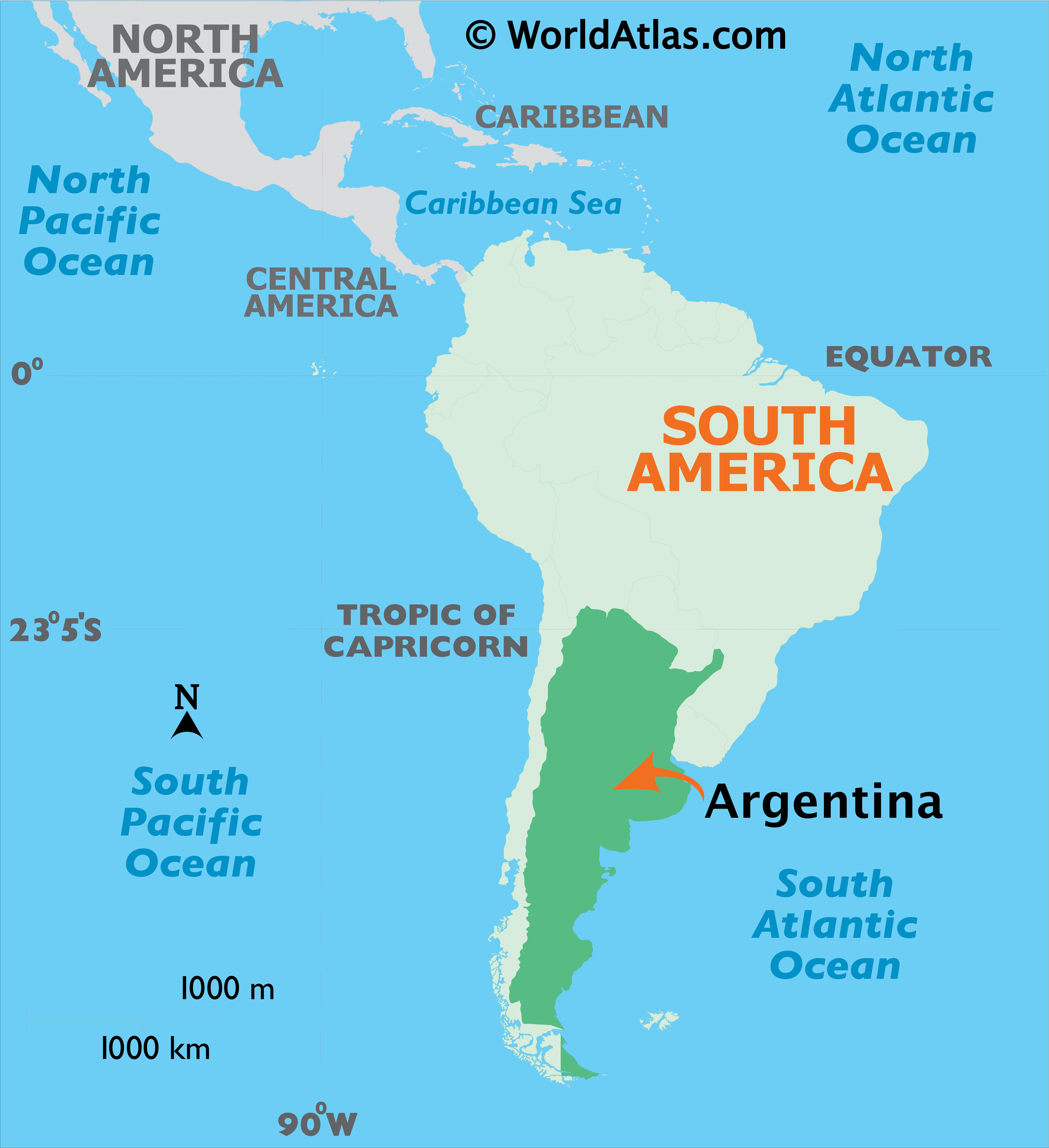
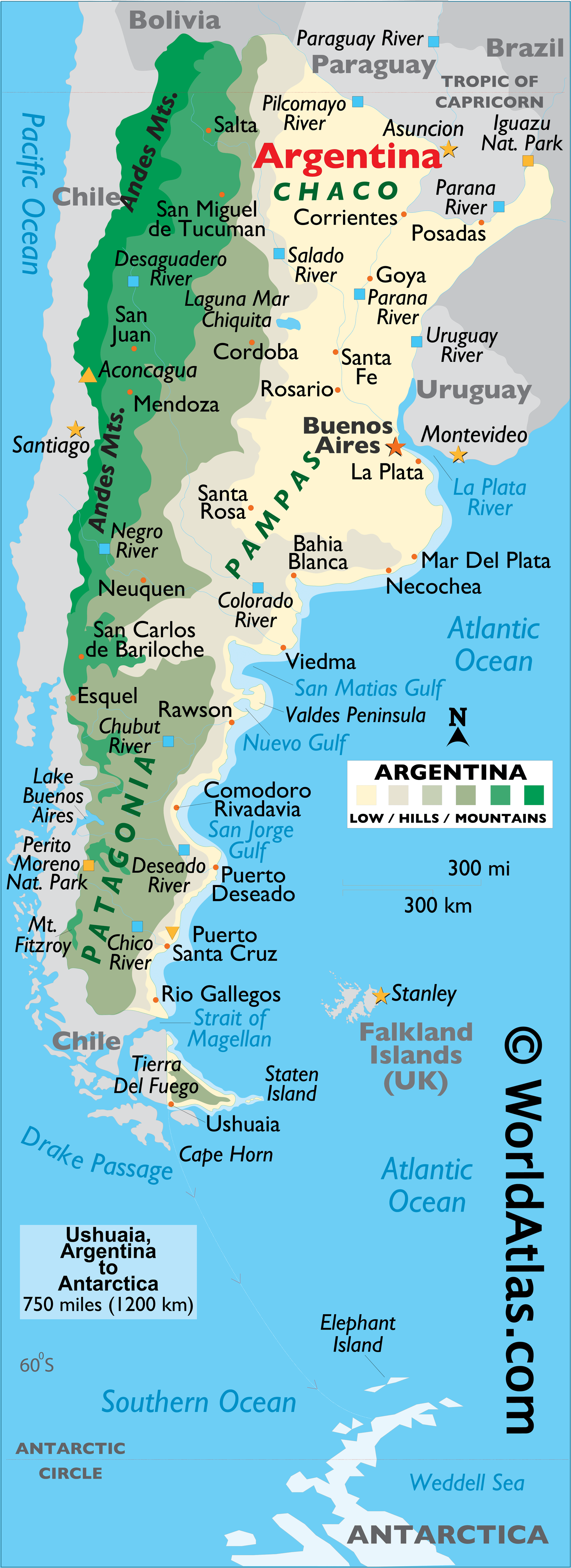
Argentina is located in South America, along the South Atlantic Ocean. It is the continent’s second-largest country, after Brazil, and covers much of the southern portion of the continent. Argentina is bordered by Paraguay, Brazil, Chile, Uruguay and Bolivia. The border between Argentina and Chile is the longest international border in South America, and the third-longest in the world. The border between Argentina and Brazil is the Iguazu River, which includes the stunning Iguazu Falls.
High Definition Political Map of Argentina
Argentina Administrative Map
Physical Map of Argentina
Transportation Map of Argentina
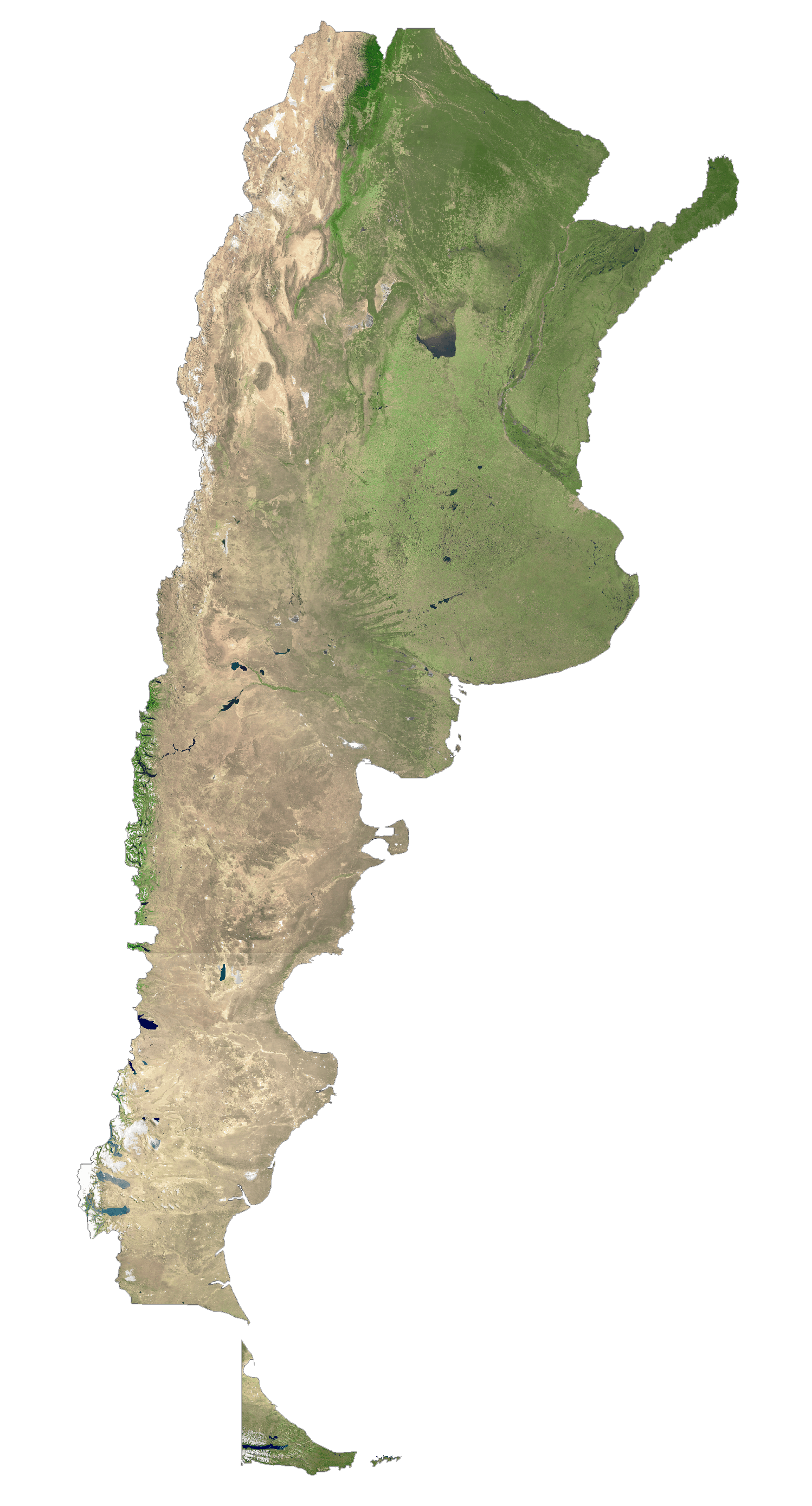
Argentina Satellite Map
Elevation Map