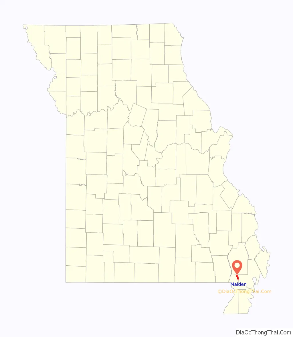
Malden is a city in the northeast corner of Dunklin County, Missouri, United States, located near the intersection of Missouri Route 25 and U.S. Route 62. The population was 4,277 at the 2010 census. Malden is within Missouri’s 8th congressional district.
| Name: | Malden city |
|---|---|
| LSAD Code: | 25 |
| LSAD Description: | city (suffix) |
| State: | Missouri |
| County: | Dunklin County |
| Elevation: | 295 ft (90 m) |
| Total Area: | 8.32 sq mi (21.55 km²) |
| Land Area: | 8.32 sq mi (21.55 km²) |
| Water Area: | 0.00 sq mi (0.00 km²) |
| Total Population: | 3,706 |
| Population Density: | 445.38/sq mi (171.97/km²) |
| ZIP code: | 63863 |
| Area code: | 573 |
| FIPS code: | 2945614 |
| GNISfeature ID: | 2395822 |
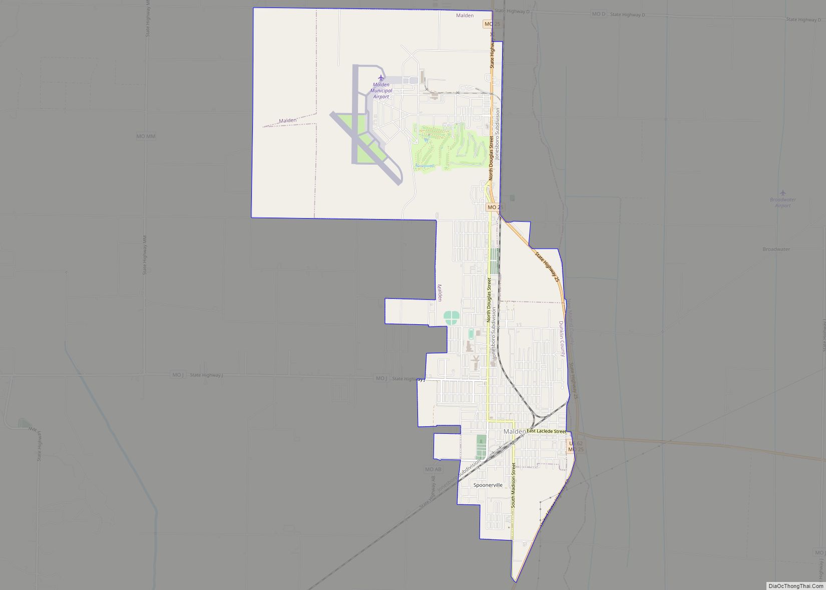
Online Interactive Map
Click on ![]() to view map in "full screen" mode.
to view map in "full screen" mode.
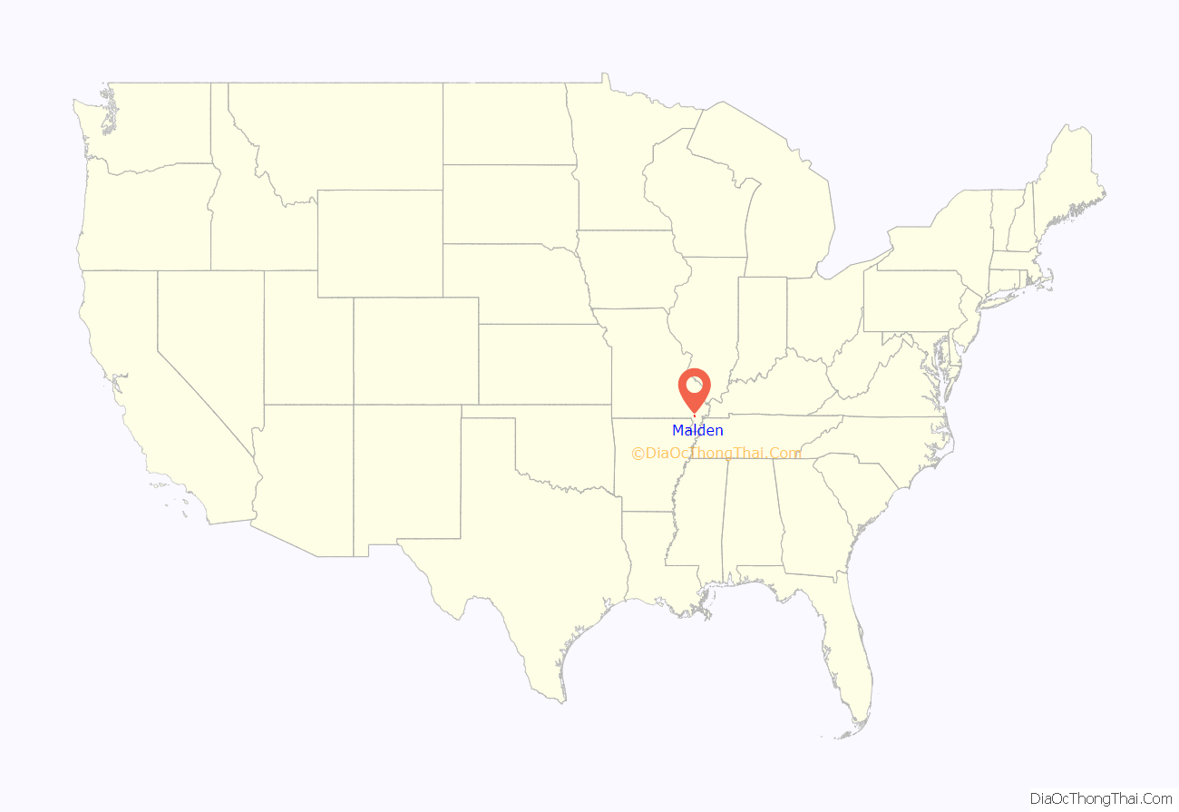
Malden location map. Where is Malden city?
History
Malden was platted in 1877 by a railroad official. Some say the community has the name of Colonel T. H. Mauldin, a county judge, while others believe the name is a transfer from Malden, Massachusetts. A post office called Malden has been in operation since 1877.
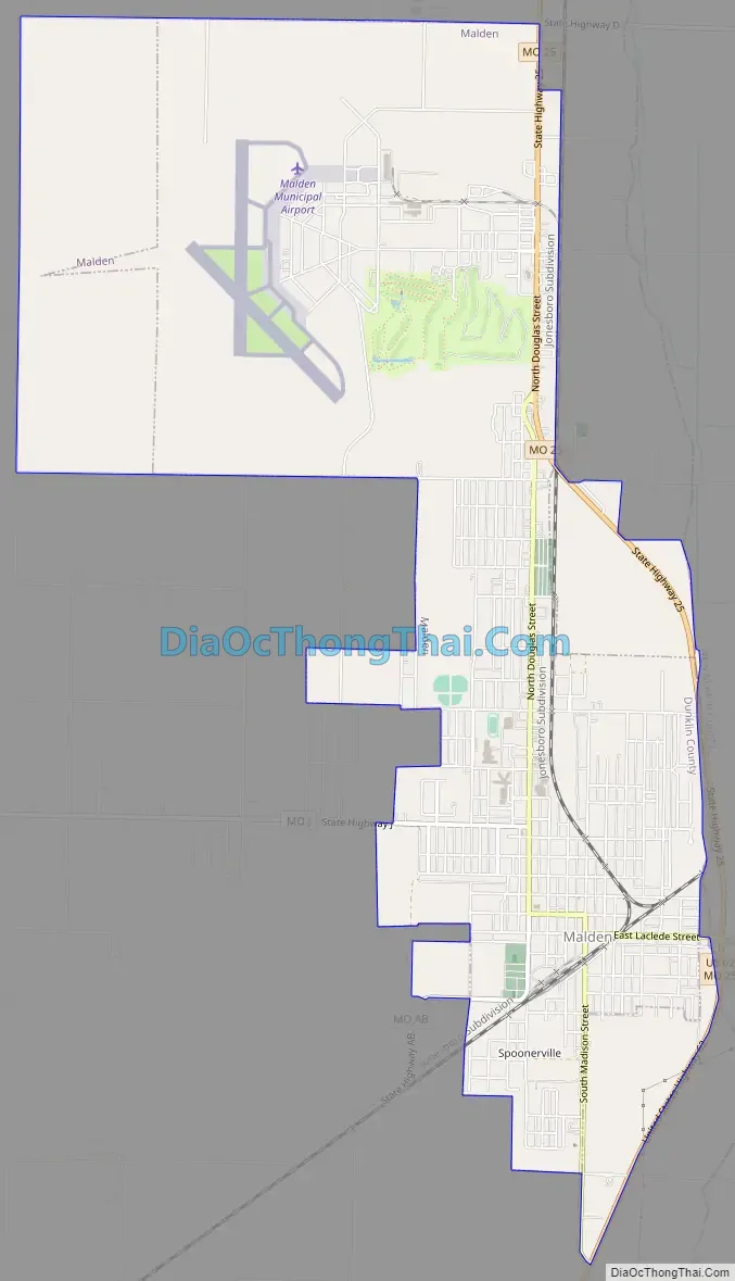
Malden Road Map
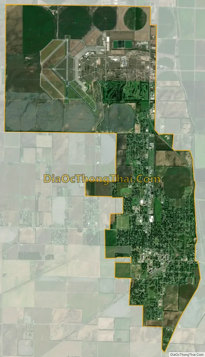
Malden city Satellite Map
Geography
Malden is located in the Missouri Bootheel and the New Madrid Seismic Zone, approximately 23 miles (37 km) west of New Madrid and the Mississippi River meander around the Kentucky Bend.
Malden is located along the Crowley’s Ridge Parkway.
According to the United States Census Bureau, the city has a total area of 7.53 square miles (19.50 km), all land.
See also
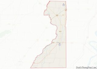
Map of Missouri State and its subdivision:- Adair
- Andrew
- Atchison
- Audrain
- Barry
- Barton
- Bates
- Benton
- Bollinger
- Boone
- Buchanan
- Butler
- Caldwell
- Callaway
- Camden
- Cape Girardeau
- Carroll
- Carter
- Cass
- Cedar
- Chariton
- Christian
- Clark
- Clay
- Clinton
- Cole
- Cooper
- Crawford
- Dade
- Dallas
- Daviess
- De Kalb
- Dent
- Douglas
- Dunklin
- Franklin
- Gasconade
- Gentry
- Greene
- Grundy
- Harrison
- Henry
- Hickory
- Holt
- Howard
- Howell
- Iron
- Jackson
- Jasper
- Jefferson
- Johnson
- Knox
- Laclede
- Lafayette
- Lawrence
- Lewis
- Lincoln
- Linn
- Livingston
- Macon
- Madison
- Maries
- Marion
- McDonald
- Mercer
- Miller
- Mississippi
- Moniteau
- Monroe
- Montgomery
- Morgan
- New Madrid
- Newton
- Nodaway
- Oregon
- Osage
- Ozark
- Pemiscot
- Perry
- Pettis
- Phelps
- Pike
- Platte
- Polk
- Pulaski
- Putnam
- Ralls
- Randolph
- Ray
- Reynolds
- Ripley
- Saint Charles
- Saint Clair
- Saint Francois
- Saint Louis
- Sainte Genevieve
- Saline
- Schuyler
- Scotland
- Scott
- Shannon
- Shelby
- Stoddard
- Stone
- Sullivan
- Taney
- Texas
- Vernon
- Warren
- Washington
- Wayne
- Webster
- Worth
- Wright
- Alabama
- Alaska
- Arizona
- Arkansas
- California
- Colorado
- Connecticut
- Delaware
- District of Columbia
- Florida
- Georgia
- Hawaii
- Idaho
- Illinois
- Indiana
- Iowa
- Kansas
- Kentucky
- Louisiana
- Maine
- Maryland
- Massachusetts
- Michigan
- Minnesota
- Mississippi
- Missouri
- Montana
- Nebraska
- Nevada
- New Hampshire
- New Jersey
- New Mexico
- New York
- North Carolina
- North Dakota
- Ohio
- Oklahoma
- Oregon
- Pennsylvania
- Rhode Island
- South Carolina
- South Dakota
- Tennessee
- Texas
- Utah
- Vermont
- Virginia
- Washington
- West Virginia
- Wisconsin
- Wyoming