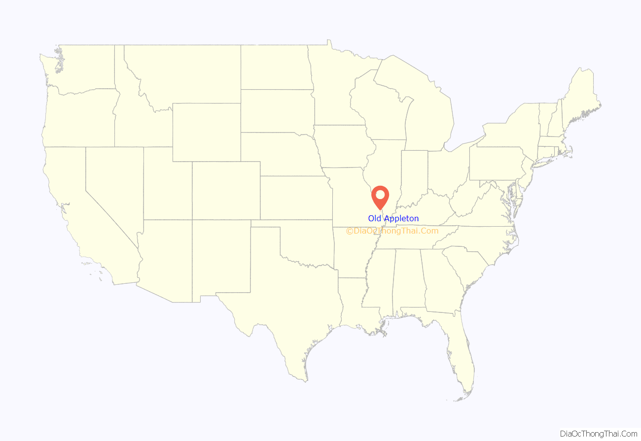
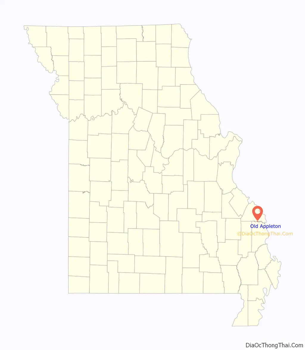
Old Appleton is a village in Cape Girardeau County, Missouri, United States. The population was 73 at the 2020 census. It is part of the Cape Girardeau–Jackson, MO-IL Metropolitan Statistical Area.
| Name: | Old Appleton town |
|---|---|
| LSAD Code: | 43 |
| LSAD Description: | town (suffix) |
| State: | Missouri |
| County: | Cape Girardeau County |
| Elevation: | 410 ft (120 m) |
| Total Area: | 0.12 sq mi (0.31 km²) |
| Land Area: | 0.12 sq mi (0.31 km²) |
| Water Area: | 0.00 sq mi (0.00 km²) |
| Total Population: | 73 |
| Population Density: | 603.31/sq mi (233.49/km²) |
| ZIP code: | 63770 |
| Area code: | 573 |
| FIPS code: | 2954200 |
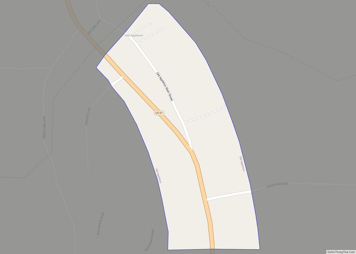
Online Interactive Map
Click on ![]() to view map in "full screen" mode.
to view map in "full screen" mode.
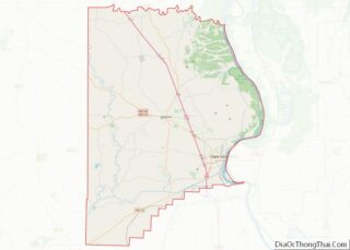
Old Appleton location map. Where is Old Appleton town?
History
Although it is not known who the original native inhabitants were of the Old Appleton area, the area eventually become home to the Shawnee and Delaware Indians. Having originated in present-day Delaware and Pennsylvania, the Shawnee and Delaware Indians had been pushed off their lands by white settlement. In the 1780s, Pierre Louis Lorimier, a French Canadian who had worked as an Indian-interpreter for the British, found it in his best interest to leave the American states. He settled Cape Girardeau in the Ste. Genevieve District with his wife, who was of mixed French and Shawnee ancestry. Lorimier was subsequently made the Indian Agent by the Spanish colonial authorities. Like Lorimier, the Shawnee and Delaware Indians had sided with the British, and found themselves in an unsavory situation. Lorimier appealed for land grants from the Spanish authorities for the settlement of Shawnee and Delaware Indians from American territory.
The Spanish granted Lorimier two large tracts of land in the Apple creek watershed, with the intention of the Shawnee and Delaware acting as a buffer against the Osage Indians, who were not on friendly terms with the Spanish authorities. Lorimer then convinced 1,200 Shawnee and 600 Delaware to relocate to the Apple Creek watershed, and in 1784 the group of Shawnee and Delaware migrated and settled down in the area of Old Appleton. The “Le Grand Village Sauvage” was to the west of present-day Old Appleton and the “Petit Village Sauvage” was to the east of Old Appleton. The Shawnee and Delaware villages had a significant amount of racial mixing with the French, and were said to have as much French ancestry as the French had Indian ancestry. Culturally, the Shawnee and Delaware had largely adopted French and American ways and lifestyles, and had built granaries and barns for the storing of their crops and housing of their cattle and horses. The Shawnee and Delaware built their log homes in the French fashion with posts set together and interstices filled with clay, with wood shingled roofs.
In the early 1800s American settlers began encroaching on the Shawnee and Delaware lands around Apple Creek. In 1807 the Shawnee requested protection from the Osage. Although the Americans had agreed to honor Spanish treaties and articles made with local tribes, the treaties were eventually ignored. In 1809, harassment and stealing by American settlers eventually drove the Shawnee and Delaware to visit the territorial governor Meriwether Lewis and pressed their “long-expressed wish” to exchange of their lands in the Apple Creek watershed with lands farther west. The Shawnee and Delaware stayed, but by 1815 the situation had worsened so much that territorial governor William Clark and US president Madison ordered all white intruders removed from Shawnee and Delaware lands. However, this order was largely ignored by the authorities. By 1816, the encroachment by white settlers left the US Federal Government no choice but to relocate the Shawnee and Delaware to lands further west.
In 1824, John McClain and John Schatz established a settlement on Apple Creek known as “Apple Creek”. By the time the post office was established in 1876 the town had become known as Appleton.
Old Appleton was also home to several breweries, among them “The Old Appleton Brewery”, until prohibition forced their closures.
In 1982, a flood on Apple creek destroyed McClain Mill and Old Appleton’s original bridge. The historic bridge was restored in 2006. The Old Appleton Bridge was listed on the National Register of Historic Places in 2009.
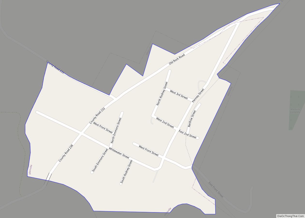
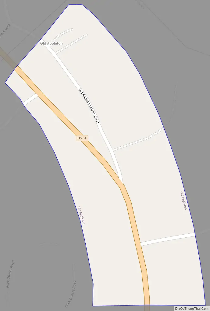
Old Appleton Road Map
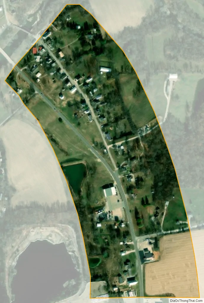
Old Appleton city Satellite Map
Geography
Old Appleton is located on the south bank of the Apple Creek and the northern border of Cape Girardeau County. Missouri Route 61 passes along the west side of the village. Uniontown lies just over one mile to the north along Route 61 in adjacent Perry County.
According to the United States Census Bureau, the village has a total area of 0.12 square miles (0.31 km), all land. The town lies on Apple Creek which forms the southern border of Perry County and the northern border of Cape Girardeau County.
See also
Map of Missouri State and its subdivision:- Adair
- Andrew
- Atchison
- Audrain
- Barry
- Barton
- Bates
- Benton
- Bollinger
- Boone
- Buchanan
- Butler
- Caldwell
- Callaway
- Camden
- Cape Girardeau
- Carroll
- Carter
- Cass
- Cedar
- Chariton
- Christian
- Clark
- Clay
- Clinton
- Cole
- Cooper
- Crawford
- Dade
- Dallas
- Daviess
- De Kalb
- Dent
- Douglas
- Dunklin
- Franklin
- Gasconade
- Gentry
- Greene
- Grundy
- Harrison
- Henry
- Hickory
- Holt
- Howard
- Howell
- Iron
- Jackson
- Jasper
- Jefferson
- Johnson
- Knox
- Laclede
- Lafayette
- Lawrence
- Lewis
- Lincoln
- Linn
- Livingston
- Macon
- Madison
- Maries
- Marion
- McDonald
- Mercer
- Miller
- Mississippi
- Moniteau
- Monroe
- Montgomery
- Morgan
- New Madrid
- Newton
- Nodaway
- Oregon
- Osage
- Ozark
- Pemiscot
- Perry
- Pettis
- Phelps
- Pike
- Platte
- Polk
- Pulaski
- Putnam
- Ralls
- Randolph
- Ray
- Reynolds
- Ripley
- Saint Charles
- Saint Clair
- Saint Francois
- Saint Louis
- Sainte Genevieve
- Saline
- Schuyler
- Scotland
- Scott
- Shannon
- Shelby
- Stoddard
- Stone
- Sullivan
- Taney
- Texas
- Vernon
- Warren
- Washington
- Wayne
- Webster
- Worth
- Wright
- Alabama
- Alaska
- Arizona
- Arkansas
- California
- Colorado
- Connecticut
- Delaware
- District of Columbia
- Florida
- Georgia
- Hawaii
- Idaho
- Illinois
- Indiana
- Iowa
- Kansas
- Kentucky
- Louisiana
- Maine
- Maryland
- Massachusetts
- Michigan
- Minnesota
- Mississippi
- Missouri
- Montana
- Nebraska
- Nevada
- New Hampshire
- New Jersey
- New Mexico
- New York
- North Carolina
- North Dakota
- Ohio
- Oklahoma
- Oregon
- Pennsylvania
- Rhode Island
- South Carolina
- South Dakota
- Tennessee
- Texas
- Utah
- Vermont
- Virginia
- Washington
- West Virginia
- Wisconsin
- Wyoming