St. James is a city in Phelps County, Missouri, United States. The population was 4,216 at the 2010 census.
| Name: | St. James city |
|---|---|
| LSAD Code: | 25 |
| LSAD Description: | city (suffix) |
| State: | Missouri |
| County: | Phelps County |
| Elevation: | 1,066 ft (325 m) |
| Total Area: | 4.28 sq mi (11.09 km²) |
| Land Area: | 4.27 sq mi (11.07 km²) |
| Water Area: | 0.01 sq mi (0.02 km²) |
| Total Population: | 3,935 |
| Population Density: | 921.11/sq mi (355.61/km²) |
| FIPS code: | 2964424 |
| GNISfeature ID: | 2396494 |
| Website: | stjamesmissouri.org |
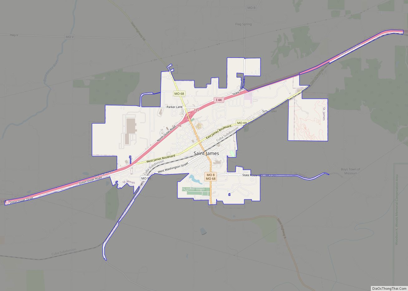
Online Interactive Map
Click on ![]() to view map in "full screen" mode.
to view map in "full screen" mode.
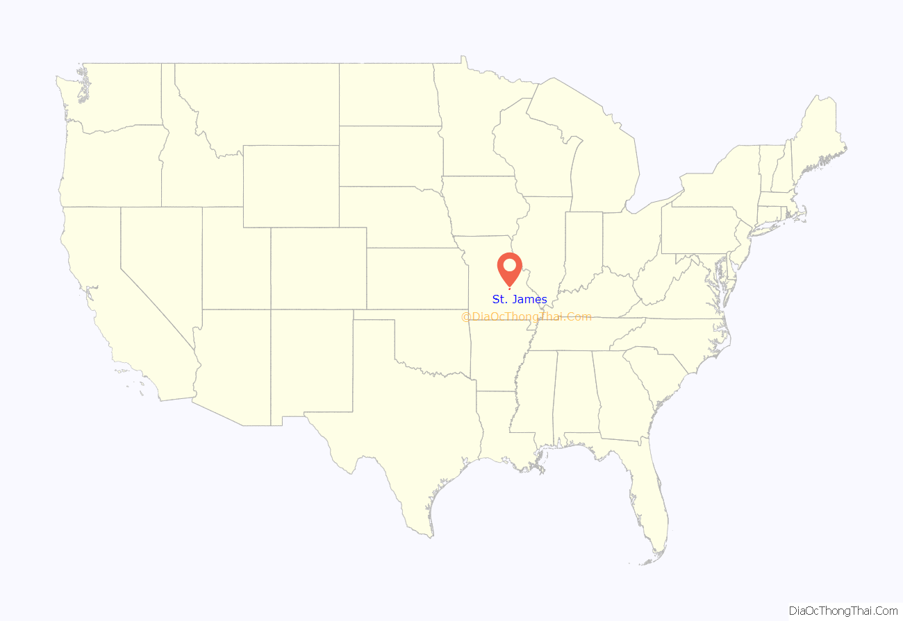
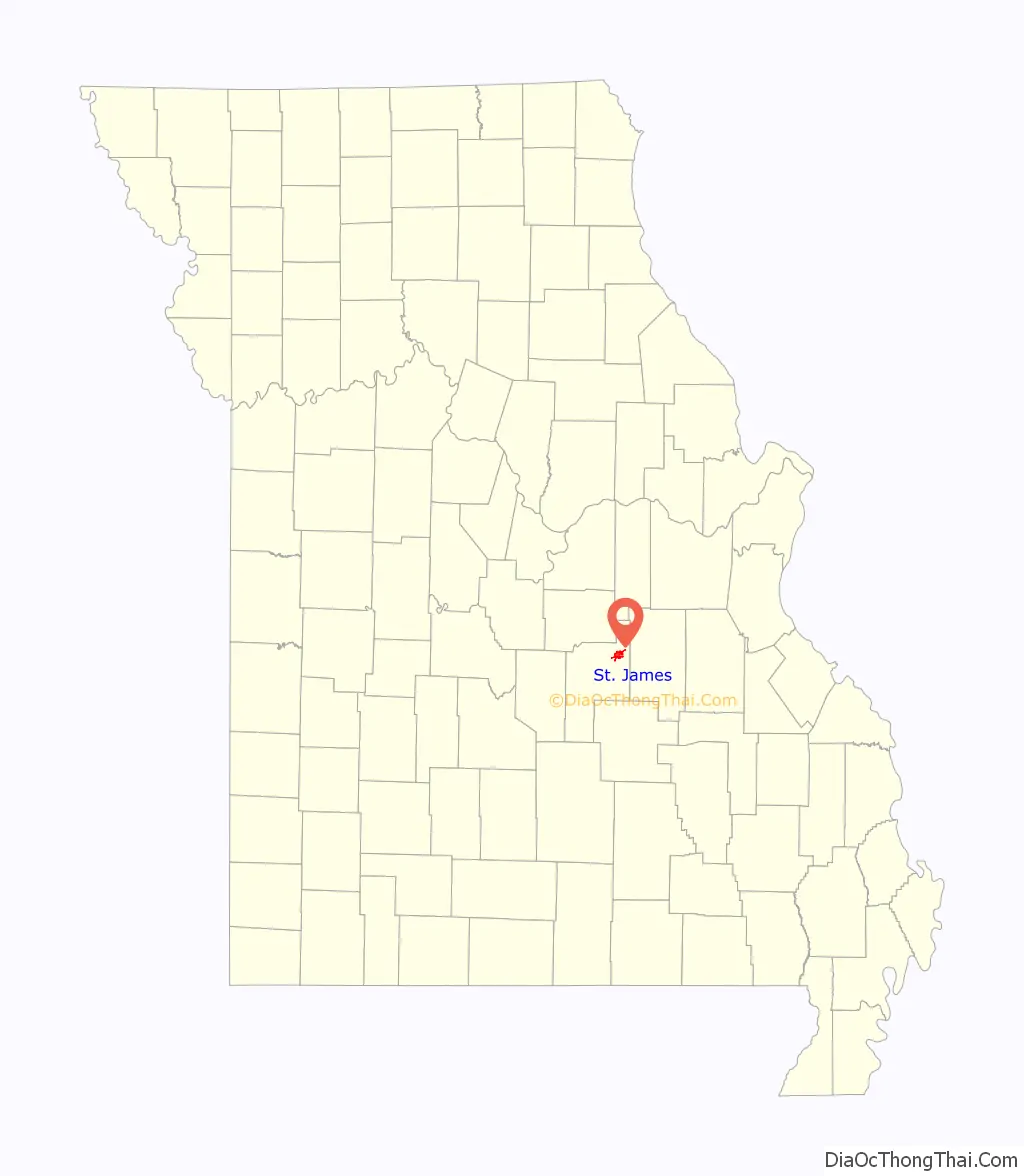
St. James location map. Where is St. James city?
History
The settlement was originally known as Big Prairie because of its location on the natural prairie of that name in the area. In 1859, when a man by the name of John Wood anticipated the extension of the St. Louis-San Francisco Railway, the settlement became known for a short time as Scioto, named after the town of Scioto, Ohio, where many of the town’s early settlers originated. In 1860, the town was named St. James to honor Thomas James, who came from Ohio and created the Meramec Iron Works. The town was intended as a shipping point for the Meramec Iron Works, which had been shipping its products by wagon train.
St. James was the part-time home of Lucy Wortham James, a wealthy philanthropist who had a love for the area. She was a descendant of Thomas James, a Chillicothe banker who founded the Maramec Iron Works. The James Foundation, a charitable organization she founded, was responsible for the St. James City Park and the James Memorial Library, as well as Maramec Spring Park. The City of St. James now owns both the park and the public library.
Mayme Ousley, the first woman elected mayor of a town in Missouri, was first elected mayor of St. James in 1921. The city hall was named after her in 2013.
The Maramec Iron Works District, St. James Chapel, and Verkamp Shelter are listed on the National Register of Historic Places.
St. James Road Map
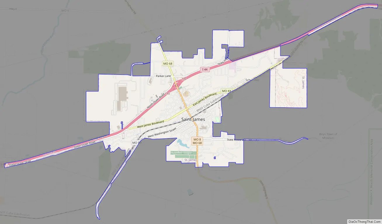
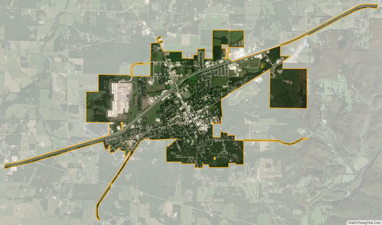
St. James city Satellite Map
Geography
St. James is located in the foothills of the Ozark Mountains at 37°59′56″N 91°36′59″W / 37.99889°N 91.61639°W / 37.99889; -91.61639 (37.998848, −91.616386). According to the United States Census Bureau, the city has a total area of 4.29 square miles (11.11 km), of which 4.28 square miles (11.09 km) is land and 0.01 square miles (0.03 km) is water.
See also
Map of Missouri State and its subdivision:- Adair
- Andrew
- Atchison
- Audrain
- Barry
- Barton
- Bates
- Benton
- Bollinger
- Boone
- Buchanan
- Butler
- Caldwell
- Callaway
- Camden
- Cape Girardeau
- Carroll
- Carter
- Cass
- Cedar
- Chariton
- Christian
- Clark
- Clay
- Clinton
- Cole
- Cooper
- Crawford
- Dade
- Dallas
- Daviess
- De Kalb
- Dent
- Douglas
- Dunklin
- Franklin
- Gasconade
- Gentry
- Greene
- Grundy
- Harrison
- Henry
- Hickory
- Holt
- Howard
- Howell
- Iron
- Jackson
- Jasper
- Jefferson
- Johnson
- Knox
- Laclede
- Lafayette
- Lawrence
- Lewis
- Lincoln
- Linn
- Livingston
- Macon
- Madison
- Maries
- Marion
- McDonald
- Mercer
- Miller
- Mississippi
- Moniteau
- Monroe
- Montgomery
- Morgan
- New Madrid
- Newton
- Nodaway
- Oregon
- Osage
- Ozark
- Pemiscot
- Perry
- Pettis
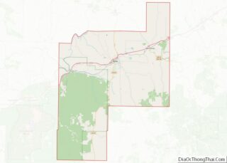
- Phelps
- Pike
- Platte
- Polk
- Pulaski
- Putnam
- Ralls
- Randolph
- Ray
- Reynolds
- Ripley
- Saint Charles
- Saint Clair
- Saint Francois
- Saint Louis
- Sainte Genevieve
- Saline
- Schuyler
- Scotland
- Scott
- Shannon
- Shelby
- Stoddard
- Stone
- Sullivan
- Taney
- Texas
- Vernon
- Warren
- Washington
- Wayne
- Webster
- Worth
- Wright
- Alabama
- Alaska
- Arizona
- Arkansas
- California
- Colorado
- Connecticut
- Delaware
- District of Columbia
- Florida
- Georgia
- Hawaii
- Idaho
- Illinois
- Indiana
- Iowa
- Kansas
- Kentucky
- Louisiana
- Maine
- Maryland
- Massachusetts
- Michigan
- Minnesota
- Mississippi
- Missouri
- Montana
- Nebraska
- Nevada
- New Hampshire
- New Jersey
- New Mexico
- New York
- North Carolina
- North Dakota
- Ohio
- Oklahoma
- Oregon
- Pennsylvania
- Rhode Island
- South Carolina
- South Dakota
- Tennessee
- Texas
- Utah
- Vermont
- Virginia
- Washington
- West Virginia
- Wisconsin
- Wyoming