Unionville is a city in Putnam County, Missouri, United States. The population was 1,735 at the 2020 census. It is the county seat of Putnam County.
| Name: | Unionville city |
|---|---|
| LSAD Code: | 25 |
| LSAD Description: | city (suffix) |
| State: | Missouri |
| County: | Putnam County |
| Elevation: | 1,047 ft (319 m) |
| Total Area: | 2.00 sq mi (5.17 km²) |
| Land Area: | 2.00 sq mi (5.17 km²) |
| Water Area: | 0.00 sq mi (0.00 km²) |
| Total Population: | 1,735 |
| Population Density: | 869.24/sq mi (335.54/km²) |
| ZIP code: | 63565 |
| Area code: | 660 |
| FIPS code: | 2975166 |
| GNISfeature ID: | 2397090 |
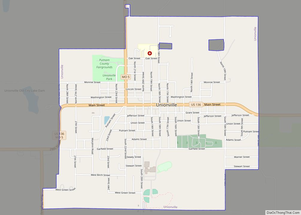
Online Interactive Map
Click on ![]() to view map in "full screen" mode.
to view map in "full screen" mode.
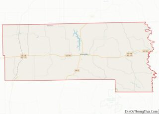
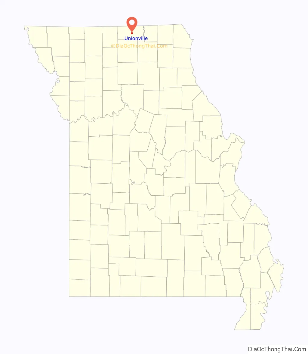
Unionville location map. Where is Unionville city?

History
Unionville was first named Harmony when established in 1853 as the county seat for Putnam County. Prior to that the county seat had moved several times, often with heated debate, thus the centralized location hoping to bring “harmony” to all concerned. (see Putnam County history for more details)
The Union Township trustees first met on February 4, 1873, at the court-house in Unionville. Since that day, Unionville straddles the municipal border between Union Township and Wilson Township.
On May 22, 1962, Continental Airlines Flight 11, en route from O’Hare Airport in Chicago, Illinois to the downtown Kansas City, Missouri airport, crashed in a clover field north of Unionville, near Lake Thunderhead, killing all 37 passengers and 8 crew. Investigators subsequently determined that one of the jetliner’s passengers, Thomas G. Doty, detonated a bomb inside the Boeing 707 in a suicide-for-insurance plot.
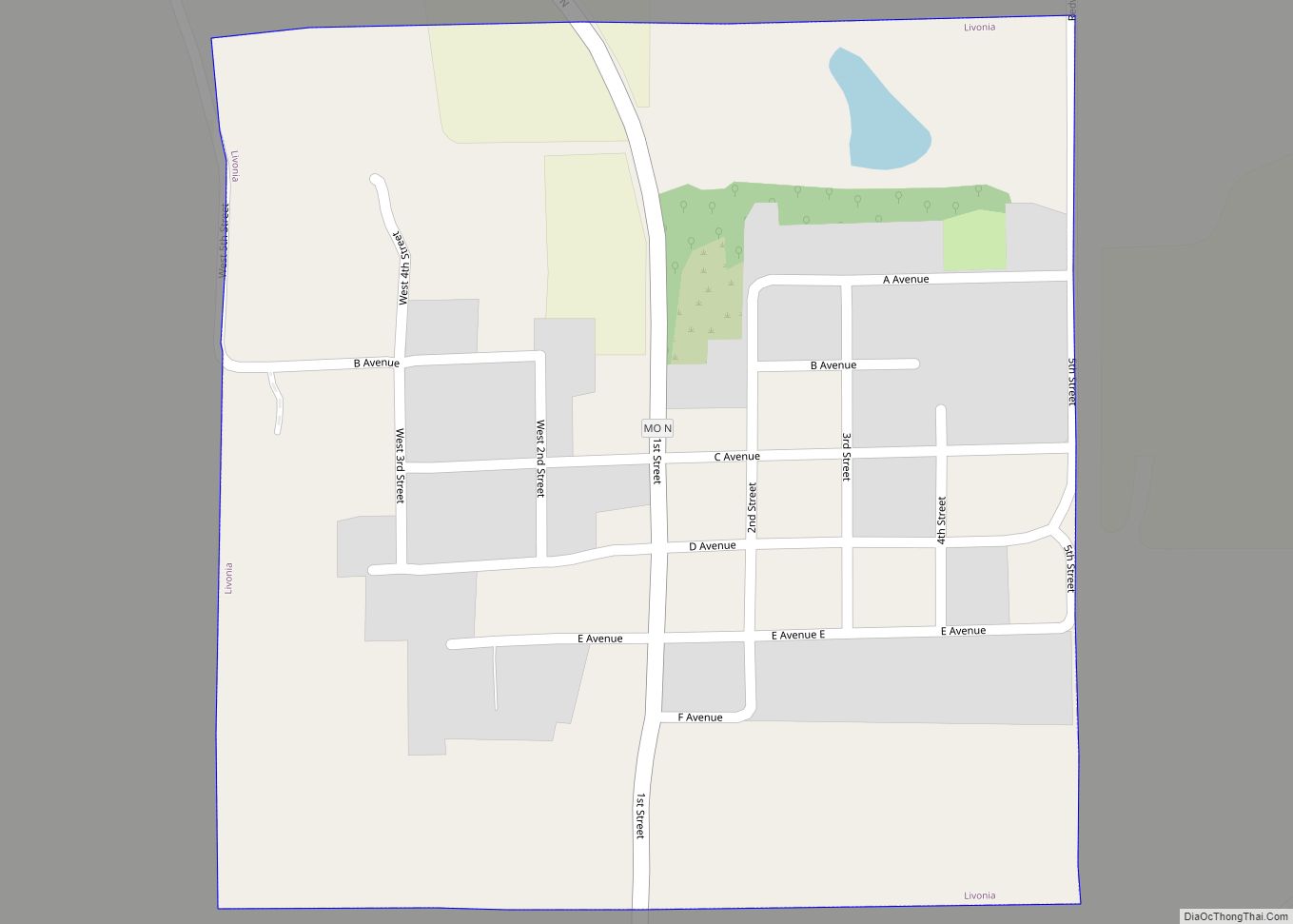
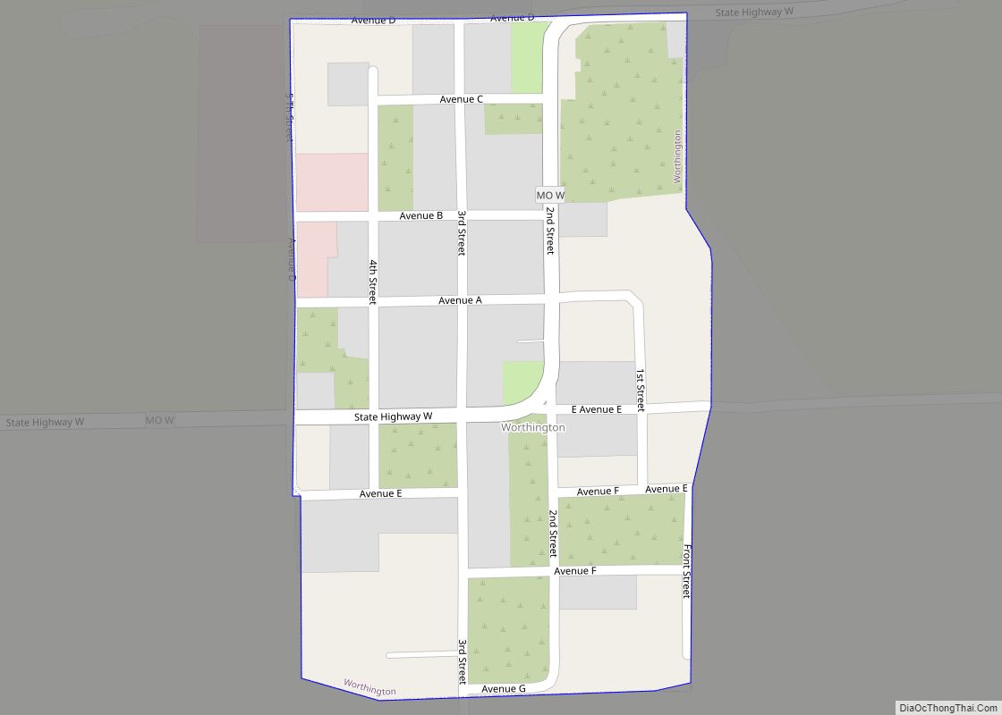
Unionville Road Map
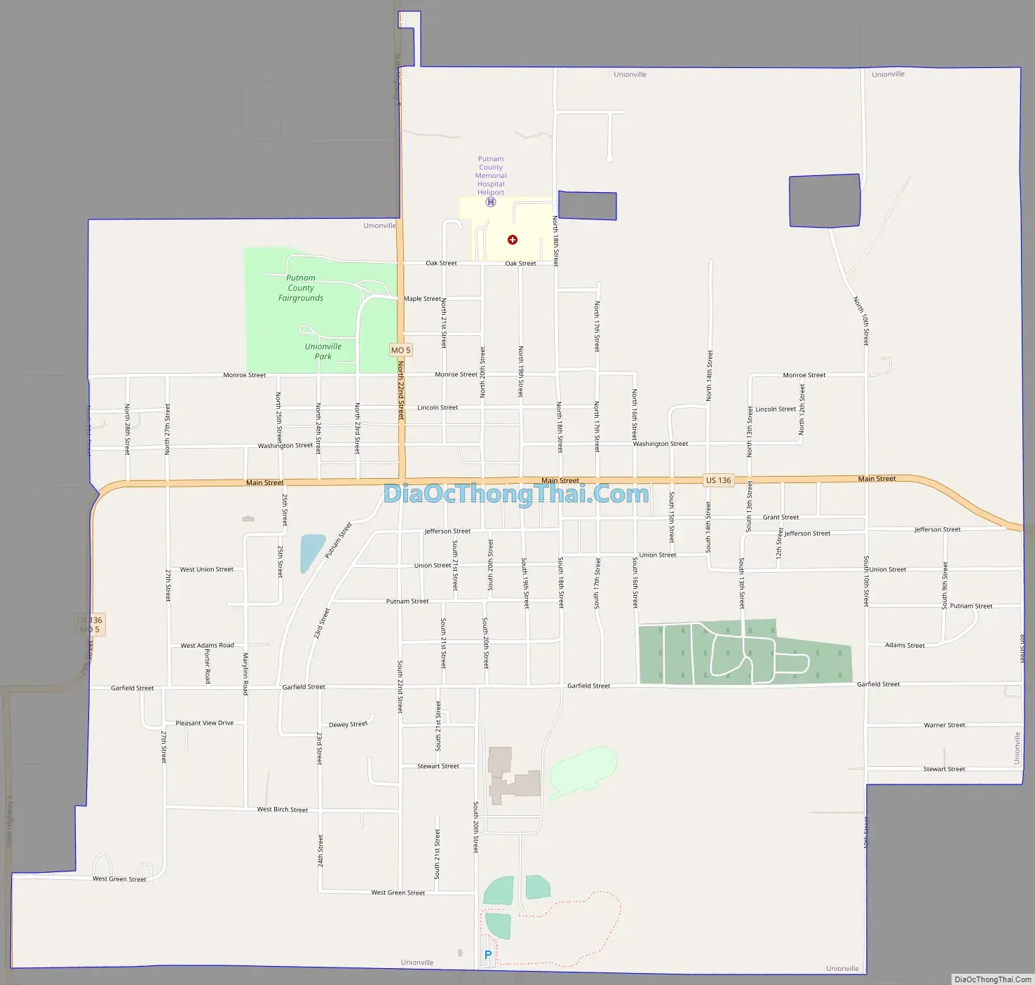
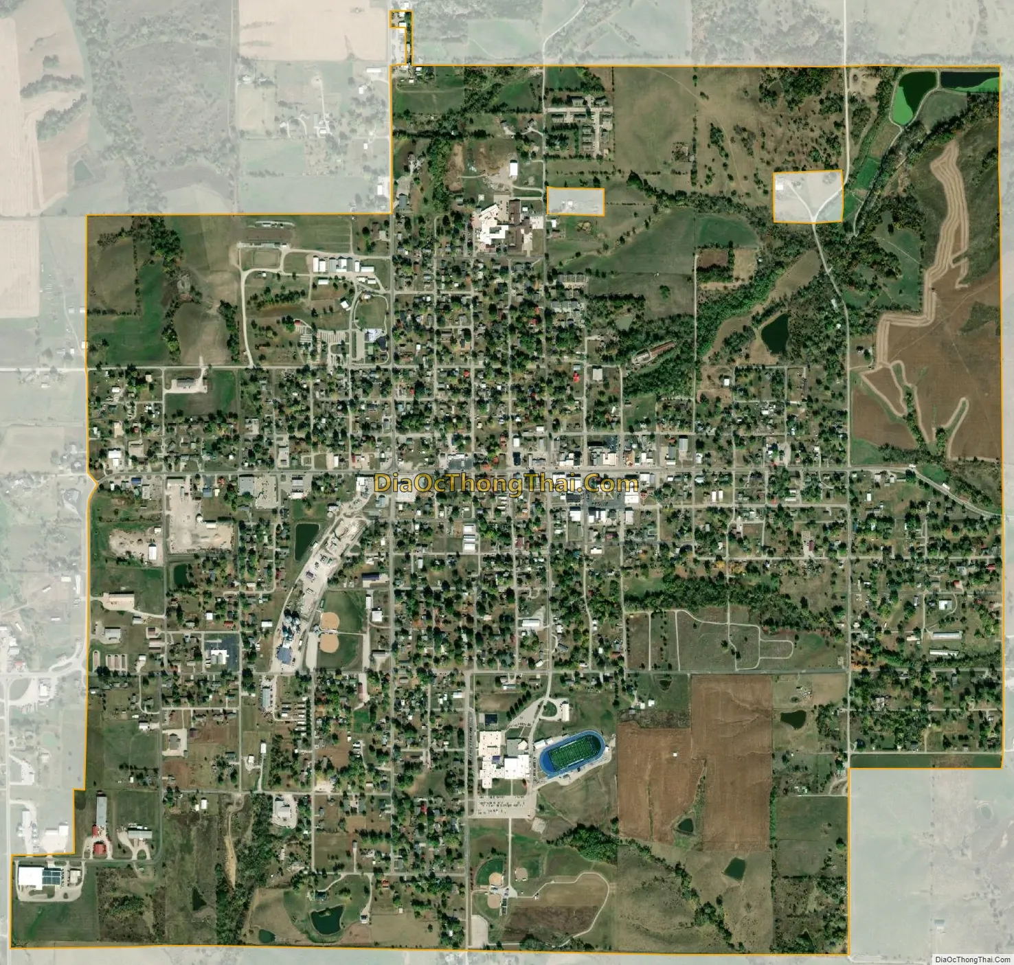
Unionville city Satellite Map
Geography
Unionville is located in central Putnam County at the intersection of US Route 136 and Missouri Route 5. Lake Thunderhead on North Blackbird Creek lies to the northwest of the city and the Missouri-Iowa border is seven miles north.
According to the United States Census Bureau, the city has a total area of 2.00 square miles (5.18 km), all of it land.
See also
Map of Missouri State and its subdivision:- Adair
- Andrew
- Atchison
- Audrain
- Barry
- Barton
- Bates
- Benton
- Bollinger
- Boone
- Buchanan
- Butler
- Caldwell
- Callaway
- Camden
- Cape Girardeau
- Carroll
- Carter
- Cass
- Cedar
- Chariton
- Christian
- Clark
- Clay
- Clinton
- Cole
- Cooper
- Crawford
- Dade
- Dallas
- Daviess
- De Kalb
- Dent
- Douglas
- Dunklin
- Franklin
- Gasconade
- Gentry
- Greene
- Grundy
- Harrison
- Henry
- Hickory
- Holt
- Howard
- Howell
- Iron
- Jackson
- Jasper
- Jefferson
- Johnson
- Knox
- Laclede
- Lafayette
- Lawrence
- Lewis
- Lincoln
- Linn
- Livingston
- Macon
- Madison
- Maries
- Marion
- McDonald
- Mercer
- Miller
- Mississippi
- Moniteau
- Monroe
- Montgomery
- Morgan
- New Madrid
- Newton
- Nodaway
- Oregon
- Osage
- Ozark
- Pemiscot
- Perry
- Pettis
- Phelps
- Pike
- Platte
- Polk
- Pulaski
- Putnam
- Ralls
- Randolph
- Ray
- Reynolds
- Ripley
- Saint Charles
- Saint Clair
- Saint Francois
- Saint Louis
- Sainte Genevieve
- Saline
- Schuyler
- Scotland
- Scott
- Shannon
- Shelby
- Stoddard
- Stone
- Sullivan
- Taney
- Texas
- Vernon
- Warren
- Washington
- Wayne
- Webster
- Worth
- Wright
- Alabama
- Alaska
- Arizona
- Arkansas
- California
- Colorado
- Connecticut
- Delaware
- District of Columbia
- Florida
- Georgia
- Hawaii
- Idaho
- Illinois
- Indiana
- Iowa
- Kansas
- Kentucky
- Louisiana
- Maine
- Maryland
- Massachusetts
- Michigan
- Minnesota
- Mississippi
- Missouri
- Montana
- Nebraska
- Nevada
- New Hampshire
- New Jersey
- New Mexico
- New York
- North Carolina
- North Dakota
- Ohio
- Oklahoma
- Oregon
- Pennsylvania
- Rhode Island
- South Carolina
- South Dakota
- Tennessee
- Texas
- Utah
- Vermont
- Virginia
- Washington
- West Virginia
- Wisconsin
- Wyoming