Webb City is a city in Jasper County, Missouri, United States. The population was 13,031 at the 2020 census. It is part of the Joplin, Missouri Metropolitan Statistical Area. Webb City also has a police department, a fire department, and animal control services.
| Name: | Webb City city |
|---|---|
| LSAD Code: | 25 |
| LSAD Description: | city (suffix) |
| State: | Missouri |
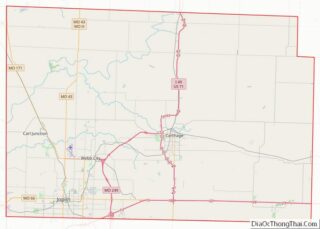
| County: | Jasper County |
| Elevation: | 1,004 ft (306 m) |
| Total Area: | 8.64 sq mi (22.38 km²) |
| Land Area: | 8.64 sq mi (22.38 km²) |
| Water Area: | 0.00 sq mi (0.00 km²) |
| Total Population: | 13,031 |
| Population Density: | 1,507.87/sq mi (582.22/km²) |
| ZIP code: | 64870 |
| Area code: | 417 |
| FIPS code: | 2978118 |
| GNISfeature ID: | 2397239 |
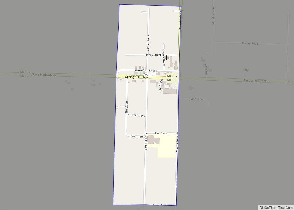
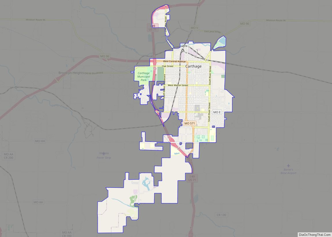
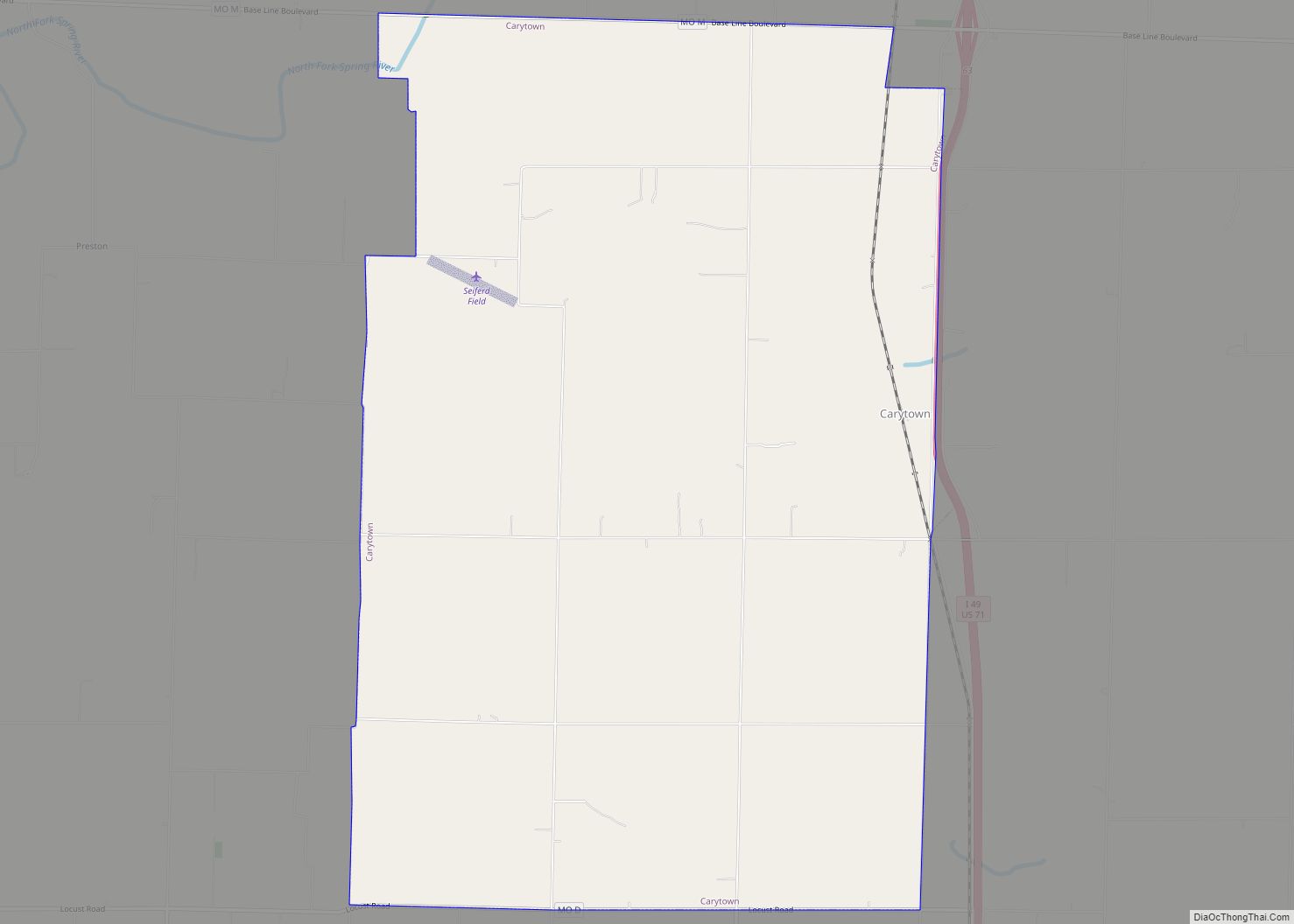
Online Interactive Map
Click on ![]() to view map in "full screen" mode.
to view map in "full screen" mode.
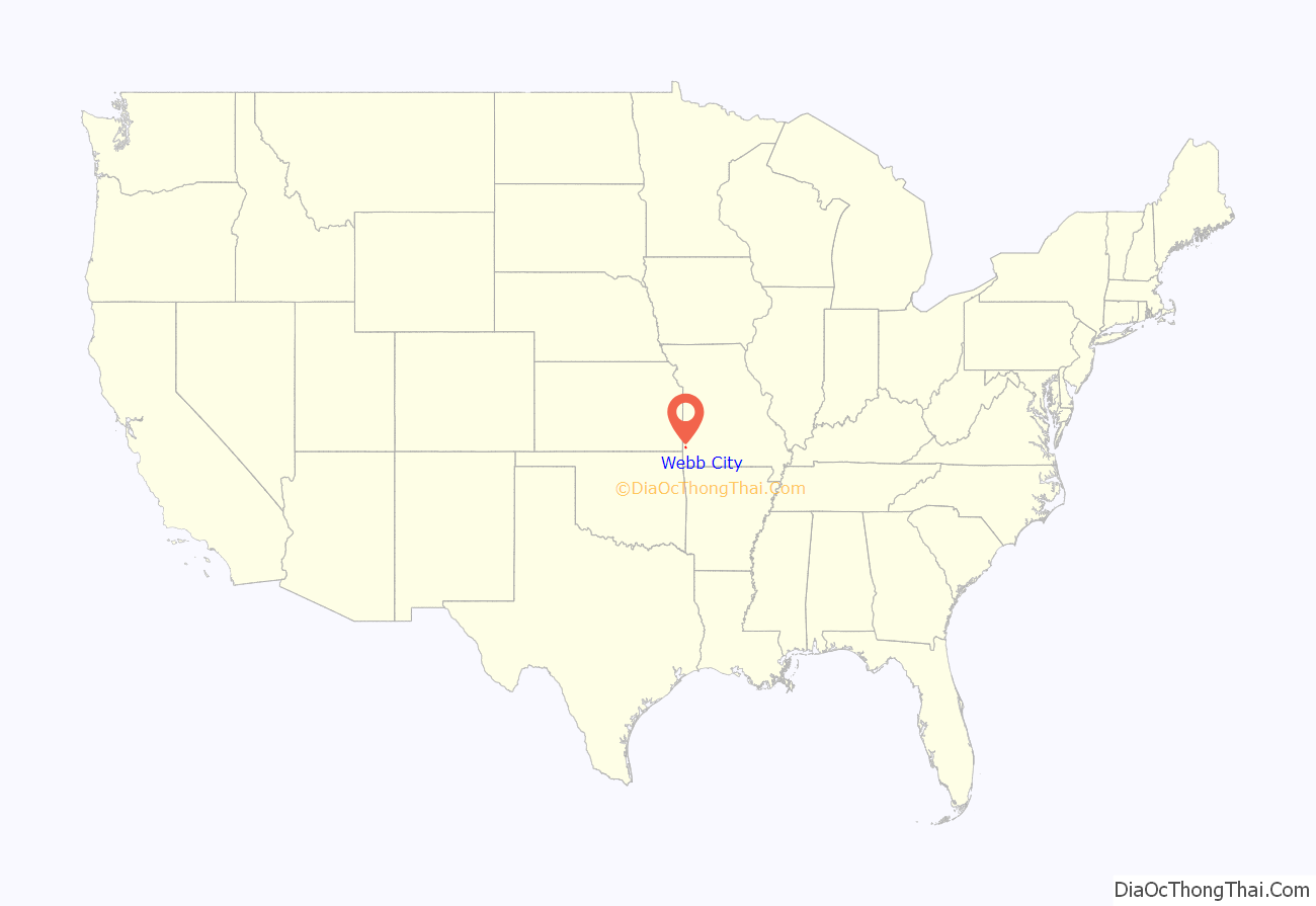
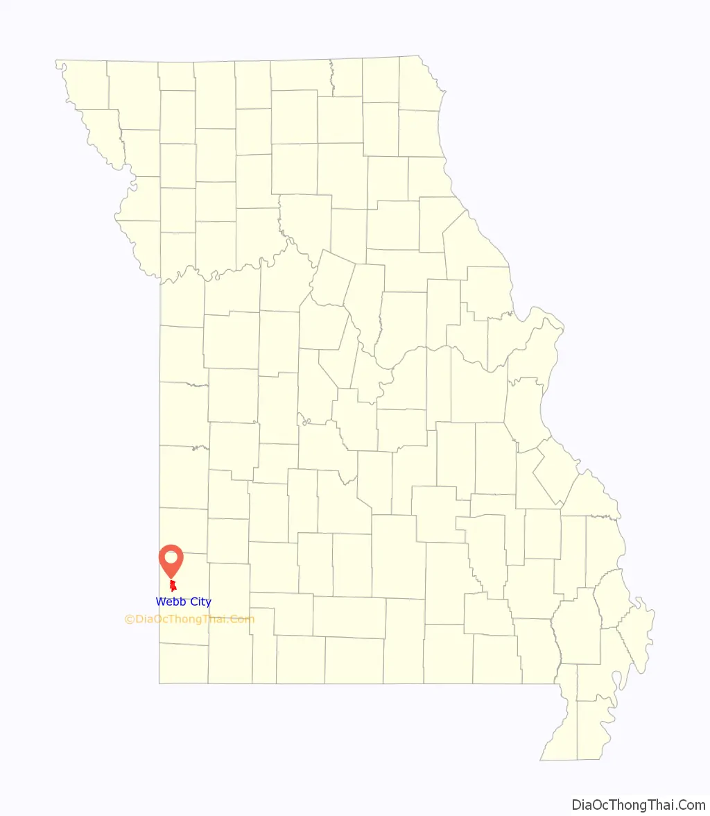
Webb City location map. Where is Webb City city?
History
Webb City (Webbville) was platted by John C. Webb in September 1875 and incorporated in December 1876, with a population of 700. The city was located on a portion of Webb’s 200-acre farm, which he entered in February 1857. There, in 1873, Webb discovered lead while plowing. With the assistance of W.A. Daugherty, he sank the first pump-shaft in 1874. Webb then leased his land to Daugherty and G.P. Ashcraft. In 1876, the Center Creek Mining Company leased the land and began operations. Some 20 years later, 700 mines were located within the limits of Webb City and adjacent Carterville, and the district ranked first in the production of zinc ore.
Webb aided the city in its material development. He donated land for a school and the first Methodist Episcopal Church, South. He built the Webb City Bank and the first hotel.
The St. Louis and San Francisco Railroad was built to Webb City in 1879, followed by the Missouri Pacific Railroad in 1881. The population increased from 1,588 in 1880 to 9,201 in 1900. After the success of the first Webb City sheet ground mine (“Yellow Dog”) in the 1890s, business boomed. The 100-room Newland Hotel was built and co-educational Webb City College was established. The Webb City Mining District was prominently represented at the Chicago Columbia Exposition in 1893 and at the 1898 Omaha International Exhibit. Webb City received for its mineral display the only silver medal awarded. A.H. Rogers built a mule streetcar line from Webb City to Carterville, 1889, the predecessor of the SouthWest Missouri Electric Railway, established 1893, and expanded in the 1900s to become the Southwest Missouri Railroad Company. a vast inter-urban system with a power plant, car barns and an employee clubhouse at Webb City.
The influx of miners supported a thriving saloon district on Daugherty Street, also called “Red Hot Street.” However due to the Prohibition movement and efforts of the Woman’s Christian Temperance Union, the city voted to become a dry city in 1910.
During World War I, zinc and lead concentrate produced in the Webb City ~ Carterville ~ Prosperity District were valued at more than $18 million. Webb City’s population increased to some 15,000.
In 1914, the Webb City Register reported that “an aggregation” took responsibility to limit the African American population of the city. The Register would describe the 1916 population of 40 Black residents as too large, calling for another periodic expulsion.
After the decline of mining in the postwar period, Webb City turned to diversified industrial and agricultural production. In the 1930s and during World War II, explosives were manufactured by powder plants located near Webb City.
The Downtown Webb City Historic District and Middle West Hotel are listed on the National Register of Historic Places listings in Jasper County, Missouri, as is the Elijah Thomas Webb Residence, an elaborate Queen Anne style three-story built by Elijah Webb, son of the town’s founder John Webb.
Webb City Road Map

Webb City city Satellite Map

Geography
According to the United States Census Bureau, the city has a total area of 8.63 square miles (22.35 km), all land.
During the late 19th and early 20th centuries, Webb City was part of the “Tri-State Mining District”, at the time the world’s largest and most productive lead and zinc mining field. The area remains surrounded by chat piles that are used primarily in road-building.
See also
Map of Missouri State and its subdivision:- Adair
- Andrew
- Atchison
- Audrain
- Barry
- Barton
- Bates
- Benton
- Bollinger
- Boone
- Buchanan
- Butler
- Caldwell
- Callaway
- Camden
- Cape Girardeau
- Carroll
- Carter
- Cass
- Cedar
- Chariton
- Christian
- Clark
- Clay
- Clinton
- Cole
- Cooper
- Crawford
- Dade
- Dallas
- Daviess
- De Kalb
- Dent
- Douglas
- Dunklin
- Franklin
- Gasconade
- Gentry
- Greene
- Grundy
- Harrison
- Henry
- Hickory
- Holt
- Howard
- Howell
- Iron
- Jackson
- Jasper
- Jefferson
- Johnson
- Knox
- Laclede
- Lafayette
- Lawrence
- Lewis
- Lincoln
- Linn
- Livingston
- Macon
- Madison
- Maries
- Marion
- McDonald
- Mercer
- Miller
- Mississippi
- Moniteau
- Monroe
- Montgomery
- Morgan
- New Madrid
- Newton
- Nodaway
- Oregon
- Osage
- Ozark
- Pemiscot
- Perry
- Pettis
- Phelps
- Pike
- Platte
- Polk
- Pulaski
- Putnam
- Ralls
- Randolph
- Ray
- Reynolds
- Ripley
- Saint Charles
- Saint Clair
- Saint Francois
- Saint Louis
- Sainte Genevieve
- Saline
- Schuyler
- Scotland
- Scott
- Shannon
- Shelby
- Stoddard
- Stone
- Sullivan
- Taney
- Texas
- Vernon
- Warren
- Washington
- Wayne
- Webster
- Worth
- Wright
- Alabama
- Alaska
- Arizona
- Arkansas
- California
- Colorado
- Connecticut
- Delaware
- District of Columbia
- Florida
- Georgia
- Hawaii
- Idaho
- Illinois
- Indiana
- Iowa
- Kansas
- Kentucky
- Louisiana
- Maine
- Maryland
- Massachusetts
- Michigan
- Minnesota
- Mississippi
- Missouri
- Montana
- Nebraska
- Nevada
- New Hampshire
- New Jersey
- New Mexico
- New York
- North Carolina
- North Dakota
- Ohio
- Oklahoma
- Oregon
- Pennsylvania
- Rhode Island
- South Carolina
- South Dakota
- Tennessee
- Texas
- Utah
- Vermont
- Virginia
- Washington
- West Virginia
- Wisconsin
- Wyoming