Zalma, once known as “Bollinger’s Mill”, is an unincorporated community and census-designated place (CDP) on the banks of the winding Castor River at a point where the river makes a horseshoe bend in southern Bollinger County in southeast Missouri, United States. When the railroad moved to town, the name Bollinger’s Mill was changed to Zalma, after railroad worker Zalma Block. Zalma is also said to come from a Native American word meaning “the end.” As of the 2020 U.S. Census, Zalma had a population of 73.
Zalma is part of the Cape Girardeau−Jackson, MO-IL Metropolitan Statistical Area. Zalma is home to a number of state parks that feature a number of activities such as deer hunting, fishing, bird watching, horseback riding, and hiking. Blue Pond, the deepest natural pond in the state of Missouri, is located outside of Zalma.
| Name: | Zalma CDP |
|---|---|
| LSAD Code: | 57 |
| LSAD Description: | CDP (suffix) |
| State: | Missouri |
| County: | Bollinger County |
| Elevation: | 394 ft (120 m) |
| Total Area: | 0.21 sq mi (0.54 km²) |
| Land Area: | 0.21 sq mi (0.53 km²) |
| Water Area: | 0.00 sq mi (0.00 km²) |
| Total Population: | 73 |
| Population Density: | 354.37/sq mi (136.50/km²) |
| ZIP code: | 63787 |
| Area code: | 573 |
| FIPS code: | 2981430 |
| GNISfeature ID: | 2786553 |
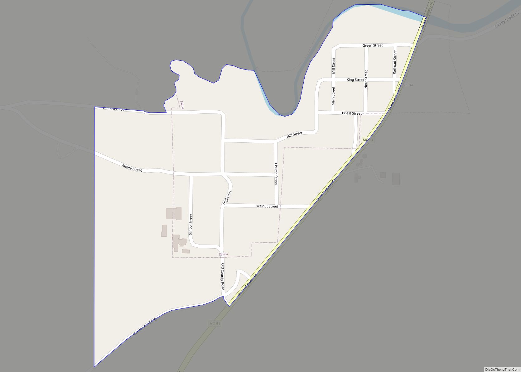
Online Interactive Map
Click on ![]() to view map in "full screen" mode.
to view map in "full screen" mode.
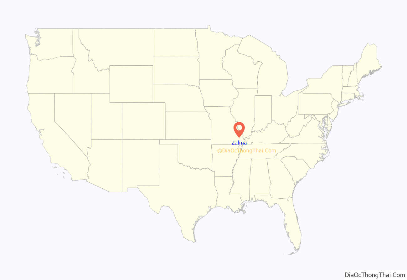
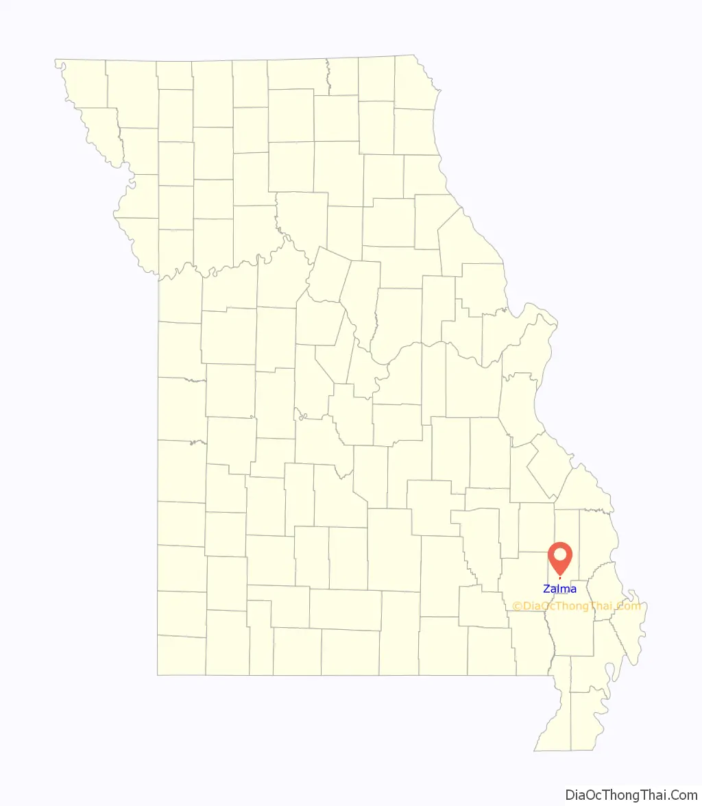
Zalma location map. Where is Zalma CDP?
History
In 1800, an Urban Asherbranner (or Asherbramer or Asherbrauner) settled on the upper portion of the Castor River, just where the river empties its waters into Mingo Bottom, and where the village of Zalma is now situated, built a log and brush dam and erected a water mill to grind corn. Philip Bollinger settled nearby.
In A History of Missouri (1908), Louis Houck states that the head rights to this mill were owned by Asherbranner himself, but were held instead by Philip Bollinger, a relative of Asherbranner’s wife, Barbara. Philip Bollinger was a relative of Major George Frederick Bollinger, who settled on Whitewater and founded Burfordville in Cape Girardeau County.
The mill was later transferred to the Davault Bollinger line. Davault’s third son, Daniel, succeeded his father as miller. Daniel is thought to have come to Zalma about mid-century (1850) to assume operation of the mill. His sister, Catherine (Kate), came with him. They repaired the log and brush dam and operated the mill until the Civil War. Daniel died about this time and his wife, Eleanora, operated the mill with hired help. This mill burned sometime between 1863 and 1873 perhaps by Southern sympathizers, but actual cause of the fire cannot be authenticated.
Zalma received its first post office in November 1876.
W.A. acquired the property and built a new mill house and a new dam. He put in machinery to grind wheat and corn, as well as a carding mill to card and wash wool.
According to the Marble Hill Press (Oct. 28, 1897), the McMinn Mill burned in 1897. The dam remained intact for several years after the mill burned, before it suffered the same fate.
On Dec. 21, 1880, Louis Houck completed a railroad between Cape Girardeau and Delta. A spur line eventually connected Zalma to the railroad. Sometime in the early 1930s the railroad was abandoned and removed.
The town’s economy remained sluggish until the timber industry moved in. The Brown Cooperage Company bought thousands of acres of timber, mostly white oak, for $1 per acre. In 1884, the Bell Messler Company placed a factory at Zalma to cut veneer and box laths. The Zalma factory was located just upstream from the mill dam. This factory provided work for women who stacked the box laths in long rows in the sun for drying. A second box factory was located on the north side of Green Street near the Railroad Street intersection, a short distance west of the present Highway 51.
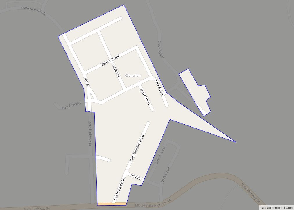
Zalma Road Map
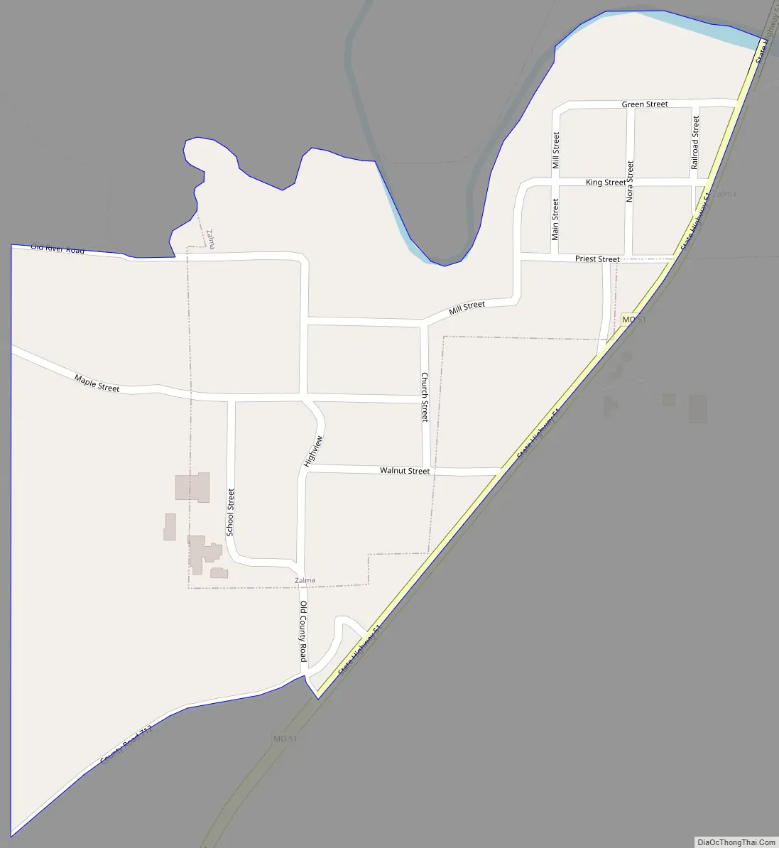
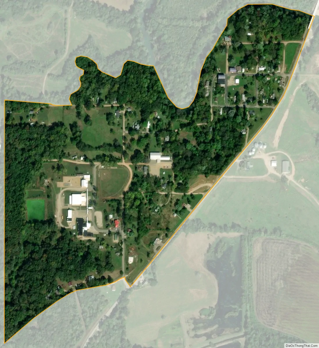
Zalma city Satellite Map
Geography
Zalma is located in southwest Bollinger County on Missouri Route 51. The Castor River flows past the north side of the community. Marble Hill is approximately 11 miles to the northeast, Gipsy is about 5.5 miles to the west and Arab is three miles to the south.
According to the United States Census Bureau, the village has a total area of 0.19 square miles (0.49 km), of which, 0.18 square miles (0.47 km) of it is land and 0.01 square miles (0.03 km) is water.
See also
Map of Missouri State and its subdivision:- Adair
- Andrew
- Atchison
- Audrain
- Barry
- Barton
- Bates
- Benton
- Bollinger
- Boone
- Buchanan
- Butler
- Caldwell
- Callaway
- Camden
- Cape Girardeau
- Carroll
- Carter
- Cass
- Cedar
- Chariton
- Christian
- Clark
- Clay
- Clinton
- Cole
- Cooper
- Crawford
- Dade
- Dallas
- Daviess
- De Kalb
- Dent
- Douglas
- Dunklin
- Franklin
- Gasconade
- Gentry
- Greene
- Grundy
- Harrison
- Henry
- Hickory
- Holt
- Howard
- Howell
- Iron
- Jackson
- Jasper
- Jefferson
- Johnson
- Knox
- Laclede
- Lafayette
- Lawrence
- Lewis
- Lincoln
- Linn
- Livingston
- Macon
- Madison
- Maries
- Marion
- McDonald
- Mercer
- Miller
- Mississippi
- Moniteau
- Monroe
- Montgomery
- Morgan
- New Madrid
- Newton
- Nodaway
- Oregon
- Osage
- Ozark
- Pemiscot
- Perry
- Pettis
- Phelps
- Pike
- Platte
- Polk
- Pulaski
- Putnam
- Ralls
- Randolph
- Ray
- Reynolds
- Ripley
- Saint Charles
- Saint Clair
- Saint Francois
- Saint Louis
- Sainte Genevieve
- Saline
- Schuyler
- Scotland
- Scott
- Shannon
- Shelby
- Stoddard
- Stone
- Sullivan
- Taney
- Texas
- Vernon
- Warren
- Washington
- Wayne
- Webster
- Worth
- Wright
- Alabama
- Alaska
- Arizona
- Arkansas
- California
- Colorado
- Connecticut
- Delaware
- District of Columbia
- Florida
- Georgia
- Hawaii
- Idaho
- Illinois
- Indiana
- Iowa
- Kansas
- Kentucky
- Louisiana
- Maine
- Maryland
- Massachusetts
- Michigan
- Minnesota
- Mississippi
- Missouri
- Montana
- Nebraska
- Nevada
- New Hampshire
- New Jersey
- New Mexico
- New York
- North Carolina
- North Dakota
- Ohio
- Oklahoma
- Oregon
- Pennsylvania
- Rhode Island
- South Carolina
- South Dakota
- Tennessee
- Texas
- Utah
- Vermont
- Virginia
- Washington
- West Virginia
- Wisconsin
- Wyoming