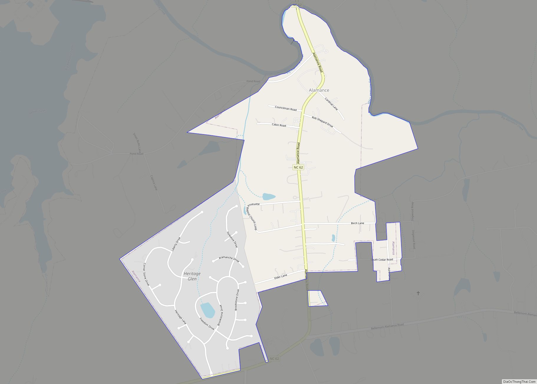
Alamance is a village in Alamance County, North Carolina, United States. It is part of the Burlington, North Carolina Metropolitan Statistical Area. The population was 951 at the 2010 census, up from 310 at the 2000 census.
| Name: | Alamance village |
|---|---|
| LSAD Code: | 47 |
| LSAD Description: | village (suffix) |
| State: | North Carolina |
| County: | Alamance County |
| Elevation: | 561 ft (171 m) |
| Total Area: | 0.80 sq mi (2.07 km²) |
| Land Area: | 0.80 sq mi (2.06 km²) |
| Water Area: | 0.01 sq mi (0.02 km²) |
| Total Population: | 988 |
| Population Density: | 1,242.77/sq mi (479.76/km²) |
| ZIP code: | 27201 |
| Area code: | 336 |
| FIPS code: | 3700640 |
| GNISfeature ID: | 1018780 |
| Website: | www.villageofalamance.com |
Online Interactive Map
Click on ![]() to view map in "full screen" mode.
to view map in "full screen" mode.
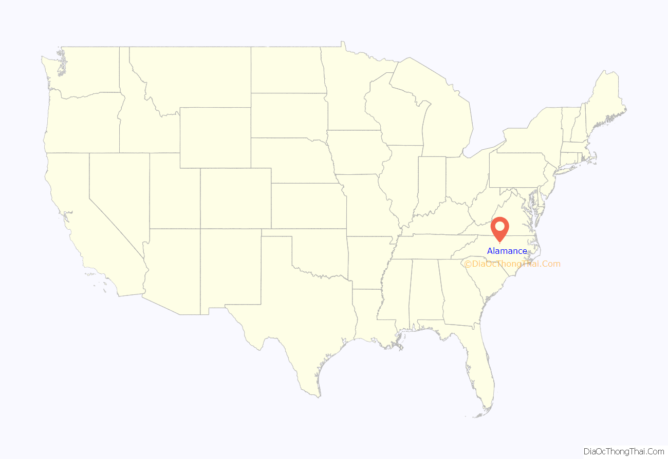
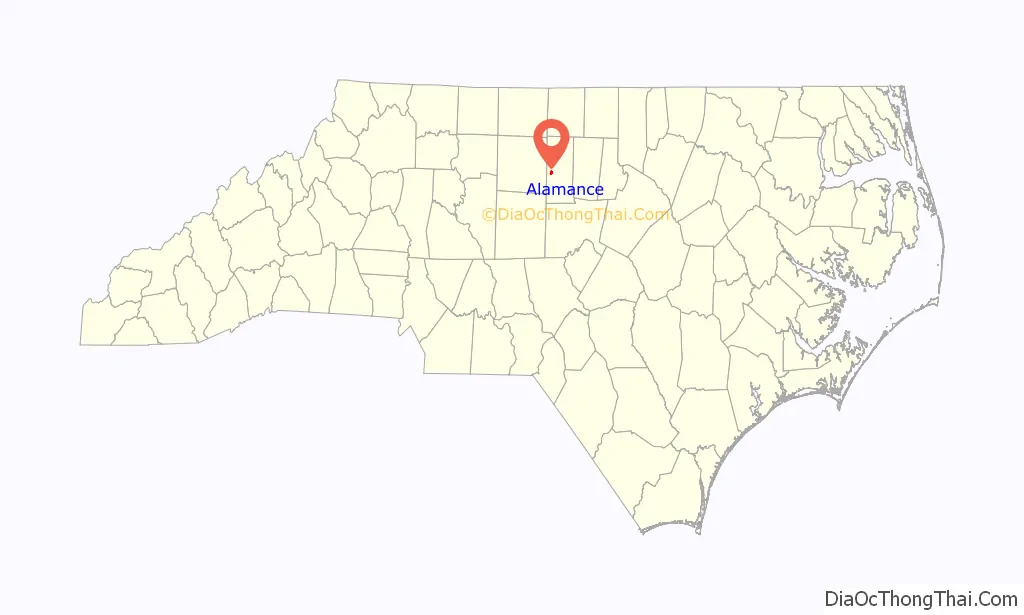
Alamance location map. Where is Alamance village?
History
Alamance was the site of the largest conflict of the War of the Regulation on May 16, 1771. Governor William Tryon’s decisive victory over a force of 2,000 Regulators effectively ended the war (Battle of Alamance). The region around Alamance was also the site of a defeat of British Loyalists in the American Revolutionary War in a skirmish known as Pyle’s Massacre on February 25, 1781.
Alamance played a significant role in the development of the textile industry in the South. In 1837 Edwin Michael Holt, son of a local farmer, built the Alamance Cotton Mill at Alamance. In 1849, Holt began converting this spinning mill into a looming mill that produced the well-known “Alamance Plaids.” This was the first factory-dyed cotton cloth produced south of the Potomac. The Holt family subsequently built scores of mills across the state, as well as becoming involved in banking, railroads, politics and other ventures.
The Alamance Battleground State Historic Site, Alamance Mill Village Historic District, L. Banks Holt House, and Altamahaw Mill Office are listed on the National Register of Historic Places.
The name is said to have been given by German settlers, from the Native American word allamanca.
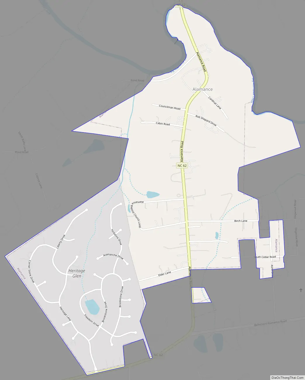
Alamance Road Map
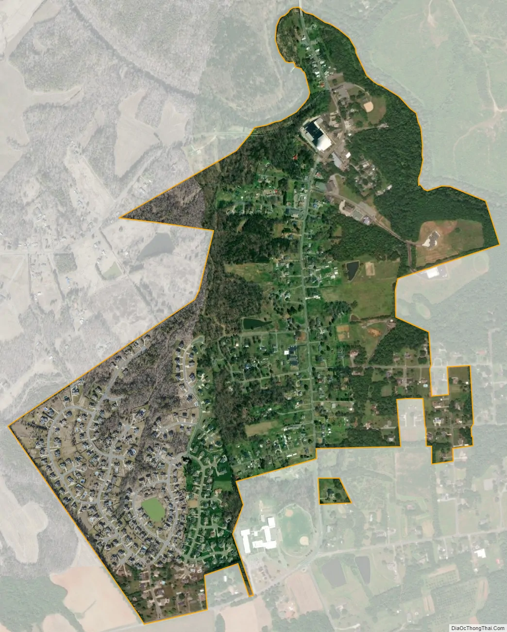
Alamance city Satellite Map
Geography
Alamance is located at 36°1′40″N 79°29′20″W / 36.02778°N 79.48889°W / 36.02778; -79.48889 (36.027672, -79.488863).
According to the United States Census Bureau, the village has a total area of 0.77 square miles (2.0 km), of which 0.0039 square miles (0.01 km), or 0.63%, is water.
Climate
The climate in this area is characterized by relatively high temperatures and evenly distributed precipitation throughout the year. According to the Köppen Climate Classification system, Alamance has a Humid subtropical climate, abbreviated “Cfa” on climate maps.
See also
Map of North Carolina State and its subdivision:- Alamance
- Alexander
- Alleghany
- Anson
- Ashe
- Avery
- Beaufort
- Bertie
- Bladen
- Brunswick
- Buncombe
- Burke
- Cabarrus
- Caldwell
- Camden
- Carteret
- Caswell
- Catawba
- Chatham
- Cherokee
- Chowan
- Clay
- Cleveland
- Columbus
- Craven
- Cumberland
- Currituck
- Dare
- Davidson
- Davie
- Duplin
- Durham
- Edgecombe
- Forsyth
- Franklin
- Gaston
- Gates
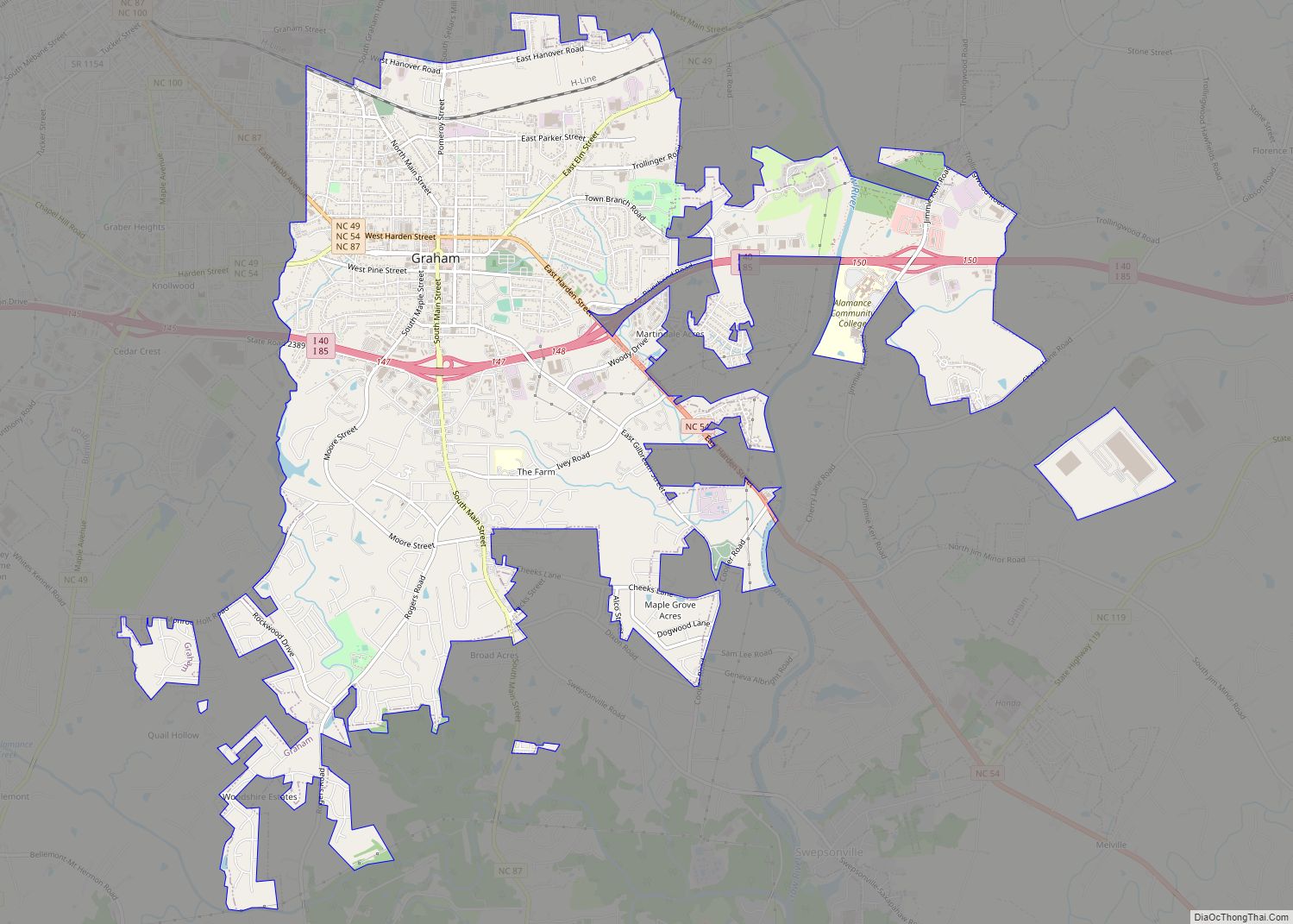
- Graham
- Granville
- Greene
- Guilford
- Halifax
- Harnett
- Haywood
- Henderson
- Hertford
- Hoke
- Hyde
- Iredell
- Jackson
- Johnston
- Jones
- Lee
- Lenoir
- Lincoln
- Macon
- Madison
- Martin
- McDowell
- Mecklenburg
- Mitchell
- Montgomery
- Moore
- Nash
- New Hanover
- Northampton
- Onslow
- Orange
- Pamlico
- Pasquotank
- Pender
- Perquimans
- Person
- Pitt
- Polk
- Randolph
- Richmond
- Robeson
- Rockingham
- Rowan
- Rutherford
- Sampson
- Scotland
- Stanly
- Stokes
- Surry
- Swain
- Transylvania
- Tyrrell
- Union
- Vance
- Wake
- Warren
- Washington
- Watauga
- Wayne
- Wilkes
- Wilson
- Yadkin
- Yancey
- Alabama
- Alaska
- Arizona
- Arkansas
- California
- Colorado
- Connecticut
- Delaware
- District of Columbia
- Florida
- Georgia
- Hawaii
- Idaho
- Illinois
- Indiana
- Iowa
- Kansas
- Kentucky
- Louisiana
- Maine
- Maryland
- Massachusetts
- Michigan
- Minnesota
- Mississippi
- Missouri
- Montana
- Nebraska
- Nevada
- New Hampshire
- New Jersey
- New Mexico
- New York
- North Carolina
- North Dakota
- Ohio
- Oklahoma
- Oregon
- Pennsylvania
- Rhode Island
- South Carolina
- South Dakota
- Tennessee
- Texas
- Utah
- Vermont
- Virginia
- Washington
- West Virginia
- Wisconsin
- Wyoming