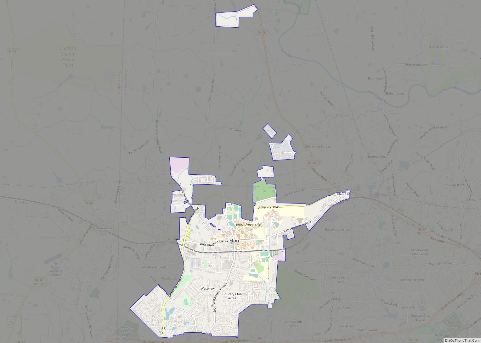
Elon (/ˈiːlɔːn/) is a town in Alamance County, North Carolina, United States. It is part of the Burlington metropolitan statistical area. The population as of the 2020 census was 11,324. The town of Elon is home to Elon University.
| Name: | Elon town |
|---|---|
| LSAD Code: | 43 |
| LSAD Description: | town (suffix) |
| State: | North Carolina |
| County: | Alamance County |
| Total Area: | 4.22 sq mi (10.94 km²) |
| Land Area: | 4.17 sq mi (10.81 km²) |
| Water Area: | 0.05 sq mi (0.13 km²) |
| Total Population: | 11,336 |
| Population Density: | 2,717.16/sq mi (1,049.03/km²) |
| ZIP code: | 27244 |
| FIPS code: | 3721095 |
| Website: | www.townofelon.com |
Online Interactive Map
Click on ![]() to view map in "full screen" mode.
to view map in "full screen" mode.
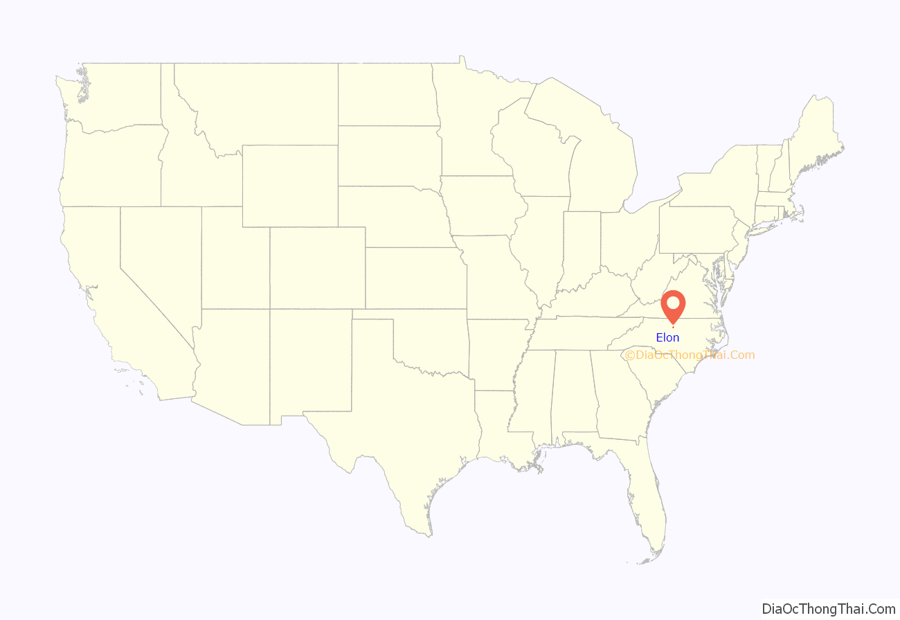
Elon location map. Where is Elon town?

History
Elon began in 1881 as a North Carolina Railroad depot in between the stations of Goldsboro and Charlotte, called “Mill Point” because it was envisioned to be a shipping point for area cotton mills. Locals called it “Boone’s Crossing.” Because of a growing population, a post office was built, which established a more permanent residency in 1888.
In 1889, the local Christian Assembly created an institution of higher learning called the “Graham Normal College”. The founders of Elon College named the school “Elon”, because they understood that to be the Hebrew word for oak, and the area contained many oak trees. The town was called “Elon College” until the college known as Elon College became Elon University. The town then changed its name officially to Elon.
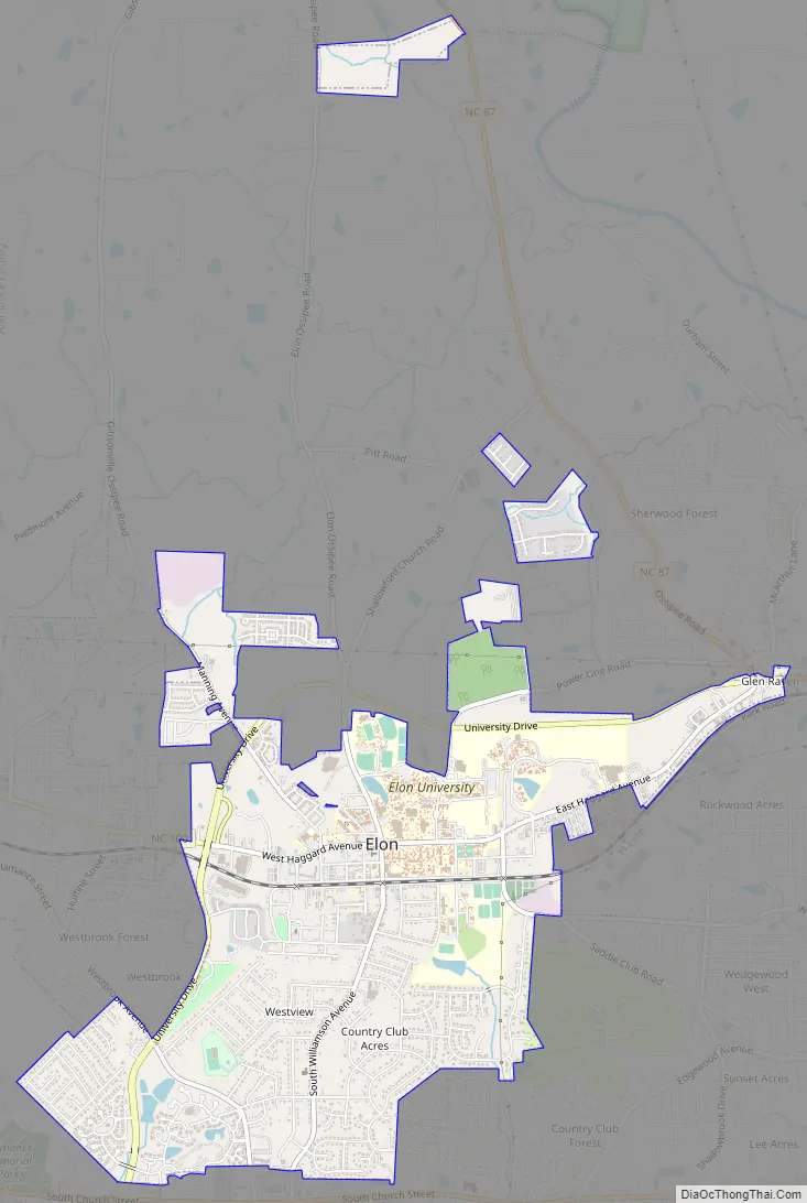
Elon Road Map
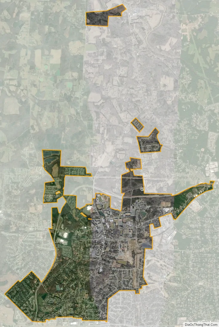
Elon city Satellite Map
Geography
Elon is located at 36°05′50″N 79°30′44″W / 36.097135°N 79.512102°W / 36.097135; -79.512102Coordinates: 36°05′50″N 79°30′44″W / 36.097135°N 79.512102°W / 36.097135; -79.512102.
According to the United States Census Bureau, the town has a total area of 3.9 square miles (10.2 km), of which 3.9 square miles (10.1 km) is land and 0.039 square miles (0.1 km), or 1.23%, is water.
See also
Map of North Carolina State and its subdivision:- Alamance
- Alexander
- Alleghany
- Anson
- Ashe
- Avery
- Beaufort
- Bertie
- Bladen
- Brunswick
- Buncombe
- Burke
- Cabarrus
- Caldwell
- Camden
- Carteret
- Caswell
- Catawba
- Chatham
- Cherokee
- Chowan
- Clay
- Cleveland
- Columbus
- Craven
- Cumberland
- Currituck
- Dare
- Davidson
- Davie
- Duplin
- Durham
- Edgecombe
- Forsyth
- Franklin
- Gaston
- Gates
- Graham
- Granville
- Greene
- Guilford
- Halifax
- Harnett
- Haywood
- Henderson
- Hertford
- Hoke
- Hyde
- Iredell
- Jackson
- Johnston
- Jones
- Lee
- Lenoir
- Lincoln
- Macon
- Madison
- Martin
- McDowell
- Mecklenburg
- Mitchell
- Montgomery
- Moore
- Nash
- New Hanover
- Northampton
- Onslow
- Orange
- Pamlico
- Pasquotank
- Pender
- Perquimans
- Person
- Pitt
- Polk
- Randolph
- Richmond
- Robeson
- Rockingham
- Rowan
- Rutherford
- Sampson
- Scotland
- Stanly
- Stokes
- Surry
- Swain
- Transylvania
- Tyrrell
- Union
- Vance
- Wake
- Warren
- Washington
- Watauga
- Wayne
- Wilkes
- Wilson
- Yadkin
- Yancey
- Alabama
- Alaska
- Arizona
- Arkansas
- California
- Colorado
- Connecticut
- Delaware
- District of Columbia
- Florida
- Georgia
- Hawaii
- Idaho
- Illinois
- Indiana
- Iowa
- Kansas
- Kentucky
- Louisiana
- Maine
- Maryland
- Massachusetts
- Michigan
- Minnesota
- Mississippi
- Missouri
- Montana
- Nebraska
- Nevada
- New Hampshire
- New Jersey
- New Mexico
- New York
- North Carolina
- North Dakota
- Ohio
- Oklahoma
- Oregon
- Pennsylvania
- Rhode Island
- South Carolina
- South Dakota
- Tennessee
- Texas
- Utah
- Vermont
- Virginia
- Washington
- West Virginia
- Wisconsin
- Wyoming