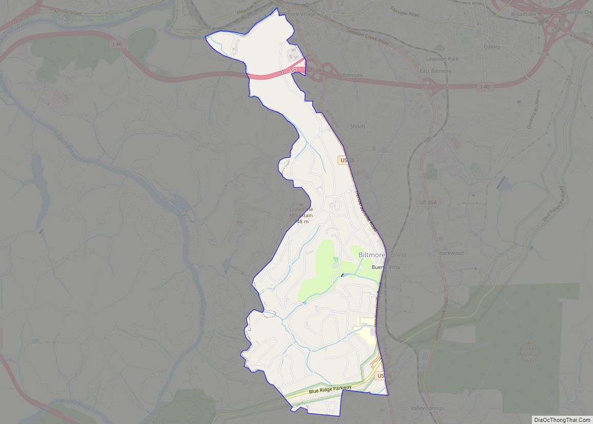
Biltmore Forest is a town in Buncombe County, North Carolina, United States. The population was 1,343 in 2010. It is part of the Asheville Metropolitan Statistical Area. Biltmore Forest is the second-wealthiest town in North Carolina by per capita income at $85,044.
| Name: | Biltmore Forest town |
|---|---|
| LSAD Code: | 43 |
| LSAD Description: | town (suffix) |
| State: | North Carolina |
| County: | Buncombe County |
| Elevation: | 2,267 ft (691 m) |
| Total Area: | 2.91 sq mi (7.54 km²) |
| Land Area: | 2.91 sq mi (7.54 km²) |
| Water Area: | 0.00 sq mi (0.00 km²) |
| Total Population: | 1,409 |
| Population Density: | 484.19/sq mi (186.94/km²) |
| ZIP code: | 28803 |
| Area code: | 828 |
| FIPS code: | 3705880 |
| GNISfeature ID: | 1019180 |
Online Interactive Map
Click on ![]() to view map in "full screen" mode.
to view map in "full screen" mode.
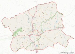
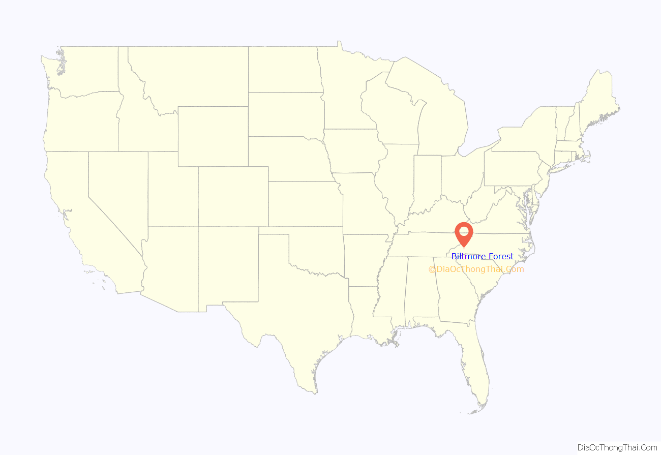
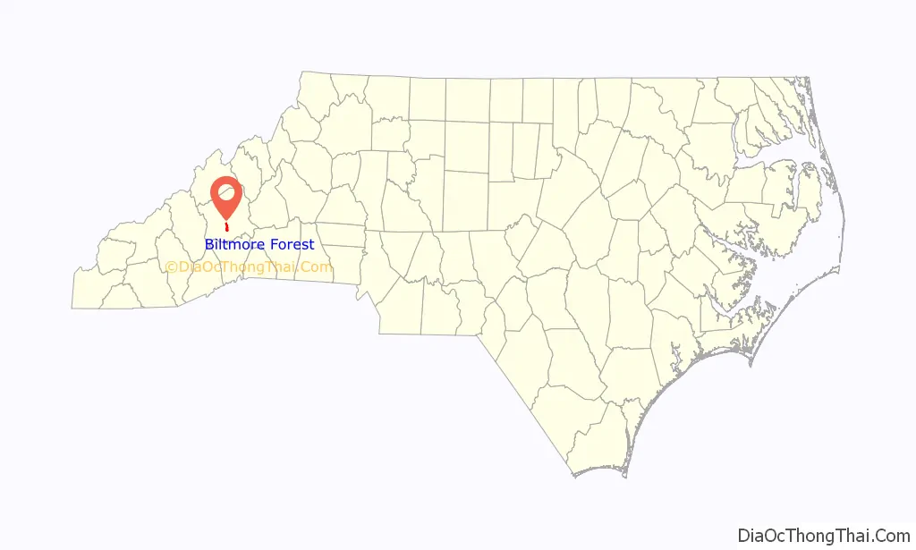
Biltmore Forest location map. Where is Biltmore Forest town?
History
In 1916, a substantial flood in Asheville, North Carolina, damaged the Biltmore Estate. The Biltmore Company sold the affected land to lessen the upkeep and tax burden. The town of Biltmore Forest was chartered in 1923 and was developed on this land. The first houses were built on White Oak Road. In 1929, Asheville annexed a portion of Biltmore Forest, but that action was reversed in 1935 by an act of the North Carolina legislature.
The Judge Junius G. Adams House, Raoulwood (Thomas Wadley Raoul House) and Gunston Hall are listed on the National Register of Historic Places.
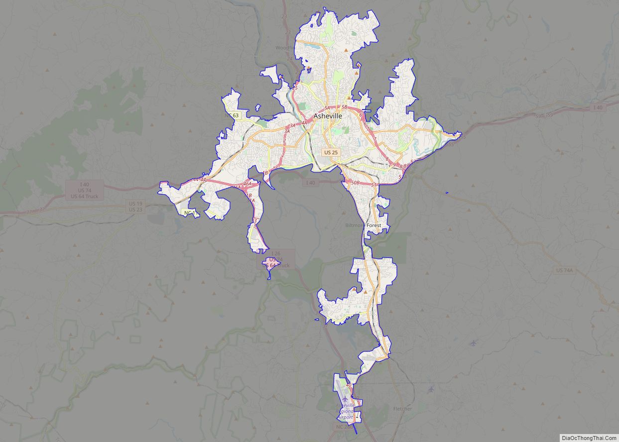
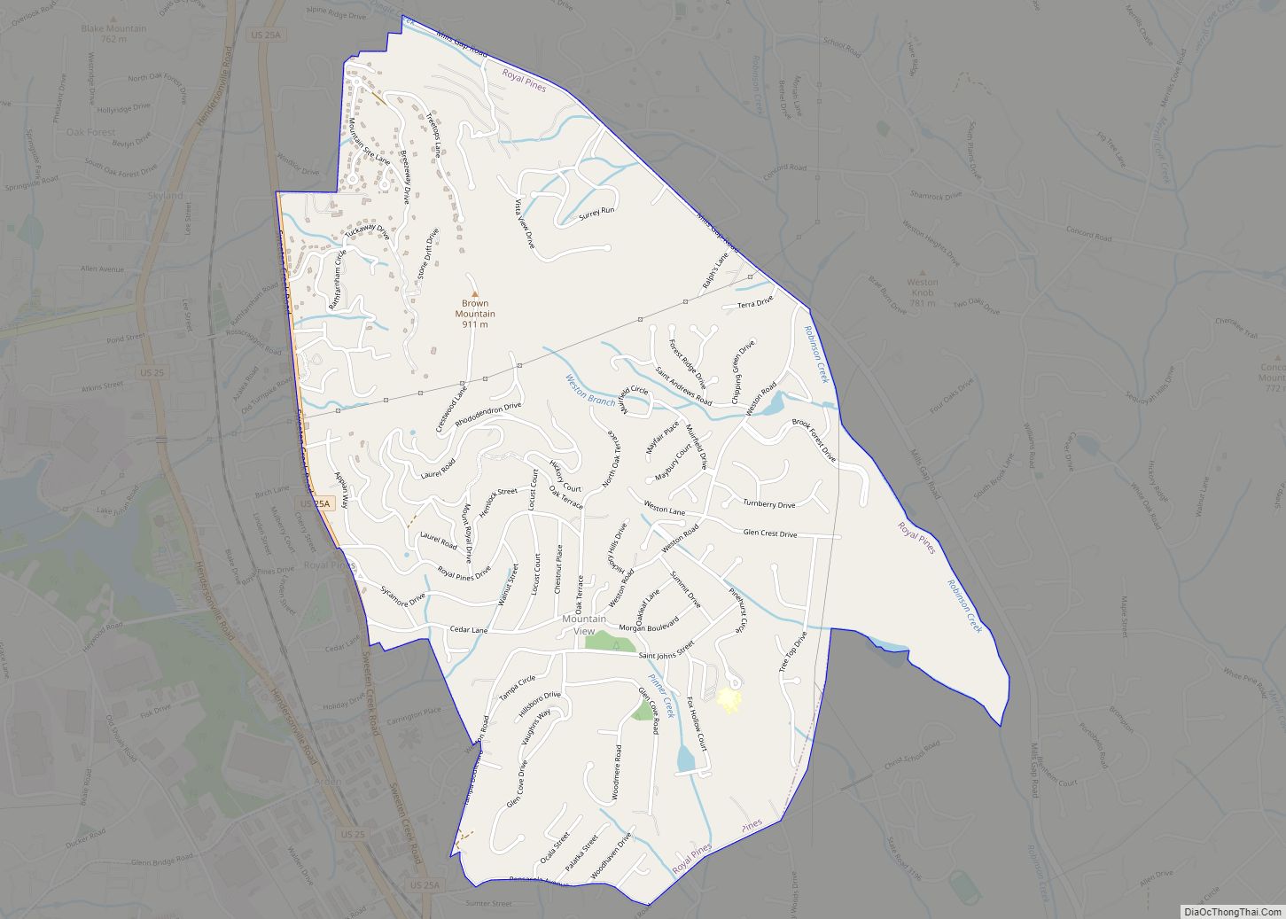
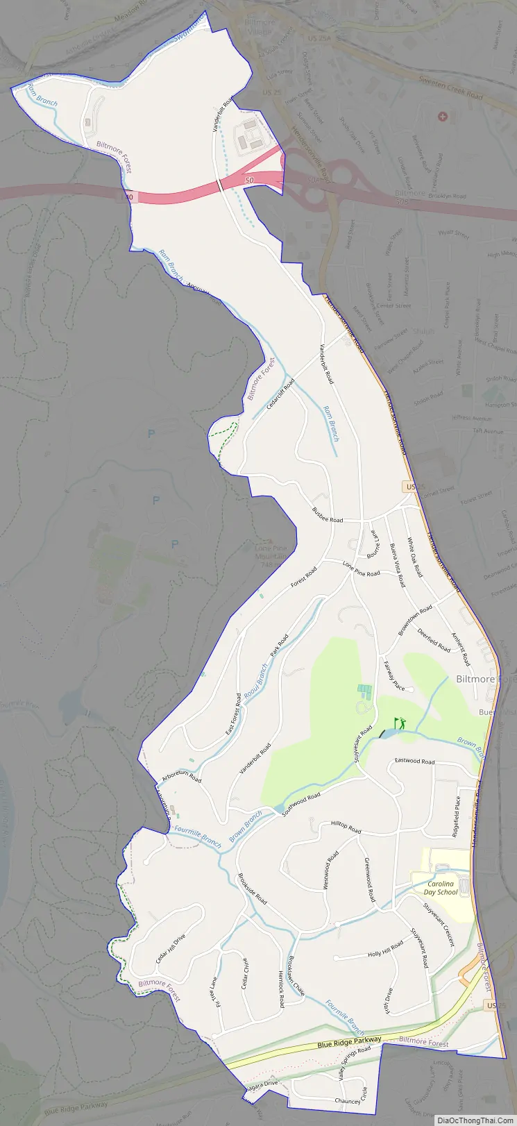
Biltmore Forest Road Map
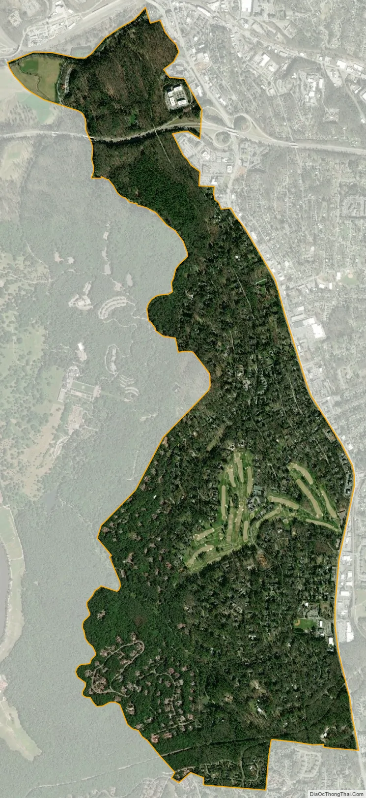
Biltmore Forest city Satellite Map
Geography
Biltmore Forest is located at 35°32′16″N 82°32′24″W / 35.53778°N 82.54000°W / 35.53778; -82.54000 (35.537884, -82.539882).
According to the United States Census Bureau, the town has a total area of 2.9 square miles (7.5 km), all land.
See also
Map of North Carolina State and its subdivision:- Alamance
- Alexander
- Alleghany
- Anson
- Ashe
- Avery
- Beaufort
- Bertie
- Bladen
- Brunswick
- Buncombe
- Burke
- Cabarrus
- Caldwell
- Camden
- Carteret
- Caswell
- Catawba
- Chatham
- Cherokee
- Chowan
- Clay
- Cleveland
- Columbus
- Craven
- Cumberland
- Currituck
- Dare
- Davidson
- Davie
- Duplin
- Durham
- Edgecombe
- Forsyth
- Franklin
- Gaston
- Gates
- Graham
- Granville
- Greene
- Guilford
- Halifax
- Harnett
- Haywood
- Henderson
- Hertford
- Hoke
- Hyde
- Iredell
- Jackson
- Johnston
- Jones
- Lee
- Lenoir
- Lincoln
- Macon
- Madison
- Martin
- McDowell
- Mecklenburg
- Mitchell
- Montgomery
- Moore
- Nash
- New Hanover
- Northampton
- Onslow
- Orange
- Pamlico
- Pasquotank
- Pender
- Perquimans
- Person
- Pitt
- Polk
- Randolph
- Richmond
- Robeson
- Rockingham
- Rowan
- Rutherford
- Sampson
- Scotland
- Stanly
- Stokes
- Surry
- Swain
- Transylvania
- Tyrrell
- Union
- Vance
- Wake
- Warren
- Washington
- Watauga
- Wayne
- Wilkes
- Wilson
- Yadkin
- Yancey
- Alabama
- Alaska
- Arizona
- Arkansas
- California
- Colorado
- Connecticut
- Delaware
- District of Columbia
- Florida
- Georgia
- Hawaii
- Idaho
- Illinois
- Indiana
- Iowa
- Kansas
- Kentucky
- Louisiana
- Maine
- Maryland
- Massachusetts
- Michigan
- Minnesota
- Mississippi
- Missouri
- Montana
- Nebraska
- Nevada
- New Hampshire
- New Jersey
- New Mexico
- New York
- North Carolina
- North Dakota
- Ohio
- Oklahoma
- Oregon
- Pennsylvania
- Rhode Island
- South Carolina
- South Dakota
- Tennessee
- Texas
- Utah
- Vermont
- Virginia
- Washington
- West Virginia
- Wisconsin
- Wyoming