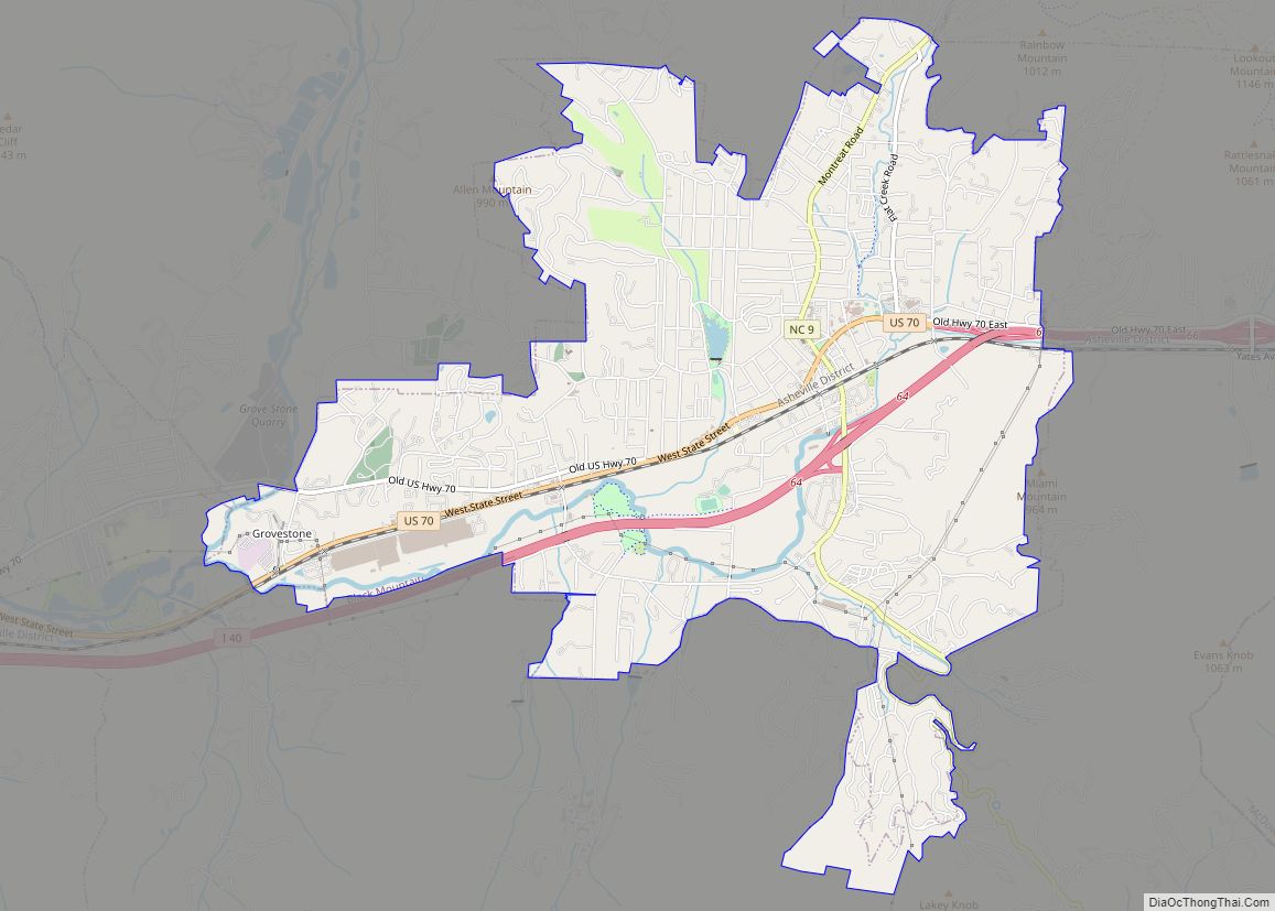
Black Mountain is a town in Buncombe County, North Carolina, United States. The population was 7,848 at the 2010 census. It is part of the Asheville Metropolitan Statistical Area. The town is named for the old train stop at the Black Mountain Depot and is located at the southern end of the Black Mountain range of the Blue Ridge Mountains in the Southern Appalachians.
| Name: | Black Mountain town |
|---|---|
| LSAD Code: | 43 |
| LSAD Description: | town (suffix) |
| State: | North Carolina |
| County: | Buncombe County |
| Incorporated: | March 4, 1893 |
| Elevation: | 2,405 ft (733 m) |
| Total Area: | 6.73 sq mi (17.42 km²) |
| Land Area: | 6.71 sq mi (17.38 km²) |
| Water Area: | 0.02 sq mi (0.04 km²) |
| Total Population: | 8,426 |
| Population Density: | 1,255.55/sq mi (484.76/km²) |
| ZIP code: | 28711 |
| Area code: | 828 |
| FIPS code: | 3706140 |
| GNISfeature ID: | 1019196 |
| Website: | www.townofblackmountain.org |
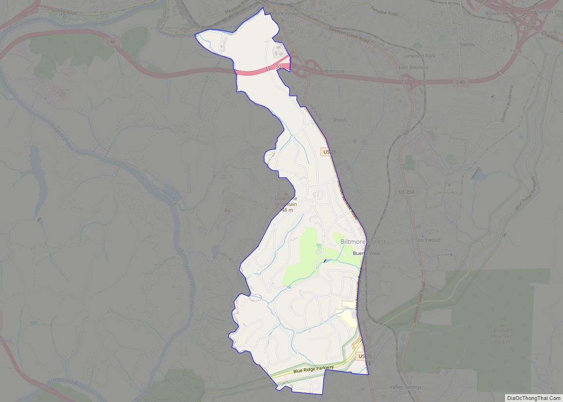
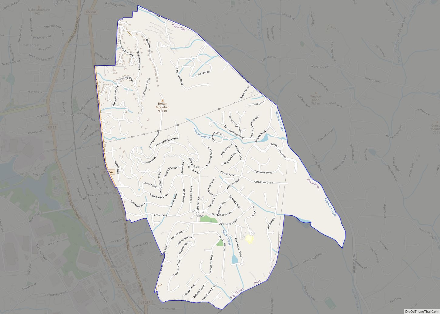
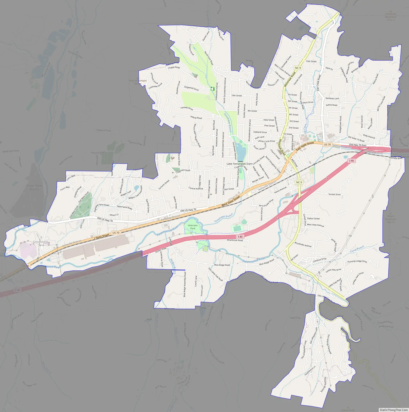
Online Interactive Map
Click on ![]() to view map in "full screen" mode.
to view map in "full screen" mode.
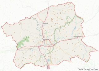
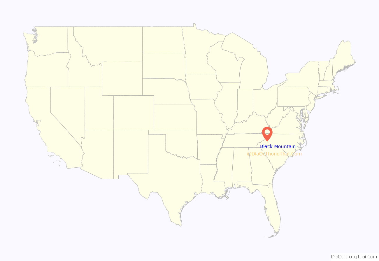
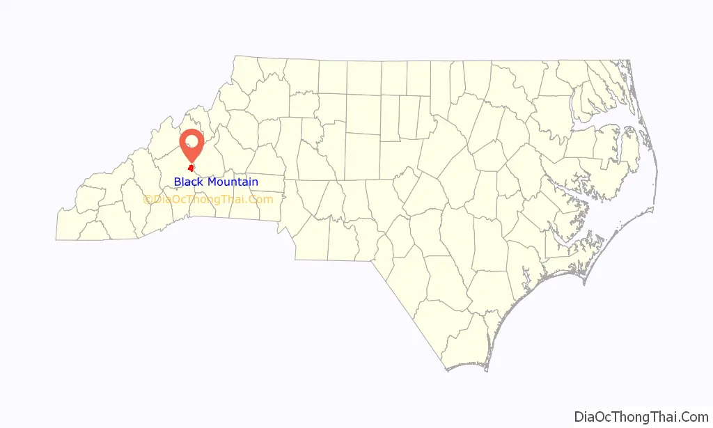
Black Mountain location map. Where is Black Mountain town?
History
Black Mountain in its present form was incorporated on March 4, 1893. The first recorded inhabitants of the area were the Cherokee. A road was built through the area in 1850 and a railroad followed in 1879.
The Black Mountain College Historic District, Black Mountain Downtown Historic District, Blue Ridge Assembly Historic District, Dougherty Heights Historic District, Rafael Guastavino Sr., Estate, Intheoaks, Monte Vista Hotel, South Montreat Road Historic District, and Thomas Chapel A.M.E. Zion Church are listed on the National Register of Historic Places.
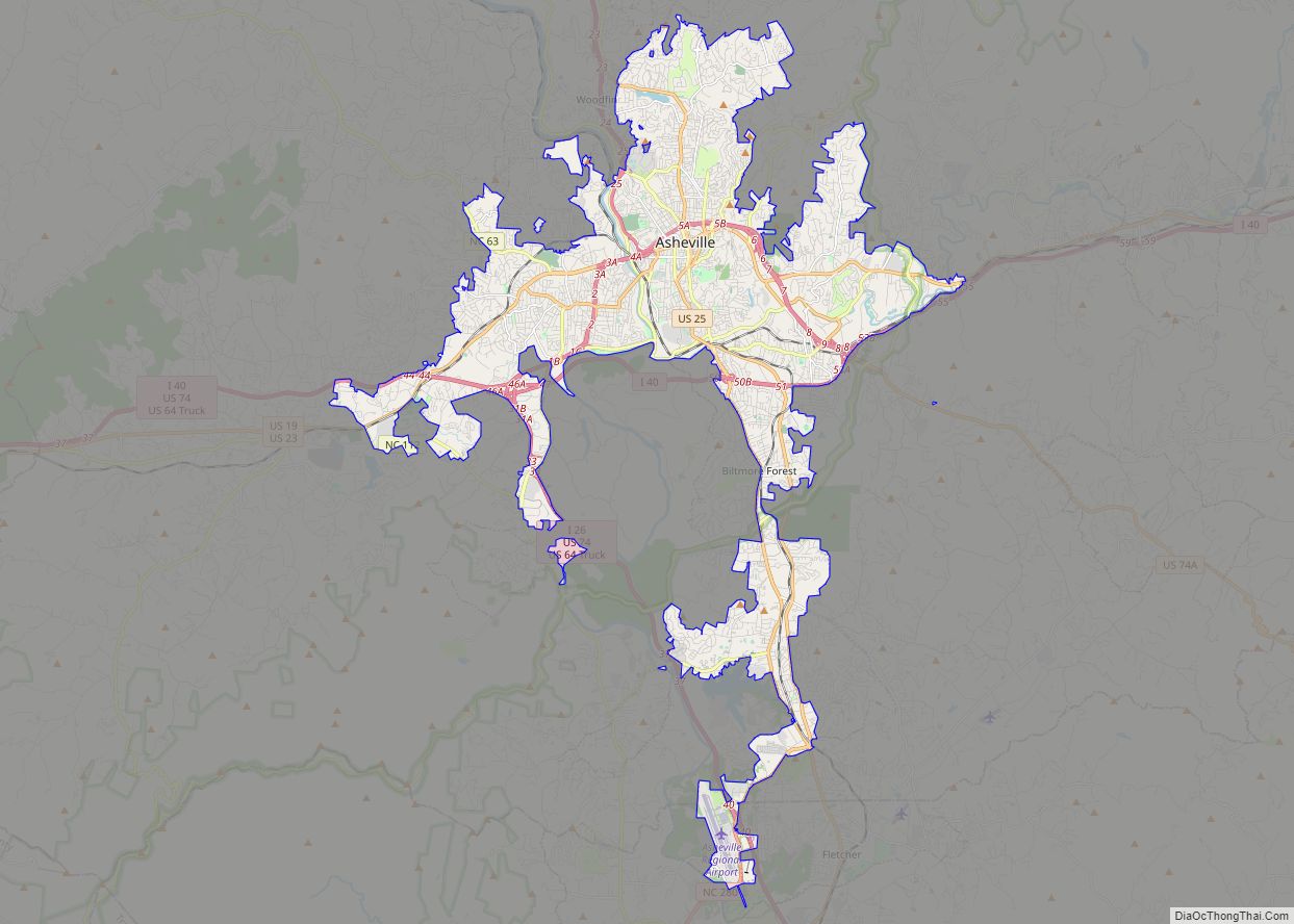
Black Mountain Road Map
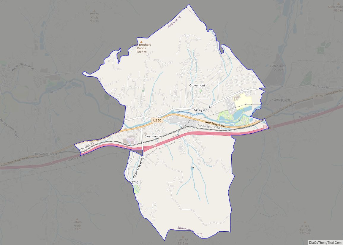
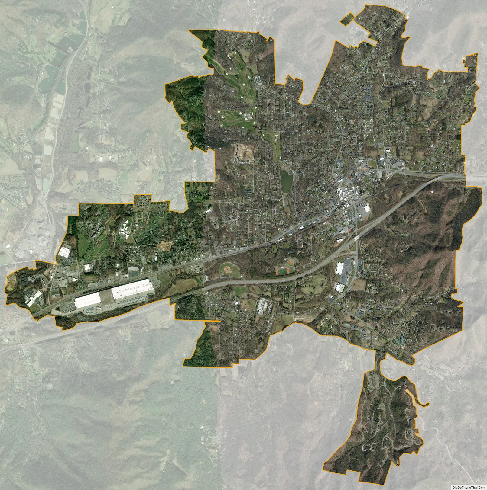
Black Mountain city Satellite Map
Geography
Black Mountain is located in eastern Buncombe County at 35°37′9″N 82°19′32″W / 35.61917°N 82.32556°W / 35.61917; -82.32556 (35.619208, -82.325434). The town of Montreat borders Black Mountain to the north, and the unincorporated community of Swannanoa is on the western border. U.S. Route 70 (State Street) is the main road through the center of town. Interstate 40 passes just to the south of downtown, with access from exits 64 and 65. Via I-40, it is 15 miles (24 km) west to Asheville and 41 miles (66 km) east to Morganton.
The Swannanoa River flows from east to west through the town, rising just 3 miles (5 km) to the east at Swannanoa Gap on the crest of the Appalachians. The Swannanoa River flows west to the French Broad River, part of the Tennessee River basin that ultimately flows to the Gulf of Mexico via the Mississippi River, while Swannanoa Creek east of the gap is part of the Catawba River-Santee River system, reaching the Atlantic Ocean north of Charleston, South Carolina.
According to the United States Census Bureau, the town of Black Mountain has a total area of 6.7 square miles (17.4 km), of which 0.015 square miles (0.04 km), or 0.23%, is water.
See also
Map of North Carolina State and its subdivision:- Alamance
- Alexander
- Alleghany
- Anson
- Ashe
- Avery
- Beaufort
- Bertie
- Bladen
- Brunswick
- Buncombe
- Burke
- Cabarrus
- Caldwell
- Camden
- Carteret
- Caswell
- Catawba
- Chatham
- Cherokee
- Chowan
- Clay
- Cleveland
- Columbus
- Craven
- Cumberland
- Currituck
- Dare
- Davidson
- Davie
- Duplin
- Durham
- Edgecombe
- Forsyth
- Franklin
- Gaston
- Gates
- Graham
- Granville
- Greene
- Guilford
- Halifax
- Harnett
- Haywood
- Henderson
- Hertford
- Hoke
- Hyde
- Iredell
- Jackson
- Johnston
- Jones
- Lee
- Lenoir
- Lincoln
- Macon
- Madison
- Martin
- McDowell
- Mecklenburg
- Mitchell
- Montgomery
- Moore
- Nash
- New Hanover
- Northampton
- Onslow
- Orange
- Pamlico
- Pasquotank
- Pender
- Perquimans
- Person
- Pitt
- Polk
- Randolph
- Richmond
- Robeson
- Rockingham
- Rowan
- Rutherford
- Sampson
- Scotland
- Stanly
- Stokes
- Surry
- Swain
- Transylvania
- Tyrrell
- Union
- Vance
- Wake
- Warren
- Washington
- Watauga
- Wayne
- Wilkes
- Wilson
- Yadkin
- Yancey
- Alabama
- Alaska
- Arizona
- Arkansas
- California
- Colorado
- Connecticut
- Delaware
- District of Columbia
- Florida
- Georgia
- Hawaii
- Idaho
- Illinois
- Indiana
- Iowa
- Kansas
- Kentucky
- Louisiana
- Maine
- Maryland
- Massachusetts
- Michigan
- Minnesota
- Mississippi
- Missouri
- Montana
- Nebraska
- Nevada
- New Hampshire
- New Jersey
- New Mexico
- New York
- North Carolina
- North Dakota
- Ohio
- Oklahoma
- Oregon
- Pennsylvania
- Rhode Island
- South Carolina
- South Dakota
- Tennessee
- Texas
- Utah
- Vermont
- Virginia
- Washington
- West Virginia
- Wisconsin
- Wyoming