Bryson City is a town in and the county seat of Swain County, North Carolina, United States. The population was 1,558 as of the 2020 census. Located in what was historically the land of the Cherokee, Bryson City was founded as the Charleston to serve as the county seat of Swain County when it was formed from parts of surrounding counties. It grew into an important local rail hub. Today the city serves as a popular tourist destination, lying just to the west of the entrance to the Great Smoky Mountains National Park, for outdoor activities in the Nantahala National Forest, and along the Nantahala River and Fontana Lake, and serves as the home of the Great Smoky Mountains Railroad, a heritage railroad that provides tours of the Nantahala valley. The popular Nantahala Outdoor Center provides guide services for many of the outdoor activities in the area.
| Name: | Bryson City town |
|---|---|
| LSAD Code: | 43 |
| LSAD Description: | town (suffix) |
| State: | North Carolina |
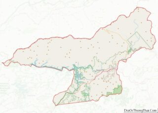
| County: | Swain County |
| Elevation: | 1,752 ft (534 m) |
| Total Area: | 2.29 sq mi (5.94 km²) |
| Land Area: | 2.18 sq mi (5.66 km²) |
| Water Area: | 0.11 sq mi (0.28 km²) |
| Total Population: | 1,558 |
| Population Density: | 713.37/sq mi (275.48/km²) |
| ZIP code: | 28713 |
| Area code: | 828 |
| FIPS code: | 3708480 |
| GNISfeature ID: | 1019348 |
| Website: | www.brysoncitync.gov |
Online Interactive Map
Click on ![]() to view map in "full screen" mode.
to view map in "full screen" mode.
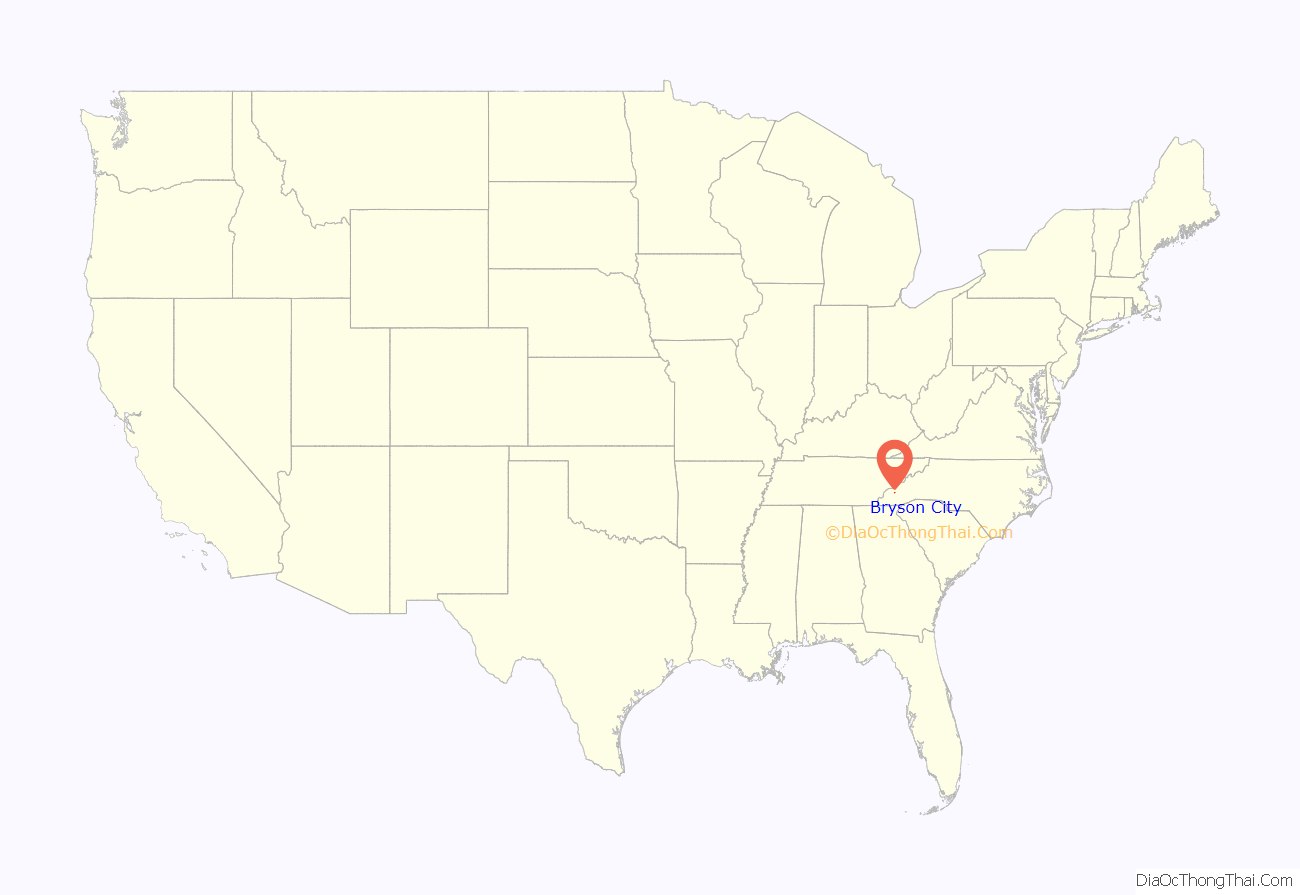
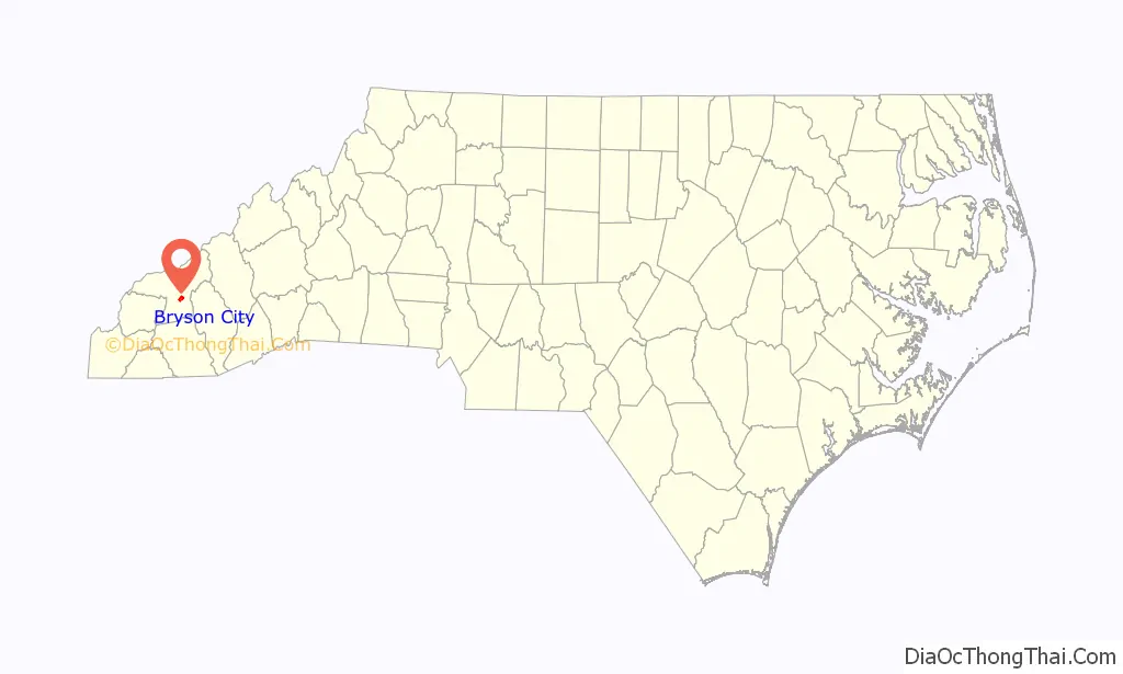
Bryson City location map. Where is Bryson City town?
History
Indigenous settlements
Indigenous cultures of Native Americans have been living and hunting along the Tuckasegee River in the vicinity of what is now Bryson City for nearly 14,000 years. The village of Kituwa, which the Cherokee believed to be their oldest village and “mother town”, was located along the Tuckasegee River. The ancient mound and village site is now controlled again by the federally recognized Eastern Band of Cherokee Indians and is preserved as a sacred site. (Bryson City developed downstream from this site.)
In 1567, an orata (minor chief) from Kituwa is believed to have met with Spanish explorer Juan Pardo in the French Broad Valley to the north. During the American Revolutionary War, many Cherokee allied with the British, hoping to expel European Americans from their territory. American soldiers burned and destroyed the town of Kituwa in 1776, but the Cherokee continued to hold annual ceremonial dances at the site throughout the 19th century.
Around 1818, a Cherokee chief known as Big Bear received a 640-acre (2.6 km) reservation of land immediately west of the confluence of Deep Creek and the Tuckasegee River. Big Bear sold part of his reservation to Darling Belk in 1819 and another part to John B. Love in 1824. Throughout the 1830s, Belk’s heirs and Love fought an extended legal battle over control of the former Big Bear land, with Love finally prevailing in 1840. The following year, Love sold part of the land to James and Diana Shuler. The Shulers, in turn, sold parts of their land to Colonel Thaddeus Bryson and merchant Alfred Cline. A small hamlet known as Bear Springs developed on what was once Big Bear’s reservation.
Contemporary history
With its population having increased, Swain County was formed from parts of Jackson and Macon counties in 1871, during the Reconstruction era. The new commissioners first met at Cline’s store at Bear Springs. Lucy Ann (Raby) Cline agreed to sell several lots of her land to form a county seat. Initially known as Charleston, the county seat was laid out in a T-shape, formed by what are now Main and Everett streets (the latter street was named for the county’s first sheriff, Epp Everett). The first Swain County Courthouse was completed in 1874. In 1872, shortly after completion of the new jail, a gang led by Harvey Cooper stormed the jail and freed Tom Colvert, whom they deemed unjustly imprisoned for killing a rival at a saloon in Robbinsville.
In 1889, the people of Charleston changed the city’s name to “Bryson City” to acknowledge the role of Thaddeus Bryson in its development, and to eliminate confusion from sharing a name with Charleston, South Carolina. The Western North Carolina Railroad laid tracks through Bryson City in 1884, greatly improving transportation to the previously isolated area. The Bryson City Bank opened in 1904. The current Swain County Courthouse was completed in 1908, replacing the former one.
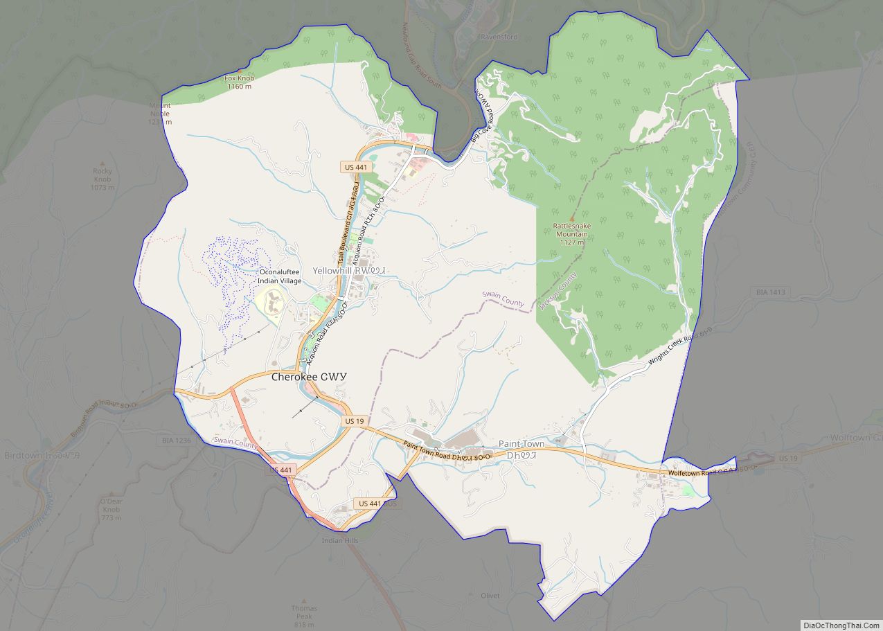
The Great Smoky Mountains National Park, which was established in 1933 during the Great Depression, generates considerable revenue to for Swain County. Horace Kephart, an author and outdoors enthusiast who was based in Bryson City for several years, was a key early proponent for creation of the park. The Deep Creek section of the park, which is immediately north of Bryson City, has a large campground and multiple trailheads. The park’s main eastern entrance is located just a few miles east of Bryson City at Cherokee. Cherokee is the southern terminus of the Blue Ridge Parkway. It is also the base of the Eastern Band of Cherokee Indians, the only federally recognized tribe in North Carolina. Many are descendants of Cherokee who avoided removal in the late 1830s.
The completion of Fontana Dam in 1944 created a reservoir, which inundated the only highway connecting Bryson City with the remote area of the Smokies known as the North Shore. The U.S. government began constructing a new highway in 1948, now known as Lakeview Drive, but it was slow. By 1972, only 7 miles (11 km) had been completed. Environmental and financial issues stalled the project, and the road became known to locals as “The Road to Nowhere”.
In 2007, the National Park Service deemed the road’s construction to be in violation of the Great Smoky Mountains National Park’s general management plan, and began working with Swain County to find an alternative.
The increasing popularity of the automobile led to a decline in railroad transportation, and Southern Railway (which had replaced the Western North Carolina Railroad) dropped passenger service in 1948. After Norfolk Southern ended freight traffic on the railroad in 1985, the state of North Carolina purchased the tracks. In 1988, the state established a scenic line, known as the Great Smoky Mountains Railroad, with its depot and departure point in Bryson City.
In 2015, the city’s first FM station was launched. WTIJ-LP (100.7) broadcasts local and nationally syndicated ministers, and Christian music. The station is owned by Grace Christian Academy and broadcasts over the air and online 24/7.
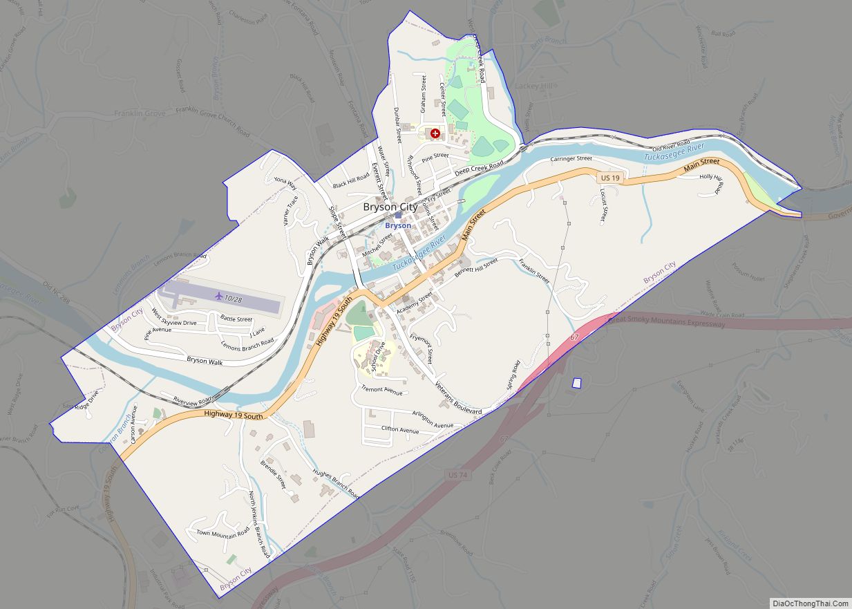
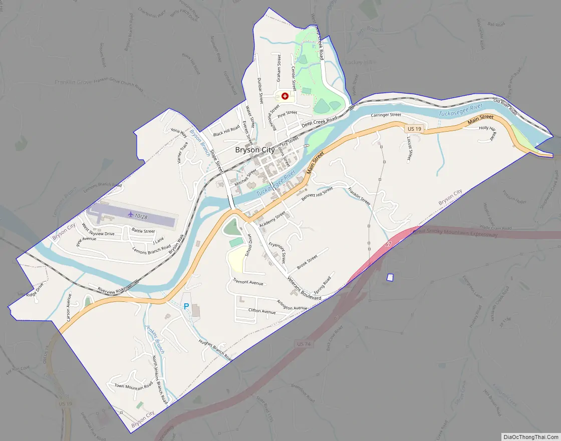
Bryson City Road Map
Bryson City city Satellite Map

Geography
Bryson City is located just west of the confluence of the Tuckasegee River, which flows westward from its source in the mountains to the east, and Deep Creek, which flows south from its source near Newfound Gap in the Great Smoky Mountains. After flowing around the Bryson City Island Park, and passing through Bryson City, the Tuckasegee flows southwestward for another 12 miles (19 km) before emptying into the Little Tennessee River. Fontana Lake, an impoundment of the Little Tennessee, covers the lower 11 miles (18 km) of the Tuckasegee.
The town is surrounded on all sides by mountains. The Great Smoky Mountains rise to the north, the Cowee Mountains rise to the south, and the Plott Balsams rise to the east. The boundary of the Nantahala National Forest passes just south of the city, and the boundary of the Great Smoky Mountains National Park passes just to the north. The Qualla Boundary, which comprises the bulk of the reservation of the Eastern Band of Cherokee Indians, dominates the area to the east.
Bryson City is centered around the junction of Everett Street and Main Street. Main Street is part of U.S. Route 19, which connects Bryson City to Cherokee to the northeast and Murphy to the southwest.
According to the United States Census Bureau, the town has a total area of 2.2 square miles (5.7 km), of which 2.1 square miles (5.4 km) is land and 0.1 square miles (0.26 km) (5.33%) is water.
See also
Map of North Carolina State and its subdivision:- Alamance
- Alexander
- Alleghany
- Anson
- Ashe
- Avery
- Beaufort
- Bertie
- Bladen
- Brunswick
- Buncombe
- Burke
- Cabarrus
- Caldwell
- Camden
- Carteret
- Caswell
- Catawba
- Chatham
- Cherokee
- Chowan
- Clay
- Cleveland
- Columbus
- Craven
- Cumberland
- Currituck
- Dare
- Davidson
- Davie
- Duplin
- Durham
- Edgecombe
- Forsyth
- Franklin
- Gaston
- Gates
- Graham
- Granville
- Greene
- Guilford
- Halifax
- Harnett
- Haywood
- Henderson
- Hertford
- Hoke
- Hyde
- Iredell
- Jackson
- Johnston
- Jones
- Lee
- Lenoir
- Lincoln
- Macon
- Madison
- Martin
- McDowell
- Mecklenburg
- Mitchell
- Montgomery
- Moore
- Nash
- New Hanover
- Northampton
- Onslow
- Orange
- Pamlico
- Pasquotank
- Pender
- Perquimans
- Person
- Pitt
- Polk
- Randolph
- Richmond
- Robeson
- Rockingham
- Rowan
- Rutherford
- Sampson
- Scotland
- Stanly
- Stokes
- Surry
- Swain
- Transylvania
- Tyrrell
- Union
- Vance
- Wake
- Warren
- Washington
- Watauga
- Wayne
- Wilkes
- Wilson
- Yadkin
- Yancey
- Alabama
- Alaska
- Arizona
- Arkansas
- California
- Colorado
- Connecticut
- Delaware
- District of Columbia
- Florida
- Georgia
- Hawaii
- Idaho
- Illinois
- Indiana
- Iowa
- Kansas
- Kentucky
- Louisiana
- Maine
- Maryland
- Massachusetts
- Michigan
- Minnesota
- Mississippi
- Missouri
- Montana
- Nebraska
- Nevada
- New Hampshire
- New Jersey
- New Mexico
- New York
- North Carolina
- North Dakota
- Ohio
- Oklahoma
- Oregon
- Pennsylvania
- Rhode Island
- South Carolina
- South Dakota
- Tennessee
- Texas
- Utah
- Vermont
- Virginia
- Washington
- West Virginia
- Wisconsin
- Wyoming