Cameron is a town in Moore County, North Carolina, United States. The population was 359 at the 2020 census.
| Name: | Cameron town |
|---|---|
| LSAD Code: | 43 |
| LSAD Description: | town (suffix) |
| State: | North Carolina |
| County: | Moore County |
| Founded: | 1875 |
| Incorporated: | 1876 |
| Elevation: | 358 ft (109 m) |
| Total Area: | 1.21 sq mi (3.14 km²) |
| Land Area: | 1.21 sq mi (3.14 km²) |
| Water Area: | 0.00 sq mi (0.00 km²) |
| Total Population: | 244 |
| Population Density: | 201.32/sq mi (77.72/km²) |
| ZIP code: | 28326 |
| FIPS code: | 3709800 |
| GNISfeature ID: | 1019484 |
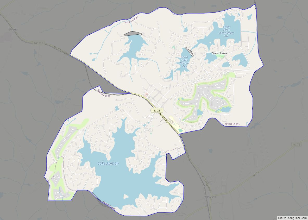
Online Interactive Map
Click on ![]() to view map in "full screen" mode.
to view map in "full screen" mode.
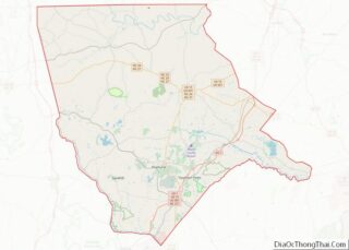
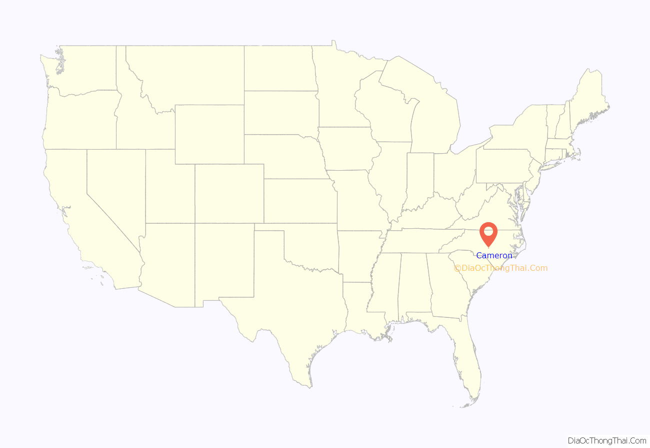
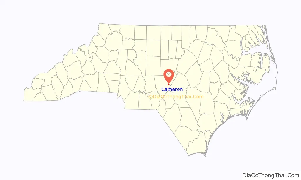
Cameron location map. Where is Cameron town?
History
Cameron grew up around a plank road that was followed in later years by a railroad. The town was planned in 1875 and incorporated in 1876. Cameron was at the end of the Raleigh and Augusta Railroad. Its location made it an ideal place for entrepreneurs to establish businesses. They built turpentine distilleries, established mercantile and hotel businesses to serve the needs of the railroad’s customers and built a thriving dewberry farming and consignment operation.
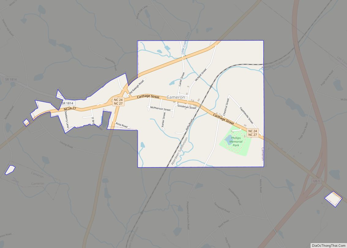
Cameron Road Map
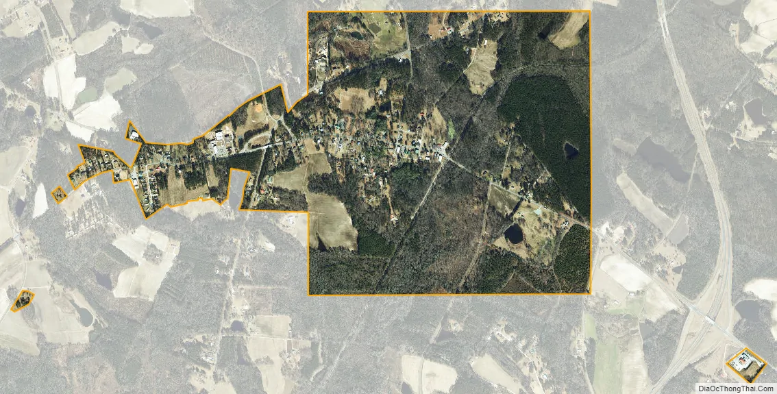
Cameron city Satellite Map
Geography
Cameron is located at 35°19′34″N 79°15′11″W / 35.32611°N 79.25306°W / 35.32611; -79.25306 (35.326096, -79.253159).
According to the United States Census Bureau, the town has a total area of 1.0 square mile (2.6 km), all land.
Neighboring towns include Vass to the south and Carthage to the west.
See also
Map of North Carolina State and its subdivision:- Alamance
- Alexander
- Alleghany
- Anson
- Ashe
- Avery
- Beaufort
- Bertie
- Bladen
- Brunswick
- Buncombe
- Burke
- Cabarrus
- Caldwell
- Camden
- Carteret
- Caswell
- Catawba
- Chatham
- Cherokee
- Chowan
- Clay
- Cleveland
- Columbus
- Craven
- Cumberland
- Currituck
- Dare
- Davidson
- Davie
- Duplin
- Durham
- Edgecombe
- Forsyth
- Franklin
- Gaston
- Gates
- Graham
- Granville
- Greene
- Guilford
- Halifax
- Harnett
- Haywood
- Henderson
- Hertford
- Hoke
- Hyde
- Iredell
- Jackson
- Johnston
- Jones
- Lee
- Lenoir
- Lincoln
- Macon
- Madison
- Martin
- McDowell
- Mecklenburg
- Mitchell
- Montgomery
- Moore
- Nash
- New Hanover
- Northampton
- Onslow
- Orange
- Pamlico
- Pasquotank
- Pender
- Perquimans
- Person
- Pitt
- Polk
- Randolph
- Richmond
- Robeson
- Rockingham
- Rowan
- Rutherford
- Sampson
- Scotland
- Stanly
- Stokes
- Surry
- Swain
- Transylvania
- Tyrrell
- Union
- Vance
- Wake
- Warren
- Washington
- Watauga
- Wayne
- Wilkes
- Wilson
- Yadkin
- Yancey
- Alabama
- Alaska
- Arizona
- Arkansas
- California
- Colorado
- Connecticut
- Delaware
- District of Columbia
- Florida
- Georgia
- Hawaii
- Idaho
- Illinois
- Indiana
- Iowa
- Kansas
- Kentucky
- Louisiana
- Maine
- Maryland
- Massachusetts
- Michigan
- Minnesota
- Mississippi
- Missouri
- Montana
- Nebraska
- Nevada
- New Hampshire
- New Jersey
- New Mexico
- New York
- North Carolina
- North Dakota
- Ohio
- Oklahoma
- Oregon
- Pennsylvania
- Rhode Island
- South Carolina
- South Dakota
- Tennessee
- Texas
- Utah
- Vermont
- Virginia
- Washington
- West Virginia
- Wisconsin
- Wyoming