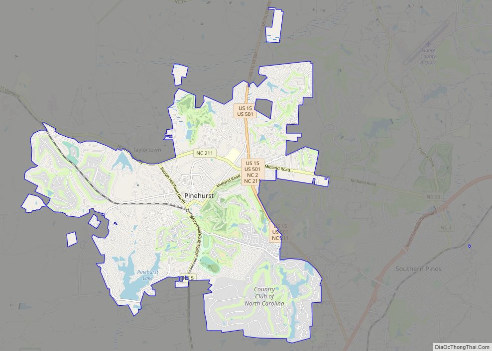
Pinehurst is a village in Moore County, North Carolina, United States. As of the 2010 census, the village population was 13,124. It is home of the historic Pinehurst Resort, a Golf resort, which has hosted multiple United States Open Championships in Golf. The village lies adjacent to the Pine Needles Lodge and Golf Club, which has hosted multiple U.S. Open tournaments in Women’s Golf. A large portion of the central village, including the resort complexes, is a National Historic Landmark District, designated in 1996 for its landscape design (by Frederick Law Olmsted) and its significance in the history of golf in the United States. Pinehurst has been designated as the “Home of American Golf” by the United States Golf Association, which announced a second headquarters in the village in 2020. The area is also known for its strong equestrian community, has hosted the former Stoneybrook Steeplechase, and currently maintains the Pinehurst Harness Track. Fox hunting is also a common sport in the area.
Despite the village’s relatively small size, the resort will host the men’s U.S. Open five times in the next three decades: Pinehurst No. 2 will host the Men’s U.S. Open in 2024, 2029, 2035, 2041 and 2047.
In addition to the Pinehurst Resort, the village is home to The Country Club of North Carolina. In the immediate area surrounding Pinehurst, there are more than 40 other golf courses.
| Name: | Pinehurst village |
|---|---|
| LSAD Code: | 47 |
| LSAD Description: | village (suffix) |
| State: | North Carolina |
| County: | Moore County |
| Founded: | 1895 |
| Incorporated: | 1980 |
| Elevation: | 561 ft (171 m) |
| Land Area: | 16.71 sq mi (43.28 km²) |
| Water Area: | 0.65 sq mi (1.68 km²) |
| Population Density: | 1,052.19/sq mi (406.24/km²) |
| ZIP code: | 28370, 28374 |
| FIPS code: | 3751940 |
| GNISfeature ID: | 1021933 |
| Website: | www.vopnc.org |
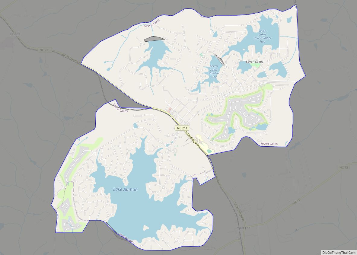
Online Interactive Map
Click on ![]() to view map in "full screen" mode.
to view map in "full screen" mode.
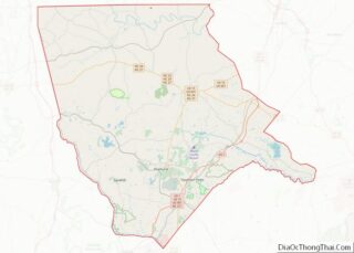
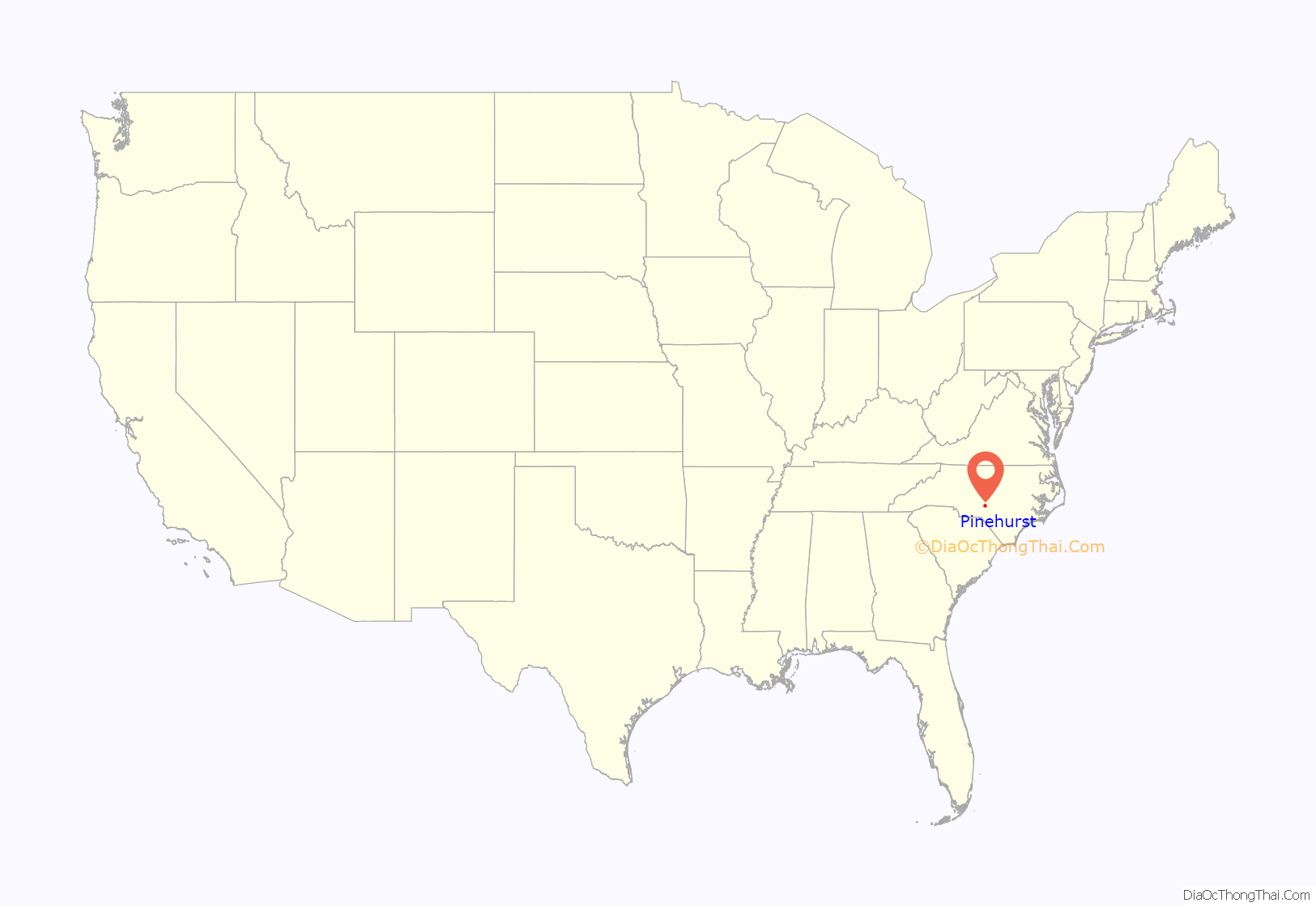
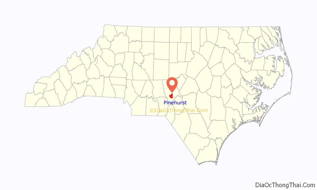
Pinehurst location map. Where is Pinehurst village?
History
In 1895, James Walker Tufts purchased 500 acres (200 ha), and eventually purchased an additional 5,500 acres (2,200 ha), of land for approximately $1.25 per acre in the North Carolina Sandhills, with the vision of building a “health resort for people of modest means”. Tufts retained Frederick Law Olmsted to design the village, which features curving lanes and a picturesque central green.
Originally dubbed Tuftstown during development, Tuftstown became the village of Pinehurst, and home of the Pinehurst Resort. In 1980, the village became a municipality.
The first golf course at Pinehurst Resort was laid out in 1897–1898. The first championship held at Pinehurst was the United North and South Amateur Championship of 1901. The best known course, Pinehurst No. 2, was designed by Donald Ross and completed in 1907. Pinehurst Race Track was established in 1915. The resort now has nine golf courses, three hotels, a spa, and extensive sports and leisure facilities.
In 1999, National Public Radio reported that many local business owners in Pinehurst were upset because the Pinehurst Resort was using lawsuits to prevent local businesses from using the term “Pinehurst” in the names of their businesses. The village council sought a written guarantee from the Pinehurst Resort that it would not force any business in the village to remove the name “Pinehurst” from its name unless the business is a direct competitor. The request came a week later in a local newspaper. The village also sued the resort over control of the name shared between the resort and village.
The Lloyd-Howe House, Pinehurst Historic District and Pinehurst Race Track are listed on the National Register of Historic Places.
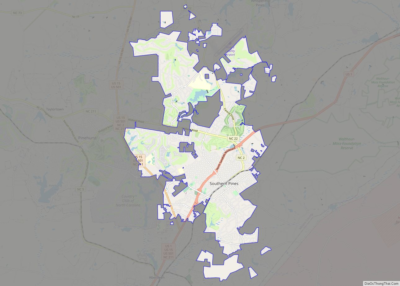
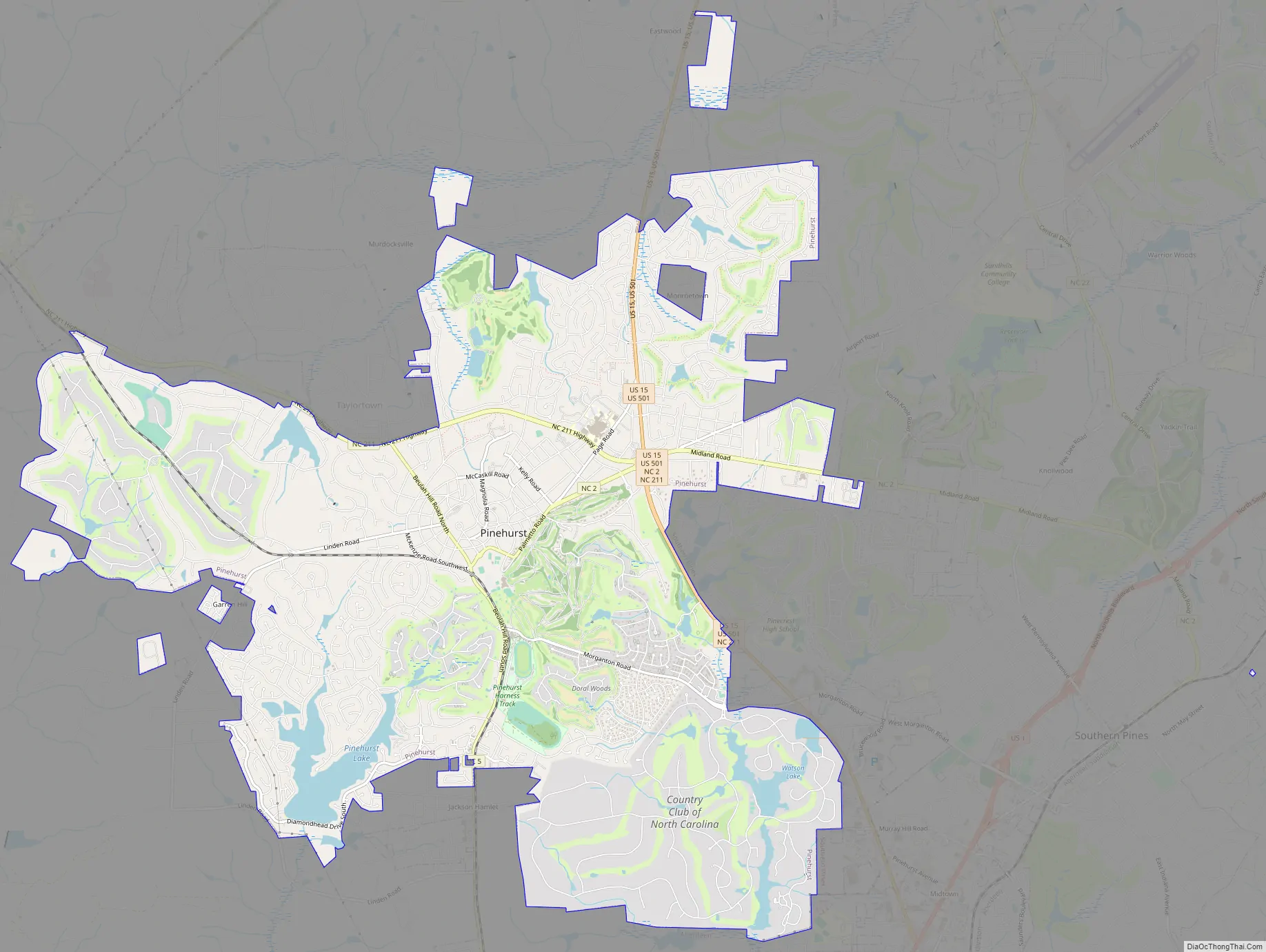
Pinehurst Road Map
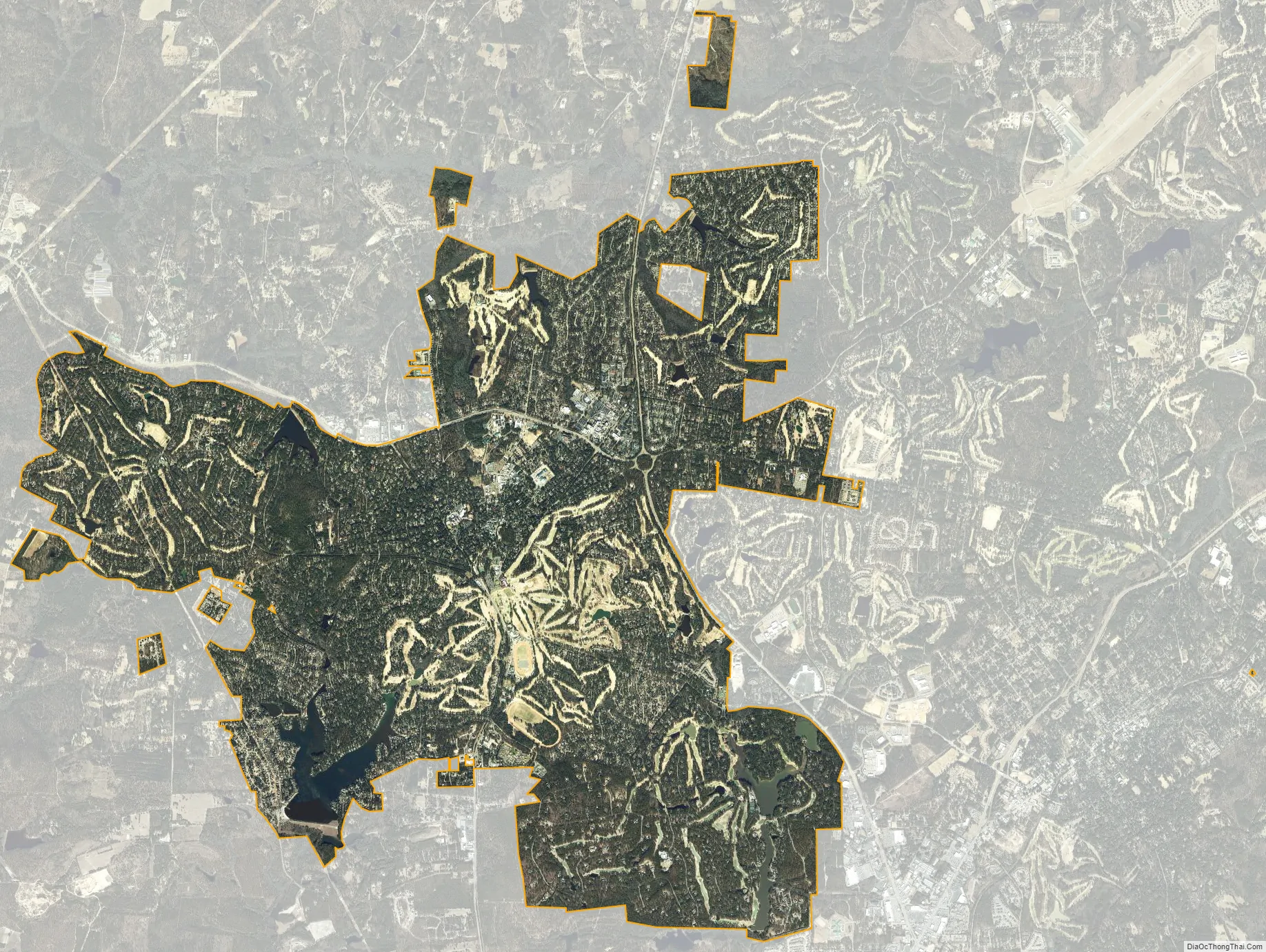
Pinehurst city Satellite Map
Geography
According to the United States Census Bureau, Pinehurst is located at 35°11′28″N 79°28′11.4″W / 35.19111°N 79.469833°W / 35.19111; -79.469833 (35.191105, −79.469829). and the village has a total area of 17.2 square miles (44.5 km), of which 16.6 square miles (43 km) is land and 0.6 square mile (1.5 km) (3.37%) is water.
Three streams, Aberdeen Creek, Horse Creek, and Joes Fork, have their headwaters in the Pinehurst area.
See also
Map of North Carolina State and its subdivision:- Alamance
- Alexander
- Alleghany
- Anson
- Ashe
- Avery
- Beaufort
- Bertie
- Bladen
- Brunswick
- Buncombe
- Burke
- Cabarrus
- Caldwell
- Camden
- Carteret
- Caswell
- Catawba
- Chatham
- Cherokee
- Chowan
- Clay
- Cleveland
- Columbus
- Craven
- Cumberland
- Currituck
- Dare
- Davidson
- Davie
- Duplin
- Durham
- Edgecombe
- Forsyth
- Franklin
- Gaston
- Gates
- Graham
- Granville
- Greene
- Guilford
- Halifax
- Harnett
- Haywood
- Henderson
- Hertford
- Hoke
- Hyde
- Iredell
- Jackson
- Johnston
- Jones
- Lee
- Lenoir
- Lincoln
- Macon
- Madison
- Martin
- McDowell
- Mecklenburg
- Mitchell
- Montgomery
- Moore
- Nash
- New Hanover
- Northampton
- Onslow
- Orange
- Pamlico
- Pasquotank
- Pender
- Perquimans
- Person
- Pitt
- Polk
- Randolph
- Richmond
- Robeson
- Rockingham
- Rowan
- Rutherford
- Sampson
- Scotland
- Stanly
- Stokes
- Surry
- Swain
- Transylvania
- Tyrrell
- Union
- Vance
- Wake
- Warren
- Washington
- Watauga
- Wayne
- Wilkes
- Wilson
- Yadkin
- Yancey
- Alabama
- Alaska
- Arizona
- Arkansas
- California
- Colorado
- Connecticut
- Delaware
- District of Columbia
- Florida
- Georgia
- Hawaii
- Idaho
- Illinois
- Indiana
- Iowa
- Kansas
- Kentucky
- Louisiana
- Maine
- Maryland
- Massachusetts
- Michigan
- Minnesota
- Mississippi
- Missouri
- Montana
- Nebraska
- Nevada
- New Hampshire
- New Jersey
- New Mexico
- New York
- North Carolina
- North Dakota
- Ohio
- Oklahoma
- Oregon
- Pennsylvania
- Rhode Island
- South Carolina
- South Dakota
- Tennessee
- Texas
- Utah
- Vermont
- Virginia
- Washington
- West Virginia
- Wisconsin
- Wyoming