Wake Forest is a town in Franklin, Granville and Wake counties in the U.S. state of North Carolina; located almost entirely in Wake County, it lies just north of the state capital, Raleigh. At the 2020 census, the population was 47,601. That is up from 30,117 in 2010, up from 12,588 in 2000. The U.S. Census Bureau estimates the city’s population to be 47,601 as of April 1, 2020. In 2007, the town was listed by Forbes magazine as the 20th fastest growing suburb in America, with a 73.2 percent increase in population between 2000 and 2006. Wake Forest was the original home of Wake Forest University for 122 years before it moved to Winston-Salem in 1956.
The U.S. Office of Management and Budget also includes Wake Forest as a part of the Raleigh–Durham–Cary Combined Statistical Area, which has a population of 2,106,463 as of U.S. Census 2020 Population Estimates. The Office of Management and Budget redefined the Federal Statistical Areas and dismantled what had been for decades the Raleigh-Durham-Chapel Hill Metropolitan Statistical Area. They have now been split them into two separate Metropolitan Statistical Areas labeled Raleigh-Cary and Durham-Chapel Hill. However they still function as one Research Triangle (or colloquially The Triangle) metropolitan area.
| Name: | Wake Forest town |
|---|---|
| LSAD Code: | 43 |
| LSAD Description: | town (suffix) |
| State: | North Carolina |
| County: | Franklin County, Wake County |
| Incorporated: | 1880 |
| Elevation: | 390 ft (120 m) |
| Total Area: | 19.67 sq mi (50.95 km²) |
| Land Area: | 19.52 sq mi (50.55 km²) |
| Water Area: | 0.15 sq mi (0.40 km²) |
| Total Population: | 54,741 |
| Population Density: | 2,438.83/sq mi (941.62/km²) |
| Area code: | 919, 984 |
| FIPS code: | 3770540 |
| GNISfeature ID: | 1023094 |
| Website: | www.wakeforestnc.gov |
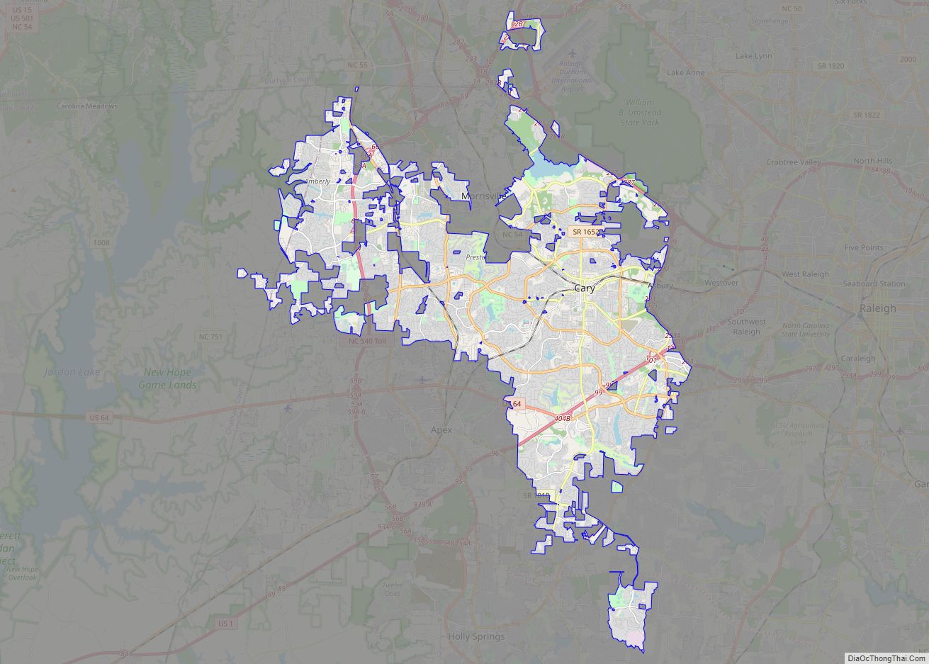
Online Interactive Map
Click on ![]() to view map in "full screen" mode.
to view map in "full screen" mode.
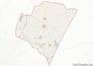
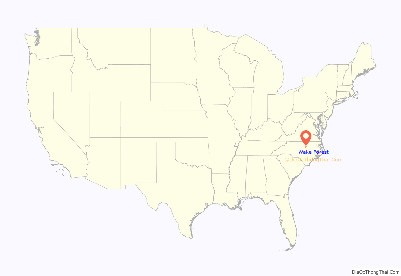
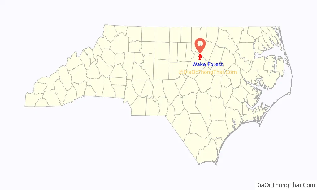
Wake Forest location map. Where is Wake Forest town?
History
In 1832, Dr. Calvin Jones, originally from New England, bought 615 acres (2.49 km) of forested land in Wake County, North Carolina. He built his plantation here. The sparsely populated area became known as the Forest of Wake, or Wake Forest. Jones sold his farm to the North Carolina Baptist Convention for $2,000, who opened the Wake Forest Manual Labor Institute, later Wake Forest College, on the site. The Raleigh & Gaston Railroad, completed in 1840, established a depot in nearby Forestville that stimulated the school and surrounding village. College leaders convinced the railroad to move the depot even closer to the college in 1874, leading to more economic development. This community was incorporated as the “Town of Wake Forest College” in 1880. In 1909, the word “College” was removed from the name of the town. The college moved to the much larger city of Winston-Salem in 1956. Southeastern Baptist Theological Seminary began offering classes on the original campus of Wake Forest University in 1950, and occupied the entire campus when the university completed its move.
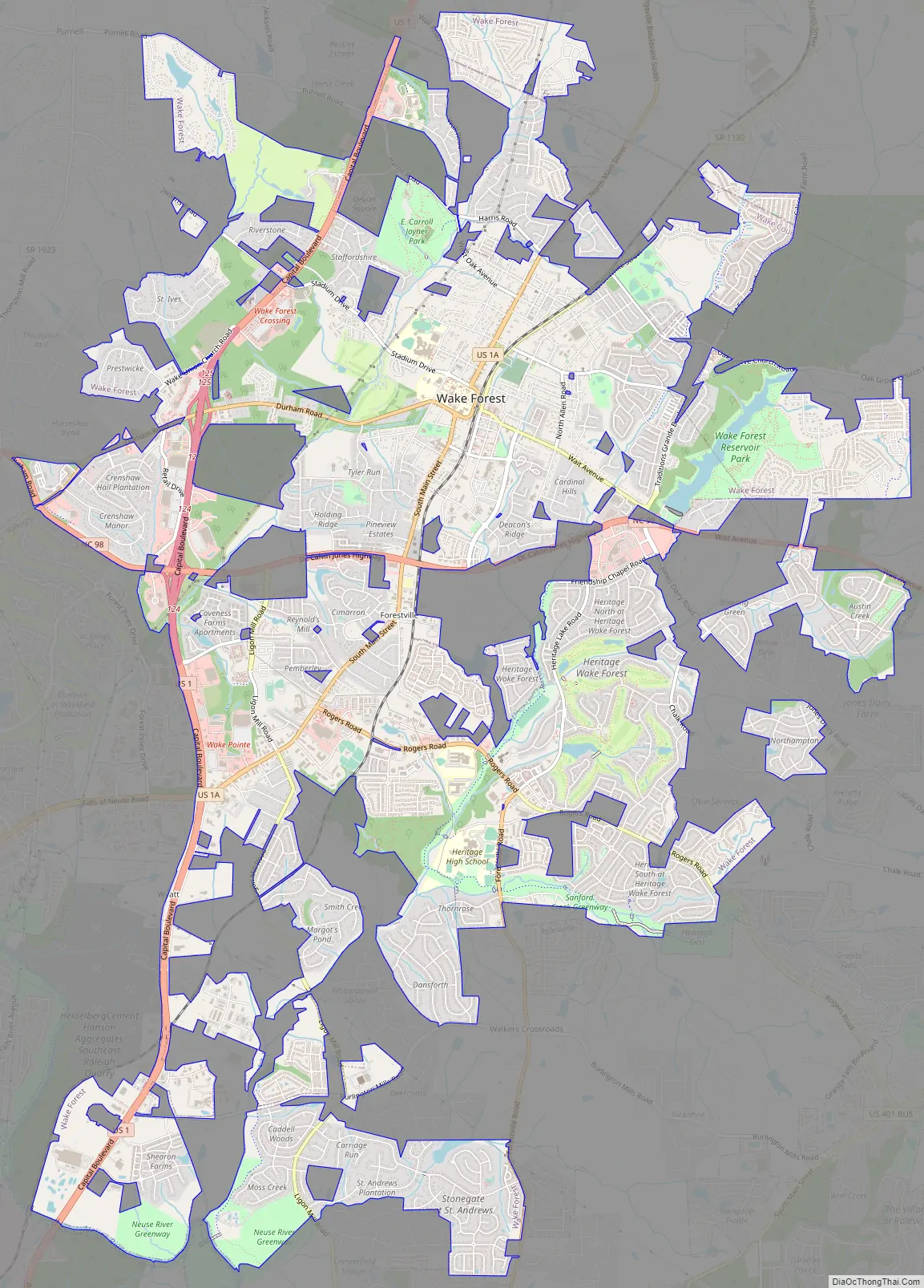
Wake Forest Road Map
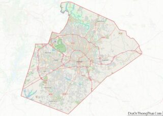
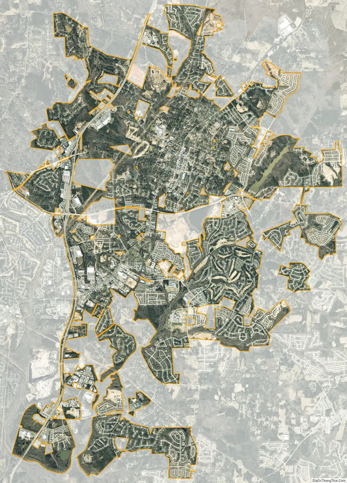
Wake Forest city Satellite Map
Geography
Wake Forest is located at 35°58′24″N 78°31′8″W / 35.97333°N 78.51889°W / 35.97333; -78.51889 (35.973289, -78.518789).
According to the United States Census Bureau, the town has a total area of 15.2 square miles (39.4 km), of which 15.1 square miles (39.1 km) is land and 0.1 square miles (0.3 km) (0.80%) is water.
Wake Forest is located in the northeast-central region of North Carolina, where the North American Piedmont and Atlantic Coastal Plain regions meet. This area is known as the “Fall Line” because it marks the elevation inland at which waterfalls begin to appear in creeks and rivers. Its central Piedmont location situates Wake Forest approximately three hours by car west of Atlantic Beach, and four hours east of the Great Smoky Mountains.
Climate
Wake Forest enjoys a moderate subtropical climate, with moderate temperatures in the spring, fall, and winter. Summers are typically hot with high humidity. Winter highs generally range in the low 50s °F (10 to 13 °C) with lows in the low-to-mid 30s °F (-2 to 2 °C), although an occasional 60 °F (15 °C) or warmer winter day is not uncommon. Spring and fall days usually reach the low-to-mid 70s °F (low 20s °C), with lows at night in the lower 50s °F (10 to 14 °C). Summer daytime highs often reach the upper 80s to low 90s °F (29 to 35 °C). The rainiest months are July and August.
See also
Map of North Carolina State and its subdivision:- Alamance
- Alexander
- Alleghany
- Anson
- Ashe
- Avery
- Beaufort
- Bertie
- Bladen
- Brunswick
- Buncombe
- Burke
- Cabarrus
- Caldwell
- Camden
- Carteret
- Caswell
- Catawba
- Chatham
- Cherokee
- Chowan
- Clay
- Cleveland
- Columbus
- Craven
- Cumberland
- Currituck
- Dare
- Davidson
- Davie
- Duplin
- Durham
- Edgecombe
- Forsyth
- Franklin
- Gaston
- Gates
- Graham
- Granville
- Greene
- Guilford
- Halifax
- Harnett
- Haywood
- Henderson
- Hertford
- Hoke
- Hyde
- Iredell
- Jackson
- Johnston
- Jones
- Lee
- Lenoir
- Lincoln
- Macon
- Madison
- Martin
- McDowell
- Mecklenburg
- Mitchell
- Montgomery
- Moore
- Nash
- New Hanover
- Northampton
- Onslow
- Orange
- Pamlico
- Pasquotank
- Pender
- Perquimans
- Person
- Pitt
- Polk
- Randolph
- Richmond
- Robeson
- Rockingham
- Rowan
- Rutherford
- Sampson
- Scotland
- Stanly
- Stokes
- Surry
- Swain
- Transylvania
- Tyrrell
- Union
- Vance
- Wake
- Warren
- Washington
- Watauga
- Wayne
- Wilkes
- Wilson
- Yadkin
- Yancey
- Alabama
- Alaska
- Arizona
- Arkansas
- California
- Colorado
- Connecticut
- Delaware
- District of Columbia
- Florida
- Georgia
- Hawaii
- Idaho
- Illinois
- Indiana
- Iowa
- Kansas
- Kentucky
- Louisiana
- Maine
- Maryland
- Massachusetts
- Michigan
- Minnesota
- Mississippi
- Missouri
- Montana
- Nebraska
- Nevada
- New Hampshire
- New Jersey
- New Mexico
- New York
- North Carolina
- North Dakota
- Ohio
- Oklahoma
- Oregon
- Pennsylvania
- Rhode Island
- South Carolina
- South Dakota
- Tennessee
- Texas
- Utah
- Vermont
- Virginia
- Washington
- West Virginia
- Wisconsin
- Wyoming