Davidson is a suburban town located in northern Mecklenburg and Iredell counties, North Carolina, United States, on the banks of Lake Norman. It is a suburb in the Charlotte metropolitan area. The population was 10,944 at the 2010 census, and in 2019 the estimated population was 13,054. The town was founded in 1837 with the establishment of the Presbyterian Davidson College, named for Brigadier General William Lee Davidson, a local Revolutionary War hero. The land for Davidson College came from Davidson’s estate, a large portion of which was donated by his son.
| Name: | Davidson town |
|---|---|
| LSAD Code: | 43 |
| LSAD Description: | town (suffix) |
| State: | North Carolina |
| County: | Iredell County, Mecklenburg County |
| Elevation: | 840 ft (256 m) |
| Total Area: | 6.59 sq mi (17.07 km²) |
| Land Area: | 6.34 sq mi (16.41 km²) |
| Water Area: | 0.25 sq mi (0.65 km²) |
| Total Population: | 15,106 |
| Population Density: | 2,383.78/sq mi (920.36/km²) |
| ZIP code: | 28035-28036 |
| Area code: | 704 980 |
| FIPS code: | 3716400 |
| GNISfeature ID: | 1019914 |
| Website: | www.townofdavidson.org |
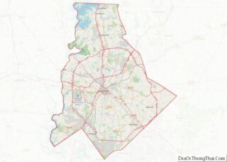
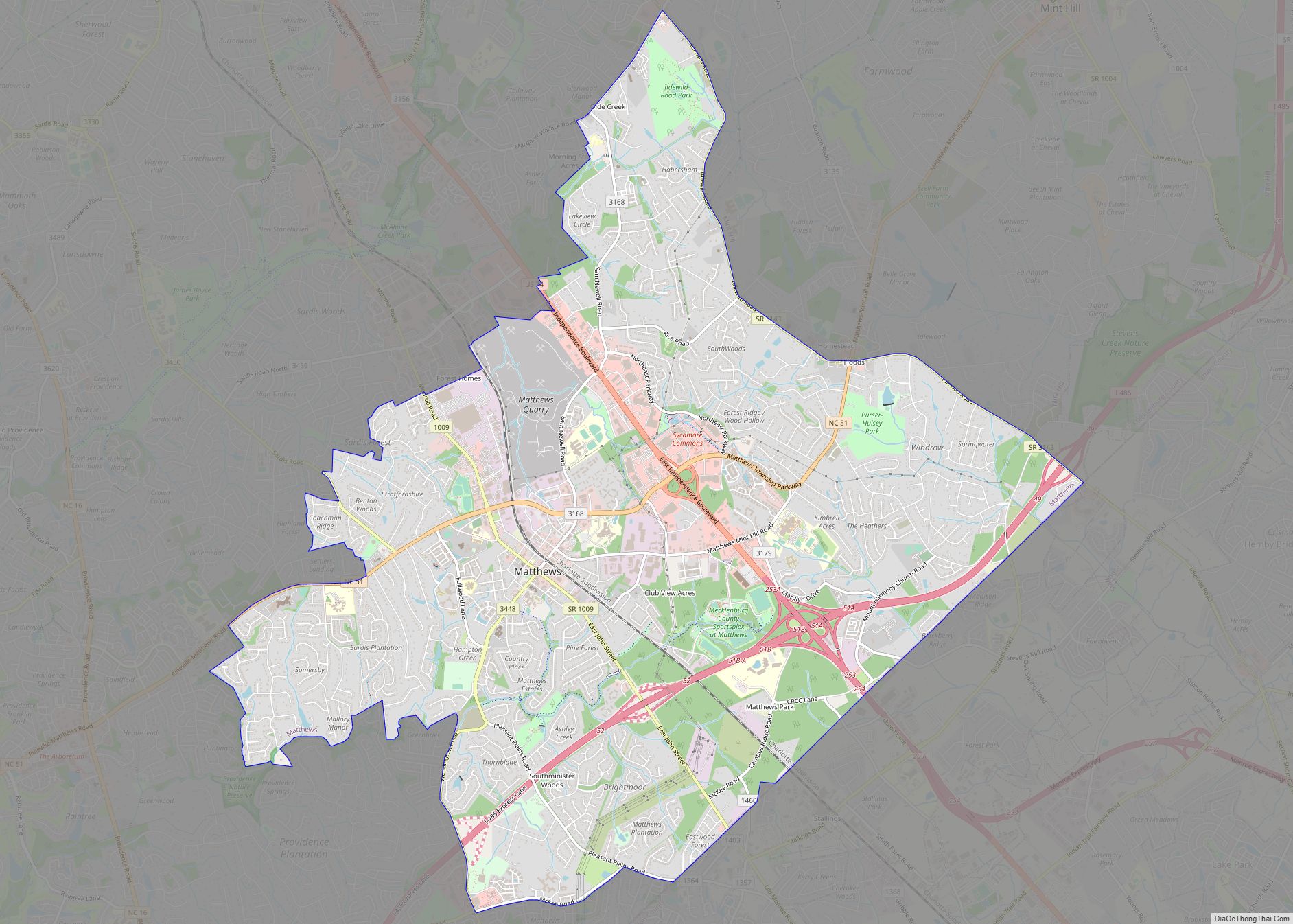
Online Interactive Map
Click on ![]() to view map in "full screen" mode.
to view map in "full screen" mode.
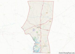
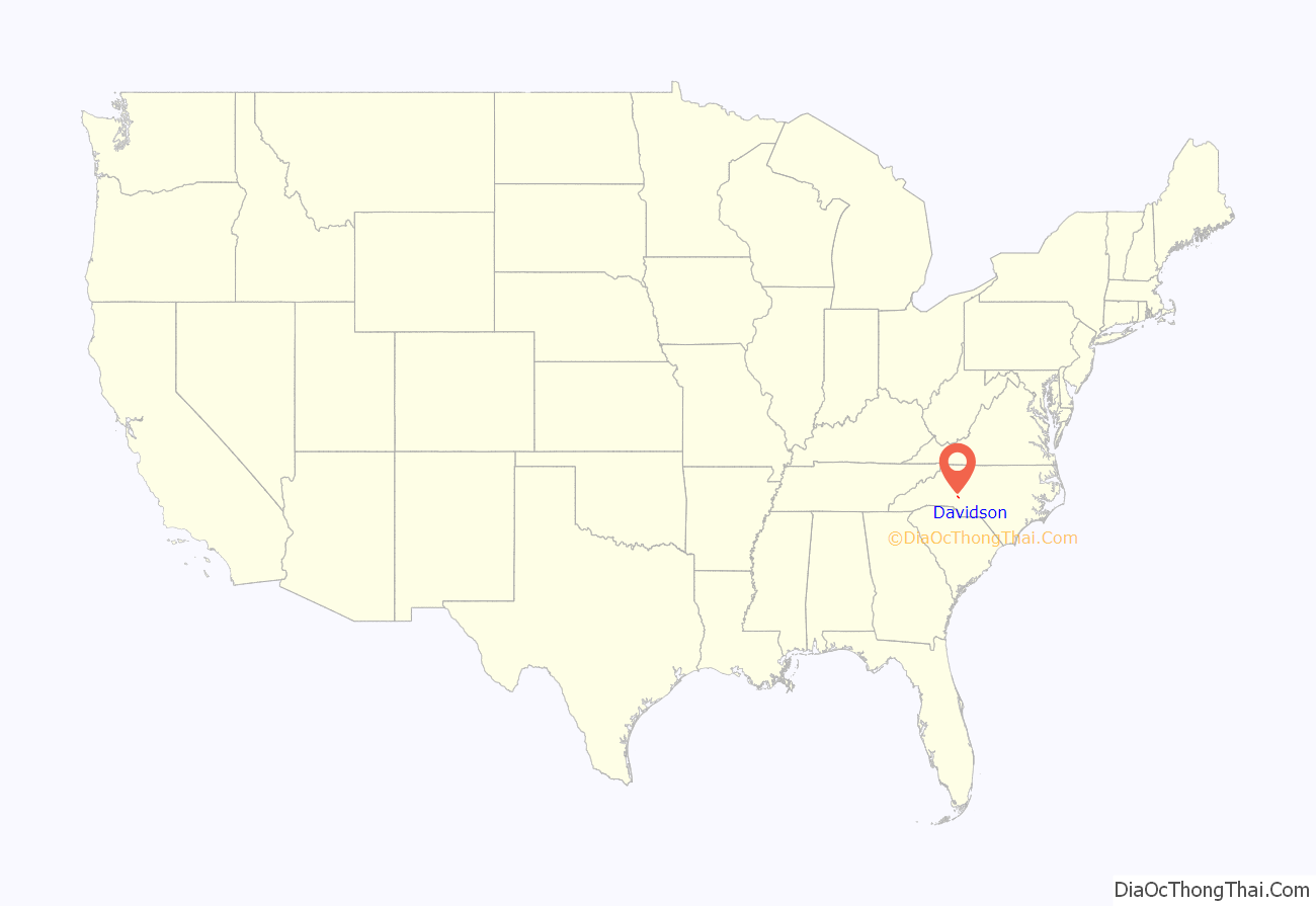
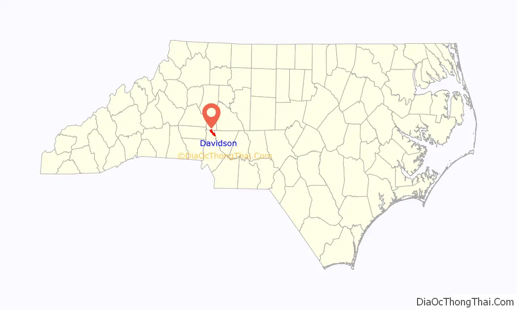
Davidson location map. Where is Davidson town?
History
John Davidson, described as “a prosperous Ulster merchant”, was a member of the Davidson family who migrated south from Pennsylvania. Davidson’s Creek was the westernmost settlement in North Carolina at the time, and according to Robert Ramsey’s Carolina Cradle, it “became the nucleus of the Centre Presbyterian Congregation.” John Davidson’s son William went on to serve in the American Revolution, eventually becoming a major. Maj. William Davidson was a cousin of Col. William Davidson, the first state senator from Buncombe County, North Carolina, who in turn was a cousin of Gen. William Lee Davidson, for whom Davidson College was named. Gen. Davidson’s son William Lee Davidson II sold 469 acres (1.90 km2) to the Concord Presbytery to start Davidson College.
The history of the town of Davidson is inextricably linked to Davidson College, which predated the surrounding community and influenced its development. Although Davidson’s growth in the late nineteenth and early twentieth centuries typified small railroad towns throughout the Piedmont, the presence of the college created a unique village. The tree-shaded campus filled with classically inspired architecture distinguished Davidson from other communities. The sway of the school also extended beyond the campus to the entire town, influencing commerce, culture, and the character of its architecture. The 1869 Branson’s business directory recorded four dry goods merchants in the town as well as a cabinetmaker, a miller, and three physicians.
Soon after the arrival of the railroad, Davidson became a shipping point for cash crops, especially cotton, and a service center for farmers. In common with other railroad towns in the region, textile investors constructed cotton mills and mill villages along the rail corridor. The Linden Cotton Factory, erected in 1890 on Depot Street, was the first textile plant in Davidson, and in 1908, the Delburg Cotton Mills was constructed nearby. Two thousand bales of cotton were sold at Davidson annually in the early 1900s.
In 1891, the name of the town was changed from “Davidson College” to “Davidson”, emblematic of the community’s expanding roles for town and gown alike. Davidson’s cotton mills spurred the growth of the town, and by 1910 the population of Davidson had reached 500 residents, climbing to 1,500 by the 1920s. Between 1900 and the Great Depression, the business district evolved from a commingling of stores and residences into contiguous rows of one- and two-story, brick commercial buildings. The heart of downtown – opposite the college – contained a full complement of small-town stores and services, including four general merchandise stores, a drug store, a laundry, tailor shop, two barber shops, a hardware store, a post office, a bank, and several restaurants. Physicians, building contractors, and milliners also had Main Street addresses. Behind Main Street along the railroad tracks stood the small 1897 Southern Railway Depot, a livery, flour mill, sawmill, cotton gins, a cottonseed oil company, a blacksmith shop, and a buggy manufacturer.
The demise of cotton farming and decline of other agricultural pursuits in the region effectively ended the town’s role as a farming service center. Meanwhile, improved highways and the advent of I-77 encouraged residents to frequent larger department stores in the cities, especially Charlotte, 22 miles (35 km) to the south. In more recent years, the emergence of suburban shopping centers around Davidson accelerated the town’s status to an all-purpose retail market.
Today, the tremendous development around Charlotte has stimulated Davidson’s growth to its current population of more than 10,000 people. Local downtown businesses, now characterized by restaurants and specialty shops, cater to this new market. Prestigious, nationally known Davidson College has made the town an intellectual and cultural center, drawing into its orbit a sizable professional class.
Beginning with the General Plan in 1993, continuing through the Land Plan of 1995 and the Planning Ordinance of 2001, the town has advocated for and implemented smart growth principles, including pedestrian orientation (resulting in a ban on drive-thru’s), mixed-use development, affordable housing, open space preservation, and connectivity. An emphasis on design has been a consistent theme in each resulting regulatory document. Additionally, the town of Davidson received National Register Historic District status in 2009 for the historic core of the town, which includes downtown.
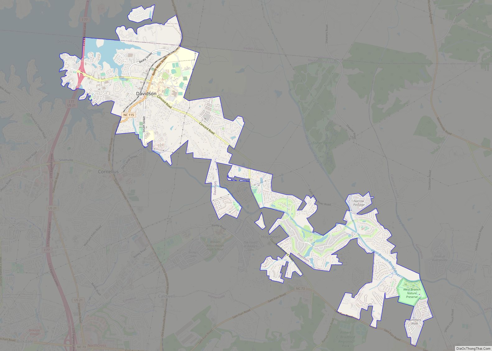
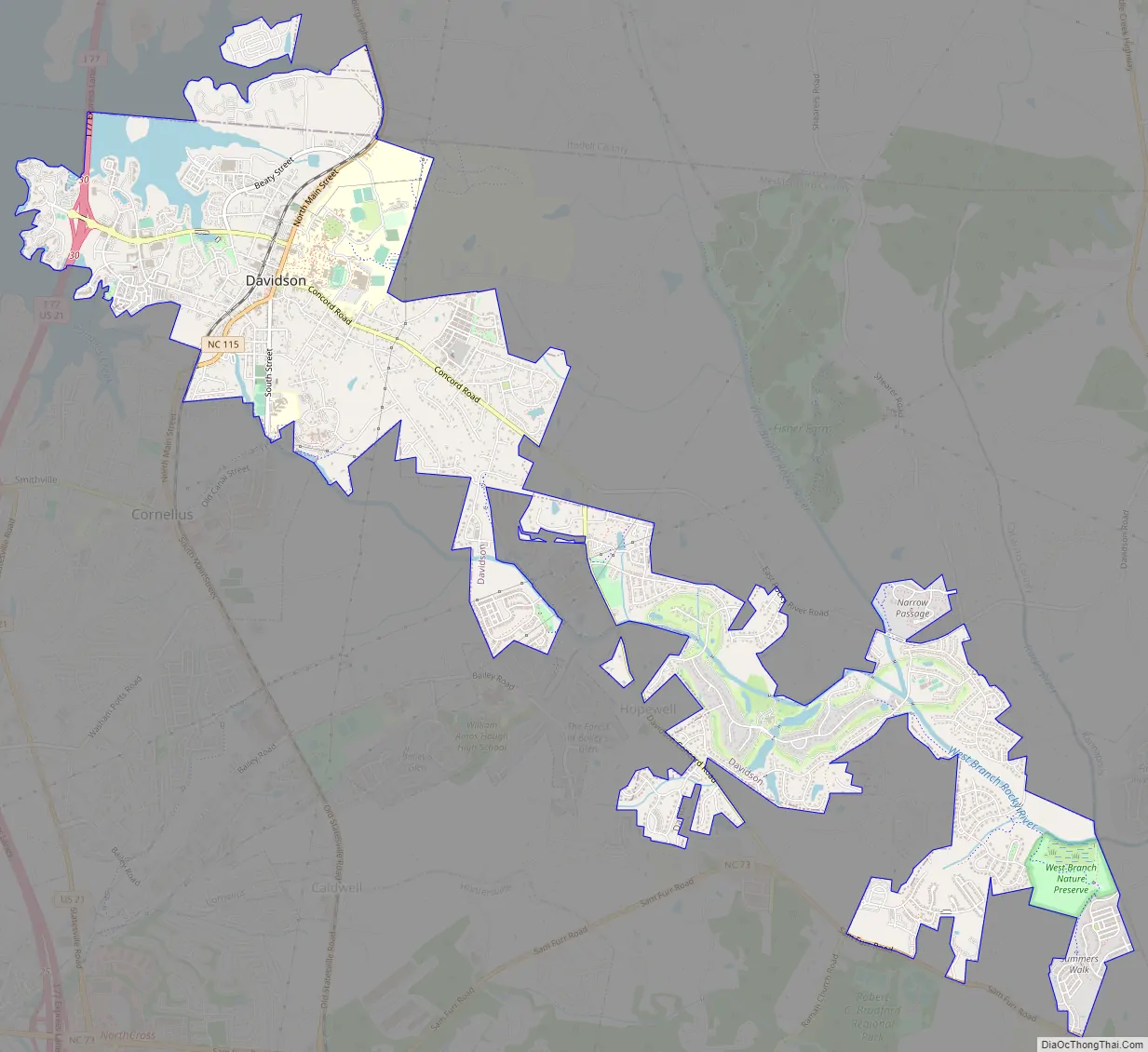
Davidson Road Map
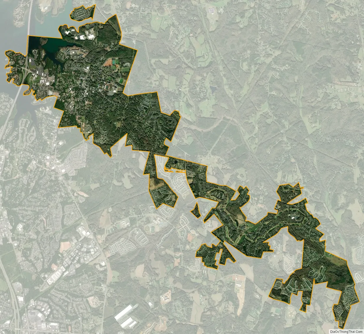
Davidson city Satellite Map
Geography
Davidson is located in the Piedmont of North Carolina at 35°29′28″N 80°49′58″W / 35.49111°N 80.83278°W / 35.49111; -80.83278, in northern Mecklenburg County, north of Charlotte. A portion of the town extends north into Iredell County. The western edge of the town follows the shoreline of Lake Norman, a large reservoir on the Catawba River. On the northwestern edge, Davidson is bordered by Lake Davidson, a runoff basin of Lake Norman. Davidson is bordered to the south by the town of Cornelius.
Interstate 77 passes through the western side of Davidson, with access from Exit 30. I-77 leads south 21 miles (34 km) to Charlotte and north the same distance to Statesville. North Carolina Highway 115 is Davidson’s Main Street; it leads north 7 miles (11 km) to Mooresville and south 6 miles (10 km) to Huntersville.
According to the United States Census Bureau, the town has a total area of 6.0 square miles (15.5 km), of which 5.8 square miles (14.9 km) are land and 0.2 square miles (0.6 km), or 4.12%, are water.
See also
Map of North Carolina State and its subdivision:- Alamance
- Alexander
- Alleghany
- Anson
- Ashe
- Avery
- Beaufort
- Bertie
- Bladen
- Brunswick
- Buncombe
- Burke
- Cabarrus
- Caldwell
- Camden
- Carteret
- Caswell
- Catawba
- Chatham
- Cherokee
- Chowan
- Clay
- Cleveland
- Columbus
- Craven
- Cumberland
- Currituck
- Dare
- Davidson
- Davie
- Duplin
- Durham
- Edgecombe
- Forsyth
- Franklin
- Gaston
- Gates
- Graham
- Granville
- Greene
- Guilford
- Halifax
- Harnett
- Haywood
- Henderson
- Hertford
- Hoke
- Hyde
- Iredell
- Jackson
- Johnston
- Jones
- Lee
- Lenoir
- Lincoln
- Macon
- Madison
- Martin
- McDowell
- Mecklenburg
- Mitchell
- Montgomery
- Moore
- Nash
- New Hanover
- Northampton
- Onslow
- Orange
- Pamlico
- Pasquotank
- Pender
- Perquimans
- Person
- Pitt
- Polk
- Randolph
- Richmond
- Robeson
- Rockingham
- Rowan
- Rutherford
- Sampson
- Scotland
- Stanly
- Stokes
- Surry
- Swain
- Transylvania
- Tyrrell
- Union
- Vance
- Wake
- Warren
- Washington
- Watauga
- Wayne
- Wilkes
- Wilson
- Yadkin
- Yancey
- Alabama
- Alaska
- Arizona
- Arkansas
- California
- Colorado
- Connecticut
- Delaware
- District of Columbia
- Florida
- Georgia
- Hawaii
- Idaho
- Illinois
- Indiana
- Iowa
- Kansas
- Kentucky
- Louisiana
- Maine
- Maryland
- Massachusetts
- Michigan
- Minnesota
- Mississippi
- Missouri
- Montana
- Nebraska
- Nevada
- New Hampshire
- New Jersey
- New Mexico
- New York
- North Carolina
- North Dakota
- Ohio
- Oklahoma
- Oregon
- Pennsylvania
- Rhode Island
- South Carolina
- South Dakota
- Tennessee
- Texas
- Utah
- Vermont
- Virginia
- Washington
- West Virginia
- Wisconsin
- Wyoming