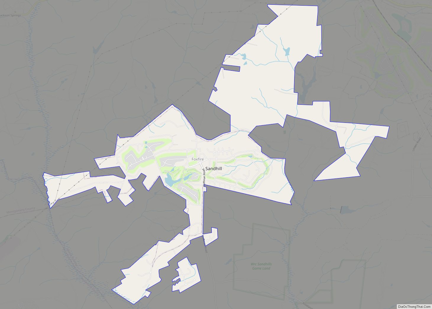
Foxfire is a village in Moore County, North Carolina, United States. The population was 902 at the 2010 census.
| Name: | Foxfire village |
|---|---|
| LSAD Code: | 47 |
| LSAD Description: | village (suffix) |
| State: | North Carolina |
| County: | Moore County |
| Elevation: | 571 ft (174 m) |
| Total Area: | 7.13 sq mi (18.47 km²) |
| Land Area: | 7.07 sq mi (18.31 km²) |
| Water Area: | 0.06 sq mi (0.15 km²) |
| Total Population: | 1,288 |
| Population Density: | 182.18/sq mi (70.34/km²) |
| ZIP code: | 27281 |
| FIPS code: | 3724570 |
| GNISfeature ID: | 1027620 |
| Website: | www.foxfirenc.com |
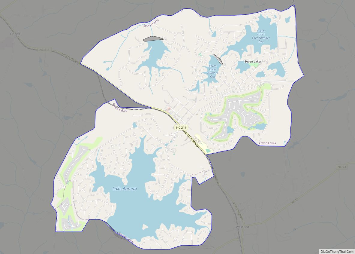
Online Interactive Map
Click on ![]() to view map in "full screen" mode.
to view map in "full screen" mode.
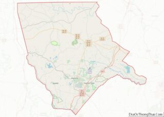
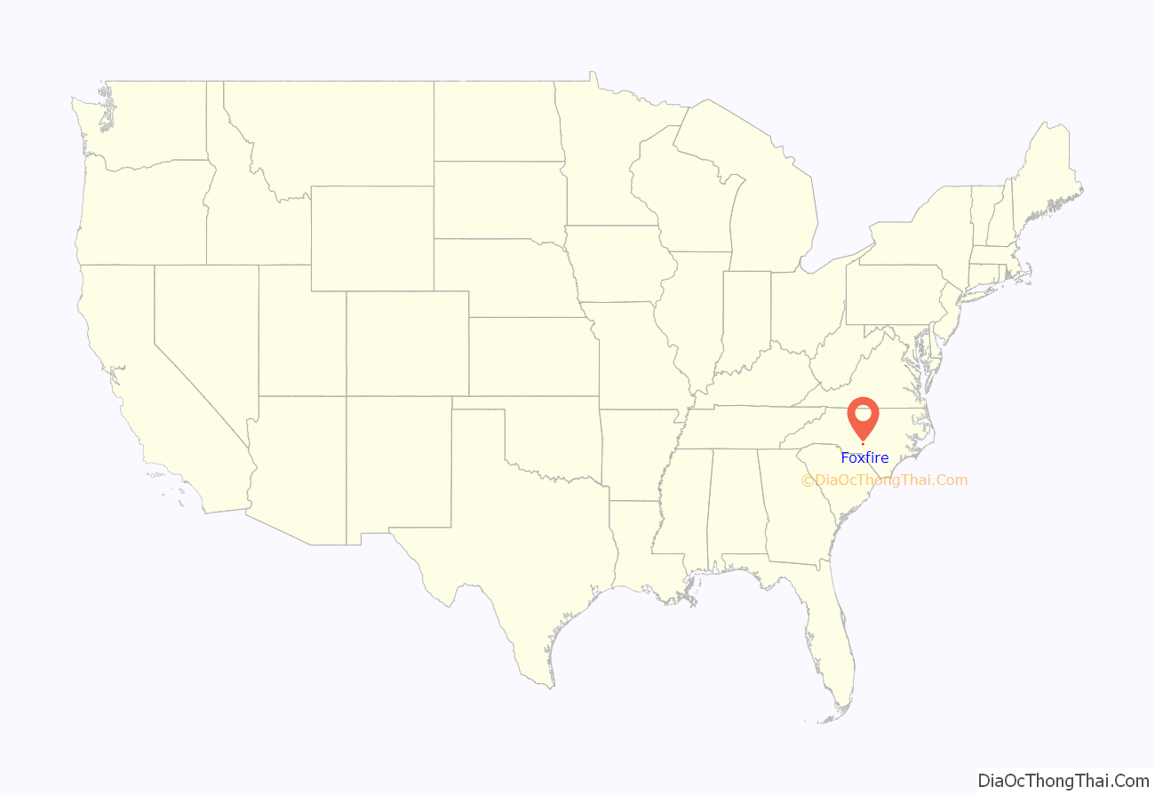
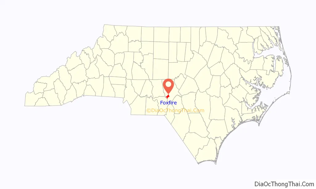
Foxfire location map. Where is Foxfire village?
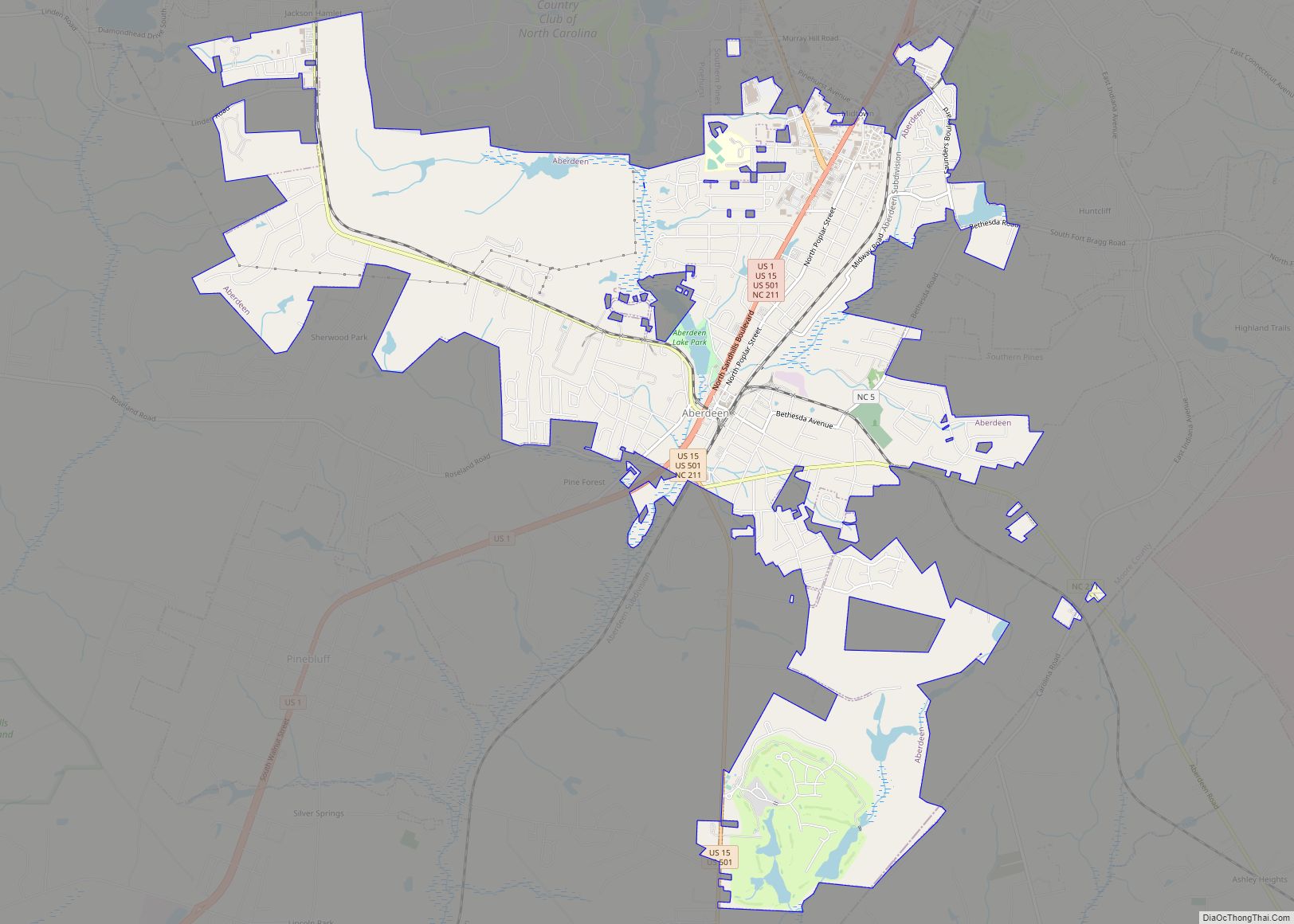
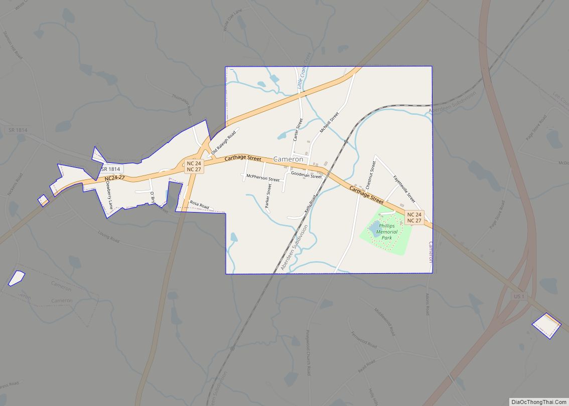
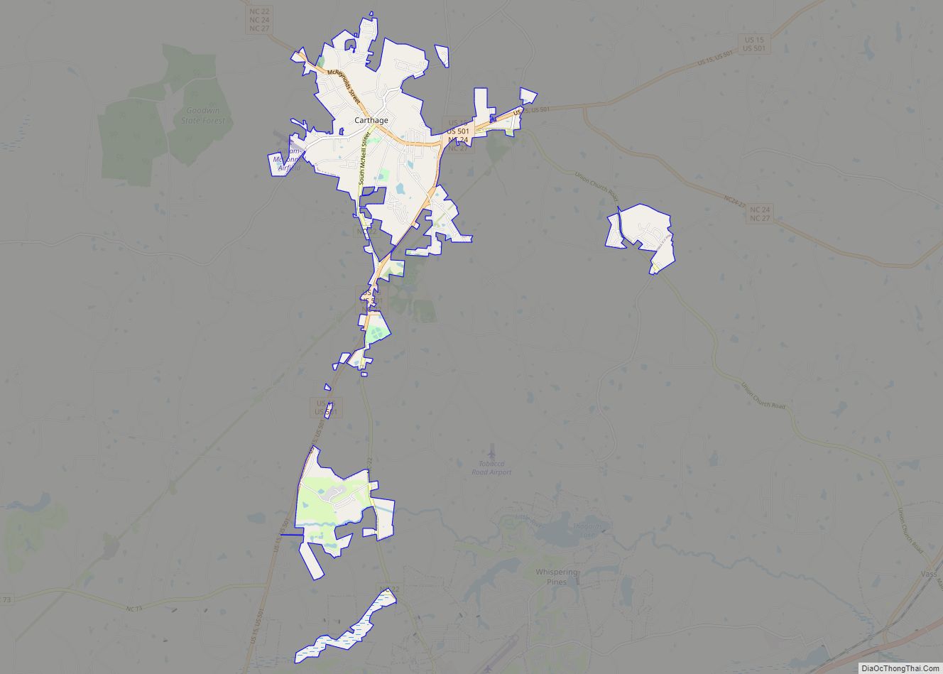
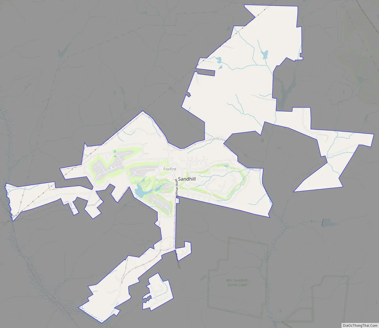
Foxfire Road Map
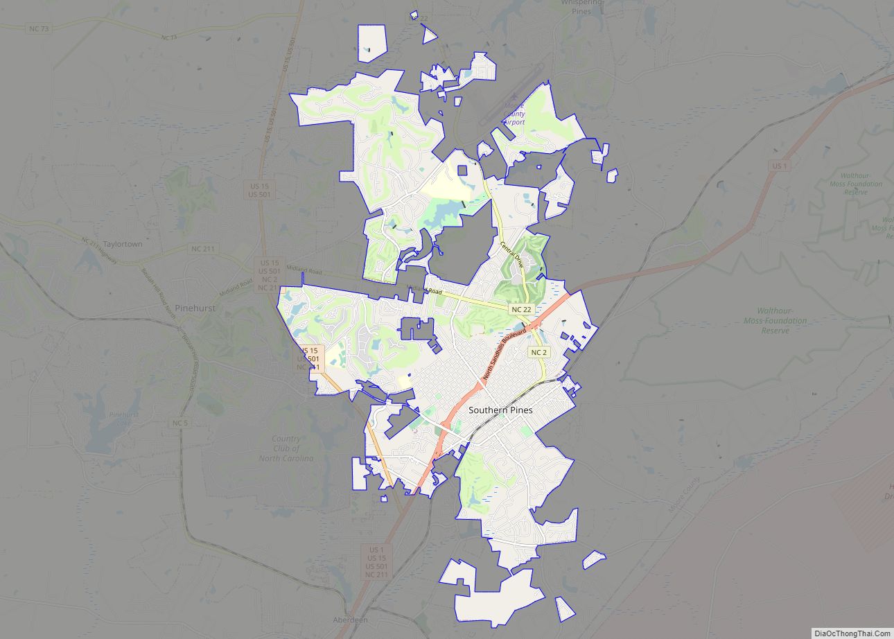
Foxfire city Satellite Map
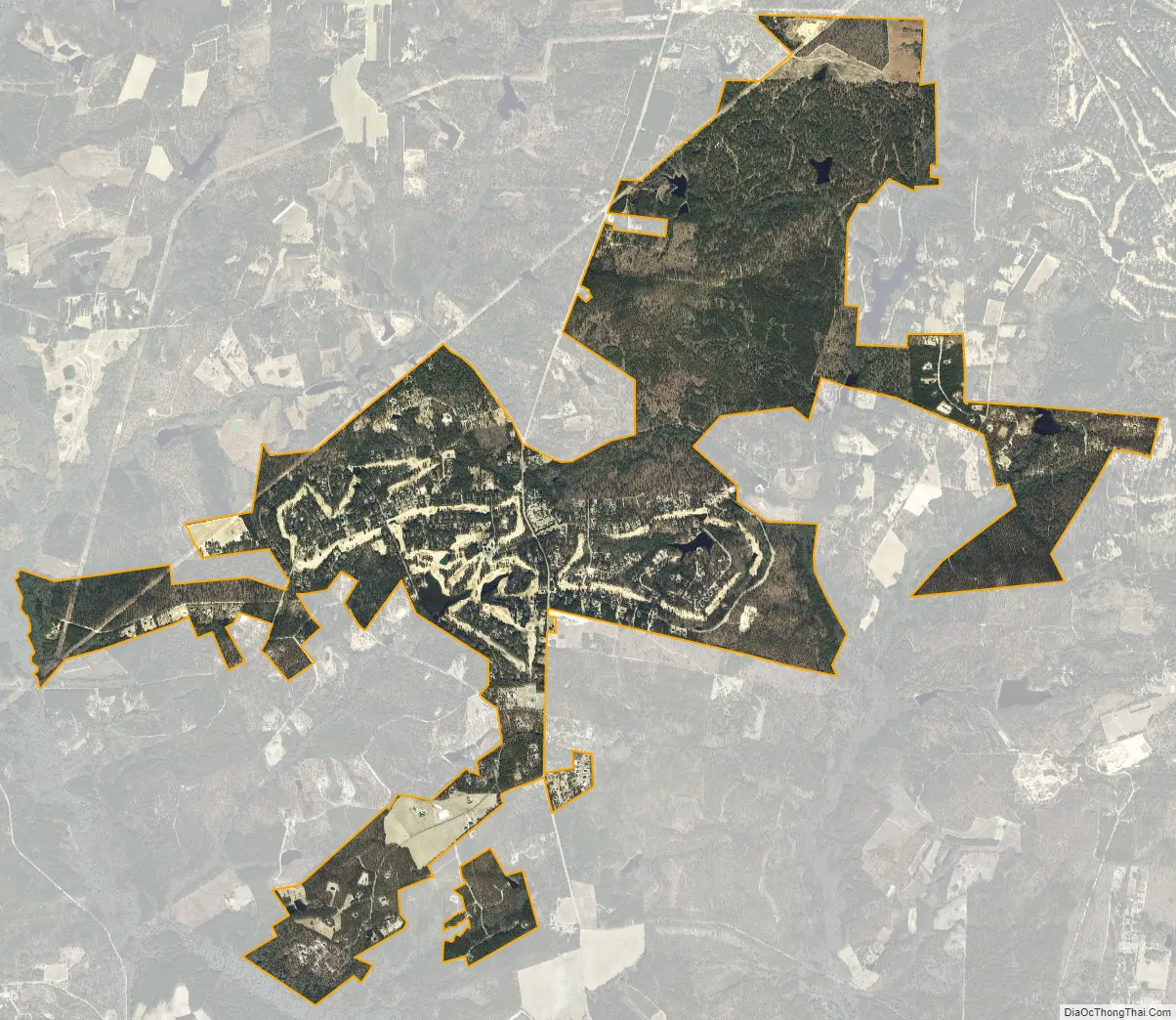
Geography
Foxfire is located at 35°10′32″N 79°34′22″W / 35.17556°N 79.57278°W / 35.17556; -79.57278 (35.175635, -79.572843).
According to the United States Census Bureau, the village has a total area of 2.9 square miles (7.5 km), of which 2.9 square miles (7.5 km) is land and 0.1 square miles (0.26 km) (2.05%) is water.
Foxfire is one of the few incorporated areas of North Carolina that does not host any primary numbered state highways (0-999).
See also
Map of North Carolina State and its subdivision:- Alamance
- Alexander
- Alleghany
- Anson
- Ashe
- Avery
- Beaufort
- Bertie
- Bladen
- Brunswick
- Buncombe
- Burke
- Cabarrus
- Caldwell
- Camden
- Carteret
- Caswell
- Catawba
- Chatham
- Cherokee
- Chowan
- Clay
- Cleveland
- Columbus
- Craven
- Cumberland
- Currituck
- Dare
- Davidson
- Davie
- Duplin
- Durham
- Edgecombe
- Forsyth
- Franklin
- Gaston
- Gates
- Graham
- Granville
- Greene
- Guilford
- Halifax
- Harnett
- Haywood
- Henderson
- Hertford
- Hoke
- Hyde
- Iredell
- Jackson
- Johnston
- Jones
- Lee
- Lenoir
- Lincoln
- Macon
- Madison
- Martin
- McDowell
- Mecklenburg
- Mitchell
- Montgomery
- Moore
- Nash
- New Hanover
- Northampton
- Onslow
- Orange
- Pamlico
- Pasquotank
- Pender
- Perquimans
- Person
- Pitt
- Polk
- Randolph
- Richmond
- Robeson
- Rockingham
- Rowan
- Rutherford
- Sampson
- Scotland
- Stanly
- Stokes
- Surry
- Swain
- Transylvania
- Tyrrell
- Union
- Vance
- Wake
- Warren
- Washington
- Watauga
- Wayne
- Wilkes
- Wilson
- Yadkin
- Yancey
- Alabama
- Alaska
- Arizona
- Arkansas
- California
- Colorado
- Connecticut
- Delaware
- District of Columbia
- Florida
- Georgia
- Hawaii
- Idaho
- Illinois
- Indiana
- Iowa
- Kansas
- Kentucky
- Louisiana
- Maine
- Maryland
- Massachusetts
- Michigan
- Minnesota
- Mississippi
- Missouri
- Montana
- Nebraska
- Nevada
- New Hampshire
- New Jersey
- New Mexico
- New York
- North Carolina
- North Dakota
- Ohio
- Oklahoma
- Oregon
- Pennsylvania
- Rhode Island
- South Carolina
- South Dakota
- Tennessee
- Texas
- Utah
- Vermont
- Virginia
- Washington
- West Virginia
- Wisconsin
- Wyoming