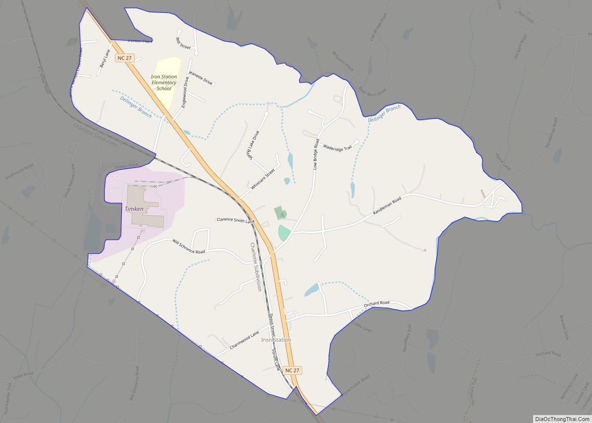
Iron Station is an unincorporated community and census-designated place (CDP) in Lincoln County, North Carolina, United States. A primarily industrial town, Iron Station’s population was 755 as of the 2010 census. It also serves as a bedroom community for the larger cities of Charlotte, Hickory, and Lincolnton.
The Iron Station post office has a ZIP code of 28080.
| Name: | Iron Station CDP |
|---|---|
| LSAD Code: | 57 |
| LSAD Description: | CDP (suffix) |
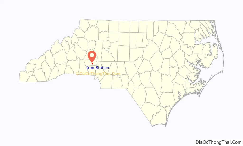
| State: | North Carolina |
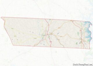
| County: | Lincoln County |
| Elevation: | 895 ft (273 m) |
| Total Area: | 2.37 sq mi (6.13 km²) |
| Land Area: | 2.36 sq mi (6.12 km²) |
| Water Area: | 0.01 sq mi (0.01 km²) |
| Total Population: | 825 |
| Population Density: | 349.28/sq mi (134.87/km²) |
| ZIP code: | 28080 |
| Area code: | 704 |
| FIPS code: | 3733820 |
| GNISfeature ID: | 987400 |
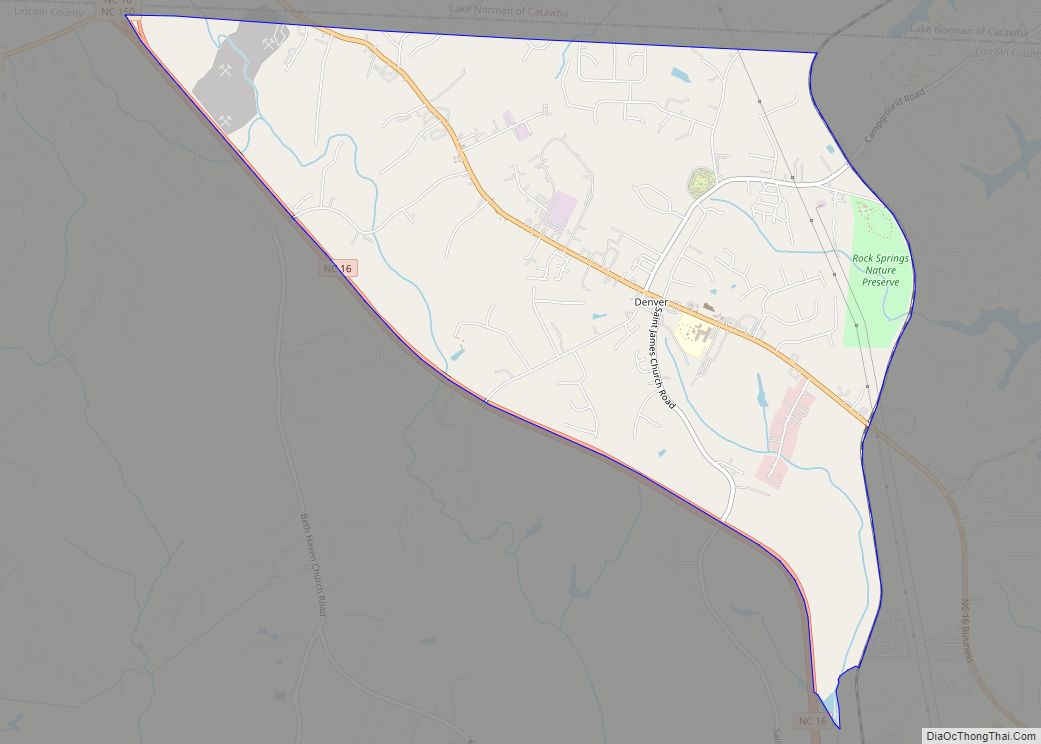
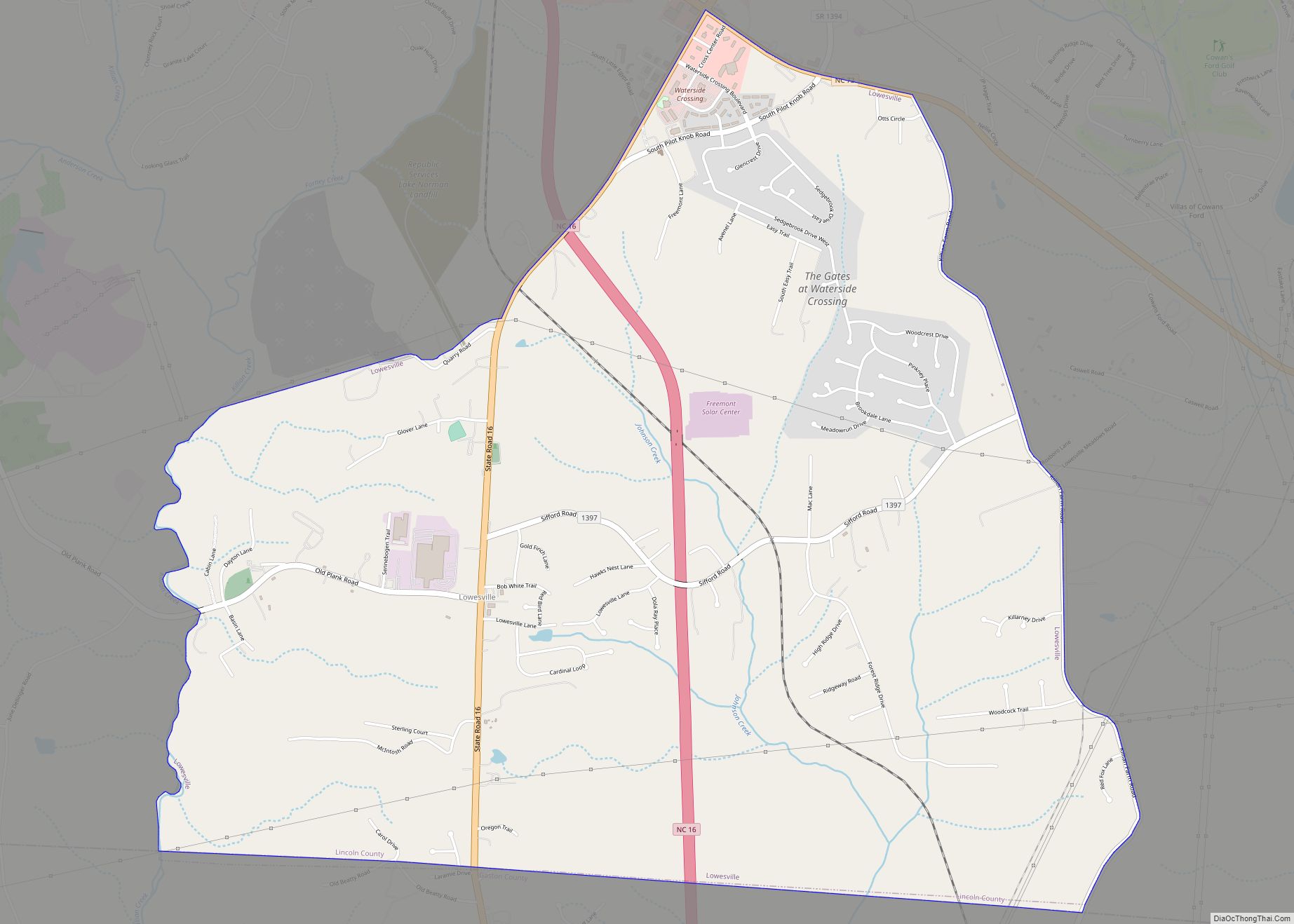
Online Interactive Map
Click on ![]() to view map in "full screen" mode.
to view map in "full screen" mode.
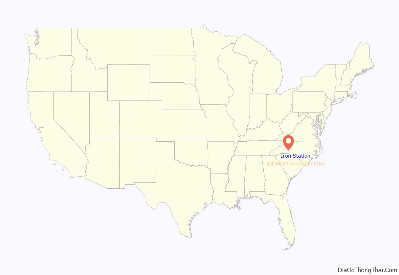
Iron Station location map. Where is Iron Station CDP?
History
Ingleside, Magnolia Grove, and Tucker’s Grove Camp Meeting Ground are listed on the National Register of Historic Places.
Iron Station was named for its history as an iron mining town with a train station.
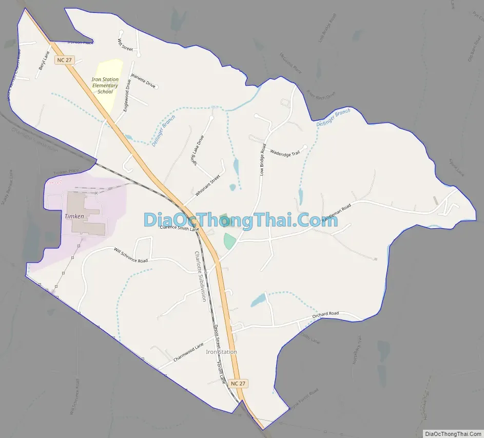
Iron Station Road Map
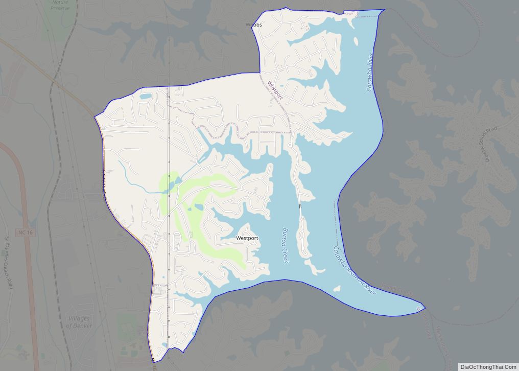
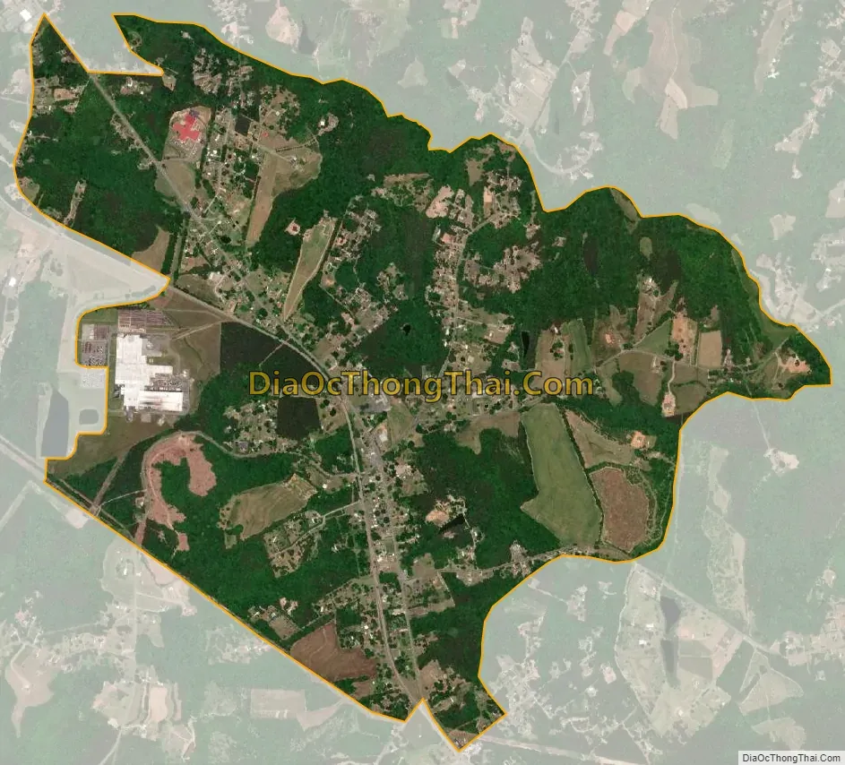
Iron Station city Satellite Map
Geography
The community is southeast of the center of Lincoln County, along North Carolina Highway 27, which leads northwest 7 miles (11 km) to Lincolnton, the county seat, and southeast 25 miles (40 km) to Charlotte.
According to the U.S. Census Bureau, the Iron Station CDP has a total area of 2.4 square miles (6.1 km), of which 3.4 acres (13,938 m), or 0.23%, are water. The community is in the Piedmont region of North Carolina, and the town center is on a ridge which drains northeast to Dellinger Branch, which forms the northeastern border of the CDP, and southwest to Hoyle Creek. The entire community is part of the Catawba River watershed.
See also
Map of North Carolina State and its subdivision:- Alamance
- Alexander
- Alleghany
- Anson
- Ashe
- Avery
- Beaufort
- Bertie
- Bladen
- Brunswick
- Buncombe
- Burke
- Cabarrus
- Caldwell
- Camden
- Carteret
- Caswell
- Catawba
- Chatham
- Cherokee
- Chowan
- Clay
- Cleveland
- Columbus
- Craven
- Cumberland
- Currituck
- Dare
- Davidson
- Davie
- Duplin
- Durham
- Edgecombe
- Forsyth
- Franklin
- Gaston
- Gates
- Graham
- Granville
- Greene
- Guilford
- Halifax
- Harnett
- Haywood
- Henderson
- Hertford
- Hoke
- Hyde
- Iredell
- Jackson
- Johnston
- Jones
- Lee
- Lenoir
- Lincoln
- Macon
- Madison
- Martin
- McDowell
- Mecklenburg
- Mitchell
- Montgomery
- Moore
- Nash
- New Hanover
- Northampton
- Onslow
- Orange
- Pamlico
- Pasquotank
- Pender
- Perquimans
- Person
- Pitt
- Polk
- Randolph
- Richmond
- Robeson
- Rockingham
- Rowan
- Rutherford
- Sampson
- Scotland
- Stanly
- Stokes
- Surry
- Swain
- Transylvania
- Tyrrell
- Union
- Vance
- Wake
- Warren
- Washington
- Watauga
- Wayne
- Wilkes
- Wilson
- Yadkin
- Yancey
- Alabama
- Alaska
- Arizona
- Arkansas
- California
- Colorado
- Connecticut
- Delaware
- District of Columbia
- Florida
- Georgia
- Hawaii
- Idaho
- Illinois
- Indiana
- Iowa
- Kansas
- Kentucky
- Louisiana
- Maine
- Maryland
- Massachusetts
- Michigan
- Minnesota
- Mississippi
- Missouri
- Montana
- Nebraska
- Nevada
- New Hampshire
- New Jersey
- New Mexico
- New York
- North Carolina
- North Dakota
- Ohio
- Oklahoma
- Oregon
- Pennsylvania
- Rhode Island
- South Carolina
- South Dakota
- Tennessee
- Texas
- Utah
- Vermont
- Virginia
- Washington
- West Virginia
- Wisconsin
- Wyoming